Central Indiana Poised To Finally Cash In On Heavy Rains…
Updated 07.08.22 @ 7:30a
0.14″. That’s it in the rainfall department, officially recorded at IND, for the month so far. While several neighborhoods have seen much more rainfall than that, it reiterates just how dry it’s been here for most immediate central Indiana communities. In fact, we have to go all the way back to June 12th to find the last 24 hour period where IND recorded anything close to even half an inch of rain (0.49″).
With all of that said, a combination of ingredients should come together to finally allow a widespread chunk of central Indiana to accumulate hefty rain totals as we get set to close out the work week.
I. We have added forcing from a cold front and wave of low pressure that will move along the boundary as it sags south this evening. This will aid in helping more widespread coverage of rain and thunderstorms fire, especially as we progress into the afternoon and evening.

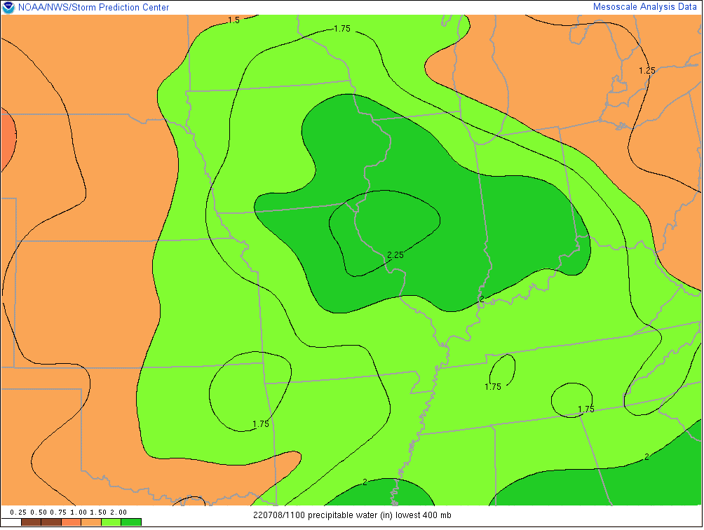
II. A truly tropical airmass engulfs the region this morning and this will remain in place until the cold front clears the area late tonight. Precipitable water values in excess of 2″ combined with dew points in the lower to middle 70s will allow rain and storms to feed off the juicy air this afternoon and evening. Rainfall rates of 2″+ per hour will be common in the heavier cells. Should storms train over the same areas, flash flooding will likely develop.
III. As the wave of low pressure moves across the state this afternoon and evening, it could help enhance the threat of severe weather, especially along and south of the I-70 corridor. A quick spin-up tornado isn’t out of the realm of possibility but the bigger severe threats appear to be from wet microbursts (damaging wind/ hail).

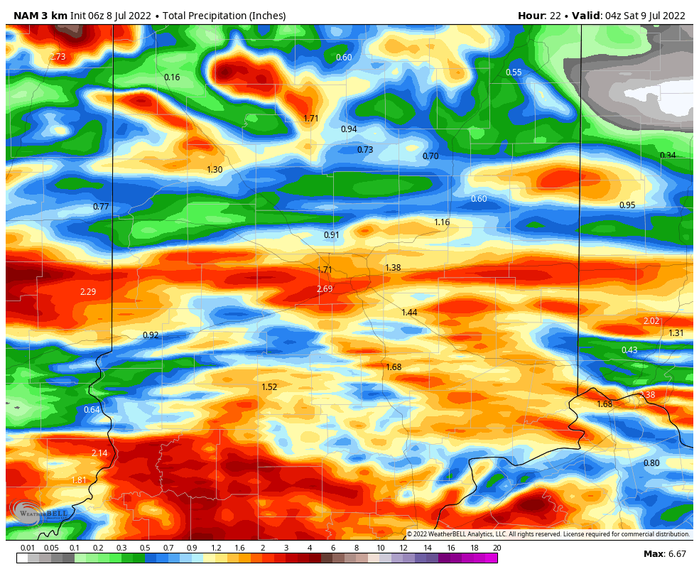
We anticipate many central Indiana neighborhoods to accumulate at least an inch of rain today with some communities seeing locally heavier totals. Again, where heavier cells train, localized flash flooding will develop.
Eventually the front will settle south and clear the state tonight. This will allow drier and MUCH less humid to return to the region just in time for the weekend. We expect plentiful sunshine, low humidity, and cooler temperatures to dominate through the day Monday.