Category: European Model

Two Totally Different Solutions For Next Week!

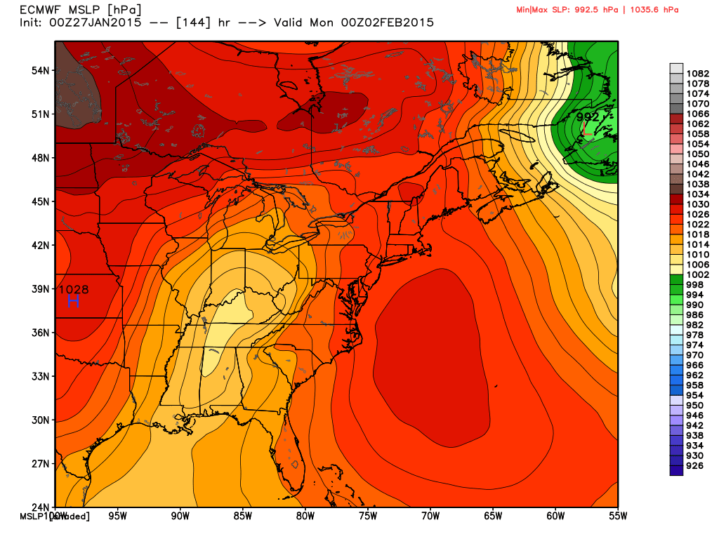
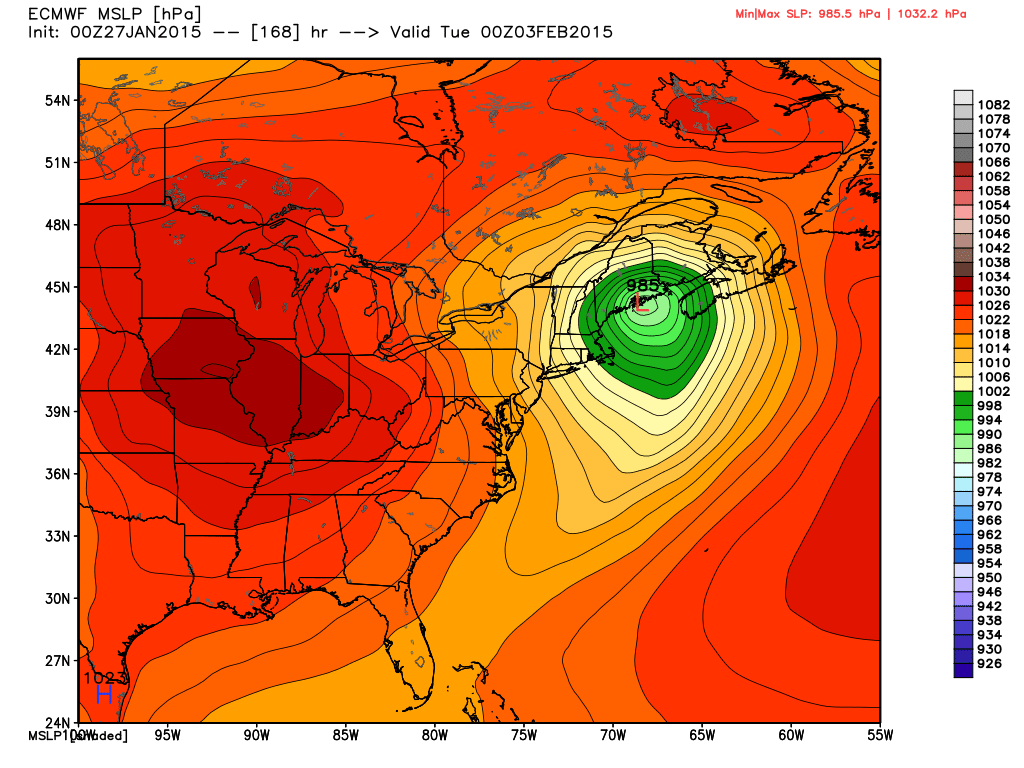
I wanted to quickly post on two totally different scenarios for next week.  Two of the more powerful forecast models we use to look into the mid-long range are in separate worlds when it comes to the weather pattern the middle to latter part of next week.

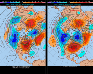
Here’s a look at the GFS upper air pattern:

gfs_z500_sig_east_38

Note the eastern ridging which would lead to well above normal temperatures during the middle to latter part of next week (by as much as 10 degrees above average), along with dry conditions.

HOWEVER, here’s a look at the European’s forecast upper air pattern late next week:

ecm_z500_anom_east_11

This would certainly be quite the significant storm for the Northeast, but the implications here are vastly different from that which the GFS shows above.  Instead of warmth and dry conditions, we’d deal with highs in the middle 30s and overnight lows in the lower to middle 20s.  Additionally, we’d also “enjoy” (okay, some folks would “enjoy”) snow showers and snow squalls the middle to latter portion of next week, as noted per the European below, including a lake Michigan connection.

ecmwf_slp_precip_ky_36


Needless to say, we have a lot to sort out in the coming days.  We’ll be here to do just that.  Make it a great Tuesday!

Permanent link to this article: https://indywx.com/two-totally-different-solutions-for-next-week/

Change On The Horizon…

So far, October 2013 is running well above normal in the temperature department: As shown above, the lower lakes and Ohio valley region has been the target for the biggest…

You must be logged in to view this content. Click Here to become a member of IndyWX.com for full access.  Already a member of IndyWx.com All-Access?  Log-in here.

Permanent link to this article: https://indywx.com/change-on-the-horizon/

Friday Forecast: Busier Times Ahead In The Good Ole Forecast Office!

Updated 10.11.13 @ 6:45a

Zionsville, IN I, like many of you, make sure to enjoy the last of the warm, sunny weather this time of year.  As veteran Hoosiers know, the months ahead present a cloudy, bitterly cold, and windy time of things.  Thankfully, we have another gorgeous day lined up to close the work week.  We discuss this and busier times ahead below!

Status-weather-clouds-iconFriday: Partly cloudy; 48/ 76

It’s only fitting that we close out the work week with the same type of weather we’ve enjoyed all week long- a cool start followed by beautiful weather conditions through the afternoon.  Get outside and spend some time soaking up the sunshine!

Status-weather-showers-day-iconSaturday: Mostly cloudy; scattered evening/ nighttime shower; 0.10″ or less; 50/ 76

Most of your daytime Saturday will provide pleasant weather to get some of those last minute chores taken care of.  We’ll notice an increase in our cloud cover followed by a broken line of showers (perhaps a rumble of thunder) rolling through the state from west to east.  We’re not looking at significant rainfall with this system.  In fact, we think most communities pick up less than one tenth of an inch of rain (if that).

Status-weather-clouds-iconSunday: Partly cloudy; 55/ 70 

While some of our extreme eastern counties may see an AM shower Sunday, most of the day will be rain-free and feature increasing sunshine.  It’ll be another pleasant day for outdoor activities.


Status-weather-clouds-iconMonday:  Partly cloudy; 45/ 69

High pressure and an associated northerly air flow will dominate our weather to begin the new work week. North breezes may gust upwards of 15 MPH Monday and this will help keep us cooler than the weekend. We’ll start the day quite chilly (middle 40s for most) before warming into the upper 60s.

Status-weather-showers-day-iconTuesday: Increasing cloudiness, PM shower; 0.10″; 54/ 73

While we have some timing issues to work out as we draw closer to the event (GFS is more progressive whereas the ECMWF is slower), we’ll go ahead and introduce shower chances to your forecast as early as Tuesday evening. Stay tuned as we fine tune things.

Status-weather-showers-scattered-iconWednesday: Rain; 0.50″; 49/ 64

As of now, we see a cold front moving through the region Wednesday. Ahead of the front, showers and possibly a thunderstorm will blow through the region.  Our winds will shift to the northwest Wednesday night/ Thursday, helping drive the coldest air so far this season into the Hoosier state Wednesday night and Thursday.

Status-weather-showers-scattered-iconThursday:  Rain; 0.50″; 44/ 57

Again, as we posted above, timing is everything with our mid to late week cold front.  Overnight model data places a heavier corridor of rain through central Indiana mid week- potentially as much as 1″-1.25″ over the two day period.

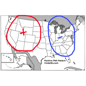
We also want to continue pointing out that with the PNA shifting back into the  positive, the stage is set for chilly air to hang around the region with more “staying power” as we move through October’s second half.  We’ve covered this in posts below and will continue to go over things as we move forward…  It’s time to certainly pull out those coats! 🙂

Permanent link to this article: https://indywx.com/friday-forecast-busier-times-ahead-in-the-good-ole-forecast-office/

Wednesday Evening Forecast Update


Forecast models continue to hint at the potential of our next significant storm system slated for a mid month arrival.  Latest data, hot off the press, remains in general agreement on the way things evolve, but details on timing and any heavy rain/ severe threat will have to be fine tuned as we move forward.

f216

gfs_namer_192_500_vort_ht_s

Permanent link to this article: https://indywx.com/wednesday-evening-forecast-update/

Sunday Afternoon Rambles…

Rain was plentiful over the region over the past 48 hours.  While widespread 2″ rainfall was common for all of central Indiana, the heaviest rainfall fell across southern and eastern Indiana.

Here are a couple of illustrations of the rainfall totals.  The first image is storm total rainfall from the past 24 hours. Note the heavy, 4″ type rains over southern and eastern Indiana. The second image is off the awesome Weatherbell model site and shows the heavy rainfall event over Indiana that unfolded on a bigger scale.  Needless to say, the short term drought concerns that we were dealing with August and September have been erased.

1379925_643932488960824_62568978_n


rtma_precip_48

Temperatures are running MUCH cooler over the region today and we also note a drier, more fall-like, air mass building into the region.  A couple of other items- it’s easy to see where the cold front is currently located (as of this post) as many in Ohio are still dealing with warm, humid conditions.  Additionally, the cold core upper level low remains to our west and will rotate over our region Monday.  This will lead to an unseasonably cool day with mostly cloudy skies and the potential of a scattered shower.

rtma_glus

As we move forward, despite the cooler air to welcome in the new work week, we remain in a warmer than average pattern overall.  The PNA continues to dominate the pattern and until this goes positive, don’t look for any sort of sustained cool weather across the eastern US.

gfs_pna_bias


The European operational and ensemble show the current trough and associated cool air retreating and allowing a warmer southwesterly air flow to build in this week.

Monday

Geopotential32at32500hPa_North32America_24


Thursday

Geopotential32at32500hPa_North32America_96After a quiet time ahead (and much needed to dry out), our next significant storm system appears to arrive around mid month.  Both the GFS and European model are in agreement with this idea.  Does another potential significant rain maker and associated severe weather event lie ahead mid month?  Possibly.

Here’s a look at the upper air pattern out at Day 10 off the European model.  We note another significant storm system ejecting out into the Plains states, most likely after dumping another impressive early autumn snow on the central and northern Rockies.

ecm_z500_anom_noram_11

The GFS idea is something similar to that of the European, suggesting confidence is relatively high, at least from this distance.

gfs_z500_sig_noram_37

All of that said, we’re still in a “transient” pattern as the next big storm is shown crashing onshore along the west coast by both models.  We shouldn’t be surprised by a “transient” pattern this time of year. It’s October, after all- a month notorious for many swings on the thermometer.

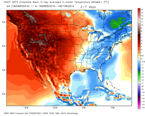
We’ll close with a look at the European’s temperatures anomalies over the course of the next 10 days.  Note the chill of early week erased with above normal warmth for the majority of the period. Also, pay attention to the unseasonable chill coming off the Rockies and into the Plains towards the end of the period below.  This is associated with the mid month storm.

tavg_anom_ecmwf_conus_1

Permanent link to this article: https://indywx.com/sunday-afternoon-rambles/