
You must be logged in to view this content. Click Here to become a member of IndyWX.com for full access. Already a member of IndyWx.com All-Access? Log-in here.
Category: European Model
Permanent link to this article: https://indywx.com/video-details-around-what-should-become-major-hurricane-laura-reviewing-our-pattern-into-mid-september/
Aug 24
VIDEO: Heat And Humidity Returns; More Organized Rain Chances Increase Late Week…
You must be logged in to view this content. Click Here to become a member of IndyWX.com for full access. Already a member of IndyWx.com All-Access? Log-in here.
Permanent link to this article: https://indywx.com/video-heat-and-humidity-returns-more-organized-rain-chances-increase-late-week/
Aug 20
Long Range Update: Closing Out August And Welcoming In Meteorological Fall…
The upcoming couple of weeks will be dominated by the tropics grabbing the headlines, but our more immediate weather pattern will become interesting, as well.
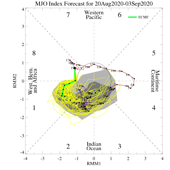
In short, the medium to long range pattern will be controlled by the MJO. We think the upcoming 7 days will feature increased heat and humidity (more typical of late-August standards), but as the MJO rumbles into Phase 2, a period of cooler air will arrive around the last couple of days of the month, or first few days of September (subject to change by a day or two from this distance).
This supports the flip back to warmth next week and paves way for at least a transient period of cool next weekend or the following week:
Sure enough, that’s where the models are going over the next 2-3 weeks:
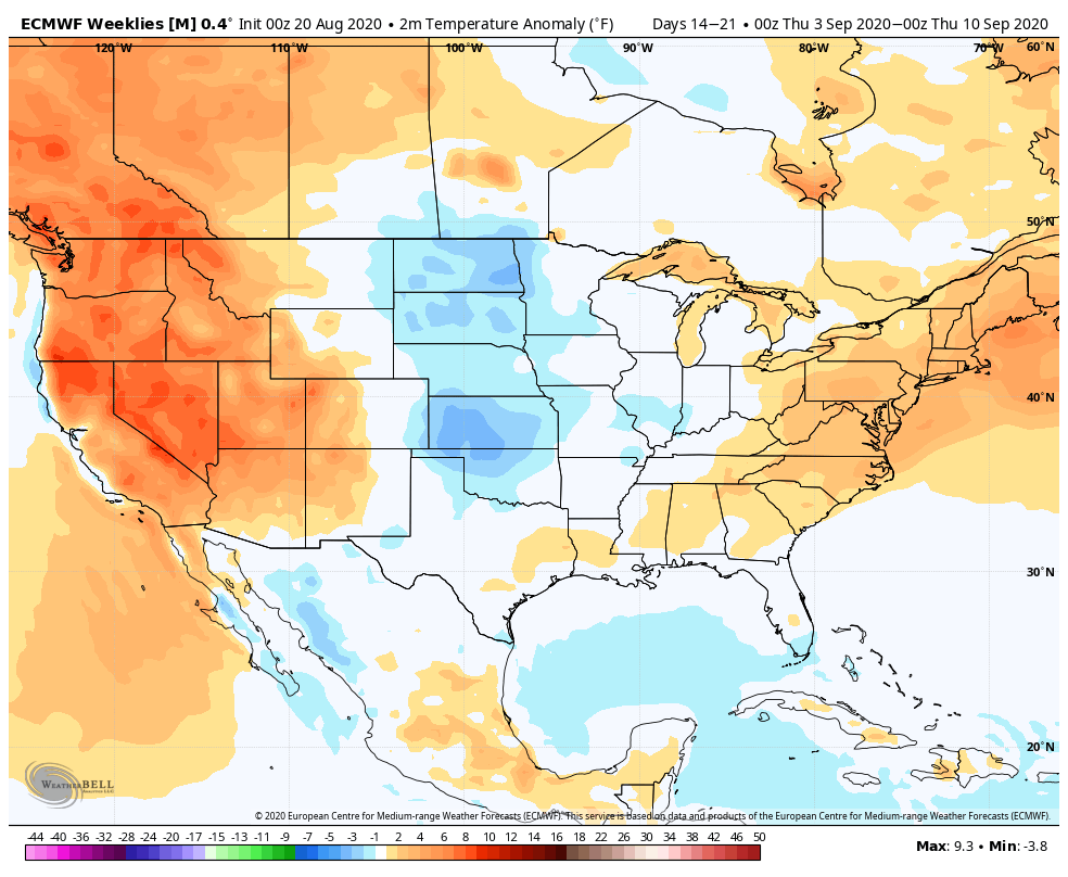
The early call on Labor Day weekend is for a cooler than normal feel.
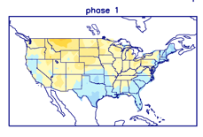
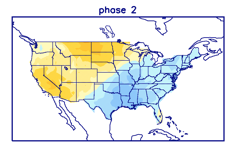
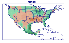
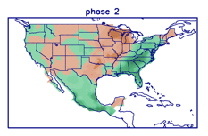
The precipitation pattern favors a wet look with Phase 1 (closing August and opening September) followed by a shift east in the wettest anomalies in Phase 2 (early to mid September).
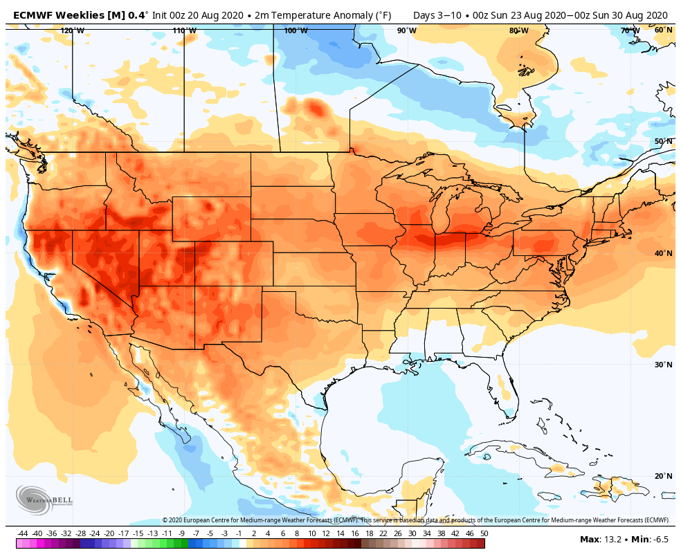
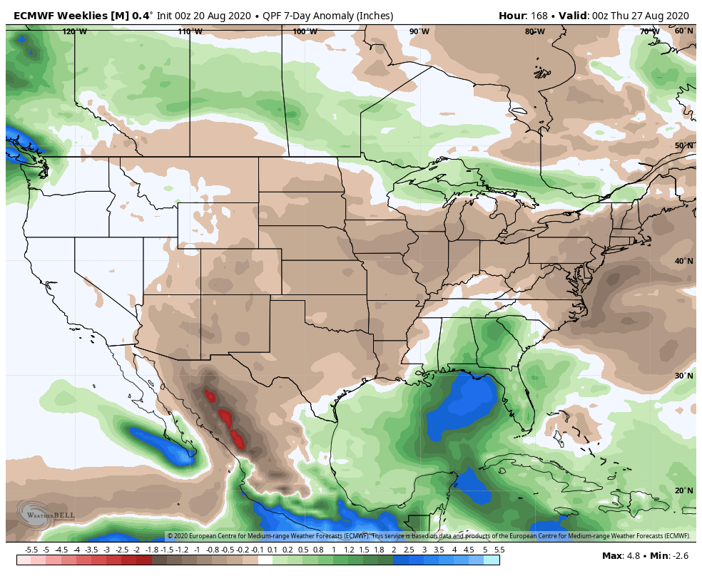
The European Weeklies show a similar look:
The wild card here has to do with how long we stay in Phase 2 (if we stay longer, cooler risks will present themselves for September) vs. going into the wheelhouse and allowing other drivers to take control. More on what lies ahead September, as a whole, in the coming days… One thing’s for sure and that’s the likelihood the tropics remain hyperactive into mid-September.
Permanent link to this article: https://indywx.com/long-range-update-closing-out-august-and-welcoming-in-meteorological-fall/
Aug 13
Long Range Update: Closing Out August…
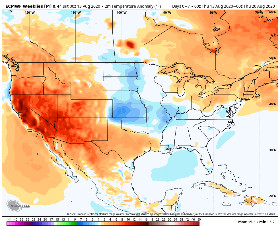
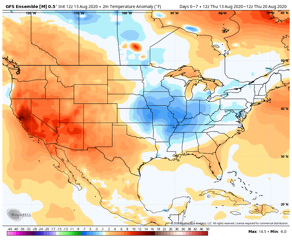
With a little over 2 weeks to go in meteorological summer, model data disagrees in the way the month- and season ends. That is, after the upcoming week where the consensus is cooler and drier than normal (we agree, as well). Let’s take a look at the data:
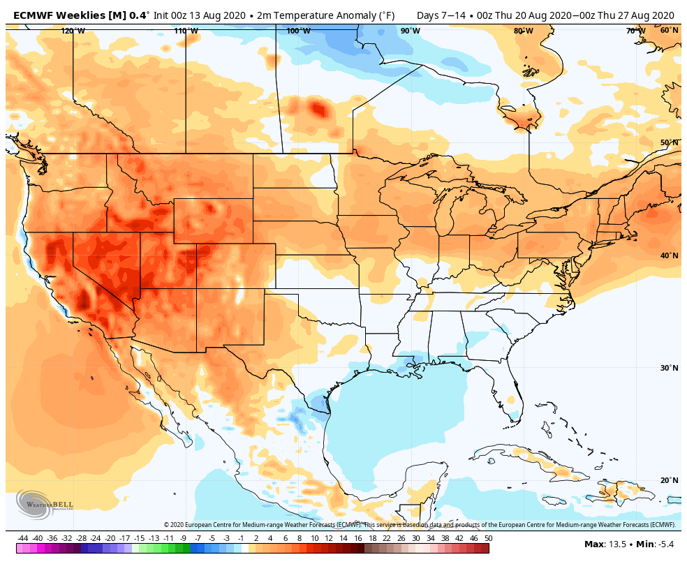
European Weeklies
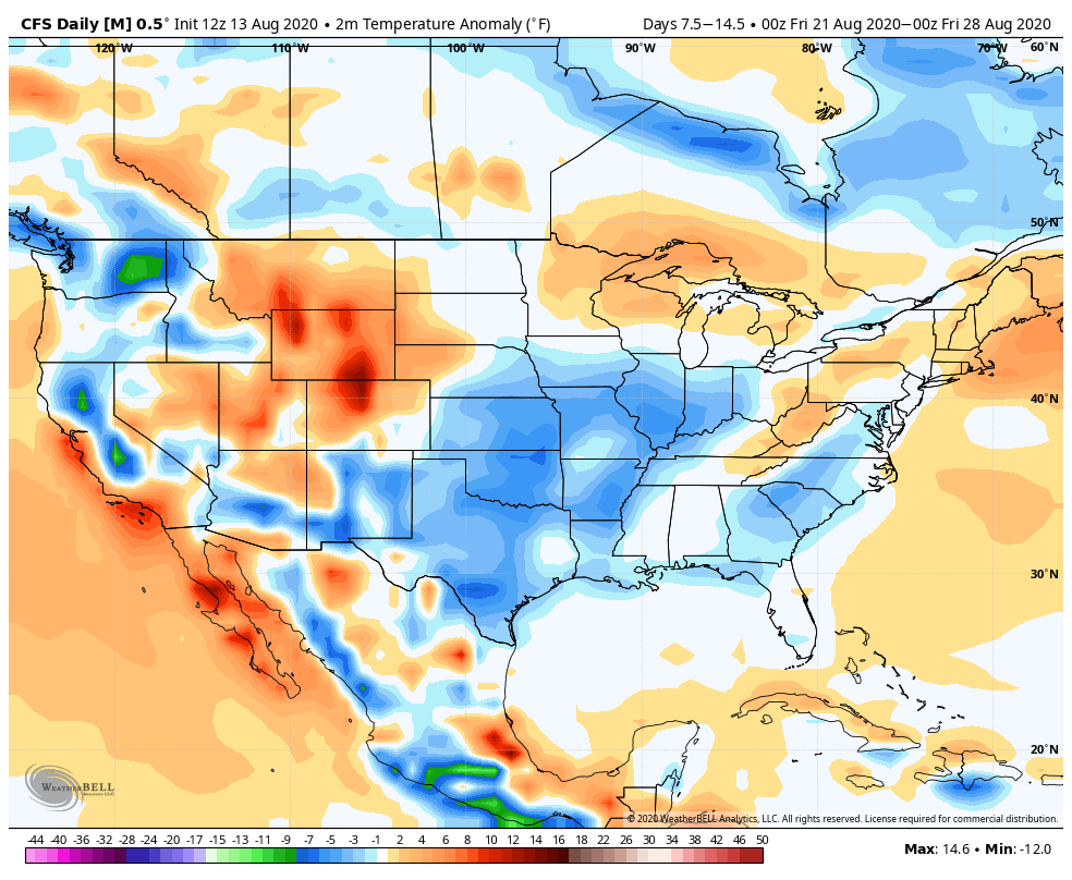
CFSv2

GEFS
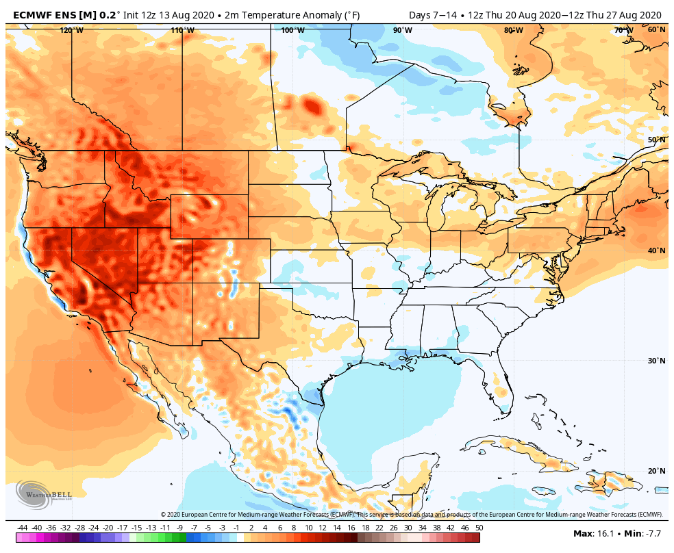
EPS

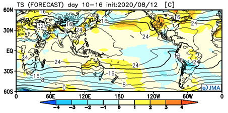
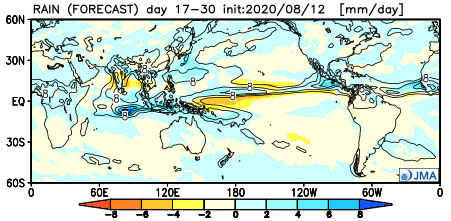
JMA
The American data and JMA Weeklies are coolest (compared to the European), but compared to Weeks 2 and 3, there’s better consensus. The initial week is also looking drier than normal- especially after a “smattering” of storms tomorrow and Saturday.

Let’s now take a look at Week 2:
European Weeklies
CFSv2
GEFS

EPS
JMA
This is where our idea begins to pivot more towards the JMA Weeklies and European data (warmer look). The reason primarily has to do with the MJO moving back into Phase 8 during this time period.
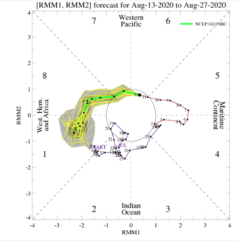
This is a warm phase in August.

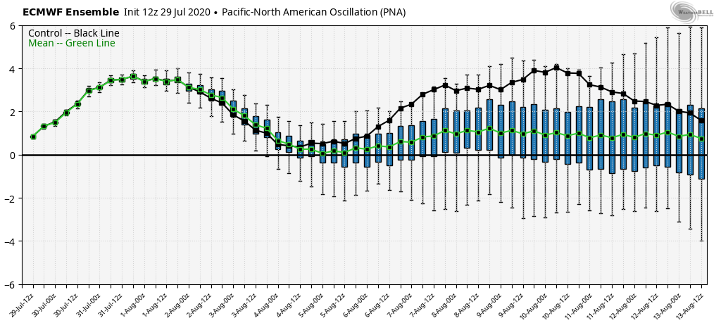
Furthermore, the PNA ‘mean’ is forecast to trend off the positive “mountain” (that will help drive the cooler pattern for the upcoming week) and more towards neutral.
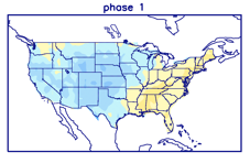
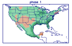
Phase 1 is also a warmer look for our part of the country and that’s the way we’re leaning for the last week of the month (despite the very cool CFSv2).
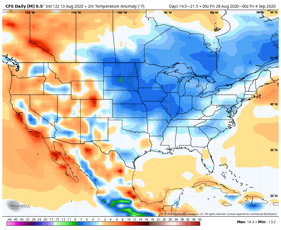
While not overly warm, we think the JMA has the best handle on the temperature pattern in the Week 3 timeframe, locally (seasonable to slightly above normal).

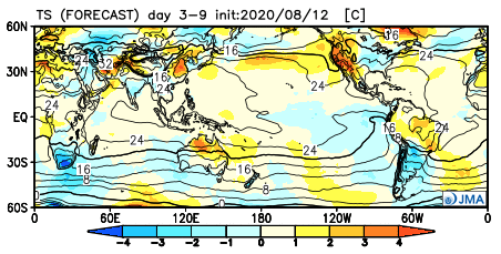
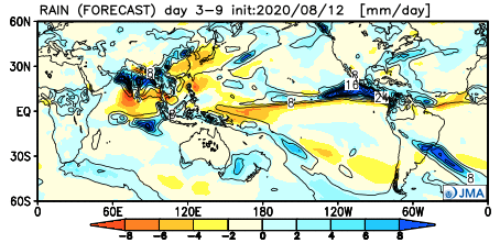
The pattern should also begin to trend wetter during this time period:
This matches up with Phase 1 of the Madden Julian oscillation:
So, to summarize, after a cool and dry period next week, we anticipate the pattern to trend warmer (more seasonable) and wetter to close the month and head into early September. One other item of note is that the tropics should really begin to heat back up during this period, as well. Of course, as is the case from time to time, that can be a wild card from a precipitation perspective. The Gulf of Mexico (GOM) looks particularly busy late August through late September, but there’s simply no way to get more specific from this distance, including potential inland impacts. It’s worth keeping a close eye though.
Before we leave, the latest JAMSTEC seasonal data updated this morning and features a “torch” of a fall, along with a warm, wet winter, locally. That southeast ridge will have to be dealt with this winter. While still early, the early lean is for a warm start to winter (including holiday season). While there are some ingredients that may keep things more interesting than what they could be otherwise, from at least this point, this doesn’t appear as if it’ll be an “exciting” winter for lovers of snow and cold. Much more later- and again, we still have a long way to go…
Permanent link to this article: https://indywx.com/long-range-update-closing-out-august/
Aug 12
VIDEO: Unsettled Weather Returns To Close The Week; Unseasonably Cool Air Arrives Next Week…
You must be logged in to view this content. Click Here to become a member of IndyWX.com for full access. Already a member of IndyWx.com All-Access? Log-in here.
Permanent link to this article: https://indywx.com/video-unsettled-weather-returns-to-close-the-week-unseasonably-cool-air-arrives-next-week/