
One of the many ingredients we like to throw into the mixing bowl when developing our medium range forecast is the teleconnection breakdown. Many times, the various teleconnections play into themselves and agree, but, at times, conflicting signals lead to a fight. At any given time, one or the other “big boy” teleconnections can take control of the pattern and simply overwhelm. As things stand now, it appears as if the two teleconnections trying to control are the EPO (Eastern Pacific Oscillation) and PNA (Pacific North America pattern), highlighted below.
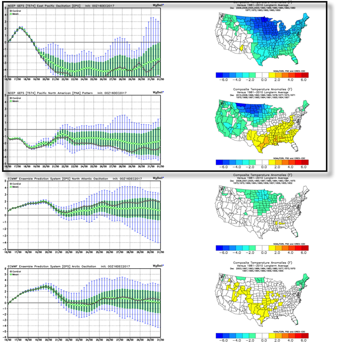 As we’d expect, as these two fight it out, a battle will ensue across the central and eventually eastern portion of the country. The negative EPO is a widespread cold pattern, while a negative PNA favors south-central and southeastern ridging (a warmer pattern).
When we look at the latest ensemble data, we see this battle playing out within the modeling.
 Eventually, we expect the deeply negative EPO to take control and overwhelm the pattern with cold. However, as this transition of power takes place, the negative PNA won’t go down without a fight and will likely play a role in the weather leading up to Christmas.
The negative PNA suggests we need to remain on guard for the potential of an interior snow/ ice event around Christmas. As we’ve been mentioning, from this distance there’s no way to say whether this is an impactful wintry event for our region, or just to our north or south. We should be able to become more detailed within the next few days…

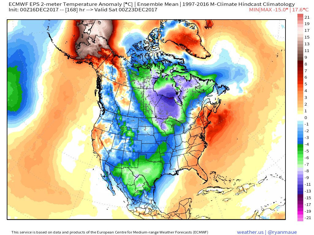
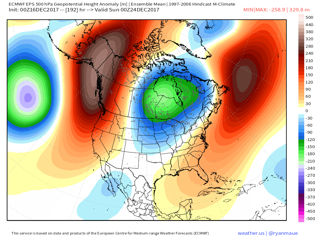
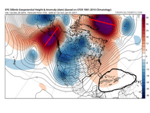
 Such a pattern illustrated above, per the European ensemble (image 1) and the GFS ensemble (image 2), would help drill a tongue of unseasonably cold air through the northern Plains, into the Mid West, and across the East.
 We’ve been discussing early snow cover across Canada and the northern tier for weeks and how models would have to “correct” colder as they realize the air masses traveling over the snowpack won’t be able to modify as they normally would without that snowpack. The differences between this November and last are startling and show how the early snowpack is beginning to “feedback” on itself leading to early-season cold air.
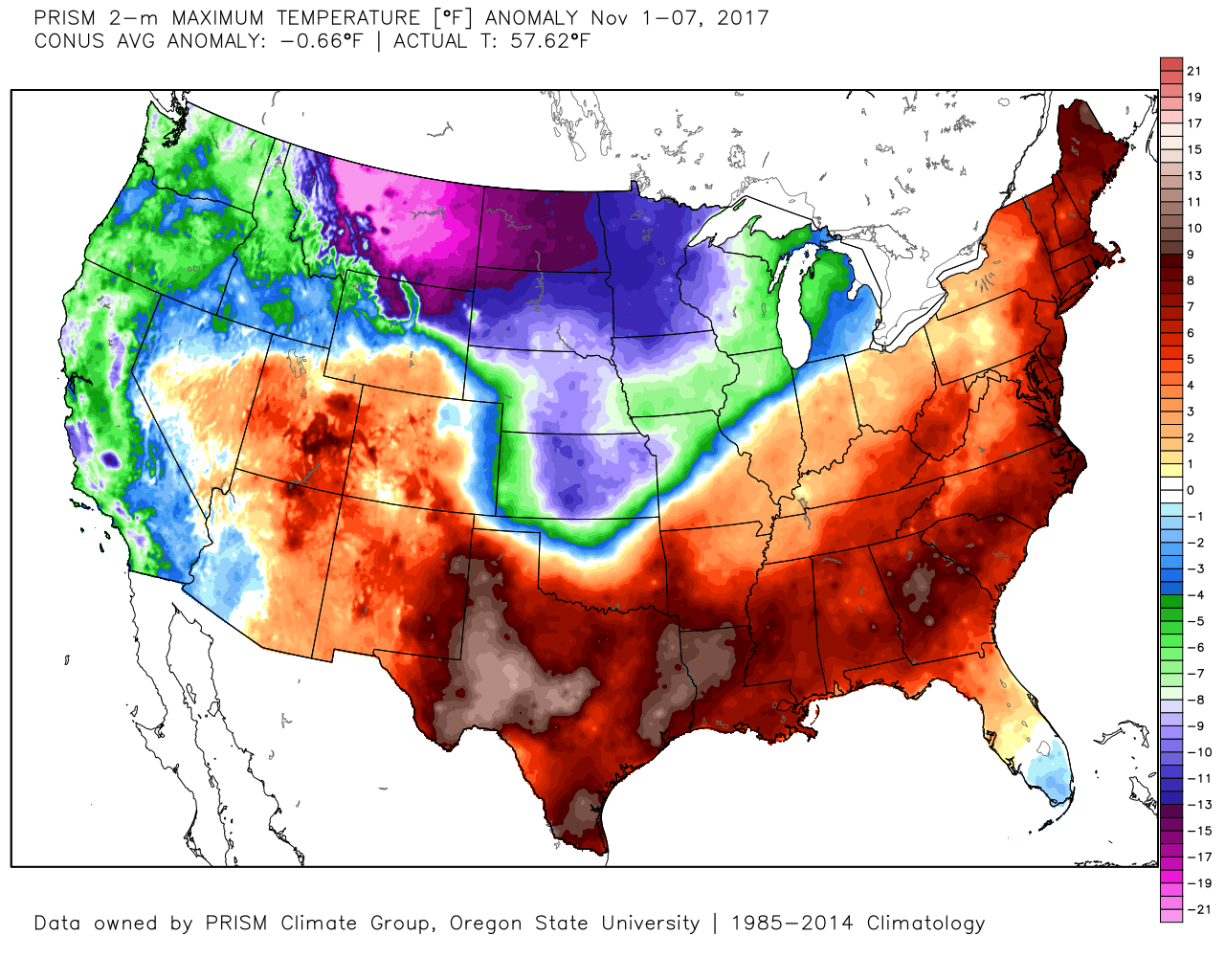
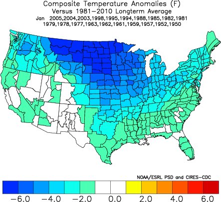
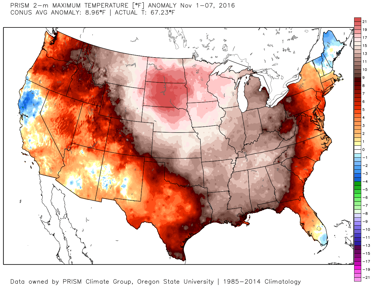 2017 snowpack and temperatures anomalies through the first week of November:
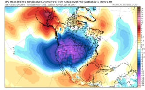
 Given the overall look to the pattern downstream, I anticipate the cold will continue to “press” and eventually overwhelm the pattern east as we progress through the second half of the month.
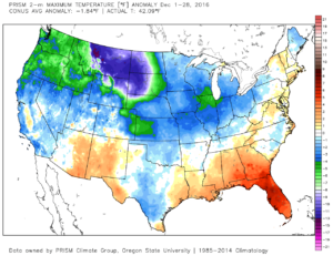
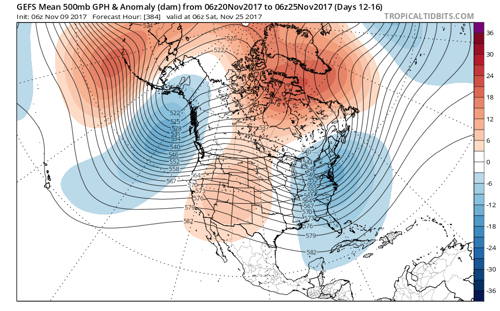
 By Day (10), the cold pattern is well established over the Lower 48. This is a coast-to-coast cold signal (heart of the cold centered over the west and central) depicted by the European ensemble, along with other modeling.
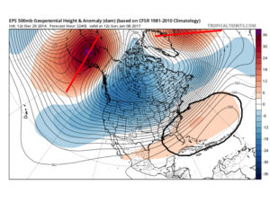
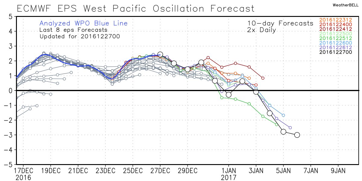
 Teleconnections support a cold pattern returning.
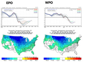
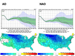
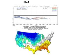 The agreement amongst teleconnections is nice to see and ups confidence in the overall direction of where this pattern is heading in regards to colder than average times looming. The negative PNA correlates nicely with the SE ridge that continues to make itself heard from time to time over the next few weeks. It should also be noted that the phases of the Arctic Oscillation (AO) and North Atlantic Oscillation (NAO) become more of a factor for mid and late winter.
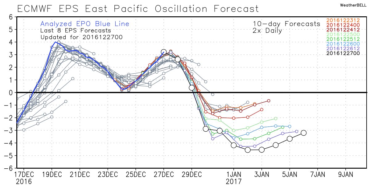
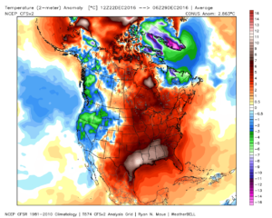
 Accordingly, we see the ensemble data flipping to a colder pattern over the upcoming (10) days. Note the low anomalies in the higher latitude regions today (Image 1) versus Day 10 (Image 2).
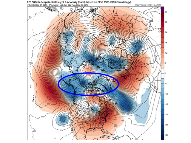
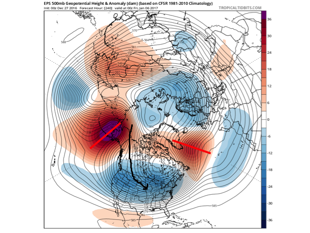 The pattern developing by Day (10) is one capable of producing another frigid regime- only January style. Cross-polar flow sets up shop and, unlike, December, some blocking is noted, as well. This can help the mean storm track shift further south. (Bye-bye Great Lakes cutters, though Mid Western and Ohio Valley Snow Lovers will find a new worry in the form of suppression potential ;-)). Individual storms will have their respected challenges, as always. As a whole, it’s a very cold, stormy look and a pattern capable of leading to an expanding snow pack across the Lower 48.