Updated 05.04.23 @ 7:50a
You must be logged in to view this content. Click Here to become a member of IndyWX.com for full access. Already a member of IndyWx.com All-Access? Log-in here.

May 04
Updated 05.04.23 @ 7:50a
You must be logged in to view this content. Click Here to become a member of IndyWX.com for full access. Already a member of IndyWx.com All-Access? Log-in here.
Permanent link to this article: https://indywx.com/video-long-range-update-and-looking-at-short-term-rain-storm-chances/
Apr 28
Updated 04.28.23 @ 2:33a
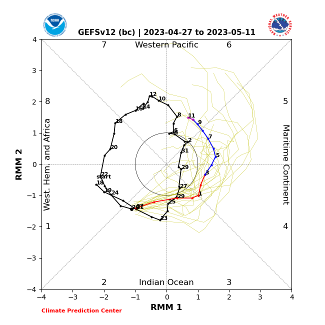
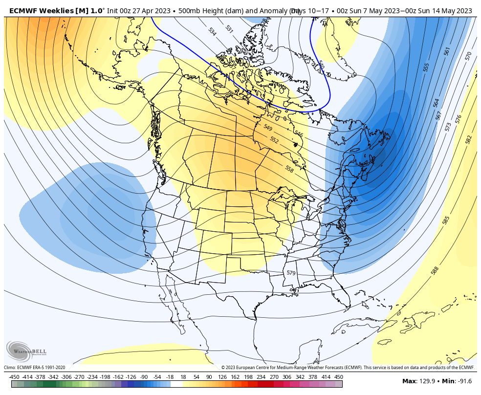
While we remain bullish on a warmer response in the Week 2-3 time period, the longevity of any sort of “warm-up” is the point we’re trying to drive home. The MJO is still forecast to amplify into Phase 6 just past May 10th. As a result, our stubborn call remains on modeling being “forced” to correct warmer during this time.

As it is, we’re in a camp of our own with that call based off Thursday’s long range update. Note both the new European Weeklies and JMA Weeklies show the eastern trough remaining.


At the very least, it’s an interesting test case on our hands that we’ll be able to see play out in real time.
Even if we do see the Week 2-3 warm up, it’s likely to be short-lived as the MJO continues to rumble into cooler phases and the teleconnections (namely the EPO and NAO) tag-team neutral to negative through the bulk of May and into early June.
The end result after any sort of warmer response during the aforementioned time period is likely for at least a slightly cooler pattern to return compared to average. The relatively drier pattern will also trend wetter late May into early June.


At the end of the day, we still see a warmer surge taking hold, locally, between Weeks 2-3. However cooler and wetter conditions likely settle back in as we navigate the back half of May and into early June at least.
Is this a hint of the times as summer matures? Not out of the question this year as we flip the page to Nino conditions…
Permanent link to this article: https://indywx.com/lr-update-may-pattern-evolution-and-early-look-at-june/
Apr 21
Updated 04.21.23 @ 7:56a
You must be logged in to view this content. Click Here to become a member of IndyWX.com for full access. Already a member of IndyWx.com All-Access? Log-in here.
Permanent link to this article: https://indywx.com/long-range-update-looking-in-more-detail-at-may/
Apr 06
Updated 04.06.23 @ 7:59a
You must be logged in to view this content. Click Here to become a member of IndyWX.com for full access. Already a member of IndyWx.com All-Access? Log-in here.
Permanent link to this article: https://indywx.com/video-improving-weather-heading-into-the-easter-weekend-long-range-update/
Apr 01
Updated 04.01.23 @ 9:53a
You must be logged in to view this content. Click Here to become a member of IndyWX.com for full access. Already a member of IndyWx.com All-Access? Log-in here.
Permanent link to this article: https://indywx.com/video-targeting-another-severe-episode-early-next-week-long-range-update-into-early-may/