Updated 07.12.22 @ 7:29a
You must be logged in to view this content. Click Here to become a member of IndyWX.com for full access. Already a member of IndyWx.com All-Access? Log-in here.

Jul 12
Updated 07.12.22 @ 7:29a
You must be logged in to view this content. Click Here to become a member of IndyWX.com for full access. Already a member of IndyWx.com All-Access? Log-in here.
Permanent link to this article: https://indywx.com/2022/07/12/video-discussing-continued-wetter-model-trends/
Jul 10
Updated 07.10.22 @ 8:25a
You must be logged in to view this content. Click Here to become a member of IndyWX.com for full access. Already a member of IndyWx.com All-Access? Log-in here.
Permanent link to this article: https://indywx.com/2022/07/10/video-weak-front-moves-through-tuesday-morning-perhaps-the-longer-range-pattern-isnt-as-dire-after-all/
Jul 09
Updated 07.09.22 @ 9:20a
You must be logged in to view this content. Click Here to become a member of IndyWX.com for full access. Already a member of IndyWx.com All-Access? Log-in here.
Permanent link to this article: https://indywx.com/2022/07/09/video-heading-back-into-a-dry-pattern/
Jul 03
Updated 07.03.22 @ 6:40a
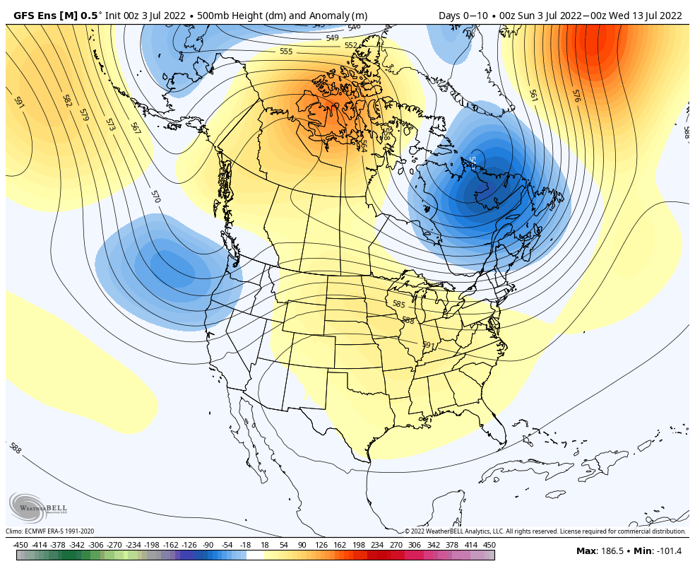
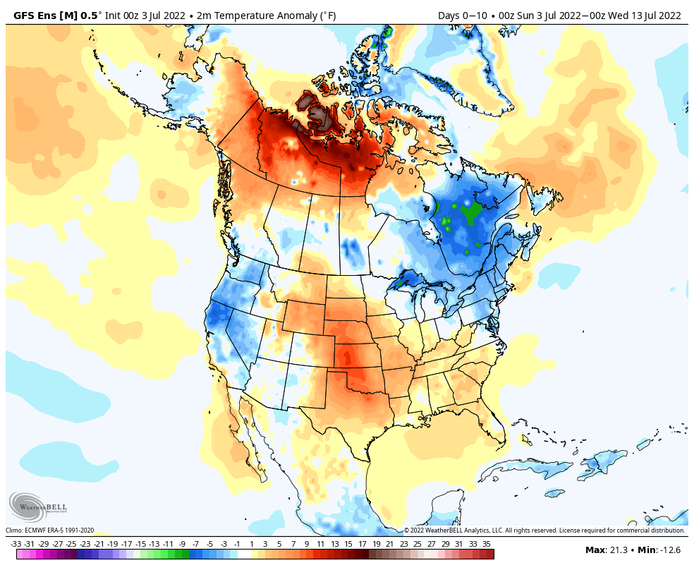

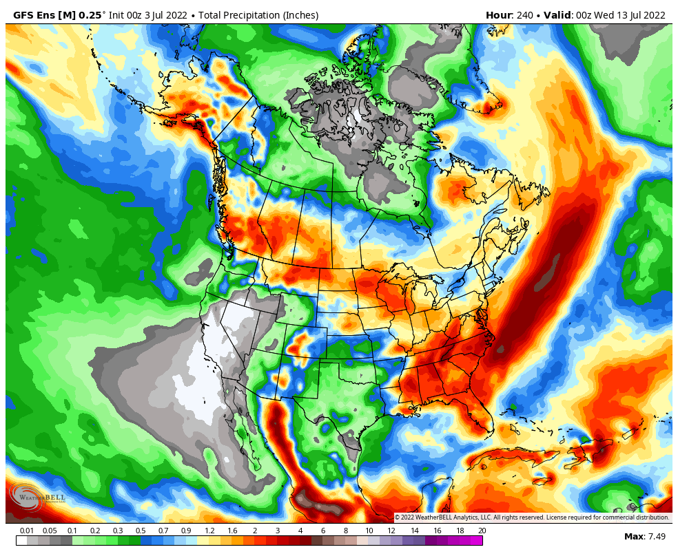
Forecast Period: 07.03.22 through 07.13.22
After a quiet holiday weekend, a much more active pattern will take hold as we navigate the 1st half of July. It won’t rain everyday, but chances of benefitting from soaking rain in more widespread fashion will be on the rise as we move into the middle and latter part of this week into the following week.
Serious heat will bake the Plains while a cooler pattern dominates the Northeast region. In between, here on the home front, we’ll note heat trying to expand northeast into the Ohio Valley (and there will be several 90°+ days thrown in the 10-day period), but each time it may look like the heat is here to stay for more than a few days, we’ll likely get cooling relief from cold fronts moving southeast around the periphery of the ridge.
We’ll have to pay close attention to some of the more “mature” storm complexes including a heightened threat of damaging straight line winds give the overall pattern. It’s impossible to pin down which complexes may include a better threat of severe weather from this distance, but this threat may include a closer look as we move into the middle and latter part of the week.
10-Day Rainfall Forecast: 1”-2”
Permanent link to this article: https://indywx.com/2022/07/03/weekly-agwx-and-severe-weather-outlook-44/
Jul 02
Updated 07.02.22 @4:45a
Thankfully, it continues to look like timing is on our side as we navigate the Independence Day holiday weekend.
A weak front moved through the region last night with scattered storms. While everyone didn’t get wet, some neighborhoods absolutely cashed in. That front will push far enough south (eventually stalling in the northern TN Valley) to allow, quieter and drier conditions to prevail today through the holiday, itself. All of those big outdoor plans should be executed without having to worry about Mother Nature throwing us any surprises (I know, famous last words, right?!).
With that said, the promised much more active (wetter) pattern is on our doorstep. The culprit? A retrograding ridge of high pressure. The GFS ensemble loop below shows this perfectly over the next couple of weeks.
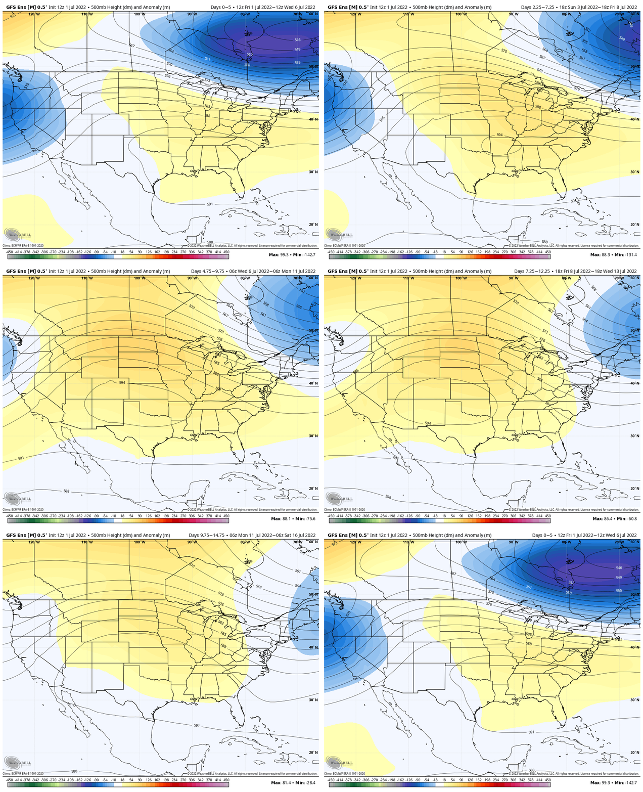
This puts the Ohio Valley in a favorable position to cash in on multiple storm clusters that will ride the periphery of the hot dome well to our west. The pressure gradient between blazing hot conditions in the Plains, back into the Four Corners, combined with cooler shots of air blowing southeast from the upper Midwest and Great Lakes may “up the ante” for some of these complexes to include potential of damaging straight line winds.
Needless to say, for a region that hasn’t enjoyed widespread soaking rains in quite some time, this is good news as we approach what’s traditionally the hottest time of the year.
Guidance continues to paint a wetter than normal picture through the middle of July.
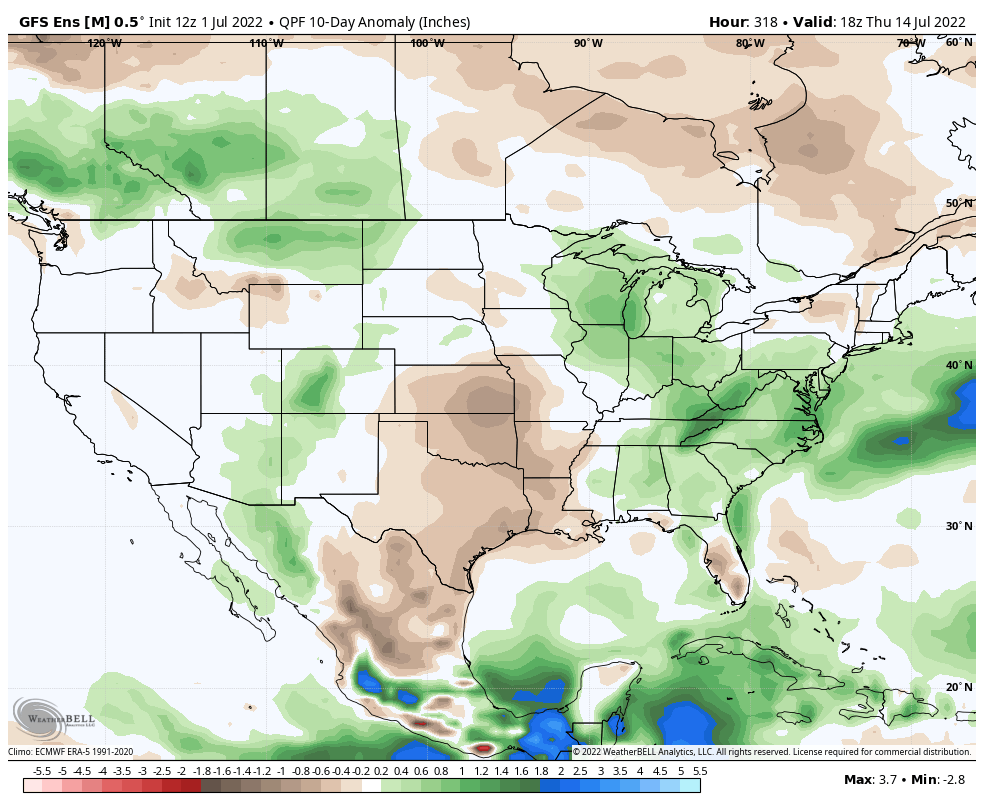
After the relatively quiet holiday weekend, the “excitement” will get underway late Monday night into Tuesday as the first in a series of storm complexes rides in from the northwest. While it most certainly won’t rain the entire time over the course of the next couple weeks, most will surely notice a significant difference in frequency of more widespread rain throughout central IN compared to of late.
Permanent link to this article: https://indywx.com/2022/07/02/ring-of-fire-long-awaited-active-pattern-on-the-doorstep/
Jul 01
Updated 07.01.22 @ 6a
You must be logged in to view this content. Click Here to become a member of IndyWX.com for full access. Already a member of IndyWx.com All-Access? Log-in here.
Permanent link to this article: https://indywx.com/2022/07/01/long-range-update-looking-through-the-month-of-july/
Jun 27
Updated 06.27.22 @ 7:10a
You must be logged in to view this content. Click Here to become a member of IndyWX.com for full access. Already a member of IndyWx.com All-Access? Log-in here.
Permanent link to this article: https://indywx.com/2022/06/27/video-gorgeous-open-to-the-new-work-week-signs-of-wetter-times-as-we-move-through-early-july/
Jun 26
Updated 06.26.22 @ 7:50a
You must be logged in to view this content. Click Here to become a member of IndyWX.com for full access. Already a member of IndyWx.com All-Access? Log-in here.
Permanent link to this article: https://indywx.com/2022/06/26/video-cooler-and-refreshing-as-we-open-the-new-work-week-what-does-mother-nature-have-in-store-as-we-roll-into-the-independence-day-weekend/
Jun 24
Updated 06.24.22 @ 7:44a
You must be logged in to view this content. Click Here to become a member of IndyWX.com for full access. Already a member of IndyWx.com All-Access? Log-in here.
Permanent link to this article: https://indywx.com/2022/06/24/video-pattern-takes-on-a-cooler-shift-leading-up-to-the-holiday-weekend-what-about-rain-chances/
Jun 23
Updated 06.23.22 @ 7:25p
You must be logged in to view this content. Click Here to become a member of IndyWX.com for full access. Already a member of IndyWx.com All-Access? Log-in here.
Permanent link to this article: https://indywx.com/2022/06/23/long-range-update-pattern-evolution-into-mid-july/