
Temperatures will attempt to approach seasonal norms Monday (average high this time of year is 40°) before arctic reinforcements blow into town Monday night and Tuesday.
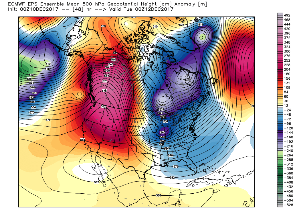 This will keep highs in the middle 20s Tuesday with wind chill values in the single digits and teens most of the day.
Scattered snow showers and embedded lake-generated squalls will accompany this arctic surge Tuesday. As the wind trajectory sets up shop Tuesday afternoon, lake effect snow bands will impact portions of northeast and east-central Indiana.
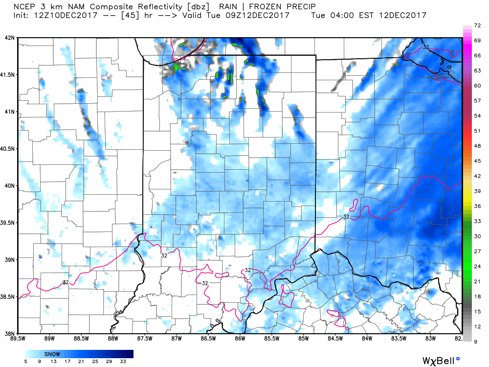
4a forecast radar Tuesday
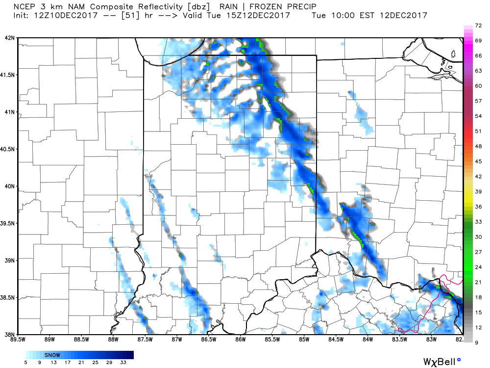
10a forecast radar Tuesday
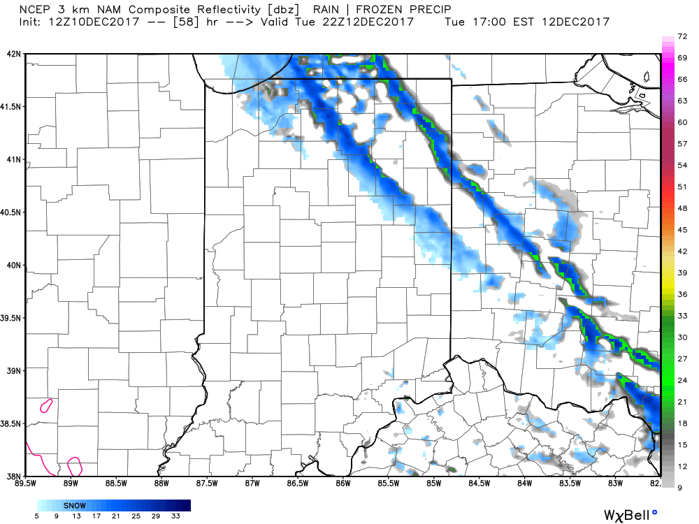
5p forecast radar Tuesday
Cold weather will continue to dominate through the work week and an additional upper level disturbance may try to ignite snow showers Thursday.
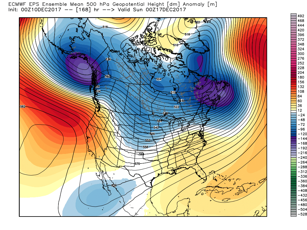
As we push into the 8-10 day time frame, a “relaxation” of the cold is anticipated, but, as we’ve been discussing, any sort of moderation will be brief in this weather pattern. Cold looks to continue to dominate, overall. With that said, there will be a window of opportunity early next week where temperatures will go above normal for a change and the European ensemble shows this brief moderation nicely.
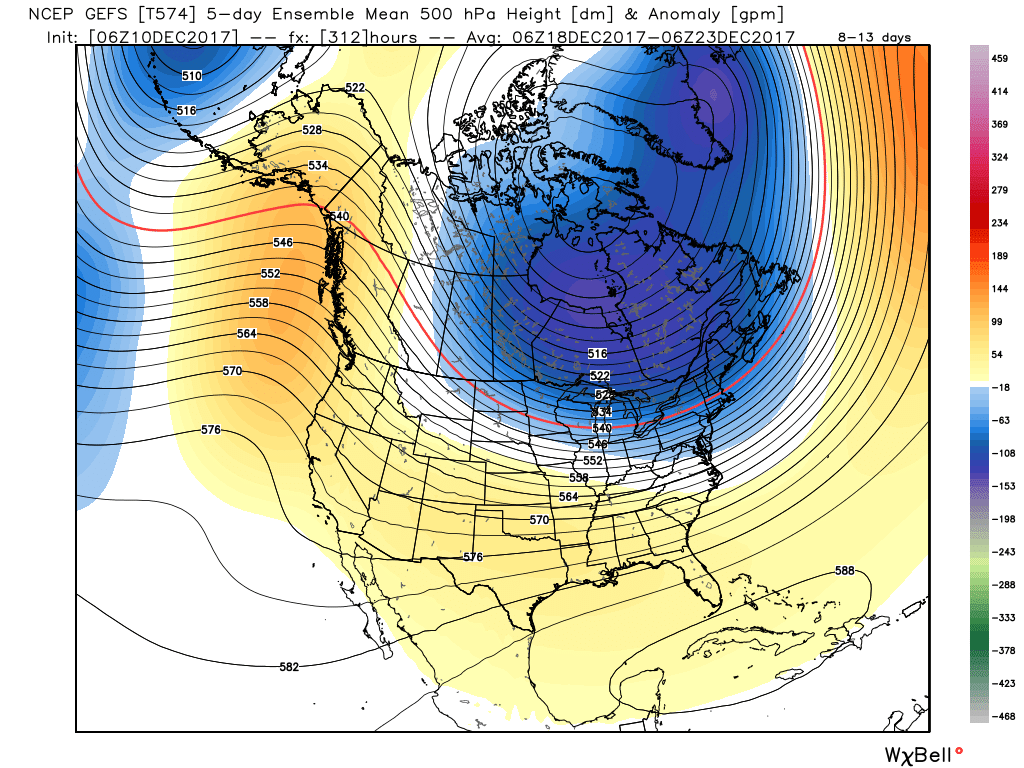
 This doesn’t last long as the pattern begins to reload as Christmas week approaches. As the evolution to a fresh cold pattern takes place, there’s a window of opportunity present for a more significant wintry system to potentially impact the Ohio Valley into the Mid Atlantic region. Notice the relatively “flat” ridge across the southern tier and associated tight thermal gradient. This look suggests we need to be on guard for the chance of a storm system to ride the thermal gradient in a west-to-east fashion, and has wintry implications for our region. Far too early for specifics; just know the possibility looms of a wintry event, locally, as Christmas week nears.
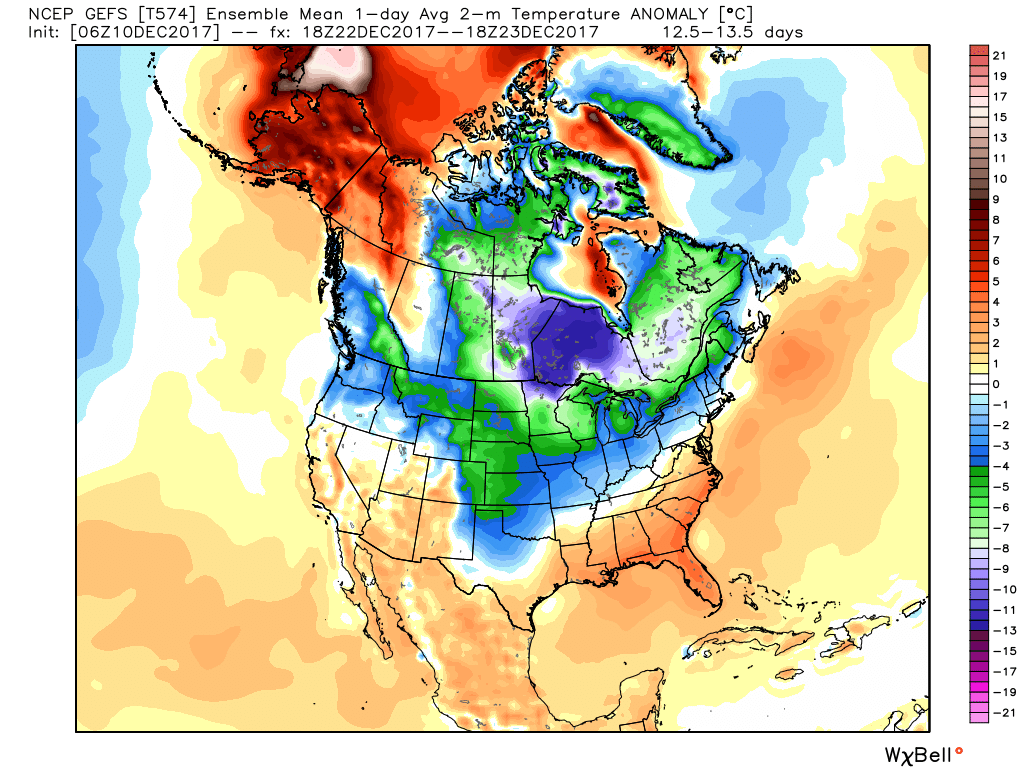 Speaking of Christmas, it sure appears as if cold will overwhelm the pattern for Christmas, itself, and the overall cold regime doesn’t show signs of letting up (with the exception of potentially a day or two) into the new year.
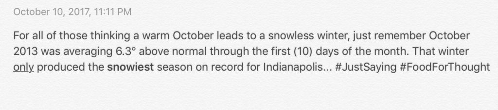
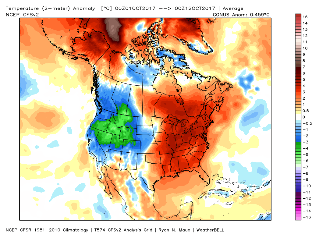 In coffee shops and my travels around the great state of Indiana, I’ve overheard lots of talk centered on because October has been so warm, another lackluster snow season awaits. Let us remind you that the infamous snow season of ’13-’14 featured a very warm first half of October.
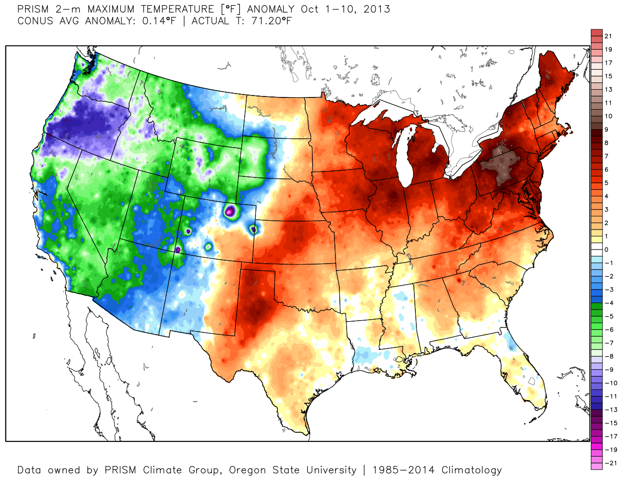
 The upcoming 7-10 days will feature more of a transitional period of weather that we’ve come to know and love around these parts. Warmth will spread northeast this weekend ahead of an approaching cold front (around 80° Saturday) before falling temperatures Sunday afternoon behind the frontal passage. The chilliest air so far this season will descend upon the region early next week. That said, the chill won’t hold and another surge of above normal warmth will spread northeast by the latter parts of next week.
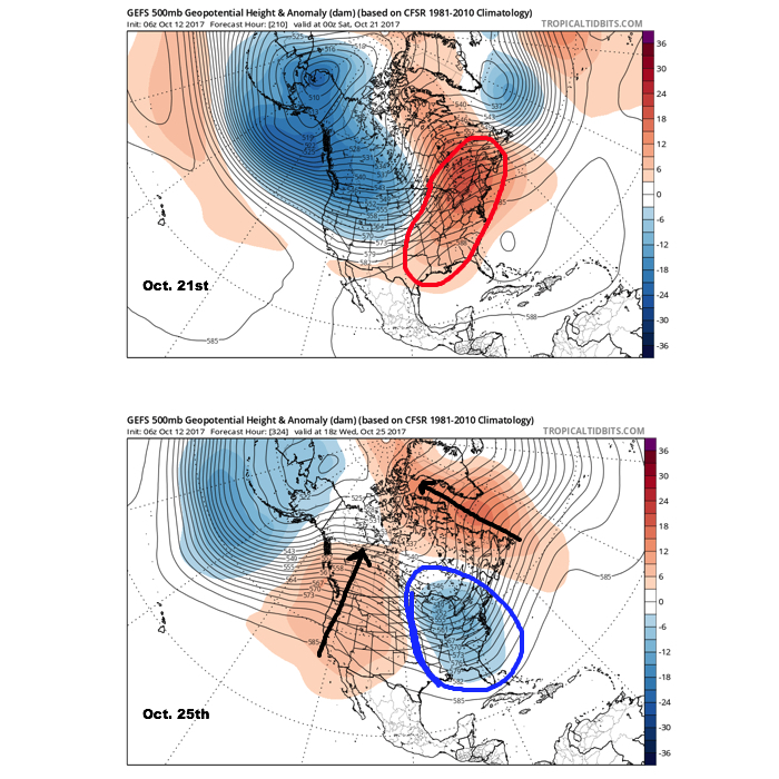 It should also be noted that analog data and research also would lean heavily in the cold direction to wrap up October and these findings also favor a chilly November… More on that later! Speaking of later, an updated 7-day will be posted this evening. Make it a great day!
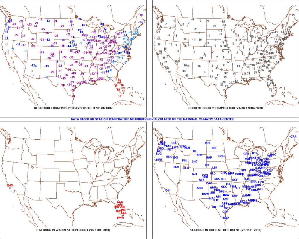 After the past week to ten days, that frigid open to the month seems like forever ago! The past 7-10 days has featured a significant January thaw, and temperatures now, MTD, are warmer than average across the Ohio Valley. Warmest anomalies can be found across the southeast region.
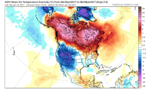
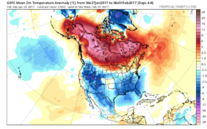
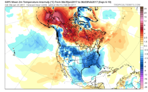
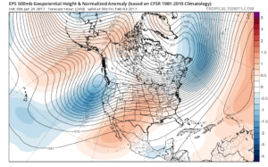
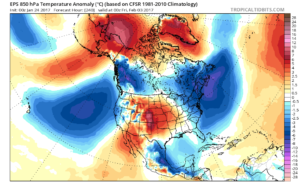
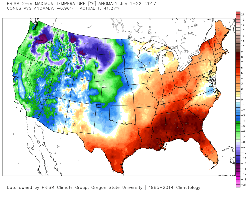 That said, the pattern is shifting back to winter for the last week of the month and while the duration, longer-term, can be argued, the next 2-3 weeks appear to offer an opportunity to play “catch up” in both the snow and cold departments. Note the developing eastern troughiness. This will bring colder air back into the east as we close January and open February. The GFS ensembles, courtesy of Tropicaltidbits.com, also develops an interesting “blocky” look towards the end of the period in Week 2. Should this verify, it would lead to a better chance of the cold, active pattern locking in.
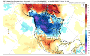
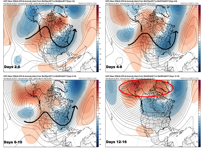
 Thinking here at IndyWx.com believes the European is likely rushing the warmer central look. Time will tell…