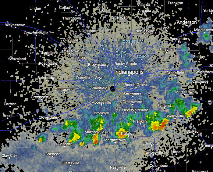
1.) A narrow, but persistent band of downpours continues to fall just south of the metro this morning. Places from Martinsville to Trafalgar and Shelbyville are enjoying needed rain this morning.
 2.) Overall, a drier air mass will build into central Indiana today and Thursday (cooler, too) before moisture returns to close the week. Scattered showers and embedded thunder are more likely Friday and again late Sunday into Monday.

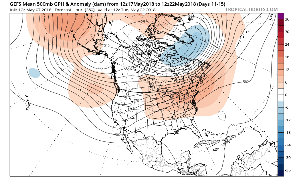
 3.) Looking ahead, we notice a more active pattern is presented off the overnight GEFS model. The heat ridge backs west and sets up a busy “ring of fire” pattern with a northwest flow aloft across our region. We have a ways to go before developing consistency and overall confidence, but this is at least an encouraging sign. The end result, should this come to fruition, would be a significantly wetter open to June.

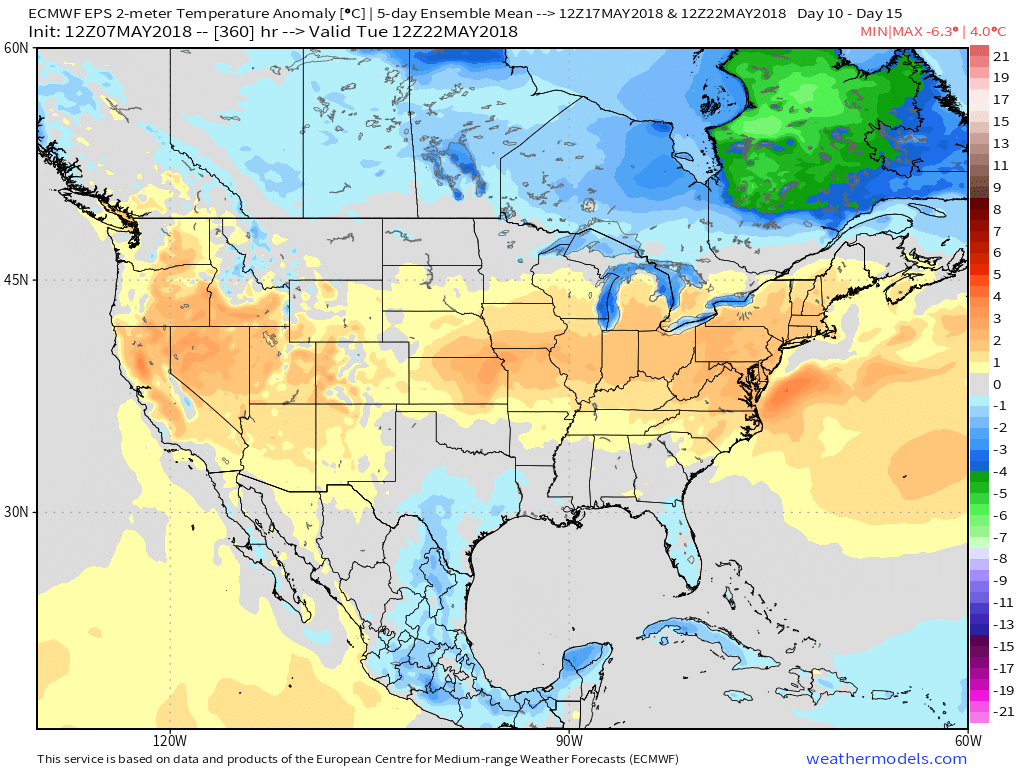
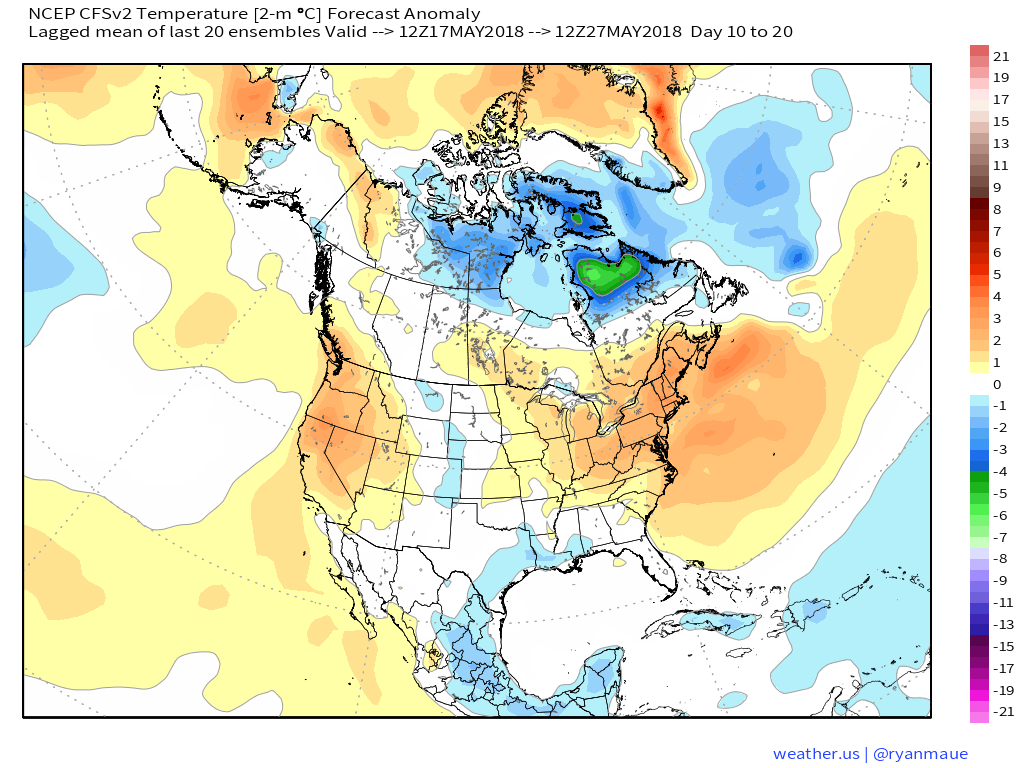
 At the surface, all three major global models agree on warmth in the long range period, including the GEFS, EPS, and CFSv2:
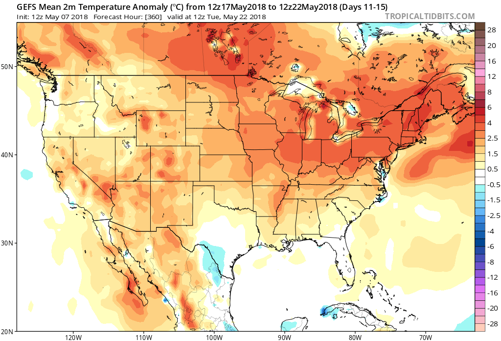
 Guidance suggests below average precipitation during the period. With broad scale ridging in place, we agree on a drier theme compared to normal. While trying to put our finger on the flip from the prolonged cold to warmer was difficult to nail down from March and April, May always looked like a drier than average month from several weeks out. (One note is the potential of active times across the Great Lakes region as “sudden summer” gains steam to the south and stubborn chill refuses to let go to our north. The gradient would promote heavier than normal precipitation relative to average).
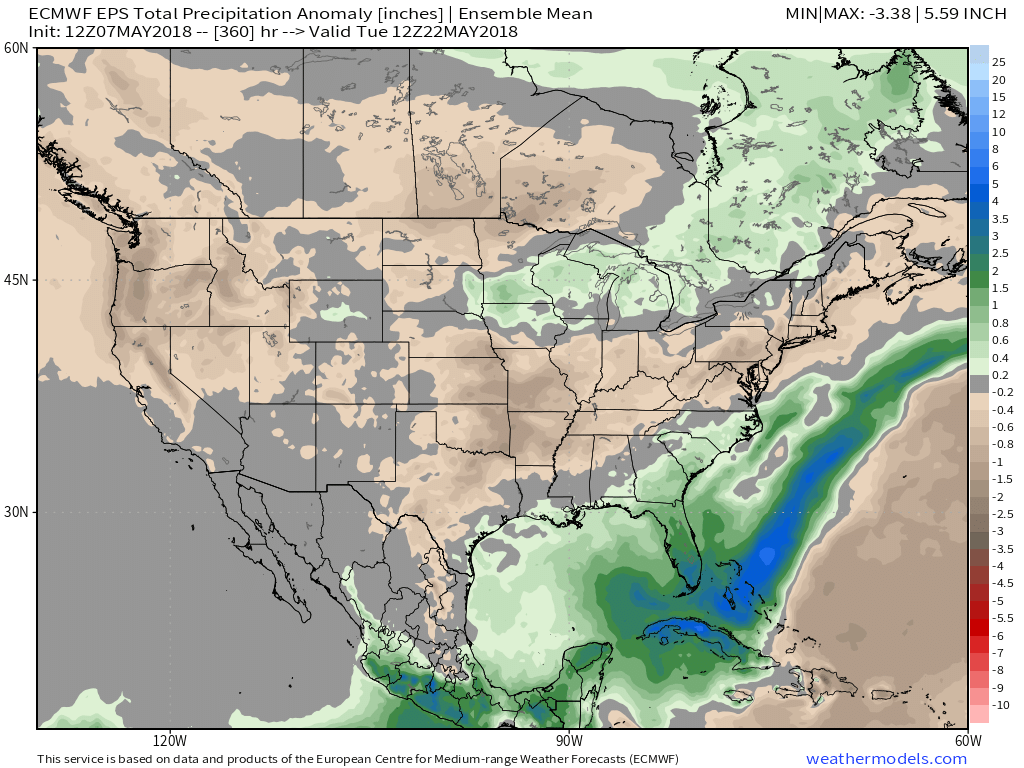
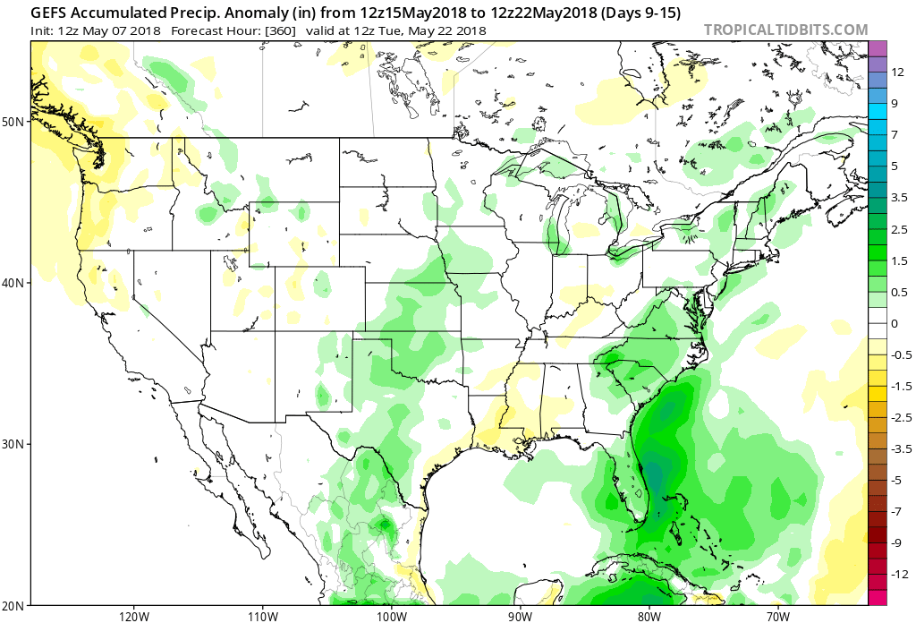 Given the agreement in the data, along with some additional pattern drivers, we continue to believe the medium to longer term period (including mid and late May) will feature an overall warmer than average pattern along with drier than normal conditions.
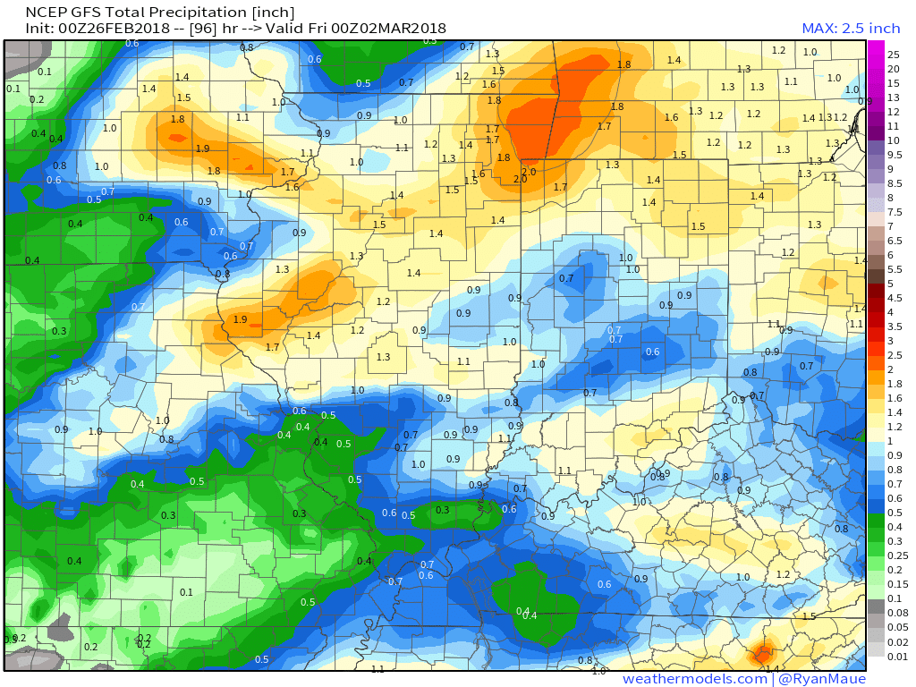
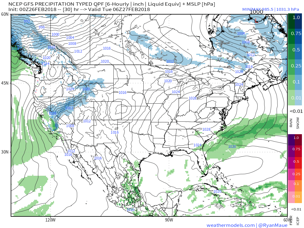 II. Our next weather maker will arrive midweek and provide a few showers Wednesday (not a huge deal from a precipitation perspective). However, as a deepening surface low tracks into the Great Lakes Thursday morning, a period of heavier rain and even thunder is possible. In general, this looks like a 0.50″ to 1.00″ type event.
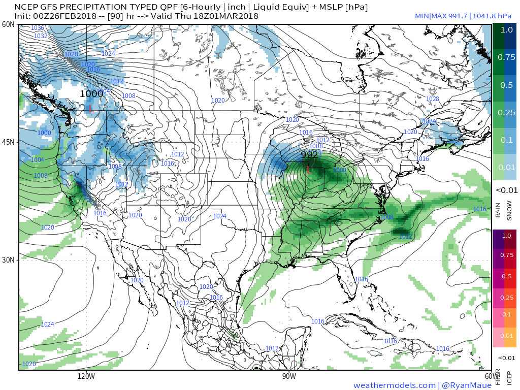
 III. Somewhat cooler air will whip in behind the low, allowing leftover precipitation to end as a couple wet snowflakes across the northern half of the state Friday morning. The bigger story will be the “bumpy” start to Friday with strong and gusty north winds.
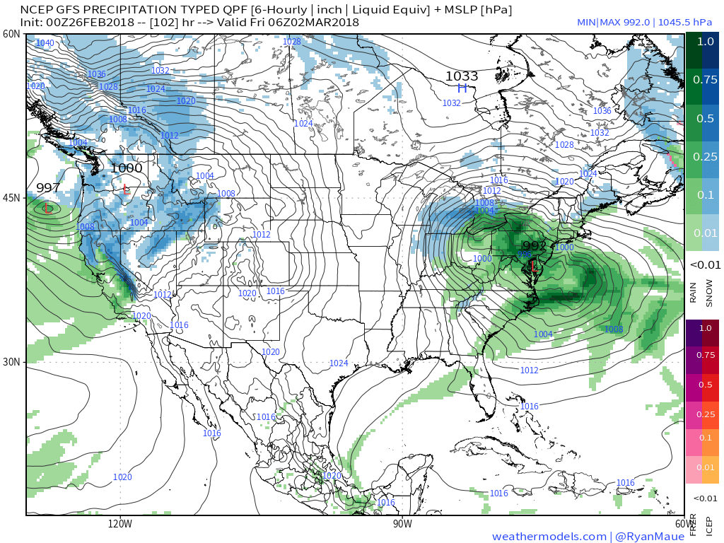 IV. High pressure returns for the weekend and with it will come a return of sunny skies. Though the mornings will be frosty, afternoon temperatures will “warm” to pleasant levels, especially with the increasingly strong early-March sun angle.
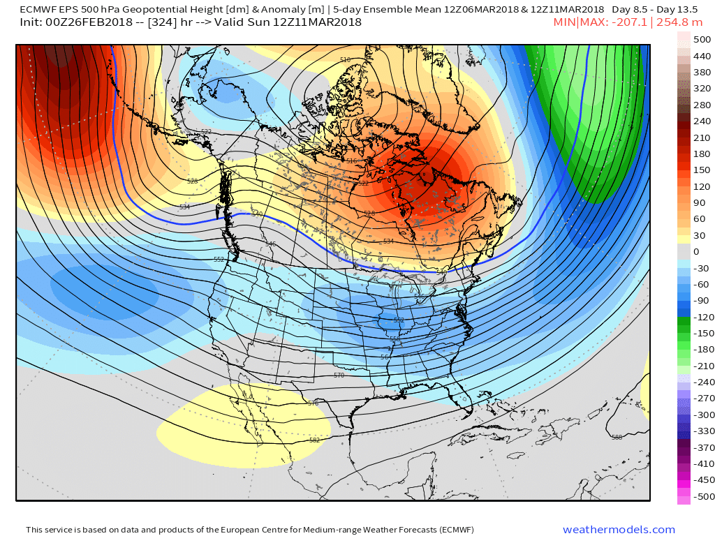
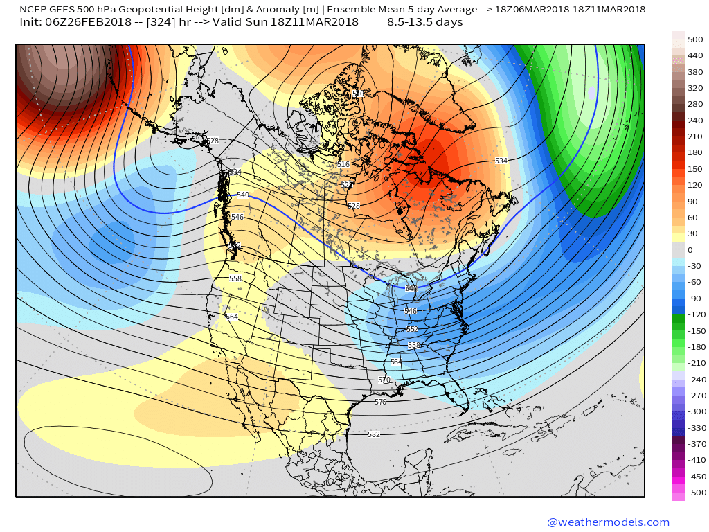
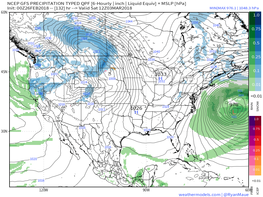 V. Looking ahead, let’s keep a close eye on the second week of March. Potential is present for a stormy period to emerge under the block. We note the GEFS and EPS (respective ensembles of the GFS and European models) are in relative agreement on a stormy, cold look during this time frame. While far too early for specifics, the potential is there for a rather widespread wintry event from the Plains into the Northeast.