
You must be logged in to view this content. Click Here to become a member of IndyWX.com for full access. Already a member of IndyWx.com All-Access? Log-in here.
Category: Ensemble Discussion
Permanent link to this article: https://indywx.com/video-pleasant-open-to-the-work-week-discussing-mjo-implications-into-june/
May 17
Sudden “Stick And Hold” Summer? Think Again…
The upcoming couple of weeks sure will feel like summer has arrived. After “pulling teeth” to get any sort of sustained warmth, the flip to warm/ hot and humid conditions is upon us.
This kind of pattern will keep heaviest rain to our northwest, but that’s not to say we won’t deal with storm complexes from time to time that will be plenty capable of depositing a quick hefty amount of water in a short period (case in point yesterday evening).
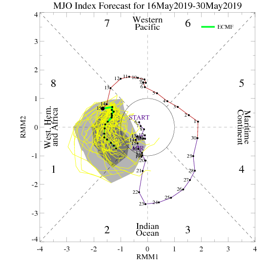
As we look ahead, the MJO continues to look like it’ll roll right into Phase 1 as we get set to close May and open June. This should ultimately mean the eastern ridge is replaced with more troughiness (may be tough to erode the southeastern ridge- where anomalous heat will likely continue for the foreseeable future) and an associated cooler pattern as we move towards early-June across our region.

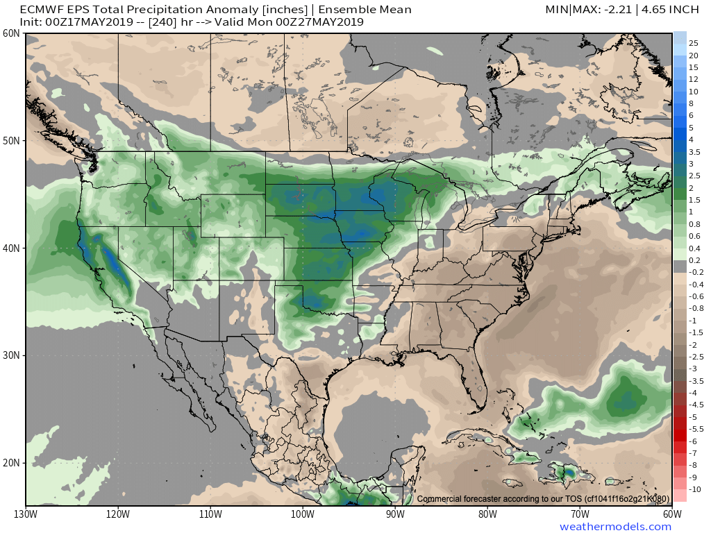
As this transition takes shape, the heaviest precipitation totals will likely shift east, including more of our immediate region, as we progress through late-May and into early June. The modeling sees this taking shape nicely.

Though we’ll likely back away from the anomalous warmth and replace things will cooler air as we move into the half-way point of the year, the same ole song and dance is expected from a precipitation perspective: wetter than average, and, at times, excessively so…
Permanent link to this article: https://indywx.com/sudden-stick-and-hold-summer-think-again/
May 15
VIDEO: Short-Term Storm Update; Fresh Thoughts On The Late May Pattern…
You must be logged in to view this content. Click Here to become a member of IndyWX.com for full access. Already a member of IndyWx.com All-Access? Log-in here.
Permanent link to this article: https://indywx.com/video-short-term-storm-update-fresh-thoughts-on-the-late-may-pattern/
May 14
VIDEO: Summer-Like Feel Develops; Talking Storm Chances In The Days Ahead…
You must be logged in to view this content. Click Here to become a member of IndyWX.com for full access. Already a member of IndyWx.com All-Access? Log-in here.
Permanent link to this article: https://indywx.com/video-summer-like-feel-develops-talking-storm-chances-in-the-days-ahead/
May 13
“Transition” Is The Name Of The Game…
As we look ahead to late-May and early June, “transition” is the word that comes to mind when describing the overall weather pattern.
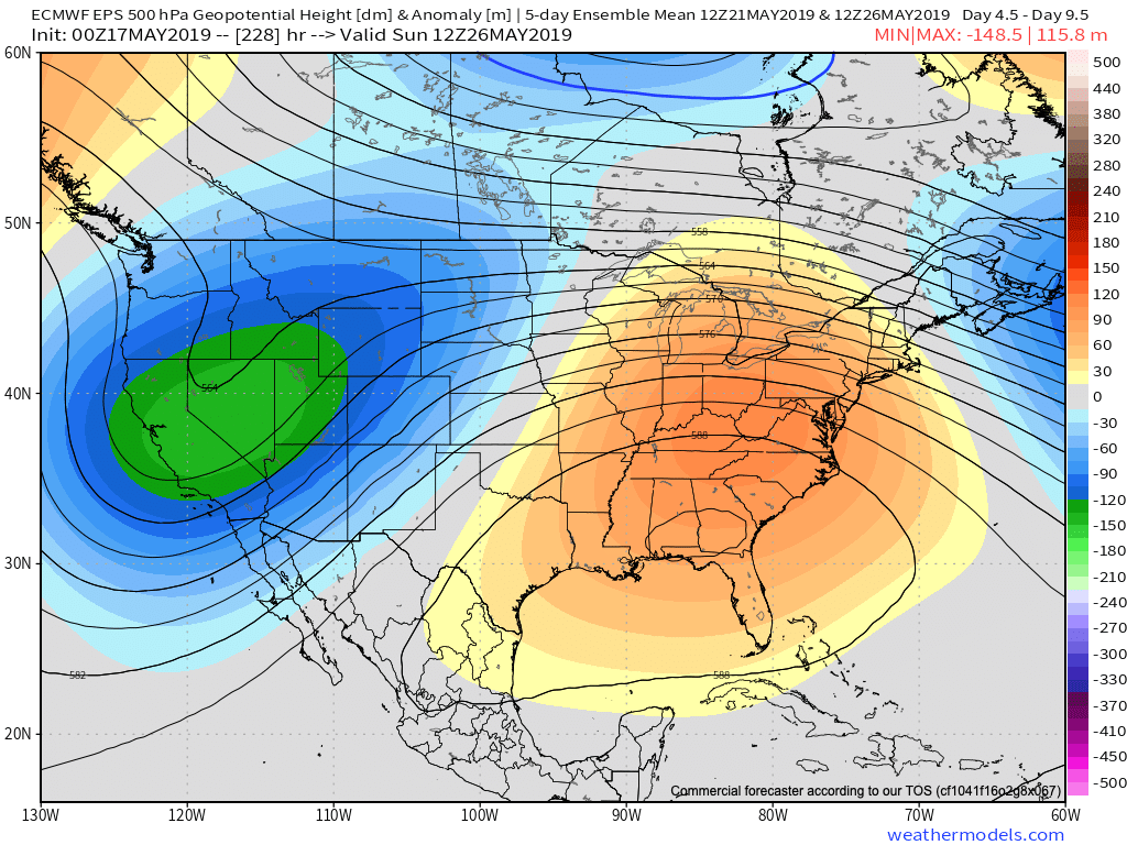
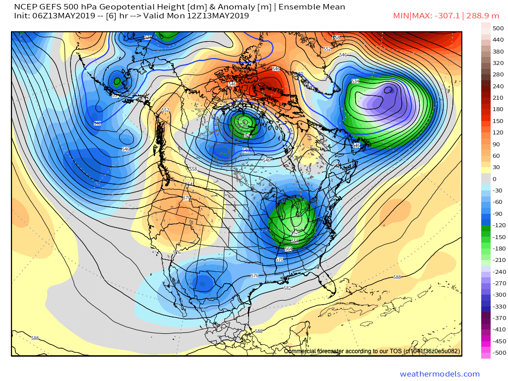
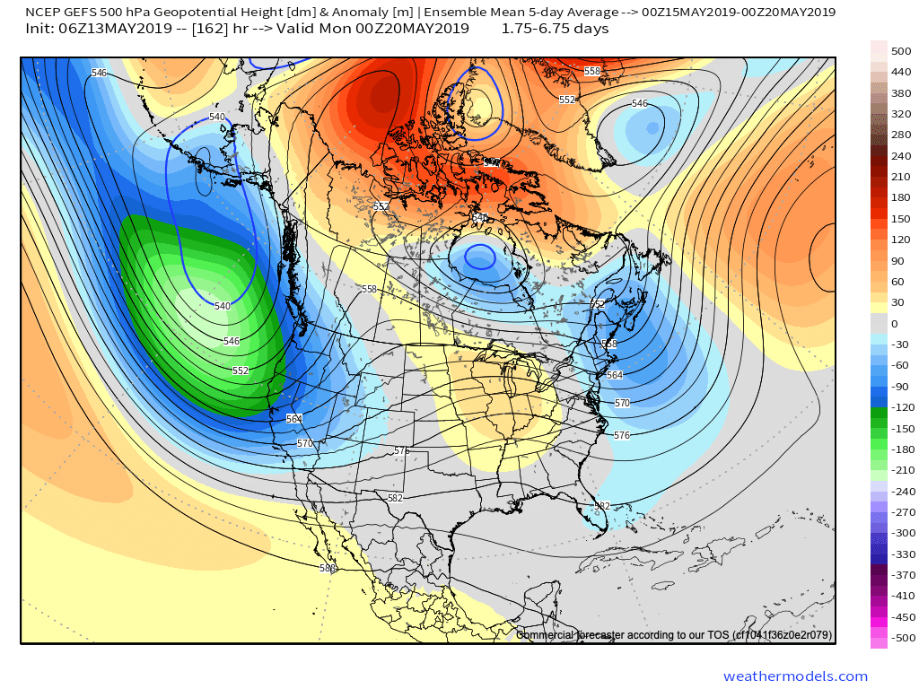
We’re going to begin pulling out of this unseasonably chilly pattern late-week and we’ll replace it with a true summer-like regime. Note the differences at 500mb between now and this weekend:
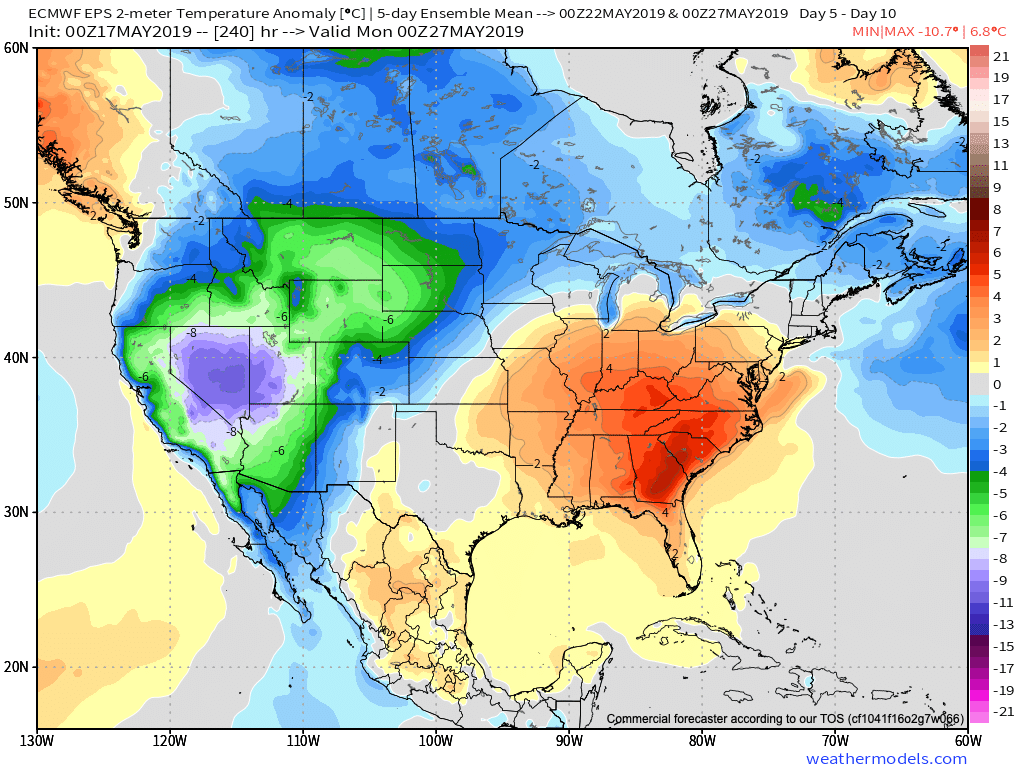
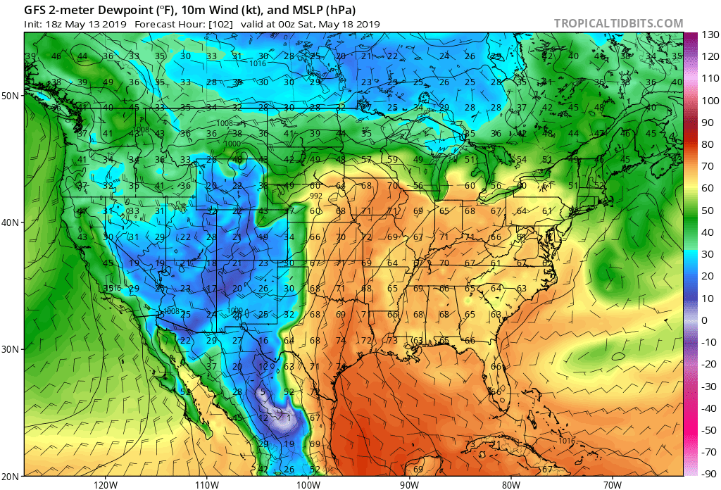
Not only will the 80s return, but oppressive dew points can be expected as well by Friday (65-70 degrees). The sweat factor will be back in full effect!
With that said, there’s reason for concern that the flip to summer may not last.
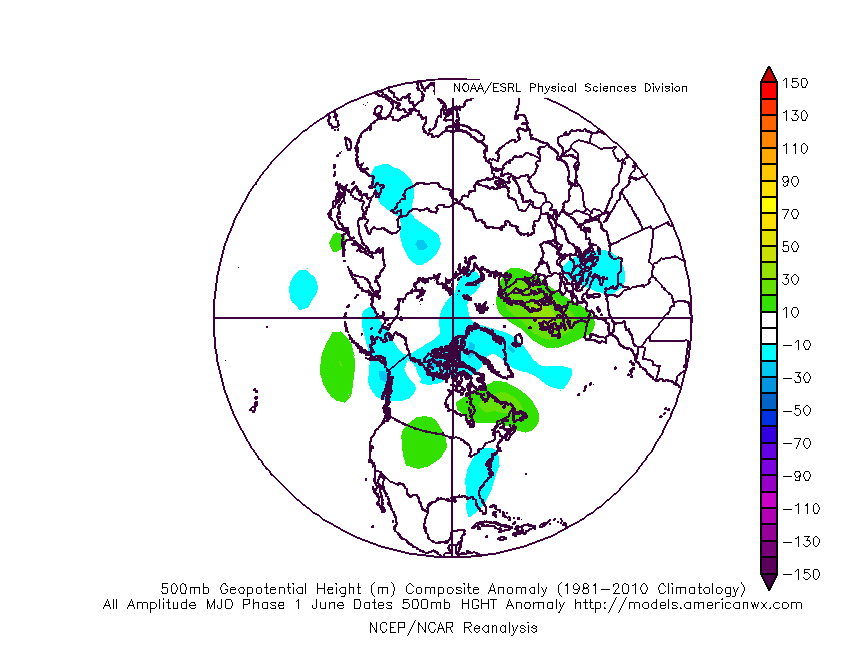
Not only do we continue to see high-latitude blocking in place, but the MJO is showing signs of rotating into Phase 1 as we inch closer to early-June. That Phase 1 this time of year is a cool one for the eastern portion of the country. Note the tendency for eastern troughiness illustrated in Image 2 below.

Perhaps ensemble data is seeing this cooler transition in the pattern on today’s 12z run:

Bottom line, confidence is high on a summer-like flip as we welcome in the weekend, continuing into early parts of Week 2, but we don’t think it’s a “stick and hold” variety of warmth. There’s growing reason to believe a flip back to cooler conditions looms before we close out the month.
Permanent link to this article: https://indywx.com/transition-is-the-name-of-the-game/