Updated 10.23.23 @ 8a
You must be logged in to view this content. Click Here to become a member of IndyWX.com for full access. Already a member of IndyWx.com All-Access? Log-in here.

Oct 23
Updated 10.23.23 @ 8a
You must be logged in to view this content. Click Here to become a member of IndyWX.com for full access. Already a member of IndyWx.com All-Access? Log-in here.
Permanent link to this article: https://indywx.com/2023/10/23/video-warm-up-this-week-eyeing-wetter-times-this-weekend-and-a-big-blast-of-chilly-air-to-close-october-open-november/
Oct 22
Updated 10.22.23 @ 8:29a
You must be logged in to view this content. Click Here to become a member of IndyWX.com for full access. Already a member of IndyWx.com All-Access? Log-in here.
Permanent link to this article: https://indywx.com/2023/10/22/video-widespread-frost-gives-way-to-warmer-weather-in-the-new-week-ahead-potent-storm-around-halloween/
Oct 21
Updated 10.21.23 @ 7:34a
The upcoming week will feature a pattern shift, albeit a transitional one, that will drive unseasonably warm temperatures north into the Ohio Valley and Great Lakes region. This will be on the heels of the first widespread frost of the season Monday morning. Ah, Indian summer at its finest.

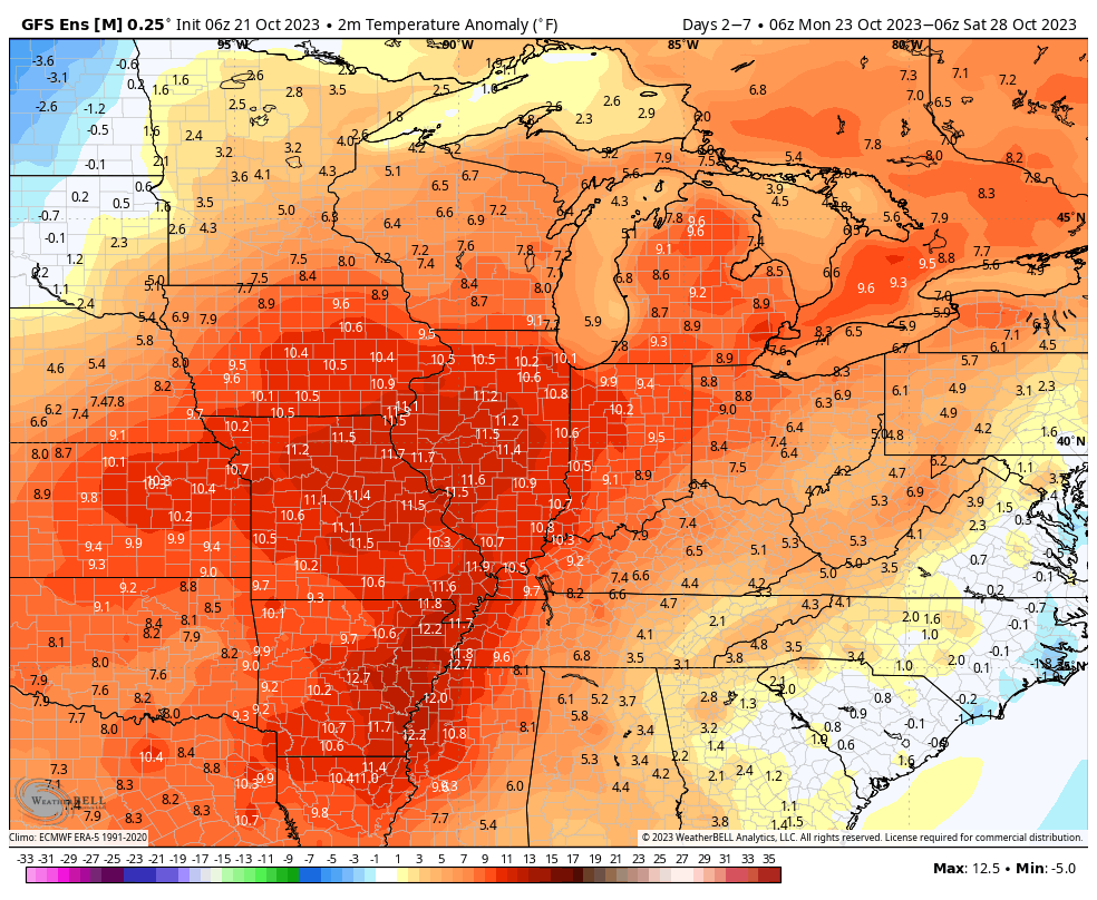
A couple of disturbances will try to make inroads into this ridge mid and late week, but will likely struggle in providing much in the way of precipitation or cooler air initially. As we push into the latter part of next week and the Halloween weekend, a larger storm system is anticipated to move east out of the Plains region. This storm will likely deliver the first widespread winter impacts (outside of the mountains of course) of the fall season.
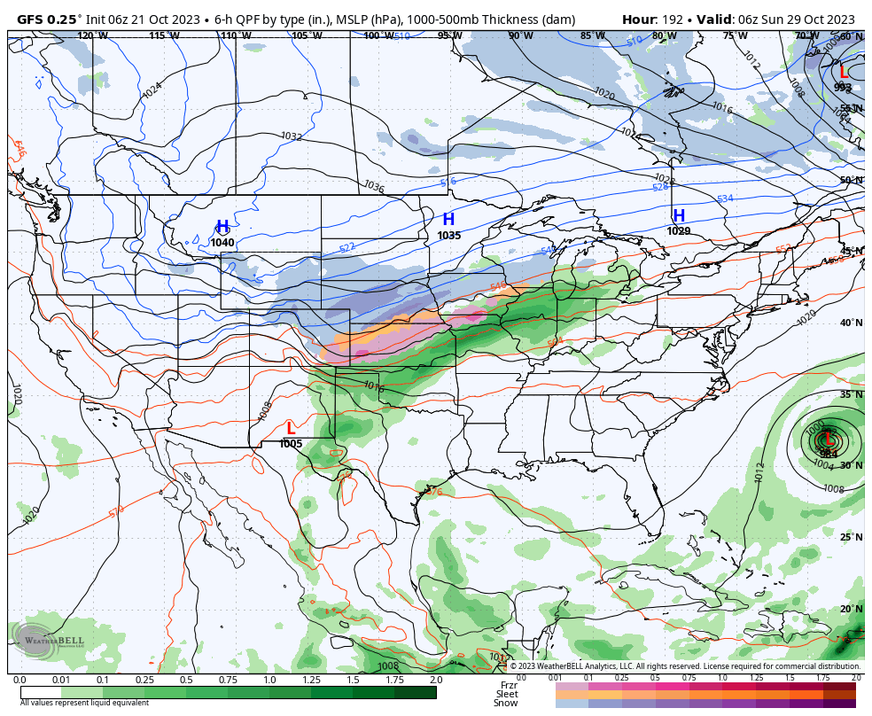
Specifics will be fine tuned as we get closer, but we expect a widespread rain (perhaps a clap of thunder) here next weekend followed by sharply colder weather prior to Halloween, itself.
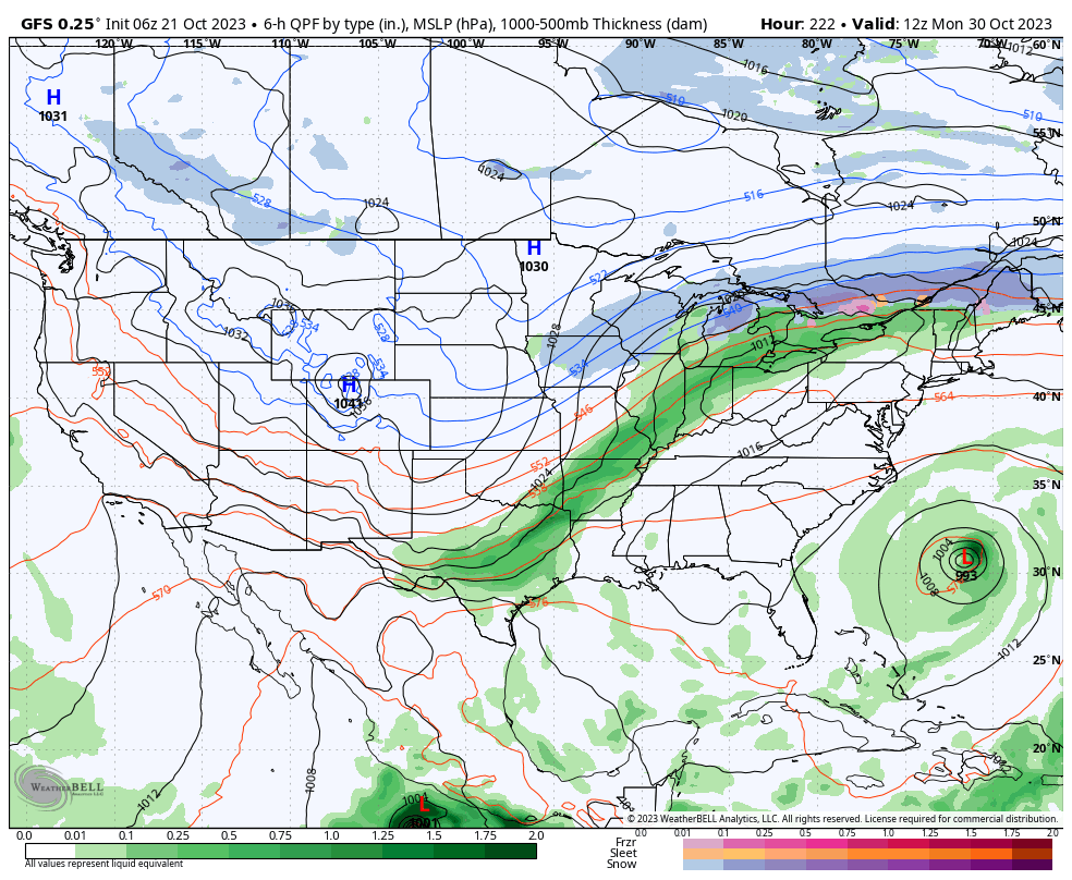
We’re left with a much different pattern to open November. This is the type regime that will likely lead to the first lake effect snow in the snow belt, drive the 1st widespread freeze into the Ohio Valley, and result in highs in the 40s in the wake of the frontal passage.


Farmers and those with ag interests, we’d suggest wrapping up harvest 23 efforts by mid next week if at all possible. Conditions will certainly become harsher and less favorable by next weekend. More to come…
Permanent link to this article: https://indywx.com/2023/10/21/the-pending-halloween-pattern-transition-and-initial-taste-of-winter/
Oct 20
Updated 10.20.23 @ 7:34a
You must be logged in to view this content. Click Here to become a member of IndyWX.com for full access. Already a member of IndyWx.com All-Access? Log-in here.
Permanent link to this article: https://indywx.com/2023/10/20/video-gusty-saturday-followed-by-a-frosty-start-monday-morning-warmer-week-on-deck/
Oct 19
Updated 10.19.23 @ 7:17a
You must be logged in to view this content. Click Here to become a member of IndyWX.com for full access. Already a member of IndyWx.com All-Access? Log-in here.
Permanent link to this article: https://indywx.com/2023/10/19/video-damp-thursday-gives-way-to-a-gusty-saturday-a-lot-to-discuss-over-the-next-10-days/
Oct 17
Updated 10.17.23 @ 5a
You must be logged in to view this content. Click Here to become a member of IndyWX.com for full access. Already a member of IndyWx.com All-Access? Log-in here.
Permanent link to this article: https://indywx.com/2023/10/17/video-new-seasonal-guidance-ups-the-ante-for-upcoming-winter-unsettled-close-to-the-work-week/
Oct 16
Updated 10.16.23 @ 7:38a
You must be logged in to view this content. Click Here to become a member of IndyWX.com for full access. Already a member of IndyWx.com All-Access? Log-in here.
Permanent link to this article: https://indywx.com/2023/10/16/video-early-and-midweek-improvements-ahead-of-a-new-storm-system/
Oct 15
Updated 10.15.23 @ 7:50a
You must be logged in to view this content. Click Here to become a member of IndyWX.com for full access. Already a member of IndyWx.com All-Access? Log-in here.
Permanent link to this article: https://indywx.com/2023/10/15/video-throwing-it-on-repeat/
Oct 11
Updated 10.11.23 @ 7:42a
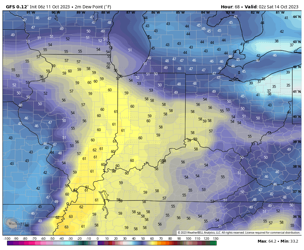
A cold front and associated area of low pressure will move through the Ohio Valley as we close the week. Briefly warmer air will surge north into the region Thursday and Friday with temperatures flirting with 80° both days.
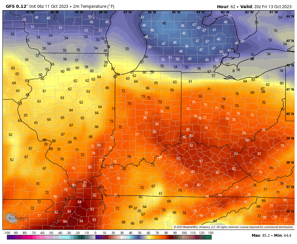
Moisture levels will also increase as dew points creep up closer towards 60°.
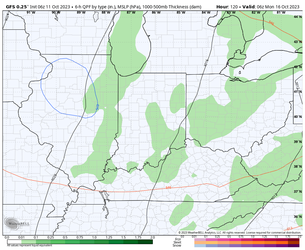
A weakening area of rain and embedded storms will rumble into the state late Friday and Friday night. Widespread severe weather isn’t expected but the Storm Prediction Center outlines the far western portion of the state in a marginal risk, primarily for a wind threat. We still bracket 0.25” to 0.75” rain potential.

Speaking of wind, non-thunderstorm gusts towards 30 MPH can be expected Friday and Saturday.

With the cold core upper low hanging around, additional spotty showers, mixed with graupel, can be expected over the weekend into early next week.

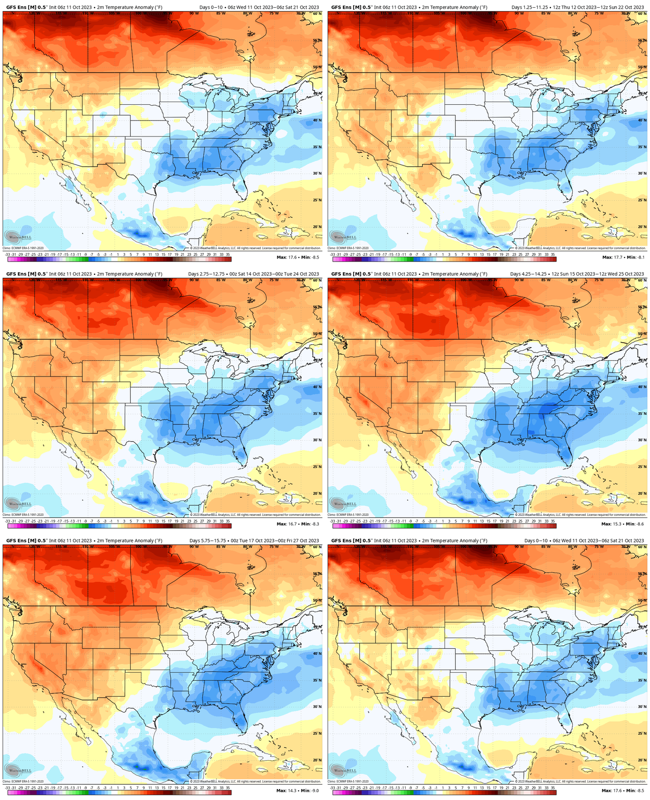
The theme over the next couple weeks is for cooler than normal conditions to dominate overall.
Permanent link to this article: https://indywx.com/2023/10/11/briefly-warmer-blustery-close-to-the-week-with-rain-and-a-few-storms/
Oct 10
Updated 10.10.23 @ 12:53p
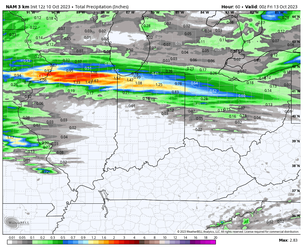
I. A warm front will lift north through Indiana Wednesday. This will serve as a focal point for locally heavy rain across the northern tier of counties Wednesday night into Thursday morning. Most high resolution modeling keeps central Indiana out of the heavy rain axis but a passing shower is certainly possible.
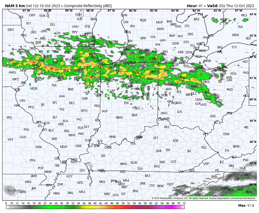
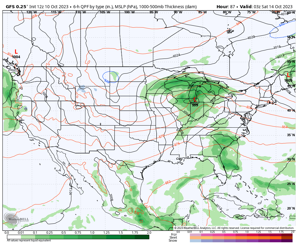
II. A cold front and associated area of low pressure will rumble across the Ohio Valley Friday with more widespread rain (embedded thunder) impacting central Indiana Friday evening and Friday night.
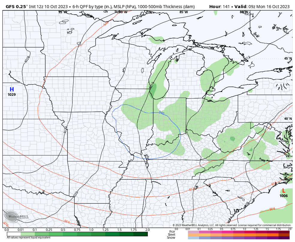
III. A cold core upper low will drop southeast Sunday into Monday. With the cold air aloft and just enough daytime heating, showers (potentially mixed with graupel) will develop. Otherwise, anticipate a “raw” close to the weekend and open to the new work week.

IV. Our recent chilly turn will only be reinforced that much further behind the passage of Friday’s cold front. Most of next week is looking below to well below normal. Time to start thinking about stocking up that wood pile. Long Range charts show another big blast of the coldest air so far this season the following week…

Permanent link to this article: https://indywx.com/2023/10/10/lunchtime-rambles-time-to-start-thinking-about-stocking-that-wood-pile/