Updated 01.25.24 @ 7:36a Dense fog is present yet again this morning, but at least we’re not dealing with heavy rain. That changes later this evening as a slug of…
You must be logged in to view this content. Click Here to become a member of IndyWX.com for full access. Already a member of IndyWx.com All-Access? Log-in here.
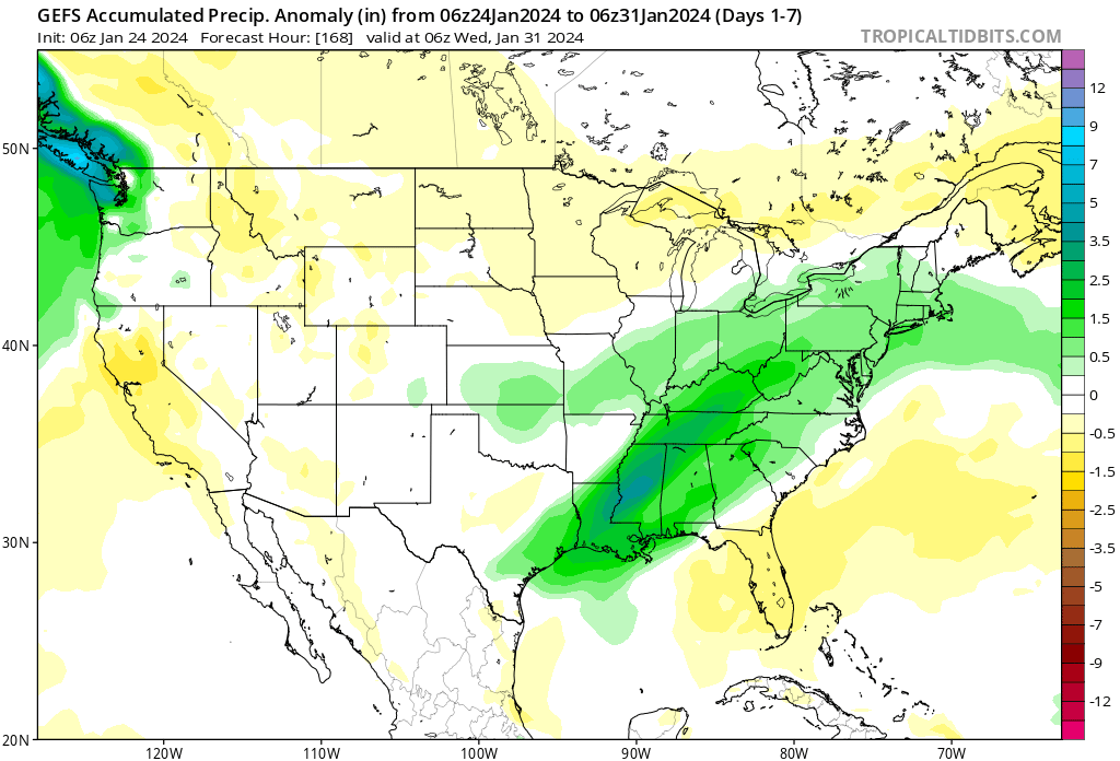
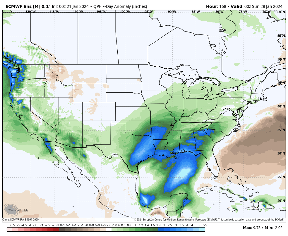
Week 1 remains significantly wetter than normal across not only our neck of the woods but a good chunk of the East.
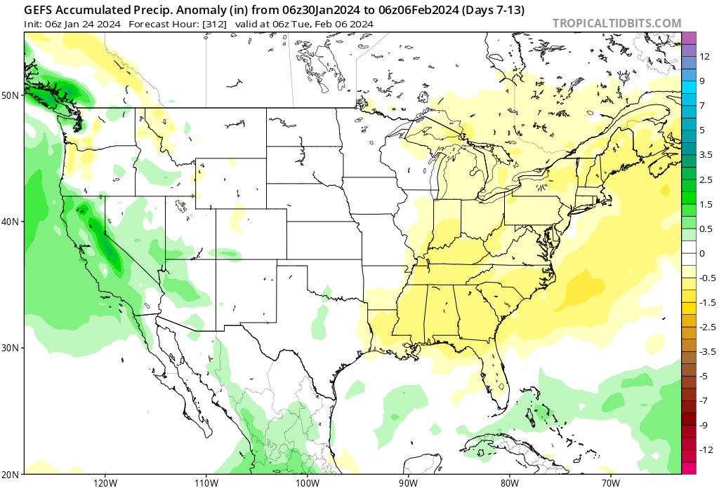
This will give way to a quieter Week 2 timeframe.
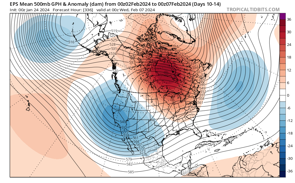
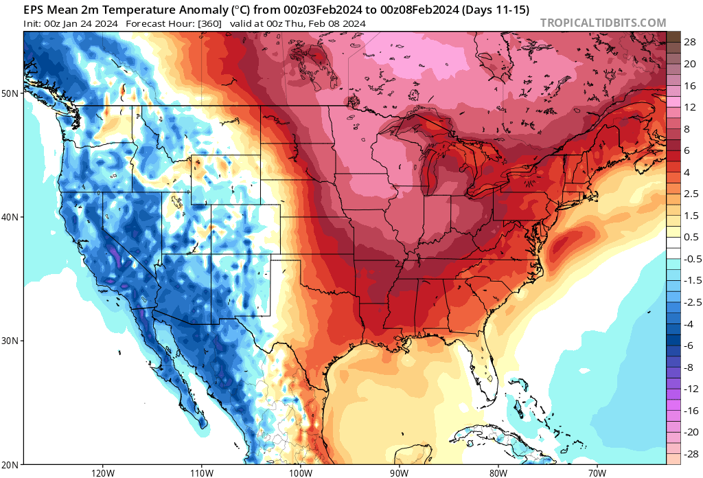
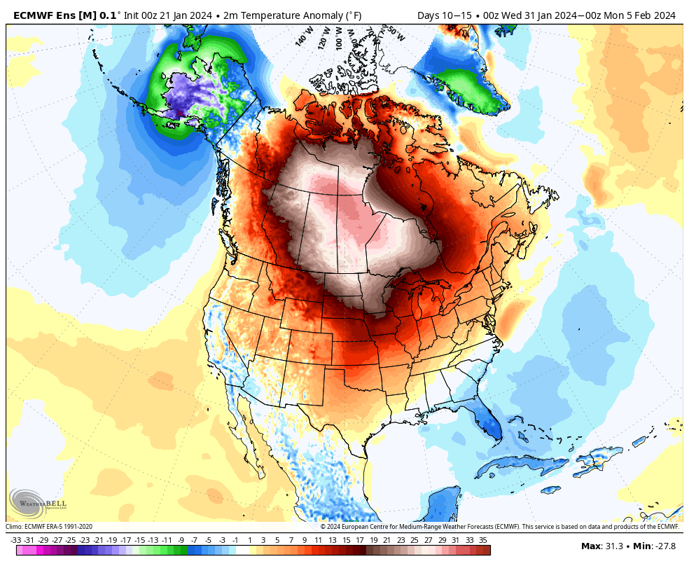
There’s some threat that the southern tier and immediate eastern seaboard never is fully able to relish in the magnitude of the warm anomalies the majority of the rest of us will see as we roll through early February. Just to reiterate, as much as we believe cold, wintry weather returns in February, it’s not after a significant period of milder times (compared to average) to open the month- likely the first 10-14 days.
Just how mild are we talking? Several days with highs into the 40s and even 50s and overnight lows in the low to mid 30s. This compares to early Feb “norms” in the low 20s and highs into the upper 30s. It’s a byproduct of the MJO and alignment with the teleconnections (PNA aside) in the warm phases. As shown Monday in our LR video, we believe this all flips around in a big way later into the month, continuing into March.
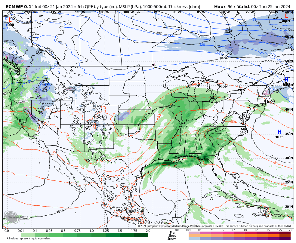
In the short term, additional waves of rain (and dense fog) will keep things gloomy around these parts. Most widespread rain will come at us now through late morning before returning Thursday evening-overnight. Most rain gauges can expect to pick up an additional 0.75” to as much as 1.25”+ during this time period.
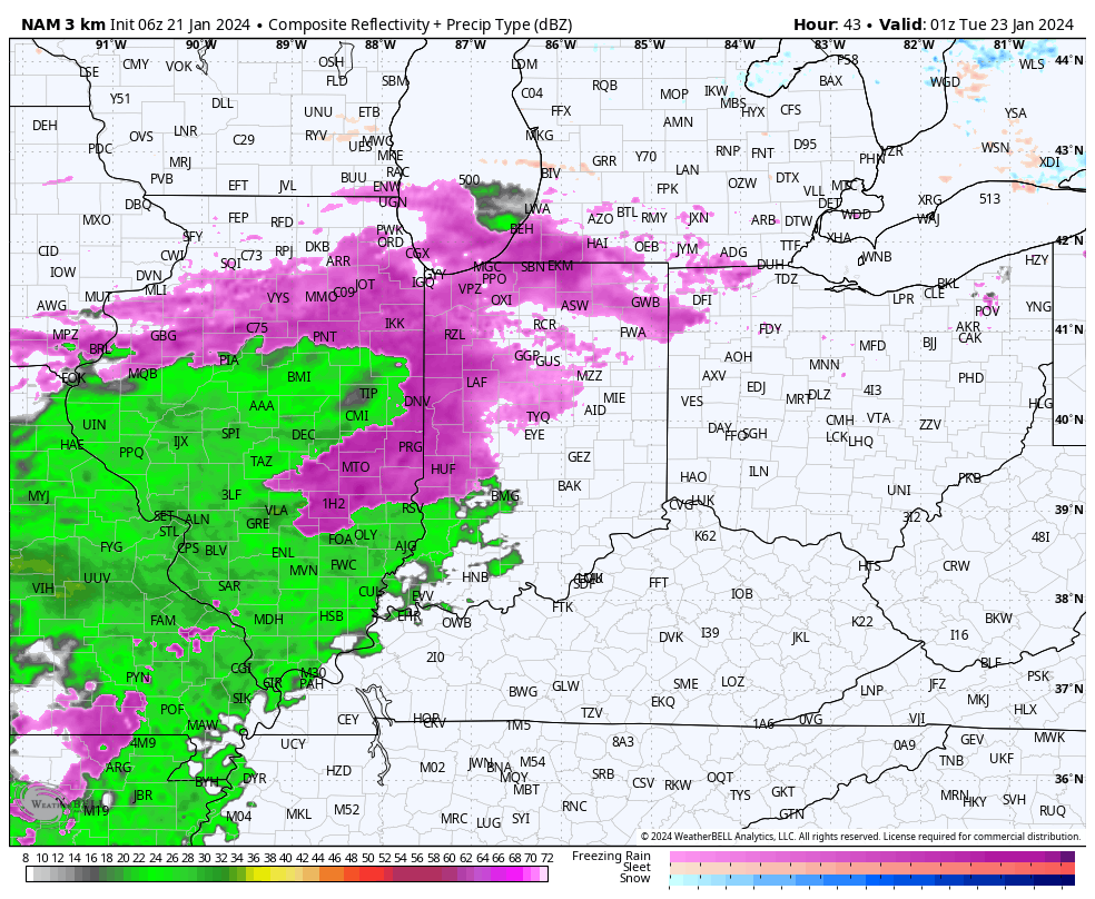
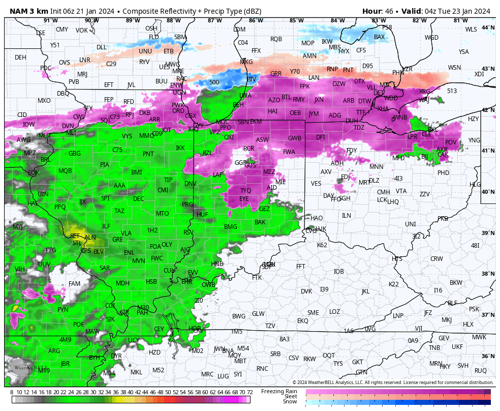
Modeling continues to differ in a major fashion with the weekend storm. The GFS is further north with heavy precipitation and a transition to leftover snow showers, locally while the European takes the suppressed route. Today will likely bring alignment between the two solutions. . .
You must be logged in to view this content. Click Here to become a member of IndyWX.com for full access. Already a member of IndyWx.com All-Access? Log-in here.
Updated 01.22.24 @ 6:56a While portions of western and northern IN will see some light sleet and freezing rain this morning, the concern here remains on what lies ahead tonight…
You must be logged in to view this content. Click Here to become a member of IndyWX.com for full access. Already a member of IndyWx.com All-Access? Log-in here.
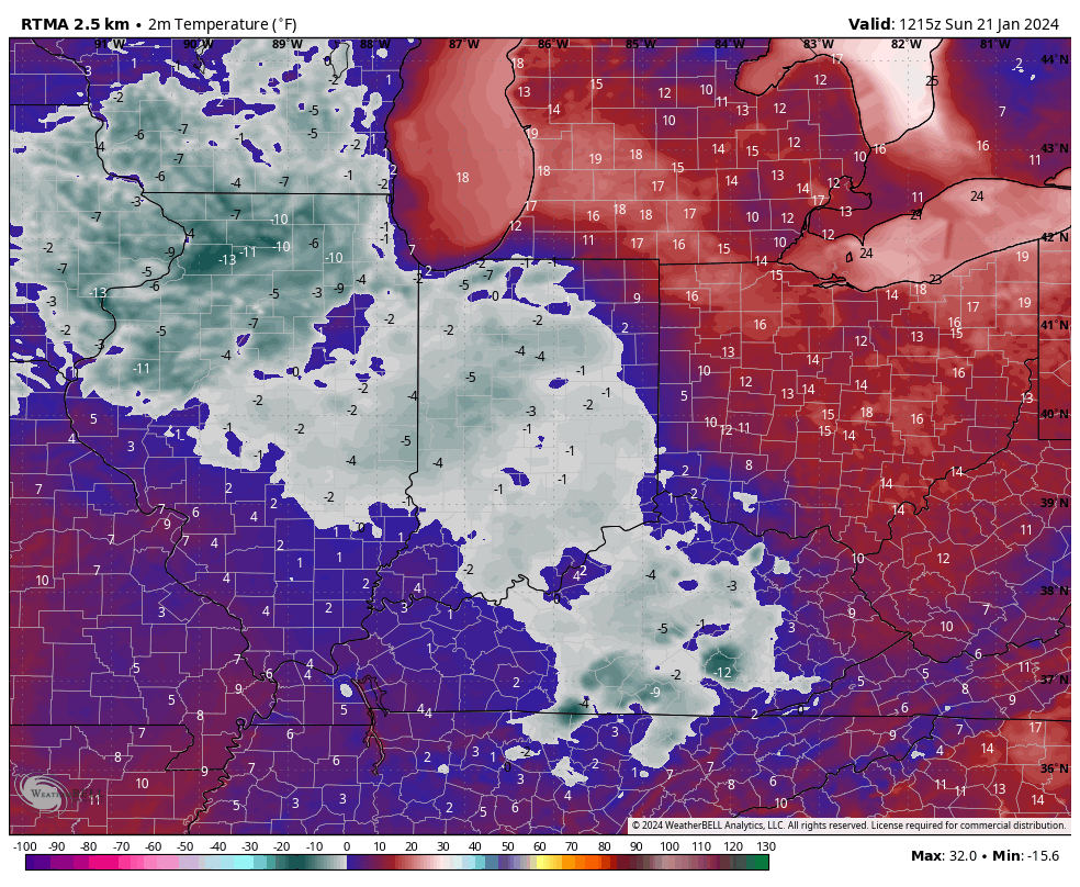
This is the 4th morning of the new year where most, if not all, of central Indiana is waking up to subzero temperatures.
While temperatures will moderate this week, our January “thaw” won’t come without a few bumps in the road. A wet and active pattern will accompany the milder air, and we’re likely also going to be dealing with periods of dense fog early and mid week.
The onset of this wet shift will come with a period of freezing rain Monday evening into Tuesday morning. Due to the extremely cold surface, it’s icing on roadways and sidewalks that worry us most as opposed to elevated (tree limbs/ power lines) icing. Anticipate slick and hazardous travel Monday night into predawn Tuesday before temperatures “warm.” If possible, we highly recommend simply staying off area roadways during this time frame.
Our next round of moderate to locally heavy rain will push into the Ohio Valley and central Indiana Wednesday into Thursday.
The late week storm may even take on a bit of a wintry flavor Friday into Saturday.
Despite this sneaky potential of a little wintry fun, it’ll be within what’s otherwise going to be a much warmer than normal period over the upcoming couple weeks (of course, once we get past tomorrow).
Not only is the MJO rolling into traditionally warm phases for this time of year, but our teleconnection suite is aligned in a manner that also strongly argues for milder to much milder than normal conditions across our neck of the woods.
Eventually, we anticipate a return of colder than normal temperatures and another opportunity for ice/ snow but likely not until we get to mid-February and beyond. If you didn’t have a chance to catch our Long Range update, we recommend listening here, including February and thoughts into meteorological spring.