Category: Ensemble Discussion

Finalized May Outlook: One Word? Volatile

Averages for May are as follows:

*High: 72.8

*Low: 52.6

*Rainfall: 5.05″

*Snowfall: Trace

When all is said and done, this is how we see the last month of meteorological spring shaping up:

Medium and longer range guidance has been anything but consistent over the past few weeks for May, which doesn’t help in producing a monthly outlook. A large part of this may have to do with the renewed hyperactive MJO.

This can lead to volatile swings in the overall pattern as we get into the mid to late part of the month. Early on, confidence is higher in a “battle” setting up between late season anomalous cold across the north and budding summer-like warmth across the south.
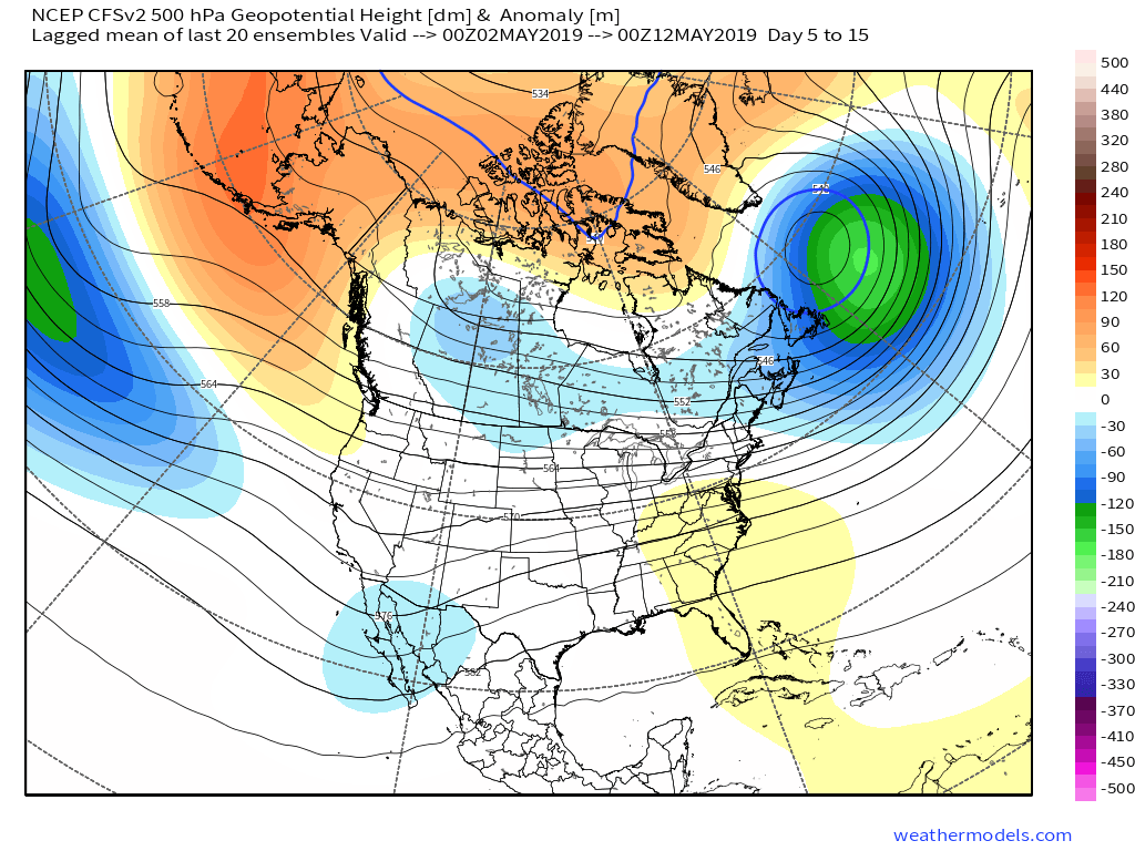
This will help add fuel to the fire in what should be an overall wet month across a large portion of the country.
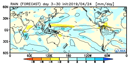
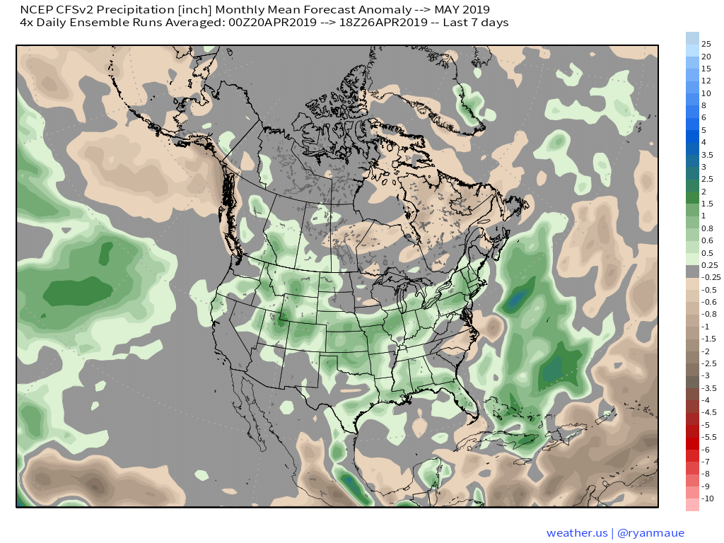
With that said, we think ridging is likely to keep the extreme southeastern region drier than normal for the bulk of the month.

As we look towards mid-May, that battle between southeastern ridging and troughiness across the northern region continues to argue for active times remaining.
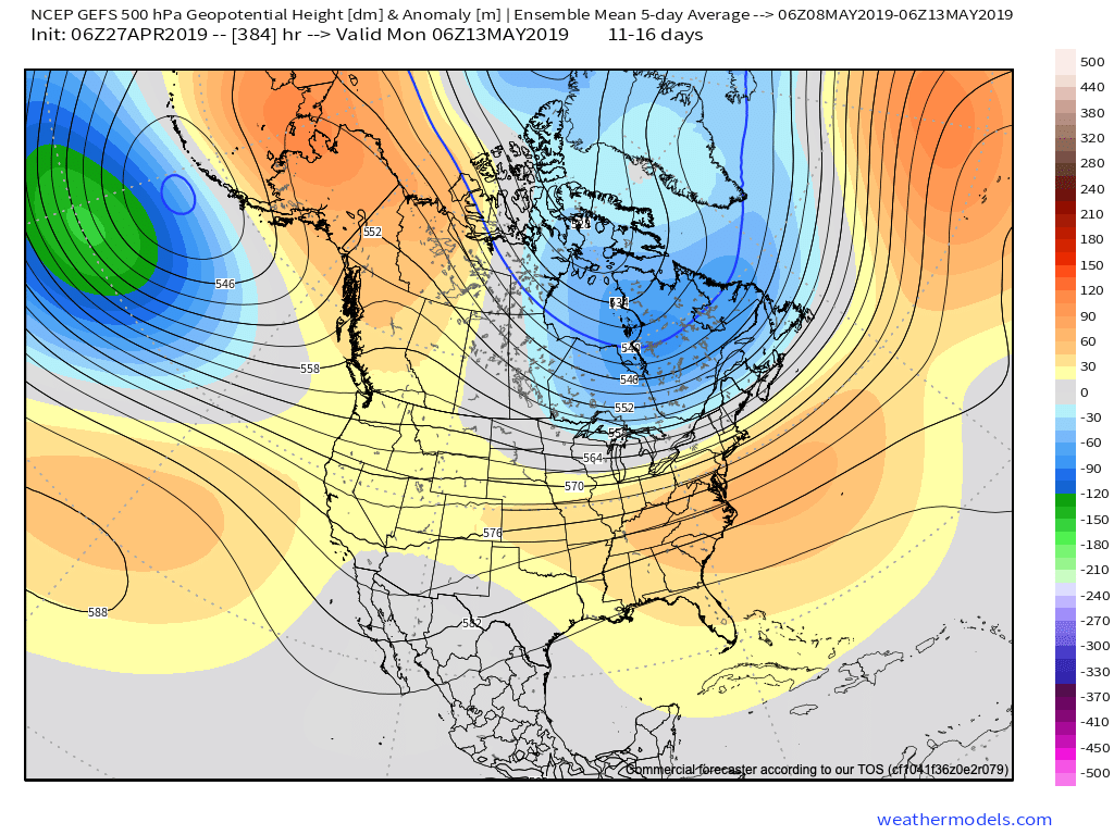
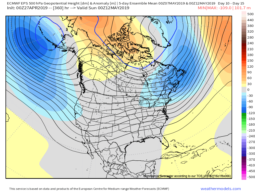
Speaking more specific to central IN and the greater OHV region overall, we think a cooler and wetter than normal month awaits. Unfortunately, delays are likely to continue from an agriculture/ Plant ’19 perspective…

Permanent link to this article: https://indywx.com/2019/04/27/finalized-may-outlook-one-word-volatile/

VIDEO: Scattered Shower Chances Increase This Evening; Wet Pattern Develops Next Week…

You must be logged in to view this content. Click Here to become a member of IndyWX.com for full access.  Already a member of IndyWx.com All-Access?  Log-in here.

Permanent link to this article: https://indywx.com/2019/04/24/video-scattered-shower-chances-increase-this-evening-wet-pattern-develops-next-week/

VIDEO: Looking At The Weekend And Ahead Towards Early May…

You must be logged in to view this content. Click Here to become a member of IndyWX.com for full access.  Already a member of IndyWx.com All-Access?  Log-in here.

Permanent link to this article: https://indywx.com/2019/04/23/video-looking-at-the-weekend-and-ahead-towards-early-may/

Thursday Storm Threat Discussion; Easter Weekend Forecast And Looking Ahead To Late April…

You must be logged in to view this content. Click Here to become a member of IndyWX.com for full access.  Already a member of IndyWx.com All-Access?  Log-in here.

Permanent link to this article: https://indywx.com/2019/04/16/thursday-storm-threat-discussion-easter-weekend-forecast-and-looking-ahead-to-late-april/

Pattern Returns To An Active Time Of Things…

One word to describe the mid-April weather pattern? ACTIVE. Tonight’s medium and long range video update dives in further…

You must be logged in to view this content. Click Here to become a member of IndyWX.com for full access.  Already a member of IndyWx.com All-Access?  Log-in here.

Permanent link to this article: https://indywx.com/2019/04/04/pattern-returns-to-an-active-time-of-things/

Here Comes Spring: More Of A Substantial Warm-Up On Deck…

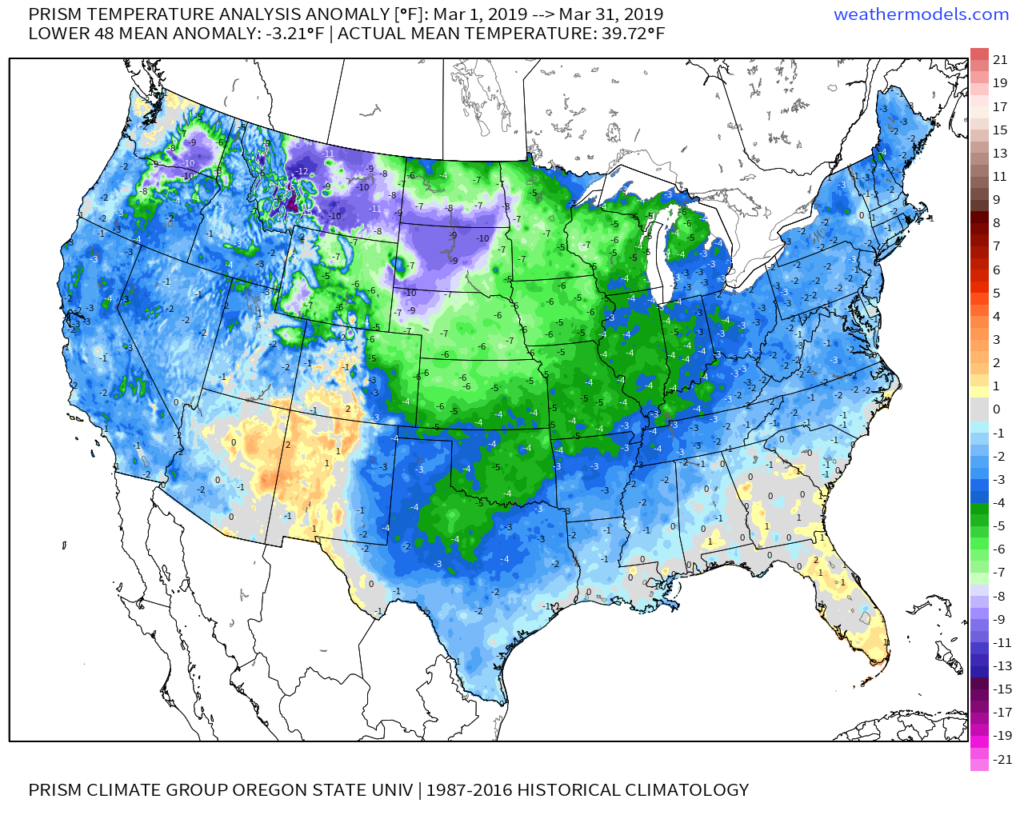
After a cold March (Indianapolis ran 4 F below average) and open to April, changes are on the horizon.

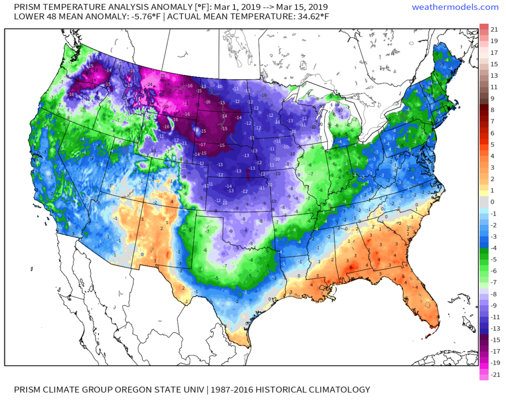
Coldest anomalies were located across the northern Rockies into the Plains during March with only the Four Corners and southern Florida escaping the unseasonably cold conditions.

Before going further, March was always expected to be the coldest month (relative to average) of meteorological spring. For new subscribers, you can find our Spring Outlook here.

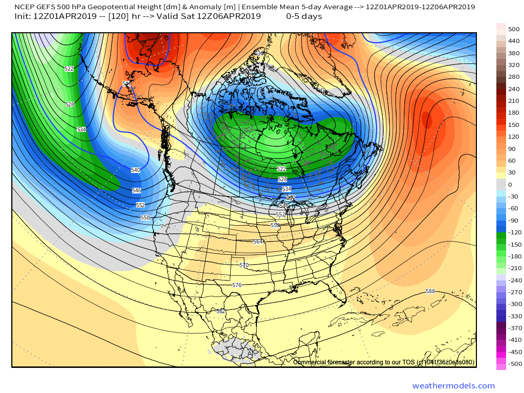
Looking ahead, note the rather dramatic shift that takes place at 500mb from the immediate term (image 1) to the medium range (or 6-10 day) period in image 2 below. Say goodbye to that AK ridge and subsequent downstream trough/ associated cooler than normal conditions.

This will likely result in the warmest air since October by the time we get to this weekend. High temperatures into the lower to middle 70s are a good bet this weekend. Saturday looks mostly dry before a few t-storms enter into the picture by Sunday.

As we look forward, additional unsettled conditions are a good bet early next week, along with seasonable to warmer than average conditions continuing.

Permanent link to this article: https://indywx.com/2019/04/01/here-comes-spring-more-of-a-substantial-warm-up-on-deck/

Long Range Video Update: April Opens Stormy And Colder Than Normal…

It’s quiet now, but a very active and stormy pattern will get underway as we head into the weekend. This busy weather pattern will continue to rule the day into…

You must be logged in to view this content. Click Here to become a member of IndyWX.com for full access.  Already a member of IndyWx.com All-Access?  Log-in here.

Permanent link to this article: https://indywx.com/2019/03/25/long-range-video-update-april-opens-stormy-and-colder-than-normal/

Now We’re Talking…

Meteorological Spring has gotten off to a cold start- to the tune of nearly 5 degrees below average at IND through 3/15.

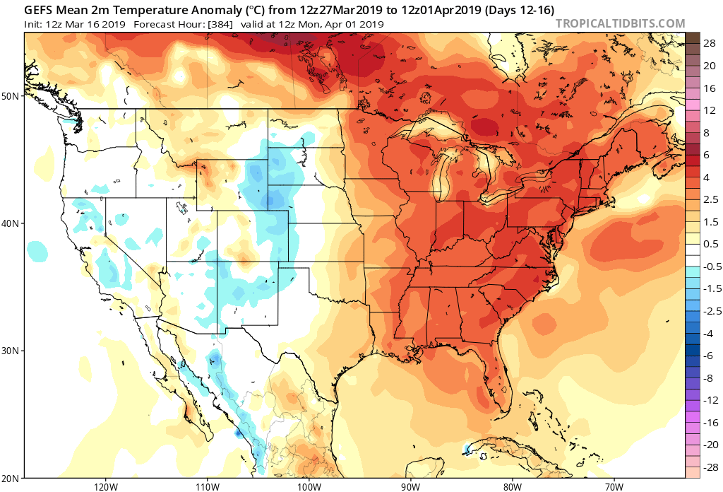
Note the brutal cold across the Northern Plains and Rockies.

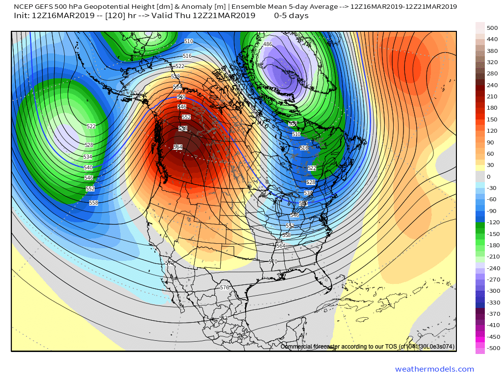
The upcoming week will feature a positive PNA pattern and associated cooler than average theme to open, before beginning to moderate mid-to-late in the work week.

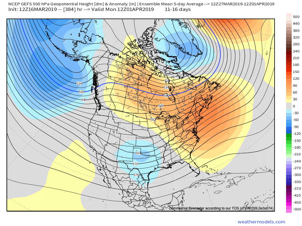
That said, time is limited on the chilly pattern and an overall significant shift to more of a sustained spring-like pattern awaits to close March and as we head into April.

Note the warmth that follows:

This will result in many more days in the 60s and 70s as we put a wrap on March and open April.

While weak systems will continue to impact the area (tomorrow, Wednesday, and again next Sunday), the deeper, moisture-laden storms will take a “backseat” during the fast-moving northwest flow. That begins to change during the last few days of the month and on into April. The latest ensemble guidance sees the return of a more active pattern, likely complete with heavier rain events and the potential of stronger storms.

Permanent link to this article: https://indywx.com/2019/03/16/now-were-talking-4/

Long Range Video Update: Changeable Pattern For The 2nd Half Of March Into April…

You must be logged in to view this content. Click Here to become a member of IndyWX.com for full access.  Already a member of IndyWx.com All-Access?  Log-in here.

Permanent link to this article: https://indywx.com/2019/03/07/long-range-video-update-changeable-pattern-for-the-2nd-half-of-march-into-april/

Sunday Morning Video: Repeat Next Weekend?

Is another damaging wind event on the horizon next weekend?

You must be logged in to view this content. Click Here to become a member of IndyWX.com for full access.  Already a member of IndyWx.com All-Access?  Log-in here.

Permanent link to this article: https://indywx.com/2019/02/24/sunday-morning-video-repeat-next-weekend/

IndyWx.com