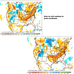
Meteorological fall runs from Sept. 1st through Nov. 30th. With that said, it’s only fitting we feel more fall-like on this the first day of meteorological fall. We note 24 hour dew point changes below. The browns indicate much drier air pressing south over the next 24-36 hours.
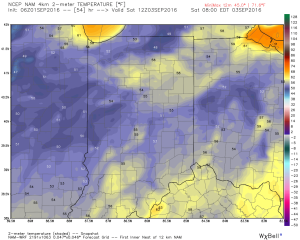
 You’ll definitely notice the drier, crisp feel to the air upon stepping outside this morning. If you try hard enough, you can almost smell fall! 🙂
That drier air will support multiple nights with low temperatures into the lower and middle 50s tonight through Sunday morning. We may even have a few neighborhoods dip into the upper 40s Friday or Saturday morning.
 We know this is the beginning of the transitional time of the year. Eventually, these cold fronts will back more and more of a punch as we rumble deeper into fall. On the flip side, summer isn’t ready to go away without a fight. In fact, temperatures well above normal will return for Labor Day, itself, and continue into the majority of next week. A string of highs in the upper 80s to lower 90s will be common next week.
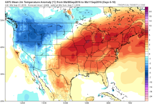 Longer term, there are indications that continue to support the idea of a potentially more significant cool down around mid September. Stay tuned…
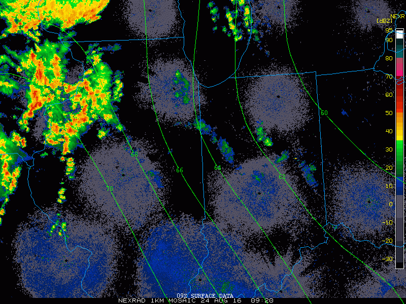 2.) HRRR futurecast radar delivers thunderstorms into central IN around the lunchtime hour.
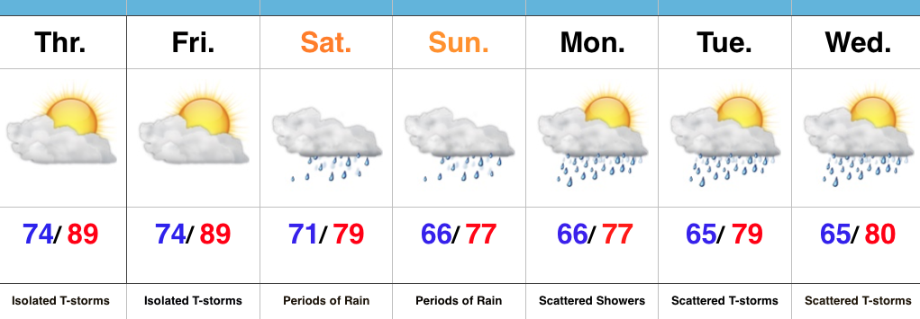
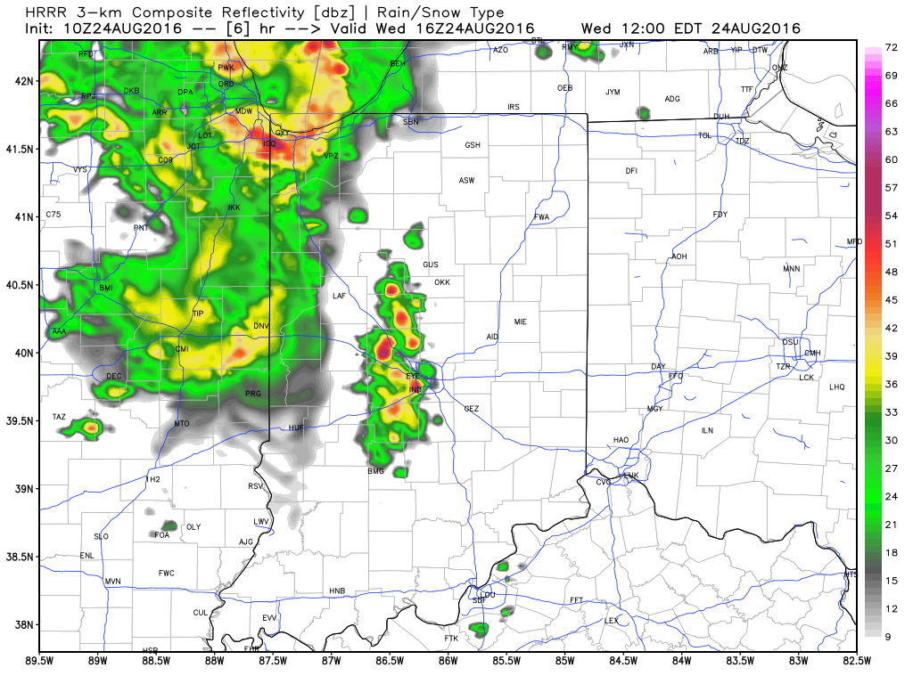 3.) Scattered thunderstorms remain Thursday (some strong to severe), but drier air will briefly push in across the northern half of the region Friday. We think from Indianapolis and points north, it’ll be a very pleasant end to the work week. That said, “briefly” is the key word. Moisture will surge north again Saturday and Sunday and isolated to scattered storms will follow suit.
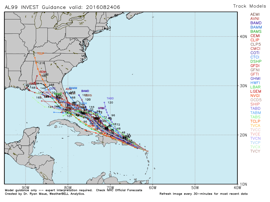
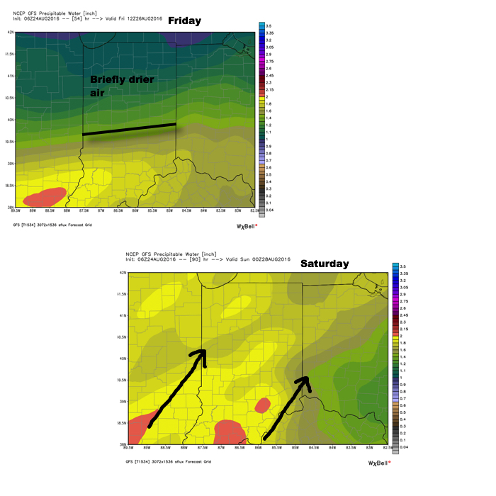 4.) Attention next week will shift to the tropics. There are many more questions than answers at this point, but understand the potential is there for significant tropical troubles next week. Intensity and track are far from etched in stone, but if your travels take you to the Gulf Coast, we suggest you remain abreast of the latest developments- particularly the southeastern FL coast and the north-central Gulf Coast.