All-Access Client Brief: Latest Thoughts Around This Weekend’s Snow…

Brief: Accumulating snow

Forecaster: McMillan

What: Accumulating snow

When: Late Saturday night into Sunday

Temperatures: Upper 20s to lower 30s

Wind: North 5-15 MPH

Blowing/ Drifting: Minimal

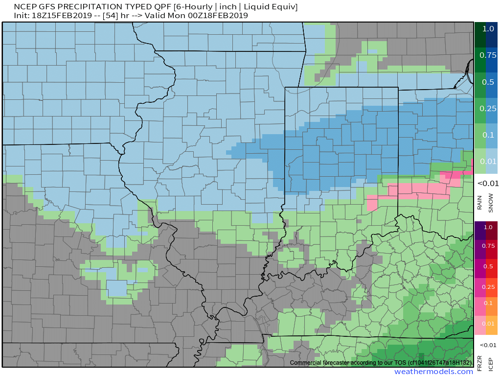
Overnight model trends are in overall better agreement, but still present notable differences- not only with the track, but overall strength and forward motion with the system. Saturday will be dry before clouds increase, lower, and thicken Saturday evening with snow overspreading the southern half of the state overnight. Mainly light to occasionally moderate snow (downstate) can be expected into the daytime on Sunday. The overall quick movement of this storm system will ultimately be a limiting factor in accumulation totals. Behind the system, much colder air will pour into the area Sunday night and Monday (single digit low and highs in the upper 10s to lower 20s).

Confidence: Low-medium

Next Update: This evening in video format

All-Access Client Brief: Plowable Snow Moves In Overnight…

Brief: Heavy Snow & Sleet

Forecaster: McMillan

What: Heavy Snow & Sleet

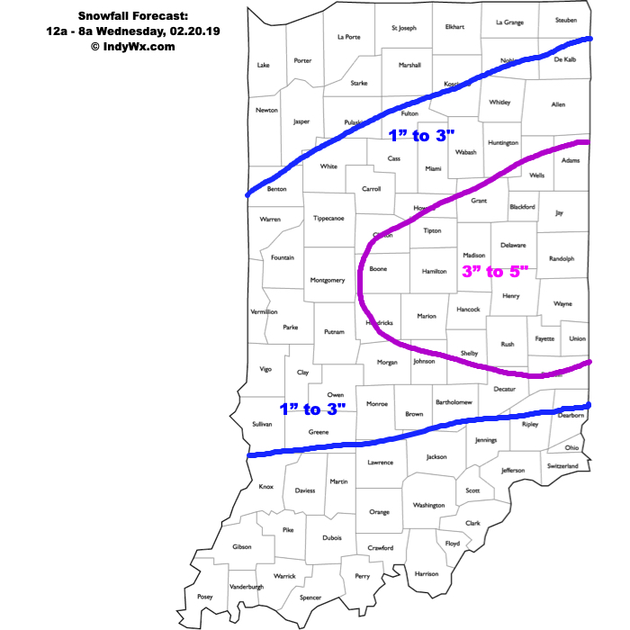
When: 12a to 8a Wednesday

Temperatures: Upper 20s to lower 30s

Wind: E 15-25 MPH

Blowing/ Drifting: Moderate before mixing with sleet

The setup remains the same as a warm front lifts north during the overnight. Copious amounts of moisture will arrive into central Indiana and with cold air in place, a period of moderate to heavy snow will develop. Timing into the city, itself, should come around, or just before, midnight. While the snow will be of the heavy, wet variety, gusty easterly winds will result in blowing and drifting snow (especially on north-south roadways) before precipitation transitions to sleet. We’ve “beefed” our accumulation forecast up to include a 3″ to 5″ band across east-central Indiana, including Indianapolis, as short-term guidance is indicating a period of significant “forcing” (or lift in the atmosphere) that will lead to heavy snowfall rates before the transition to sleet. A couple of hours with snowfall rates in excess of 1″ per hour will likely be observed in that 1a to 3a window. Precipitation will transition to sleet and a period of freezing rain between 3a and 5a from south to north, before turning to all rain in the city before sunrise. Further north, a transition to rain won’t be noticed until after 8a, but the majority of precipitation will likely be over with by that point (just lingering drizzle and fog).

Confidence: High

Burst Of Snow Transitions To Sleet & Freezing Rain Before Ending…

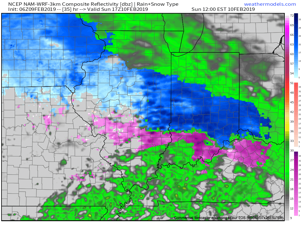
A burst of snow will move across central Indiana during the predawn hours (a few hours earlier than guidance suggested). Precipitation will become more widespread late morning into the early afternoon hours and as milder air aloft arrives on the scene, light snow will transition to sleet and freezing rain before ending. Further north (Kokomo to Ft. Wayne), precipitation is expected to remain all snow where 1”-3” will fall today before ending. Highs will top out around the freezing mark later this afternoon before falling into the middle 20s tonight. A few slick spots may develop on area roadways.

Much more later this morning on the week ahead and what looms further down the road as we wrap up the month.

All-Access Client Brief: Wintry Close To The Weekend…

Brief: Accumulating snow

Forecaster: McMillan
What: Accumulating snow

When: Sunday morning into the evening

Temperatures: Upper 20s to lower 30s

Wind: E 10-20 MPH

Blowing/ Drifting: Minimal 

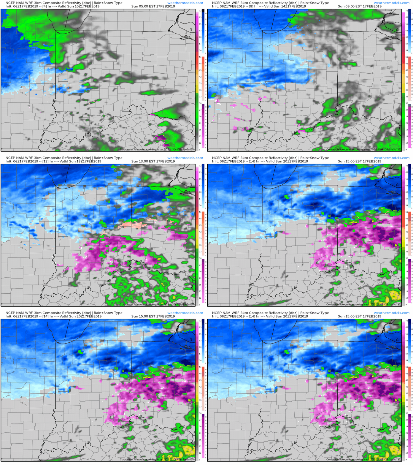
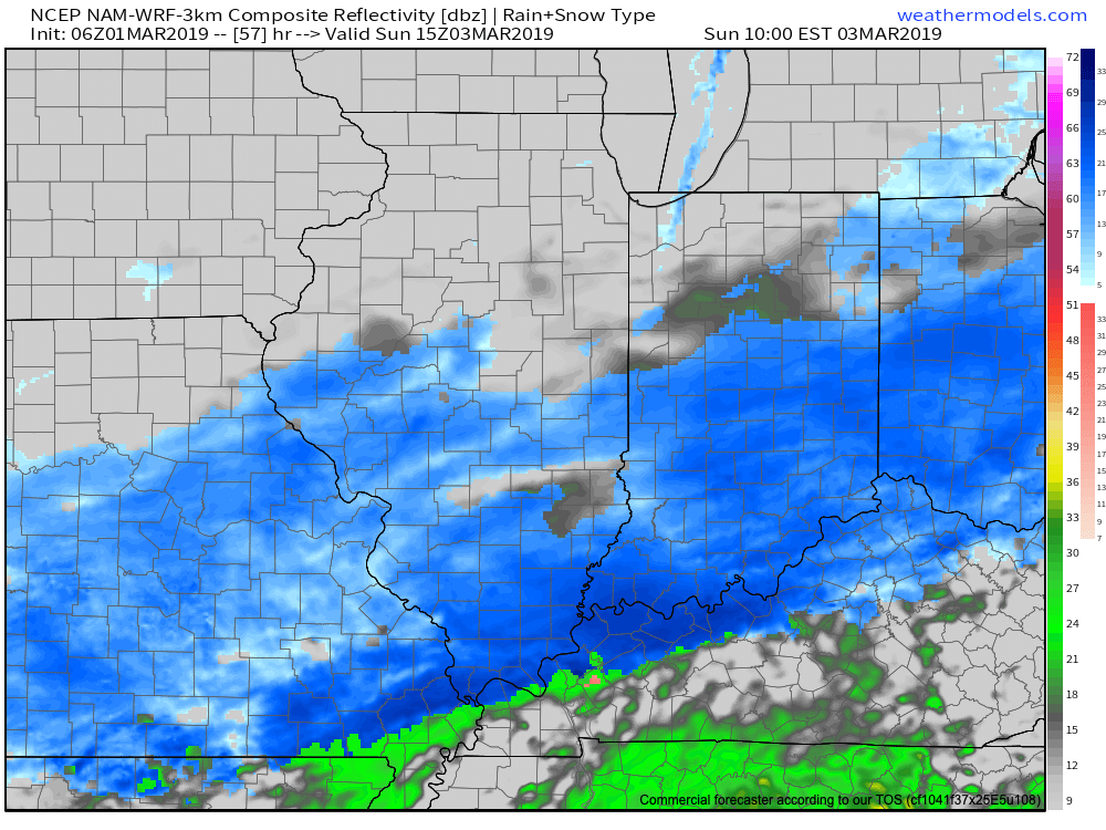
We’re heading into the 2nd consecutive weekend with a snowy close across at least portions of central Indiana- especially along and north of I-70. Upper level energy will get snow going during the predawn hours Sunday before potentially a more significant period of snow takes hold late morning into the afternoon. This is thanks to a surface wave moving northeast along the OH River eventually into western PA. We believe just north of the surface low a stripe of snow (potentially to the tune of 3″ to 5″) will develop from east-central IN into OH and on into central PA. We’ll have to fine tune this as we progress into the weekend. Please stay tuned.

Confidence: Medium

Snow And Freezing Rain For The 2nd Half Of The Weekend…

Brief: Accumulating snow and freezing rain

Forecaster: McMillan

What: Accumulating snow and freezing rain

When: Late Sunday morning into Sunday evening

Temperatures: Lower 20s rising to near freezing by Sunday night

Wind: SE to S 5-15 MPH

Blowing/ drifting: Minimal to non-existent

After a cold and quiet open to the weekend, a disturbance will overspread moisture over the top of a modifying (still cold enough for trouble) air mass as we close the weekend. Snow will likely reach Indianapolis and surrounding communities late morning Sunday, continuing into the afternoon hours. Snowfall intensity will be light with occasional moderate bursts. As relatively milder air aloft gets pulled north, precipitation will end as light freezing rain Sunday evening. While we don’t anticipate heavy accretion, a light glaze will likely be noted on top of the freshly fallen snow Sunday evening.

Confidence: Medium to high

Next Update: 5p