Category: Client

Couple Thoughts On This Weekend And Next Week’s Storms; Colder Trends Build Long Term…

Updated 01.01.24 @ 6:41p

I hope you and your family are enjoying an incredible New Year’s Day! What a game we have on our hands at halftime in the Rose Bowl.

I post this in flight back to home base from ushering in the new year in the beautiful Berkshire mountains. Our regularly scheduled client video discussions will return tomorrow morning. I trust you’ve been following along with both short and long term pattern ideas daily over the past week.

The immediate term opens with quiet and unseasonably calm conditions while the end of the upcoming 10-day stretch will end much colder. The transition between start and finish will turn much more hectic around these parts as we track not one, but two storm systems between this weekend and early next week. While there’s no doubt we’ll trend colder than average by Day 10, questions abound with just how cold we go. Should we get a snowpack down, subzero is on the table.

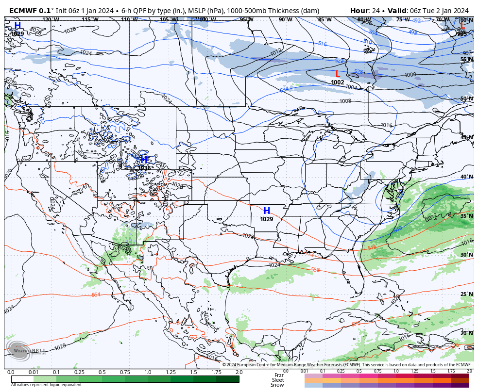
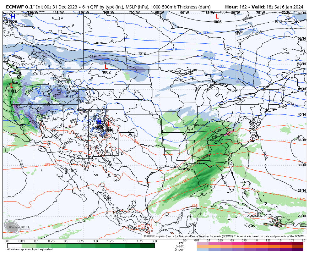
Speaking of the aforementioned more “hectic” pattern, this kicks into gear over the weekend. While modeling likes more of a suppressed track at this distance, thinking here is that guidance will start to pick up on a more organized northern piece of energy, or surface low reflection, that will accompany the primary Gulf low. I suspect a secondary, organized, shield of precipitation into the OHV region Friday night into Saturday. Will that be enough to put our neck of the woods into a winter storm risk during this timeframe? Too early to call at this distance, but given where the PNA, EPO, and Greenland Block that will be starting to mature, I’d recommend keeping an eye on what will likely be an eventual click or two northwest as the week goes along. It’s likely either a “snow or no” type situation here with storm #1, as opposed to having to worry about rain or mixing issues.

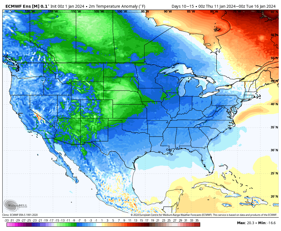
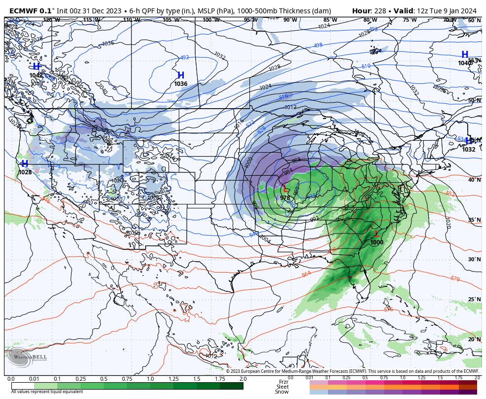
As for storm #2 early next week, our early idea takes the primary low into the OHV before a secondary low “takes over” along the eastern seaboard. The energy transfer likely brings just enough mild air north into the central Ohio Valley to create more of a rain to snow type scenario, locally. The coldest air of the season so far will likely follow in the 10-15 day.

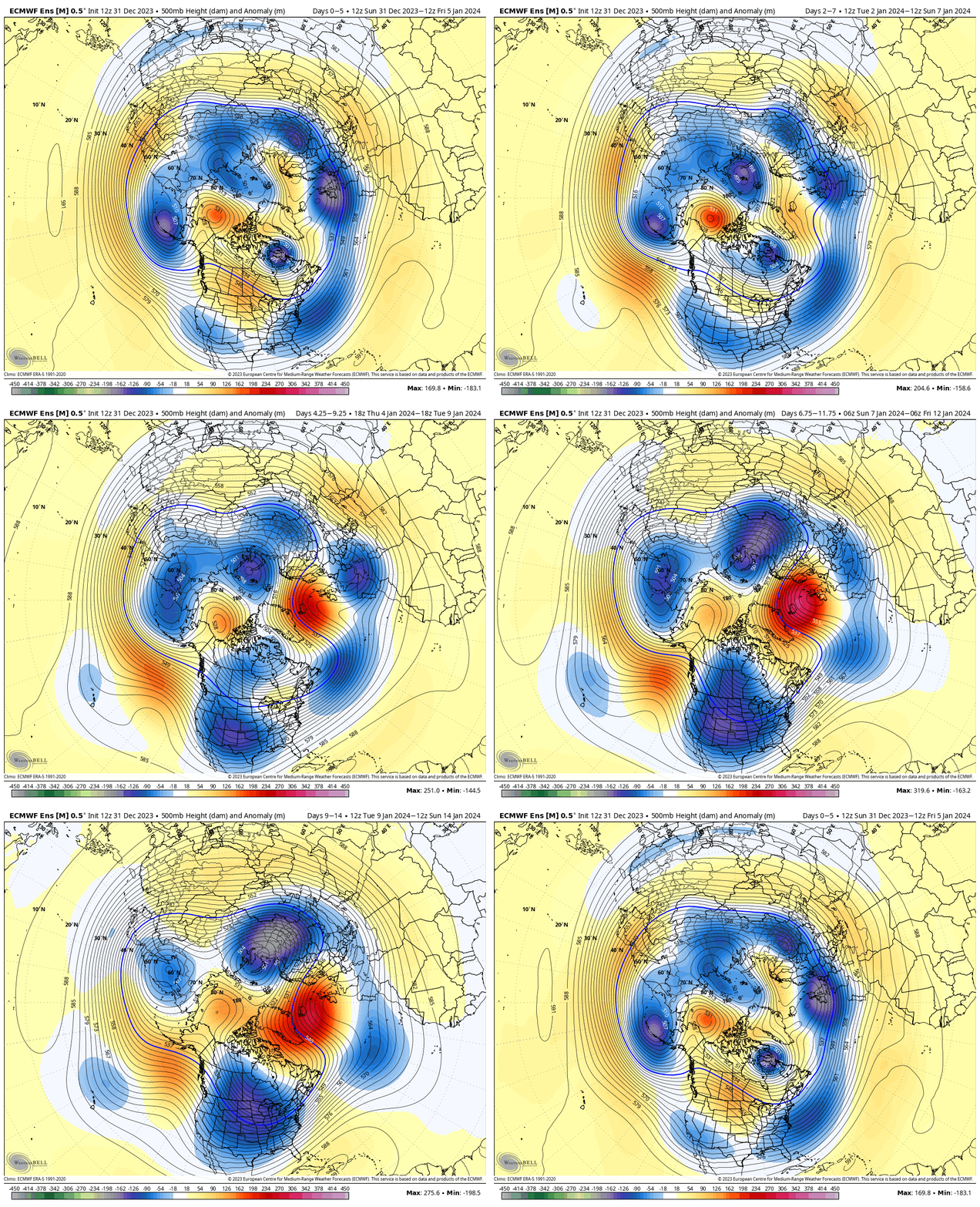
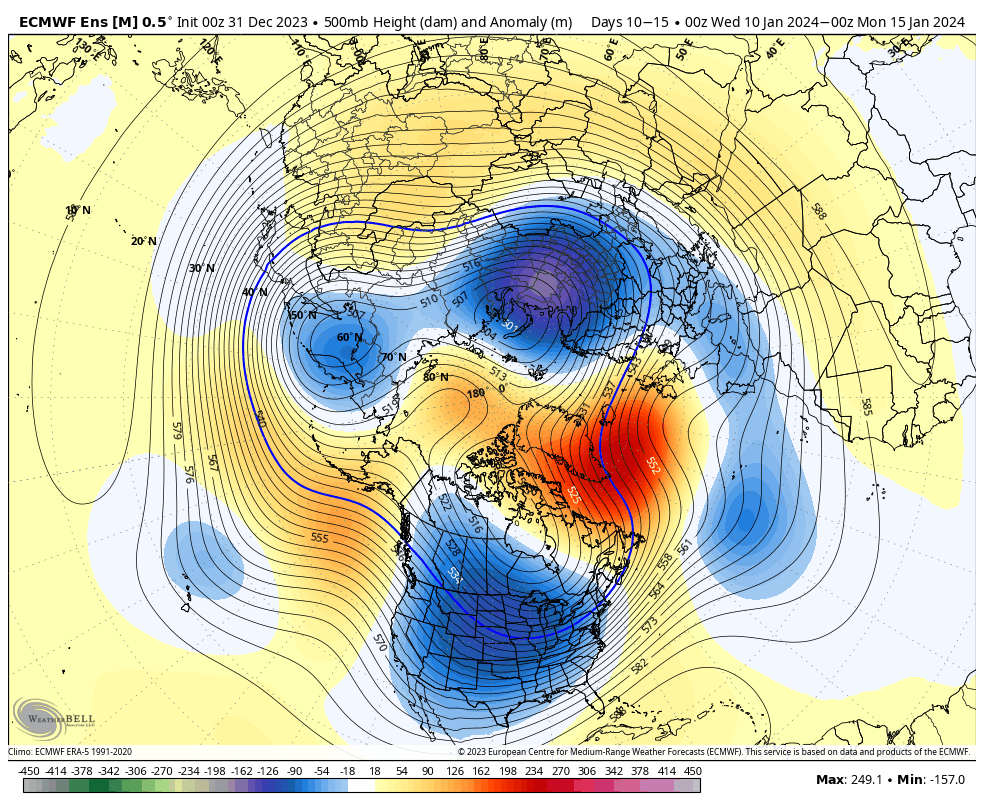
Speaking of the 10-15 day, the look above is an absolute textbook upper air pattern not only for cold, but continued opportunities of winter weather here as we rumble into mid-January. By this point, other long term pattern drivers, such as the NAO and AO (of course to go along with the MJO, PNA, and EPO) will be factored in to where we head not only for the 2nd half of the month, but into late winter and spring. Recent trends certainly suggest the colder options are gaining traction. Today’s European Weekly update reflects a more persistent stretch of high latitude blocking I can remember o/ the past few winters. This ups the ante for a stormy stretch into and through the heart of winter. Given the longer term NAO and MJO look, I’d suspect the colder threat (relative to normal) is on the table into spring this year.

Much more in the AM! Make it a great evening!

Permanent link to this article: https://indywx.com/couple-thoughts-on-this-weekend-and-next-weeks-storms-colder-trends-build-long-term/

Happy New Year; All Is Calm (For Now)…

Updated 01.01.24 @ 7:40a

From our family to yours, we’re wishing you a joyous and prosperous 2024, filled with health and happiness!

The weather pattern through Friday is simply about as quiet as one could ask for by early January standards. High pressure will keep us dry and seasonably chilly. A weak disturbance will drift across the northern Great Lakes Wednesday evening into Thursday morning and could set off a few light snow showers, but even if this does take place, we’ve already wasted more pixels than needed. 🙂

A calm, quiet start to the new year is on tap.

Things begin to change this weekend as low pressure organizes in the western Gulf of Mexico with a trough extending north into the central Plains. Both features will move east and then head up the eastern seaboard over the weekend. The all-important question here has to do with the northern energy. Do we get a reflection of a surface low into the Ohio Valley and associated heavier precipitation, or are we mostly bypassed off to the south (thanks to the primary low taking control)? Stay tuned. This picture should become much clearer over the upcoming 24-48 hours. Sensible weekend weather here ranges from an all out winter storm to nothing more than light snow.

Another storm will follow early next week. Finally, a big ole batch of arctic air will likely expand into the region in the 10-15 day period. By that point the question will become just how cold can we go? A lot of that will have to do with what, if any, snowpack we have down by that time. Are we just colder than average by mid January standards or talking sub-zero stuff?

Needless to say, enjoy the quiet times while we have them. A fresh Client video will be posted first thing in the morning with more details on this and more.

Happy new year!

Permanent link to this article: https://indywx.com/happy-new-year-all-is-calm-for-now/

Potential Is Mighty, But Can It Turn To Reality?

Updated 12.31.23 @ 4:13p

We’re heading towards a “special” pattern over the next couple weeks, especially for winter weather enthusiasts. The potential in the said pattern is mighty, but can potential become reality? Thankfully, we have a quiet open to the month to track all of the possibilities that begin to take their position this upcoming weekend.

It’s easy to become enamored with the expansive trough and coast to coast cold that follows in the 10-15 day range (by the way, truly bitter air should arrive during this period), but what’s more interesting to me is the building Greenland Block. That kind of block usually promotes all sorts of wintry “fun and games” here and across a large chunk of the country. It’s also note worthy as it tends to lead to more sustainable wintry conditions. Perhaps the “extreme and nothing in between” cold solution/ lean for the latter part of January may have merit?

While far too early for specific details, the stormy shift appears to be a good call with the initial storm taking aim on the region this upcoming weekend, followed by a second system that also has the potential of producing wintry weather the early and middle part of the following week. Simply put, the threat of winter storm(s) is growing over the course of the upcoming 10 days.

Details to follow in the week ahead!

Permanent link to this article: https://indywx.com/potential-is-mighty-but-can-it-turn-to-reality/

Thoughts On The First Couple Weeks Of The Year (And Beyond)…

Updated 12.31.23 @ 8:40a

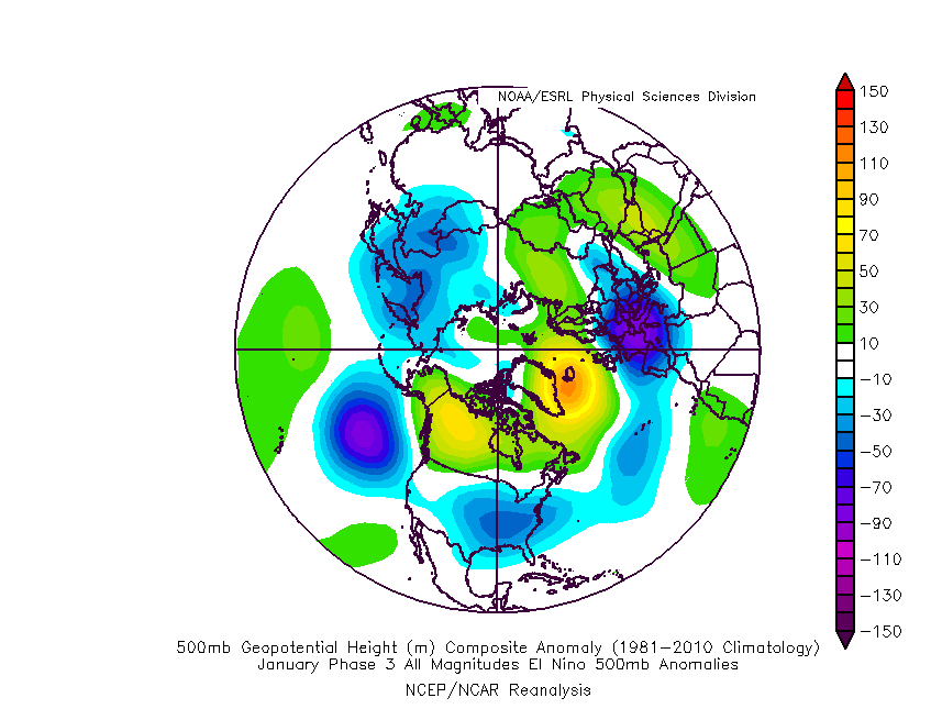
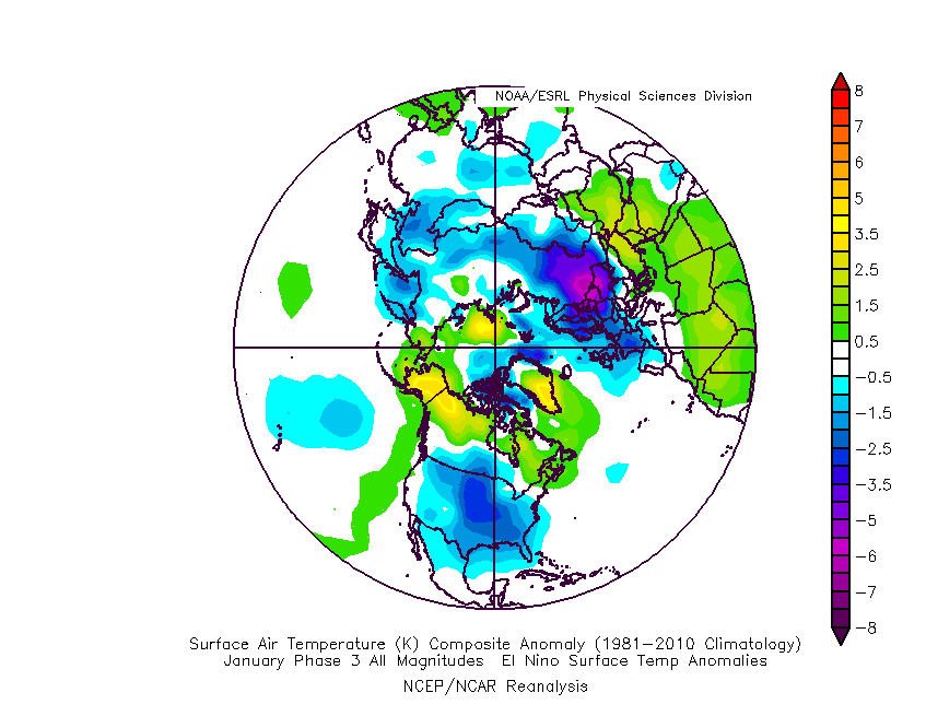
The MJO is rolling right into the notorious cold (for this time of year) phase 3 as we open up the new year.

The composite analog for phase 3 in January from an upper air and surface temperature anomaly standpoint:

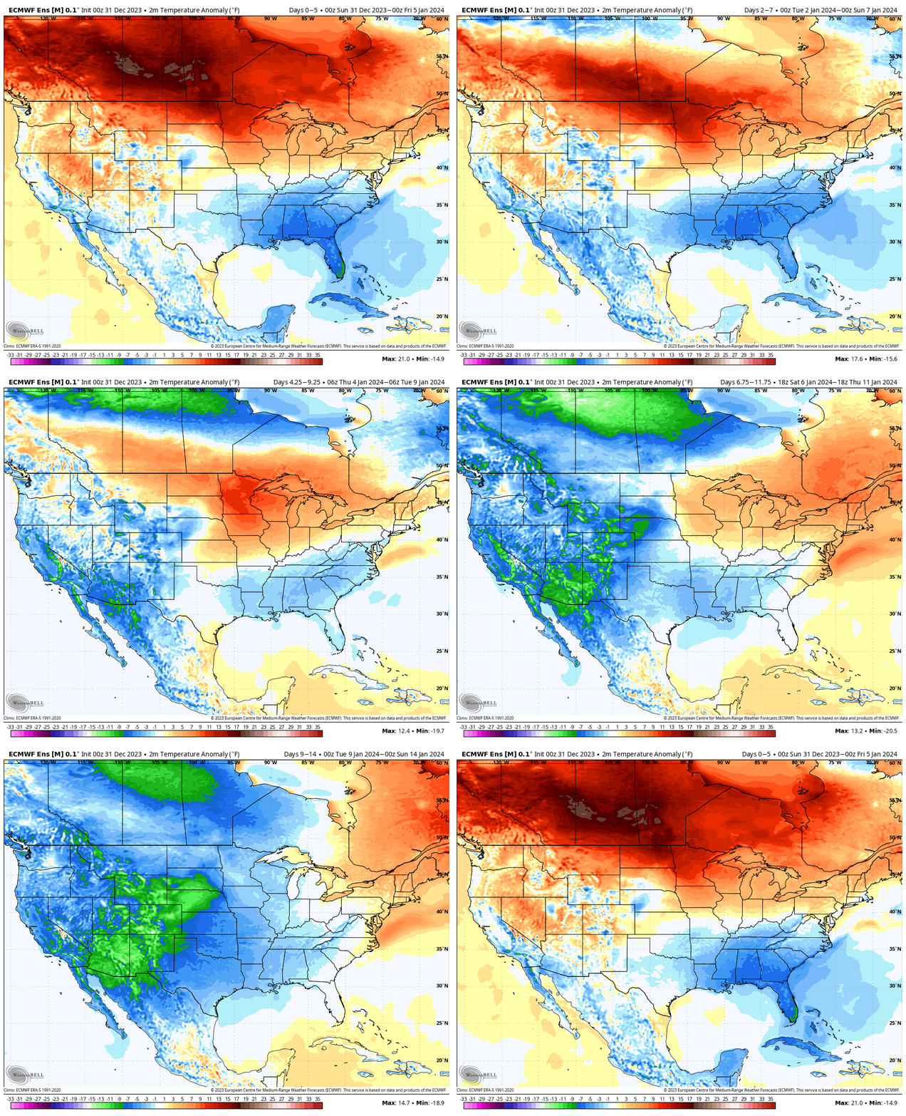
Ensemble guidance shows the widespread colder than normal temperatures overspreading the country. Like clockwork, this is almost identical to the Phase 3 analog above.

After a quiet week, we’ll watch 2 storms in the 5-10 day period. The first comes along next weekend. While still far too early to get detailed, this one does have potential to serve up some wintry mischief to the Ohio Valley, including central Indiana.

The second storm follows and it’s behind this feature that more of a truly arctic air mass will get involved in our pattern.

The pattern will stay busy as the arctic air presses in. At the same time, note the Greenland block beginning to form. Winter weather enthusiasts have to be chomping at the bit by that 10-15 day look. Needless to say, we can expect a rapidly expanding snow pack across the Lower 48 over the next couple weeks.

Thereafter, all eyes will remain on the MJO. Do we roll into the “null phase,” such as what the European suggests or swing through the traditionally mild/ warm phases such as the American guidance portrays? Stay tuned…

Permanent link to this article: https://indywx.com/thoughts-on-the-first-couple-weeks-of-the-year-and-beyond/

Clipper Delivers Light Snow For NYE…

Updated 12.30.23 @ 7:54a

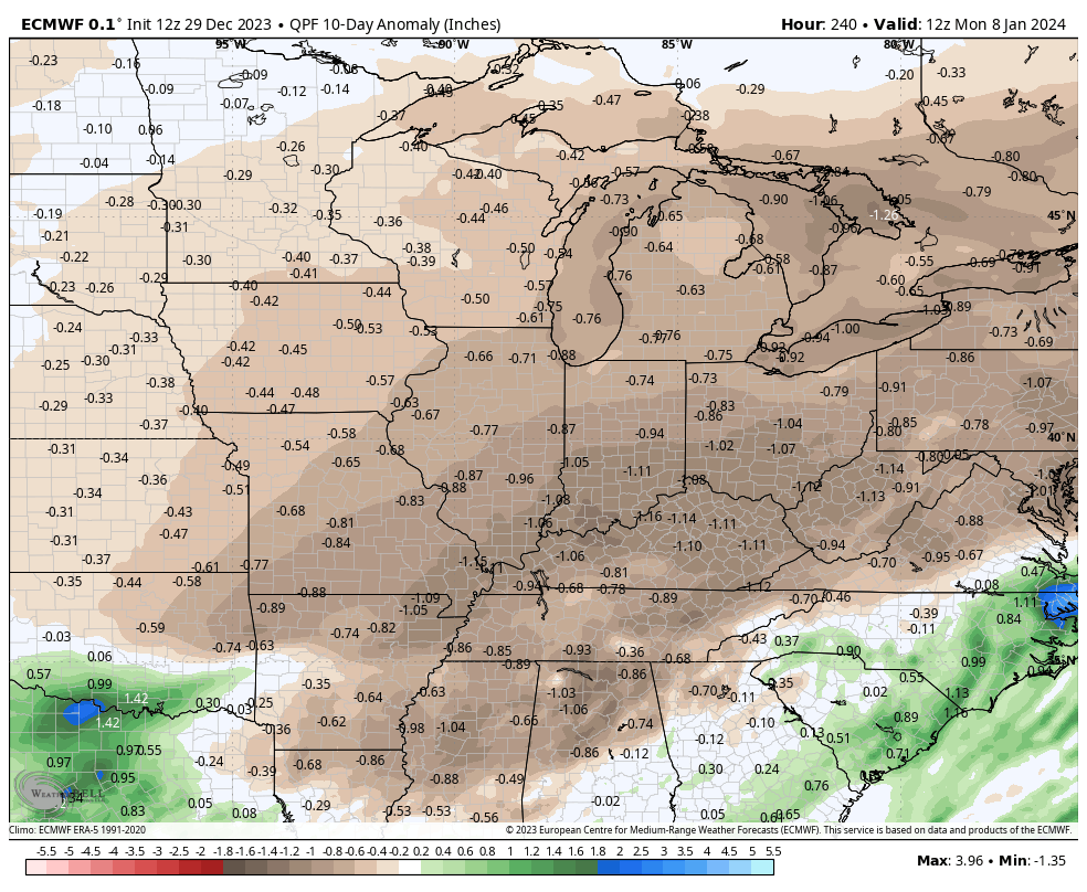
Despite our New Year’s Eve clipper, we’re heading for an unusually quiet weather pattern to open up the new year. The upcoming 10 days are forecast to run well below average from a precipitation standpoint.

In fact, after tomorrow’s light snow, it may not be until late next weekend or closer towards January 10th that we’re talking about our next precipitation chances. Rare, indeed, for this time of year.

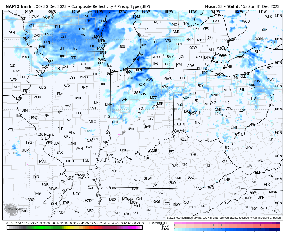
Back to this morning’s headline and our clipper. Sunday should dawn dry but light snow will begin to become more widespread across central Indiana by mid to late morning.

Light snow will continue to fall through the early afternoon before we get into a brief lull in the activity. During this time frame we can also expect 10-20 MPH winds which may limit visibility slightly as the light snow falls. Daytime accumulation, if any, should be no more than a dusting.

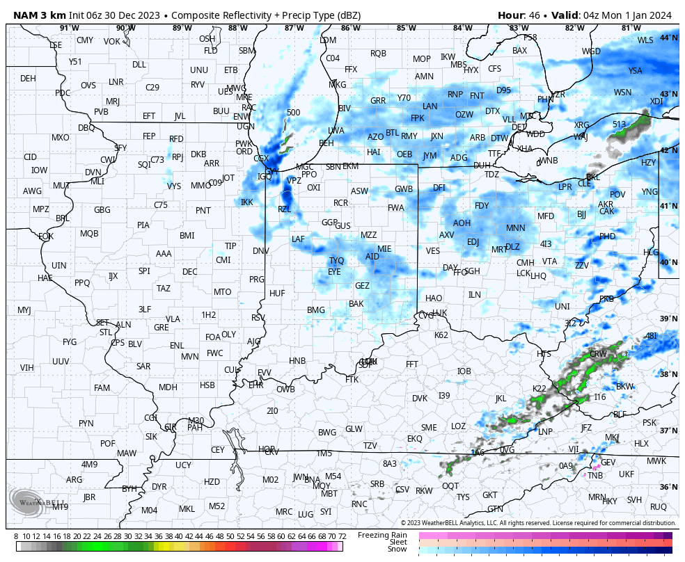
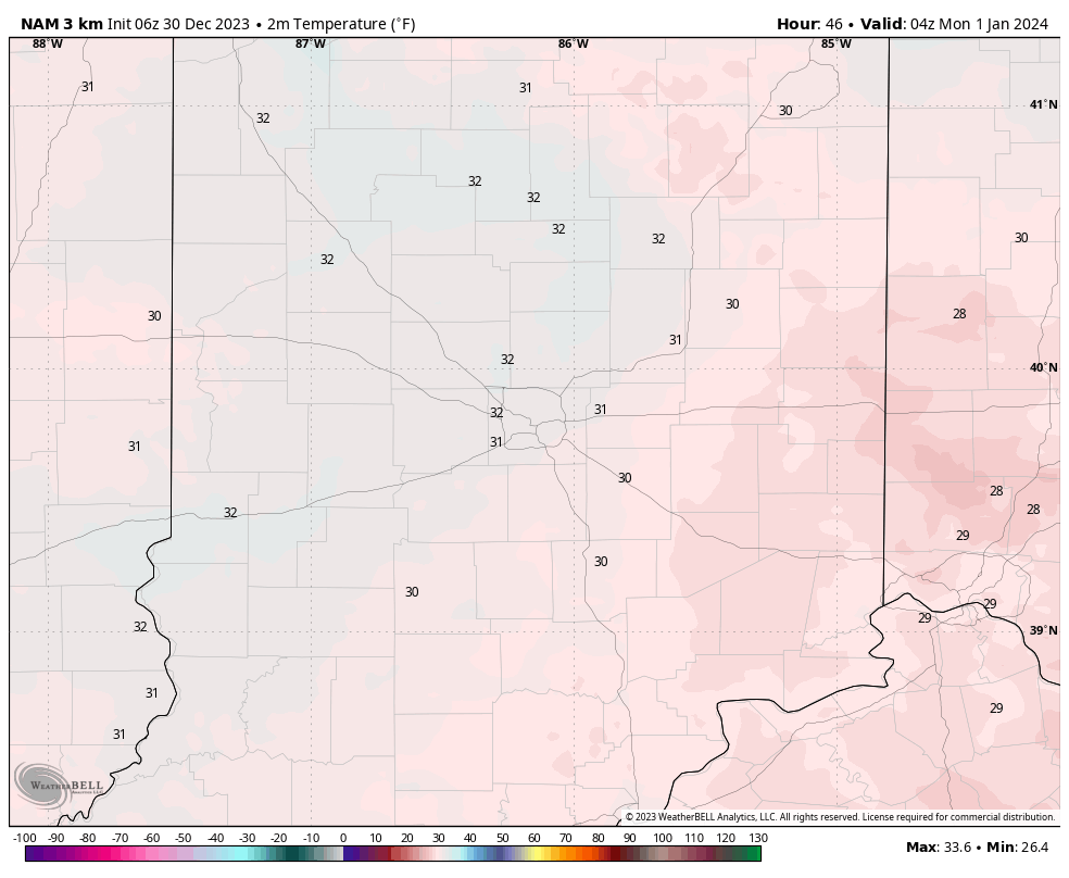
After the lull in the activity, a second round of light snow will develop towards 10p to 11p, or so.

Though still light in nature, temperatures will settle below the freezing mark as this secondary batch of light snow falls.

While certainly not a heavy event by any means, just enough light snow and temperatures falling below freezing will likely create some localized slick spots across central Indiana tomorrow evening.

(Snow removal Clients, salting is recommended tomorrow evening).

Those with NYE plans out and about should allow extra time traveling home tomorrow evening. Light snow will diminish during the overnight and drier conditions should return for New Year’s Day, itself.

Permanent link to this article: https://indywx.com/clipper-delivers-light-snow-for-nye/