You must be logged in to view this content. Click Here to become a member of IndyWX.com for full access. Already a member of IndyWx.com All-Access? Log-in here.
When: Late Wednesday morning through Thursday afternoon
Temperatures: 18° to 24°
Wind: NE 10 – 20 MPH and gusty
Blowing/ Drifting: Considerable
Pavement Impacts: Plowing and salting will be required
Summary: Wednesday will dawn with quiet conditions in place but snow will arrive into central Indiana by late morning. Initially, we’re only talking about light snow into the afternoon and evening. Snow will become more widespread and heavier throughout the “heart” of central IN during the overnight hours and Thursday morning before eventually giving way to lighter snow Thursday afternoon, eventually ending from west to east. Downstate, a mix of freezing rain, sleet, and brief snow is expected, including icy travel. Once again, this will be an efficient snow producer. Instead of snow ratios of 10:1 we expect closer to 15 to 20:1 ratios (similar to that of what southern parts of the state experienced Monday). The dry, powdery nature of the snow will combine with gusty northeast winds to create blowing and drifting issues by Wednesday evening through Thursday, especially in the open country. Gusty winds will persist Thursday night even as the snow comes to an end, extending the blowing and drifting concerns.
Keep That Head On A Swivel…Before we talk about what’s ahead, it was a snowy night across south-central Indiana. Many of the reports coming in from down that way indicate our 3″ to 5″ forecast played out quite nicely, including most common snowfall totals between 4″ and 5″ (with a few isolated heavier amounts). Thank you for those ground truth reports, friends! I know we’ve said it before, but they are more valuable than you know!
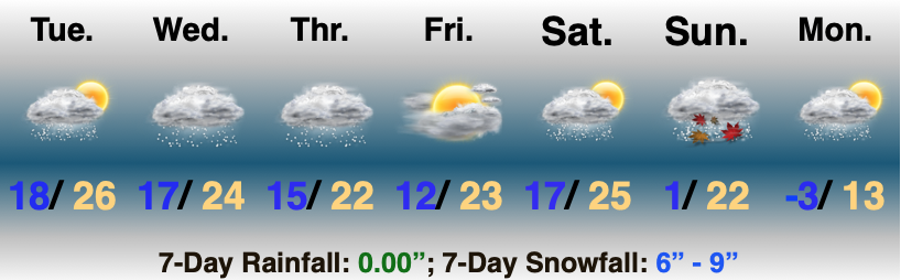
Now to look ahead. Storm systems will come flying through fast and furious over the upcoming 7-days. Scattered lingering snow showers and flurries today will give way to a steadier snow as we move into Wednesday. Meanwhile, an icy mixture of sleet and freezing rain is expected across far southern Indiana. After the 12z model suite is complete this afternoon, we’ll be back with a fresh look on expected snowfall amounts later this evening.
Friday appears to offer up a much needed one day breather from wintry systems with cold, dry conditions expected. Then our attention will shift to the weekend and threat of potentially a more significant winter storm. Guidance is trying to sort out which feature has the best chance of phasing into a more potent storm system. The GFS likes the lead wave this weekend while the European holds things off until early next week. Please stay tuned.
You must be logged in to view this content. Click Here to become a member of IndyWX.com for full access. Already a member of IndyWx.com All-Access? Log-in here.
Most of the daytime today will only feature light snow, but don’t let that fool you. With such a cold, arctic airmass in place, even the “light” snow is creating travel issues in spots. Take it slow out there, friends.
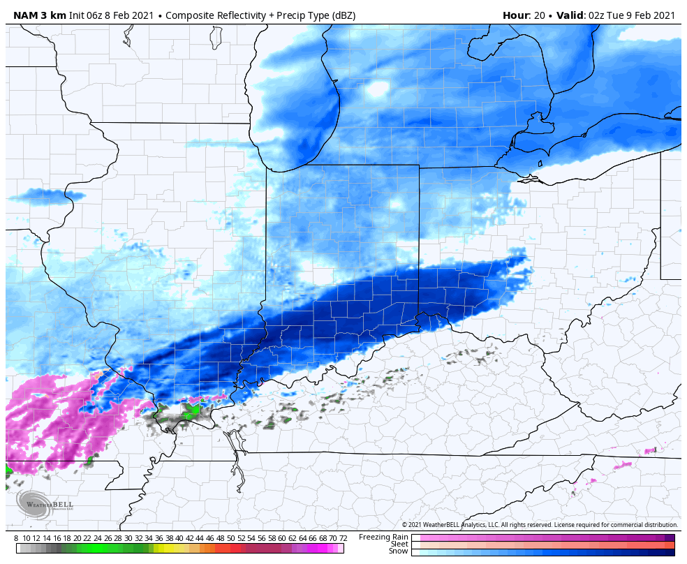
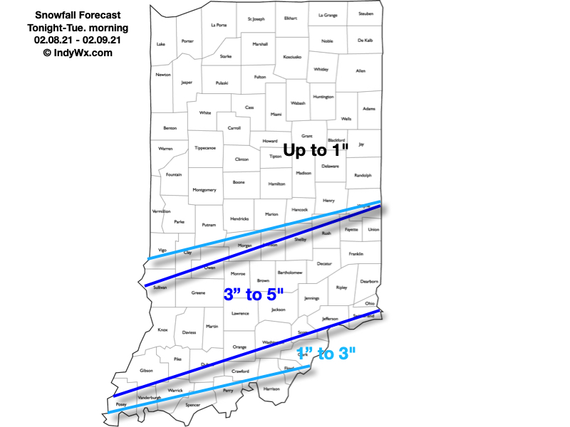
A new piece of upper level energy will streak across the region tonight and help snow to become more organized in aerial coverage. A narrow, but efficient band of steadier snow is expected to get going across south-central Indiana around, or just after, sunset. It’s within this snow where we expect several inches of snow to accumulate tonight and early Tuesday morning.
Snow will become moderate to heavy at times across south-central IN tonight.
Most of the steady snow will exit to the east before sunrise Tuesday. We’ll then be left with periods of flurries and light snow through the remainder of the day.
Here’s our snowfall forecast with tonight’s system:
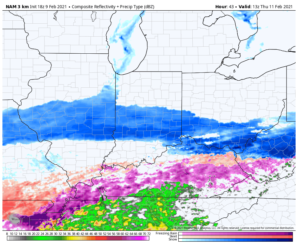
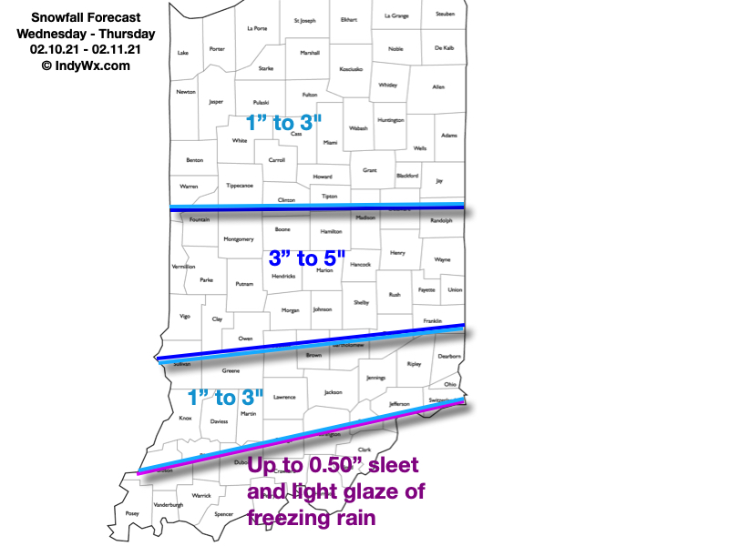
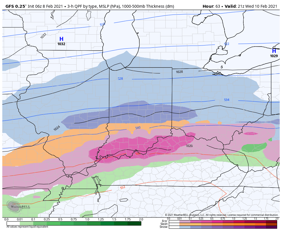
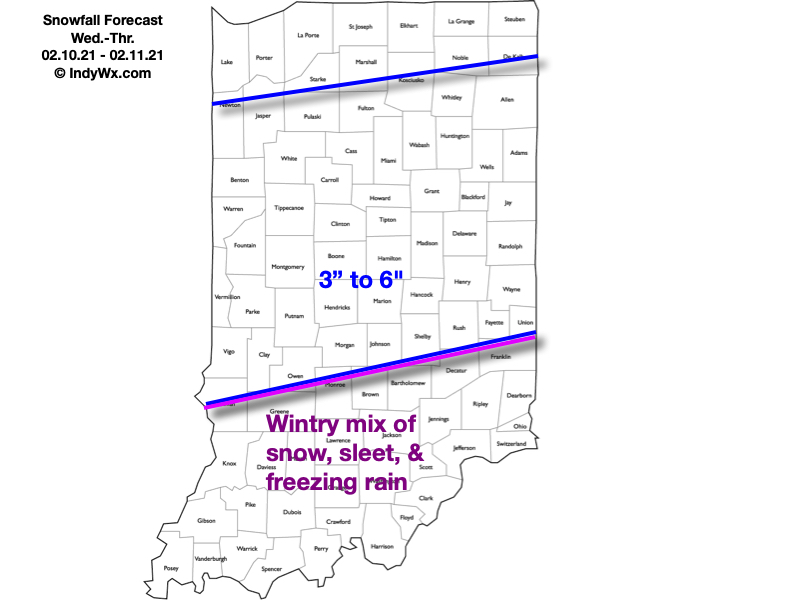
Attention will then shift to a “juicier” midweek storm system. An arctic boundary will remain draped to our south while a surface wave rides northeast along the stalled front. This will allow more widespread, heavier precipitation to push into the region (from southwest to northeast) through the morning Wednesday. For a time, moderate to heavy precipitation rates are expected Wednesday evening into Wednesday night. The early call on this system continues to be for an all snow event across central Indiana (where we think 3″ to 6″ of fresh snow is a good bet) with more of a wintry mix of snow, sleet, and freezing rain across southern portions of the state as warmer air aloft gets pulled north. Unfortunately, I think even southern portions of the state remain cold at the surface, continuing the threat of an icy glaze vs. a plain ole rain.
Widespread wintry precipitation will overspread the region Wednesday.
Here’s our snowfall forecast for Wednesday and Thursday:
As the snow continues to add up, concern will mount around the issues that will likely come from a blowing and drifting perspective- especially as a fresh arctic intrusion arrives late week. If that wasn’t enough, additional “fun and games” are on the table for the upcoming weekend, followed by the coldest air so far this season (and in some cases in a couple of years).