VIDEO: The Spring “Fling” Is On…
Updated 02.23.21 @ 7:51a
You must be logged in to view this content. Click Here to become a member of IndyWX.com for full access. Already a member of IndyWx.com All-Access? Log-in here.
Updated 02.23.21 @ 7:51a
You must be logged in to view this content. Click Here to become a member of IndyWX.com for full access. Already a member of IndyWx.com All-Access? Log-in here.
Updated 02.22.21 @ 8:15a

Gusty Out This Morning…Westerly winds are blowing at a good clip this morning, including gusts of 30-40 MPH. These will continue into the afternoon before diminishing. All in all, we’re looking at a much milder stretch of weather in the week ahead. Compared to the past couple of weeks, most days will be downright balmy. Sunshine will return tomorrow and remain with us through the day Friday. It continues to look like Wednesday night’s frontal passage will be an uneventful one.
As we look ahead to the weekend, shower chances return Saturday as a couple of systems team together. As of now, the northern and southern stream energy doesn’t look like it’ll phase until over the Northeast/ New England region. As such, this doesn’t look like a big deal here, but we’ll continue to keep an eye on things.
Averages: H: 43°/ L: 26° on the 22nd –> H: 45°/ L: 28° on the 28th
Updated 02.21.21 @ 8:48a
You must be logged in to view this content. Click Here to become a member of IndyWX.com for full access. Already a member of IndyWx.com All-Access? Log-in here.
Updated 02.20.21 @ 8:29a
Before we dive into the challenges late next week, the potential is still very much alive and kicking for a period of slick conditions to develop Sunday evening/ night. While we’ll likely be in the middle 30s during the majority of the time this light precipitation is falling, the concern remains, given the duration and magnitude of the cold air (ground is now reported frozen “8 to 12”), that any liquid precipitation that falls will freeze on untreated area roadways and sidewalks. If you have travel plans Sunday night, plan to give yourself plenty of extra time.
Light rain should arrive between 8p and 10p (west to east across the state) Sunday before ending as a bit of light snow (little to no accumulation expected as of now). Total precipitation should be 0.20″ or less for most with this event.

As we look ahead, the next item of possible trouble awaits for mid and late week. A cold front will push south of the area Wednesday night into Thursday morning. While this may generate a brief period of light rain transitioning to light snow, it’s what follows that’s of more interest.
Operational guidance (both the European and GFS) suggest this late week system will present a winter storm for our friends in the TN Valley, but we advise to tread with caution for now.
The reason? A strongly negative PNA.
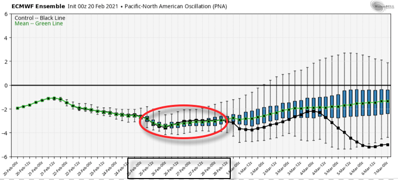
You know the drill by now. This should lead to a more stubborn southeastern ridge and subsequent further north storm track.
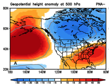
Over time, I’d suspect we’ll see just that- the models trending further north with this particular storm system.
As it is, ensemble guidance is already significantly further north than their respective operational counterparts. At the very least, another interesting case study is in front of us…
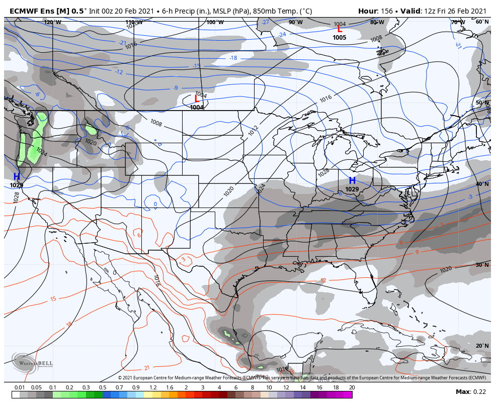
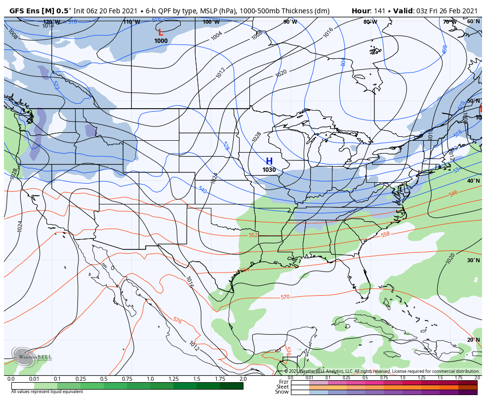
Stay tuned!
Updated 02.19.21 @ 6:19p
You must be logged in to view this content. Click Here to become a member of IndyWX.com for full access. Already a member of IndyWx.com All-Access? Log-in here.