You must be logged in to view this content. Click Here to become a member of IndyWX.com for full access. Already a member of IndyWx.com All-Access? Log-in here.
Category: Client
Permanent link to this article: https://indywx.com/video-wet-windy-saturday-looking-ahead-to-halloween-and-the-colder-pattern-that-awaits/
Oct 25
VIDEO: Busy Time Of Things In The Good Ole Forecast Office…
You must be logged in to view this content. Click Here to become a member of IndyWX.com for full access. Already a member of IndyWx.com All-Access? Log-in here.
Permanent link to this article: https://indywx.com/video-busy-time-of-things-in-the-good-ole-forecast-office/
Oct 24
VIDEO: Significant Fall Storm Brewing…
You must be logged in to view this content. Click Here to become a member of IndyWX.com for full access. Already a member of IndyWx.com All-Access? Log-in here.
Permanent link to this article: https://indywx.com/video-significant-fall-storm-brewing/
Oct 23
VIDEO: Saturday Washout And Reasons To Buy The Cold Early November Idea; Winter ’19-’20 Chatter…
You must be logged in to view this content. Click Here to become a member of IndyWX.com for full access. Already a member of IndyWx.com All-Access? Log-in here.
Permanent link to this article: https://indywx.com/video-saturday-washout-and-reasons-to-buy-the-cold-early-november-idea-winter-19-20-chatter/
Oct 23
Rain Chances Going Up This Weekend; Taste Of Winter Blows Into Town Before Halloween…
Dry weather will prevail today and the majority of Thursday across central Indiana (a light passing shower is possible across northern Indiana, but this won’t be a big deal).
Scattered light showers are possible Thursday night into the day Friday, along with an increase in cloud cover, but again, significantly more dry time is anticipated than wet. Some won’t see a drop of rain Friday.

As we rumble into the weekend, a vigorous upper level low in Oklahoma will “bowl” east across Arkansas and then shoot northeast across the Ohio Valley Saturday into Sunday. (Hint, you may want to get used to this kind of storm track over the upcoming winter). This will result in increasing aerial coverage of rain Saturday.
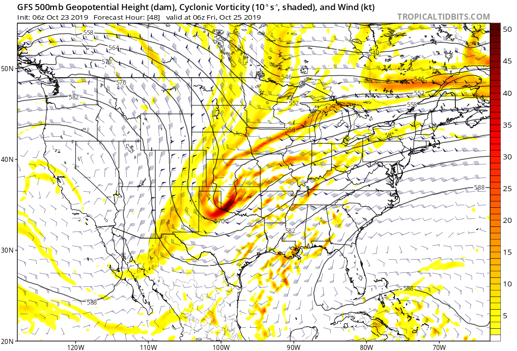
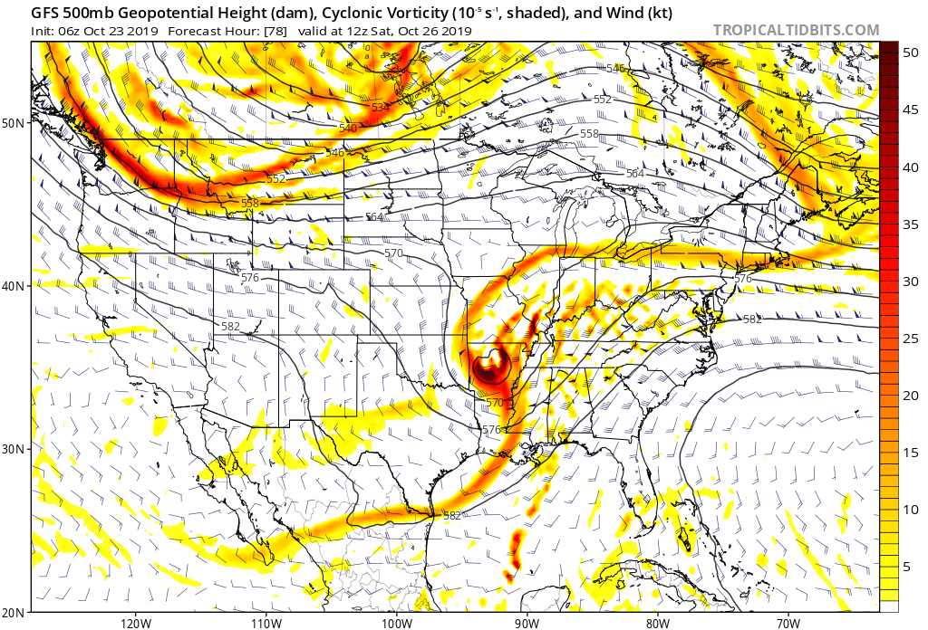
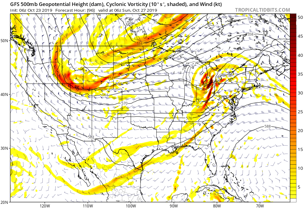
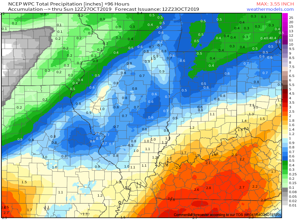
Rain will exit off to the northeast Saturday night and a drier second half of the weekend is expected. By the time all is said and done, a solid 0.50″ to 1″ of rain is expected (we’re currently siding with a blend of the aggressive European and lighter GFS).
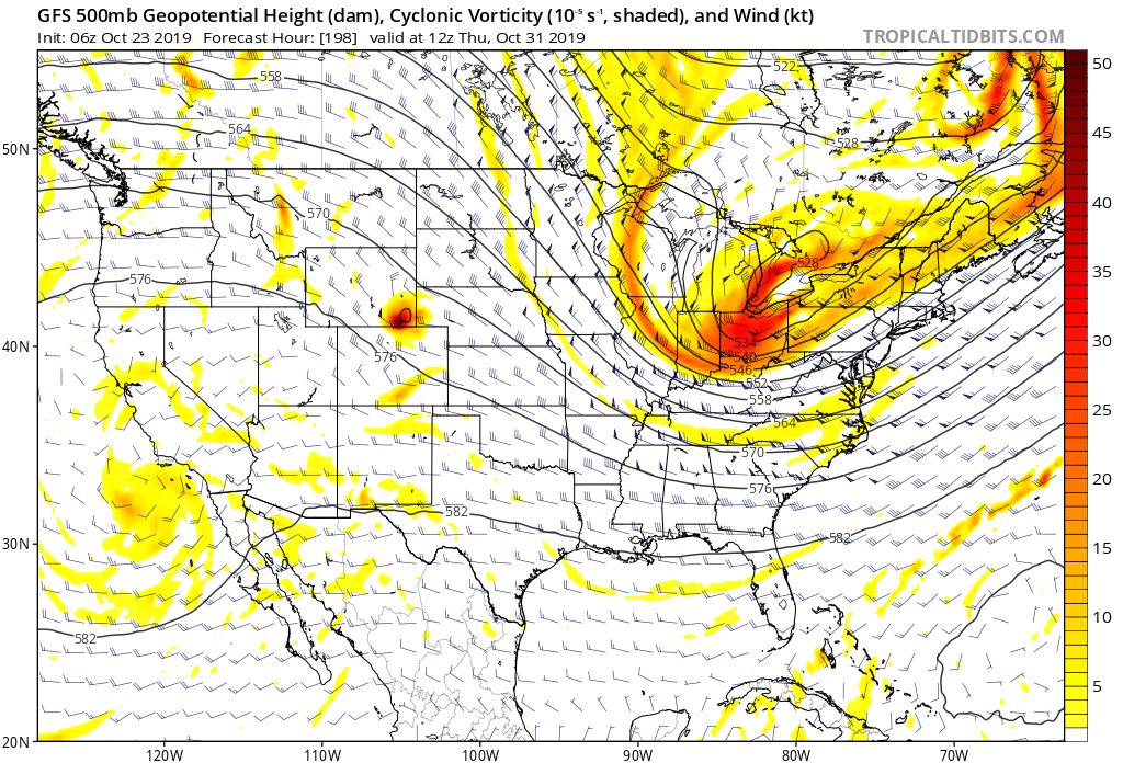
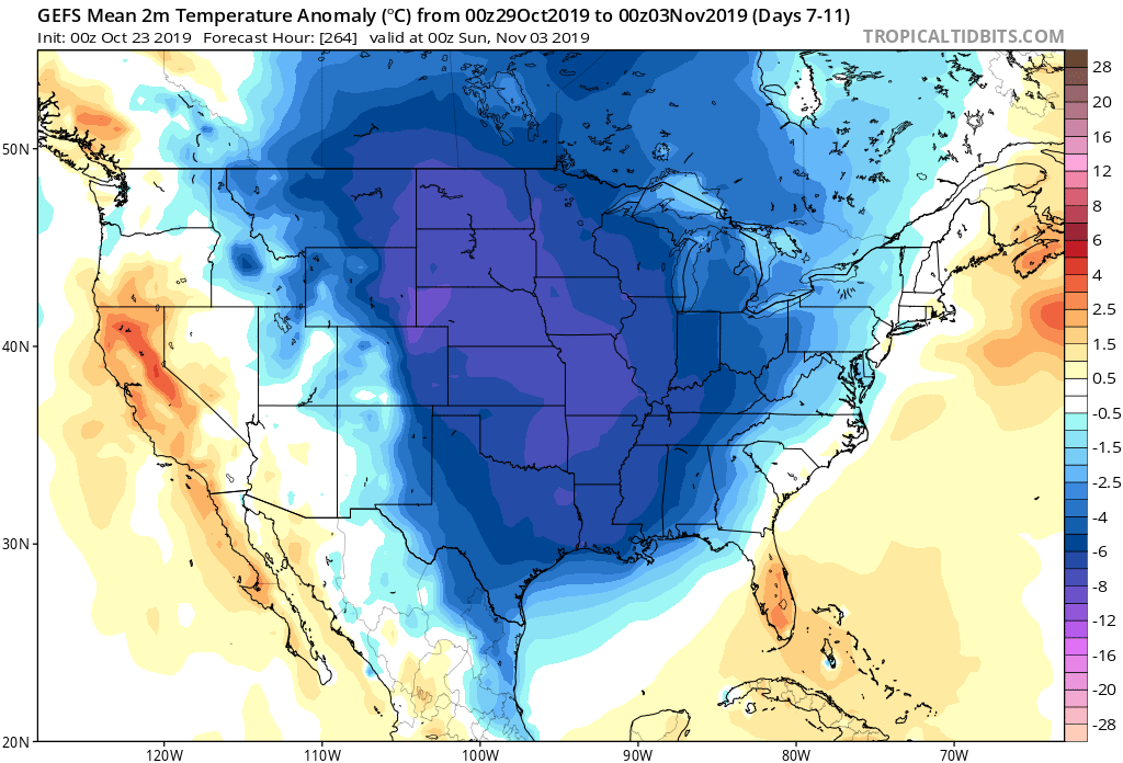
After a wet 1st half of the weekend, all eyes will be set on a taste of winter that’s dialed up just before Halloween. A cold front will blow through the Ohio Valley early next week with the threat of rain followed by sharply colder air. As upper level energy rounds the base of the digging significant trough, the first flakes of the season can be expected across the region before Halloween (still will have to fine tune timing). This pattern will also serve up the first accumulating lake effect snow event of the season, including the Snow Belt regions of IN, MI, and OH.
Permanent link to this article: https://indywx.com/rain-chances-going-up-this-weekend-taste-of-winter-blows-into-town-before-halloween/
