Never Trust An Arctic Wave: Accumulating Snow Prospects Growing This Weekend…

Updated: 02.02.21 @ 6:15p

While we have a few flurries (thanks to a little help from Lake Michigan) flying this evening, the bulk of the upcoming 48 hours will be rather quiet across the region. The next item on the agenda will come in the form of a cold front Thursday afternoon. As of now we anticipate rain (perhaps a brief early mix, but this won’t be a big deal) to arrive into central Indiana between 11a-1p Thursday. Mostly light to, at times, moderate rain will continue into the evening hours before ending as a brief period of wet snow Thursday evening (again, little if any impacts are expected).

Rainfall totals between 0.25″ and 0.50″ can be expected Thursday PM with the passage of the cold front.

The relatively quiet regime should return Friday, but by this time all eyes will be focused on the 1st of (2) arctic frontal systems. The 1st of these arctic fronts will sweep through the state Saturday PM and early Sunday. As this takes place, an arctic wave is expected to form along the leading edge of the true arctic air Saturday evening. This should result in an expanding area of snow that originally develops in the central Plains Friday night/ Saturday morning before pushing east, northeast Saturday into Sunday. With the arctic air pouring into the region, this should be a high ratio type snow and blowing/ drifting issues will likely be more of a problem than with the majority of systems so far this season.

While this is all taking place, a secondary low pressure system should develop along the Carolina coast early Sunday morning and it’s this system that will likely become the primary “player on the field” late in the weekend or early next week. Before that though, the arctic wave will likely result in a stripe of accumulating snow from the central Plains into the Ohio Valley, including central Indiana (too early for specific amounts). This will lay the groundwork for the coldest air of the season early next week…

Snow removal clients, as well as those in the ag. industry should keep close tabs on the weekend forecast. While we’re not expecting a widespread heavy snow event, the combination of snow, wind, and eventual bitterly cold air will lead to significant impacts as we move forward.

I would plan on temperatures falling into the single digits below zero, along with wind chill values potentially approaching 20° below zero by early next week.

Stay tuned.

02.01.21 Weather Bulletin: The Arctic Hounds Come Calling…

Updated 02.01.21 @ 6:34p

Bottom Drops Out Early Next Week…Brief high pressure will build overhead through the next 24 to 48 hours and supply a return of sunshine. We may still have a few light flurries around through the early afternoon Tuesday, but the story over the next couple of days will be improving weather, albeit still chilly.

Our next storm system will approach Wednesday night and Thursday in the form of a cold front. Precipitation should arrive Thursday morning as a cold rain (might start as a brief wintry mix, but this shouldn’t be a big deal). The cold front will then sweep through the state Friday morning. Highs will likely take place during the predawn hours with falling temperatures through the day. Any lingering morning precipitation should exit stage right relatively quickly.

Things become much more interesting over the weekend as a couple of arctic fronts sweep across the region. The first front will feature vigorous upper level energy and will likely result in a period of snow. The second front will really drop the “arctic hammer” and not only lead to the coldest air we’ve seen in quite some time, but a continuation of snow chances into early next week.

We’ll keep a close eye on the development of things for the weekend. With arctic air getting involved, it’ll likely maximize any available moisture and a couple of seemingly rather “harmless” snow events could turn into over-achievers as we grow closer. I’d keep close tabs on the weekend forecast.

Bitter air will pour into the region early next week, including dangerously cold wind chill values. Those with ag/ livestock interests should be prepared to make adjustments for the severe cold.

February 2021 Outlook…

Updated 01.31.21 @ 9:35p

As we head into the last month of meteorological winter, there are growing signs we’ll have to contend with some of the most significant cold so far this season. Add in the fact that the pattern drivers are more aligned to continue the recent active times and things could get quite interesting in the weeks ahead.

For the first time this winter, it appears as if the teleconnections will combine to favor not only a continuation of the active storm track, but also argue for the likelihood of more sustained cold air (especially compared to Dec. and Jan.).

Note how the latest CFSv2 monthly product continues to shift colder for February.

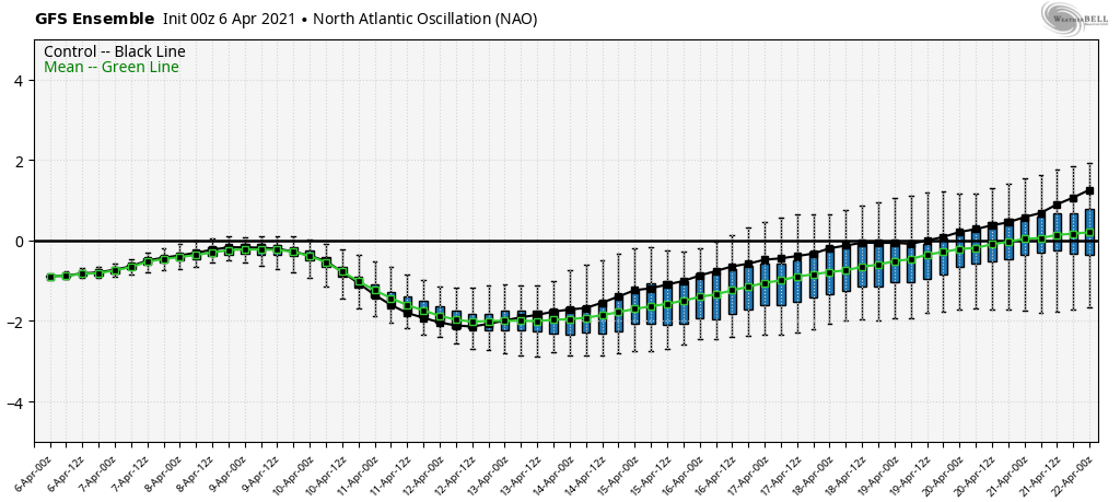
We believe the AO, NAO, PNA, and EPO will remain negative through the majority of the month. Getting the EPO negative would be a big deal and go a long way in supporting the idea cold would be able to stick around with more staying power relative to normal. (The threat of significant arctic air getting into the mix during the 1st half of the month is a growing concern). The negative PNA would favor southern ridging and help to direct storms further north than what we would see otherwise- especially given the strongly negative AO and corresponding blocking.

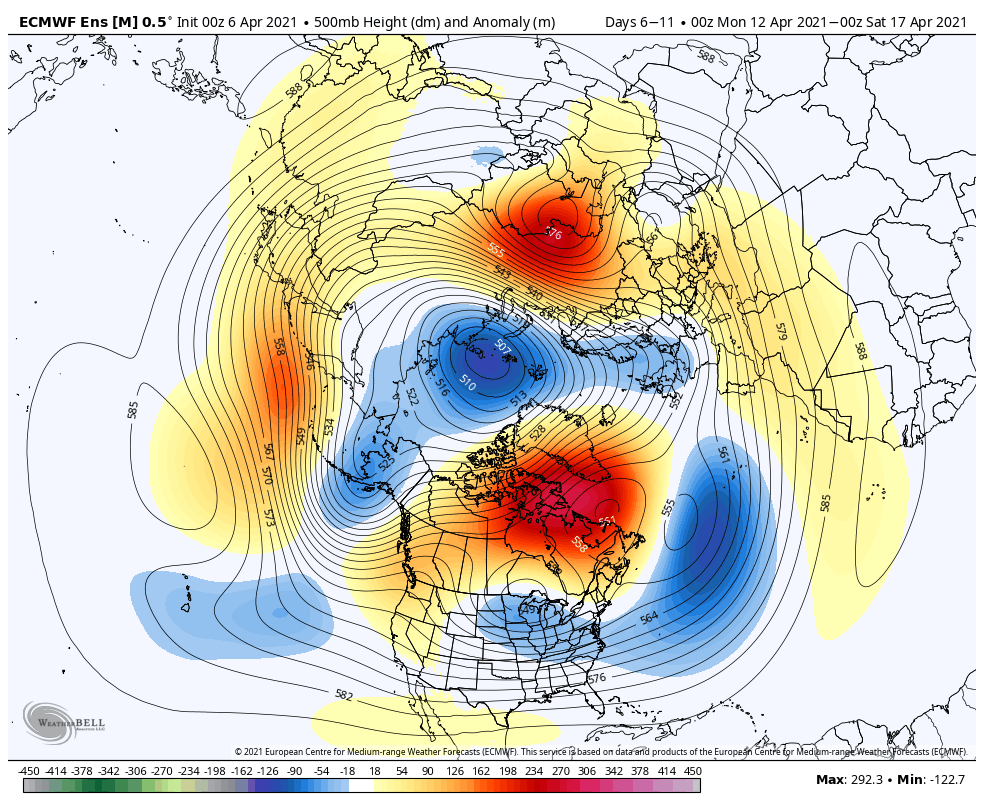
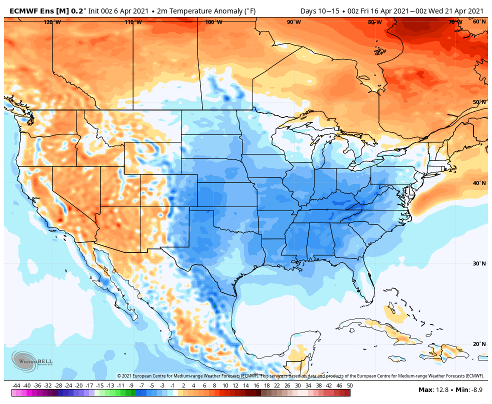
Note the how the European ensemble shows the colder anomalies overspreading the country through the first couple weeks of February.

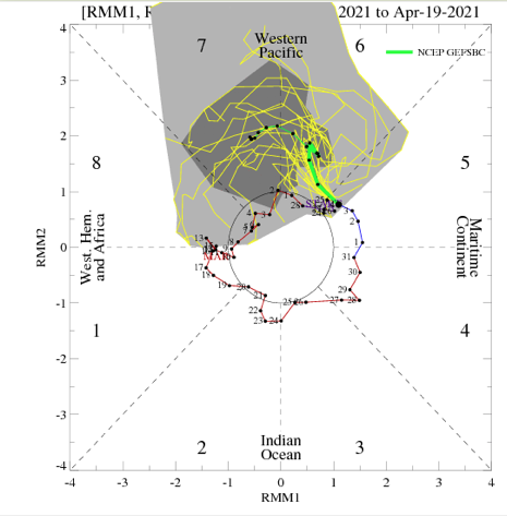
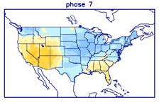
Given what we’ve discussed above including the MJO movement, this has merit.

The busy pattern will produce frequent storm systems through our general neck of the woods and with the more widespread cold around, I think we’re looking at multiple winter weather threats of significance through the month. Needless to say, I believe the month should produce above normal snowfall (average at IND is 6.5″ for Feb.).

Here’s our monthly outlook, including temperatures that should average 1° to 3° below normal with 1″ to 2″ above normal precipitation in Indianapolis, itself.

Winter weather enthusiast? Giddy up!