
You must be logged in to view this content. Click Here to become a member of IndyWX.com for full access. Already a member of IndyWx.com All-Access? Log-in here.
Category: Client
Permanent link to this article: https://indywx.com/video-latest-details-on-saturday-reviewing-thanksgiving-week-weather/
Nov 21
Note On Saturday’s Snow Threat…
Boy, this snow season has gotten off to a rollicking start. It’s been a while since we’ve had to deal with multiple legitimate winter threats prior to Thanksgiving, but that’s the case this year. (December is also looking quite active from a wintry precipitation perspective).
As for Saturday’s event, confidence is too low to issue an initial snow “zone” map. The overall idea remains here that the best shot of accumulating wet snow will likely fall from north-central parts of the state into the northern half of Ohio, but the nature of the event will likely result in some “haves and have nots.”
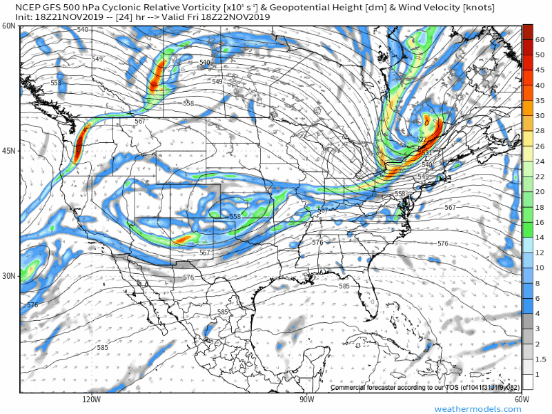
Note the upper low is poised to track along the I-70 corridor, per this evening’s GFS model run. This looks reasonable to us.
With only marginally cold air in place, this is the kind of setup that can help manufacture air cold enough to result in a “thump” of wet snow for portions of the region- especially if heavier precipitation rates are involved. This is also the kind of event that would likely lead to banding features as opposed to a more “uniform” snow shield (hence the “have and have nots” that will likely occur).
At the end of the day, an accumulating wet snow event is most certainly still on the table for portions of central Indiana, but we need to factor in a couple of additional model runs before publishing our initial snow zone map.
More overnight or early Friday morning…
Permanent link to this article: https://indywx.com/note-on-saturdays-snow-threat/
Nov 21
VIDEO: “Thump” Of Heavy, Wet Snow A Good Bet For Portions Of The Area This Weekend; Looking Ahead To Thanksgiving Week…
You must be logged in to view this content. Click Here to become a member of IndyWX.com for full access. Already a member of IndyWx.com All-Access? Log-in here.
Permanent link to this article: https://indywx.com/video-thump-of-heavy-wet-snow-a-good-bet-for-portions-of-the-area-this-weekend-looking-ahead-to-thanksgiving-week/
Nov 20
VIDEO: Rain Returns Thursday; Winter Weather Maker For Some Saturday…
You must be logged in to view this content. Click Here to become a member of IndyWX.com for full access. Already a member of IndyWx.com All-Access? Log-in here.
Permanent link to this article: https://indywx.com/video-rain-returns-thursday-winter-weather-maker-for-some-saturday/
Nov 19
Evening Update On Thursday Rain; Weekend Mischief…
Quick update this evening just to touch base on the afternoon/ evening model data.
We’re still anticipating a dry Wednesday, but caution that conditions will be ripe overnight to result in areas of dense fog Wednesday morning. It’ll be wise to allow extra time to work and school in the morning just to be safe.
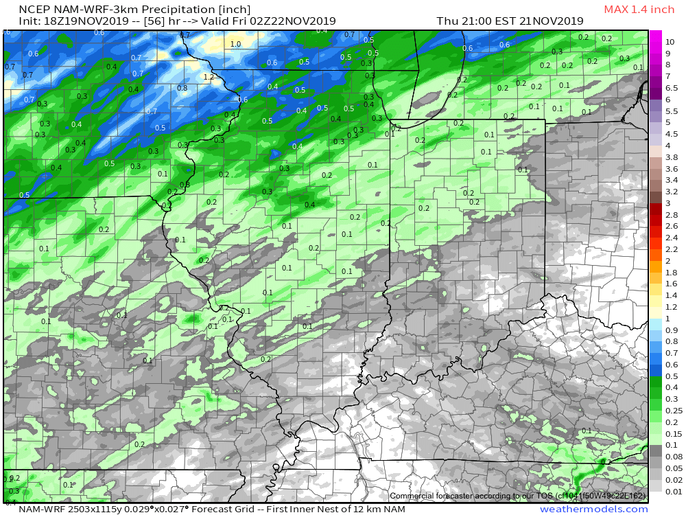
As we look ahead, rain will return to the region Thursday as an area of low pressure lifts into the Great Lakes region. This will drag a cold front through our region Thursday night into Friday morning. Looking at the most updated high resolution data suggests the steadiest rain will arrive around or just after lunchtime Thursday.

With that said, rainfall amounts aren’t anticipated to be significant. Most will be between 0.10” and 0.25” with a few heavier totals.
After a quiet Friday, moisture will overspread the region once again this weekend. This is the “follower” system modeling has struggled with over the past week. We were confident this would be a local player due to the overall upper level pattern, despite the inconsistent modeling. Sure enough, the consensus of modeling this evening brings in another system in the Saturday-Sunday time frame. With marginally cold air, this isn’t expected to be a widespread winter weather maker, but we continue to closely monitor the potential of localized “more meaningful” wintry precipitation across portions of the central and northern Ohio Valley. Note the wide range of possibilities individual GFS ensemble members print off:

We’ll continue to keep close tabs on things the next couple days and have a fresh update posted early tomorrow morning reviewing the latest overnight data. Specifics should become much more clear with regard to the weekend system once we get to Thursday…
Permanent link to this article: https://indywx.com/evening-update-on-thursday-rain-weekend-mischief/