You must be logged in to view this content. Click Here to become a member of IndyWX.com for full access. Already a member of IndyWx.com All-Access? Log-in here.
Category: Client
Permanent link to this article: https://indywx.com/video-generally-quiet-pattern-this-week-late-month-thoughts/
Sep 14
Weekly AG And Severe Weather Update…
Forecast Period: 09.15.19 through 09.21.19
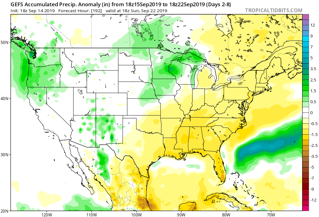
7-Day Precipitation: Precipitation is expected to run below normal through the forecast period.
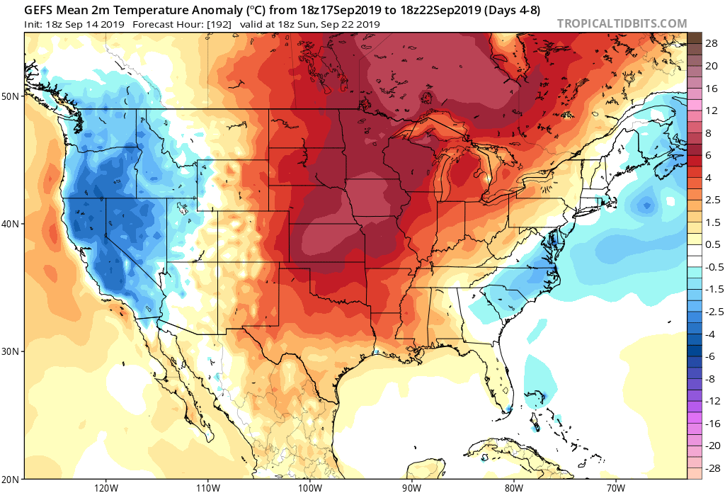
7-Day Temperatures: The upcoming forecast period above will feature well above average temperatures.
Severe Outlook: Widespread and organized severe weather isn’t expected through the forecast period.
Summary: A couple of storm complexes will “flirt” with central Indiana as we open up the new week, but these should be in a weakening state (if not flat-out diminish entirely) as they grow closer to our immediate region. Other than that, dry and warm/ hot weather is expected until late week. Things look increasingly unsettled with better coverage of showers and thunderstorms during this time. We’re still only looking at scattered coverage with any one particular rain gauge expected to accumulate less than half an inch by late next weekend.
*Next week’s AG/ Severe Weather Update will incorporate frost/ freeze outlooks, as well as drought discussion(s) across the Lower 48.
Permanent link to this article: https://indywx.com/weekly-ag-and-severe-weather-update-6/
Sep 13
Interesting Test Case In Front Of Us: Euro Vs. Everyone Else…
As we look ahead to late September, there’s a battle beginning to take place in model land. When we pull back the curtain, we note the GEFS and EPS handle the evolution of the EPO in two totally different manners in the Week 2 time period.
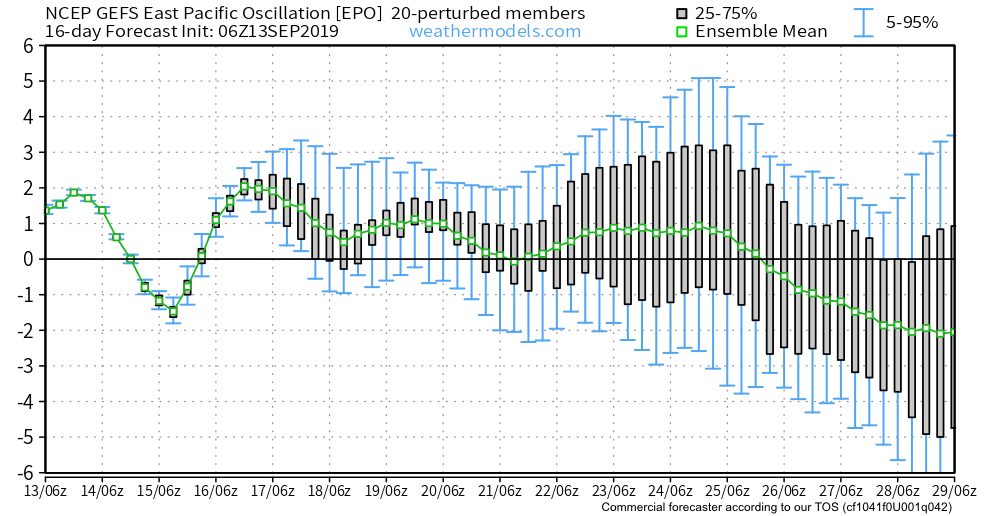

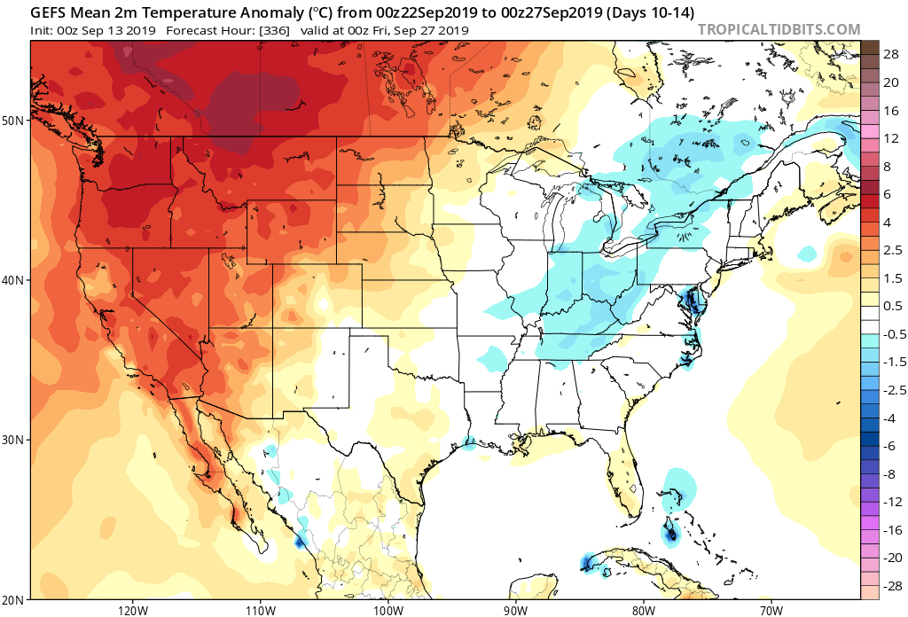
Our stand on the evolution of the pattern remains unchanged: that much cooler times will return as we get set to wrap up the month and head into early October. Updated data, aside from the European, suggests we’re on the right track with that train of thought.
JMA Weeklies- Week 2

CFSv2- Week 2

GEFS- Week 2

Permanent link to this article: https://indywx.com/interesting-test-case-in-front-of-us-euro-vs-everyone-else/
Sep 12
Thursday Morning Rambles: Warmth Continues To Dominate Over The Next 10 Days…
A “cold front” will pass Friday evening. Despite the threat of a couple widely scattered storms this afternoon/ evening, a broken line of storms may accompany the front Friday afternoon and evening. We’re not expecting widespread rain or storm activity with the passage of this front and some yards won’t see a drop of rain over the next couple of days.
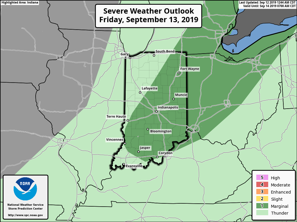
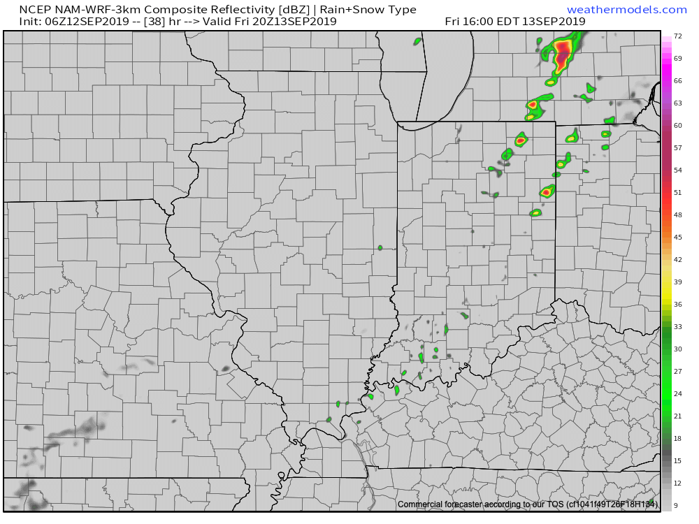
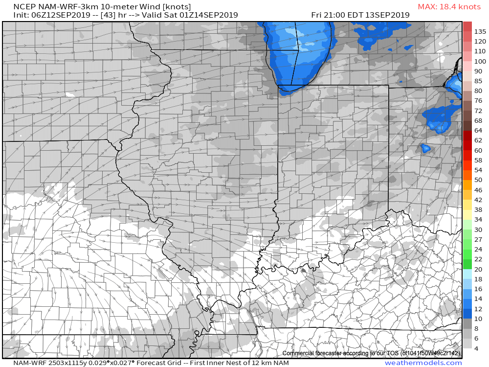
While somewhat drier air will briefly work into the region Saturday, temperatures will remain well above average. The humidity will return next week.
As we look ahead over next week, generally quiet conditions are anticipated. The big story in the weather department will be the continuation of summer-like heat and an active time of things in the tropics.
Let’s start with the tropics. Guidance overnight has trended further east with the disturbance that at one time appeared it was heading for the Gulf of Mexico. Instead, our East Coast friends should take note of the disturbed weather in the Caribbean. Some model guidance spins this up into a hurricane over the upcoming weekend as it at least “flirts” with the Southeast US coast (perhaps in an eerily similar fashion as Dorian). The item in the open Atlantic is another we’ll have to keep close eyes on for Week 2 for the Gulf of Mexico. Unfortunately, the upper pattern is a favorable one for the Southeast US coastline to experience a landfall over the next couple of weeks…
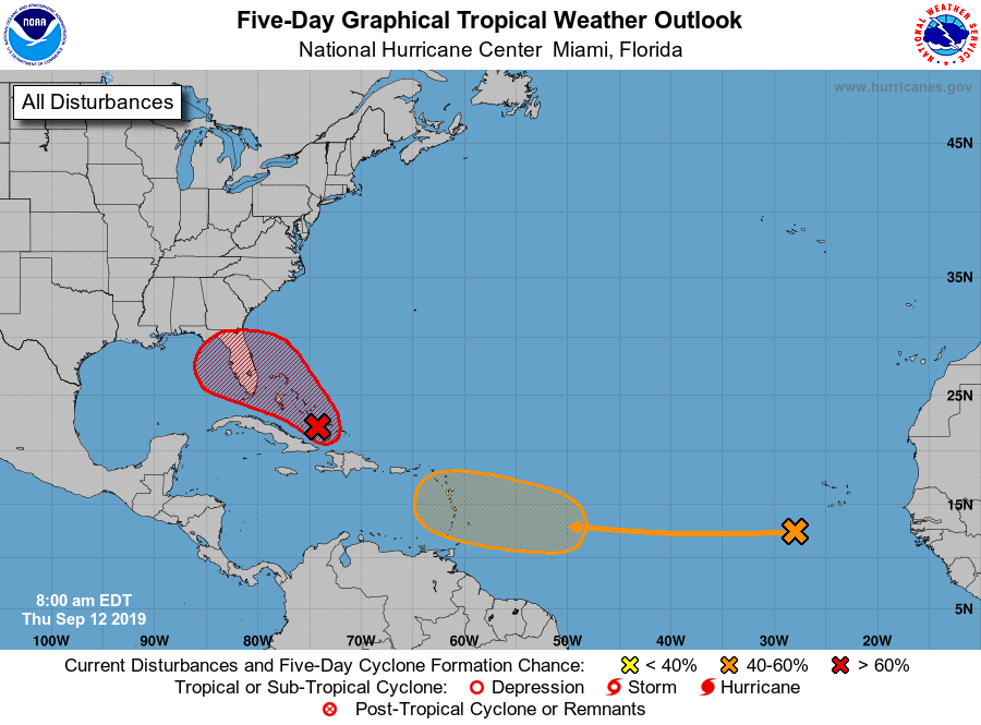
That same pattern through the next couple of weeks is also one that will continue to produce an “extended summer” across the East.
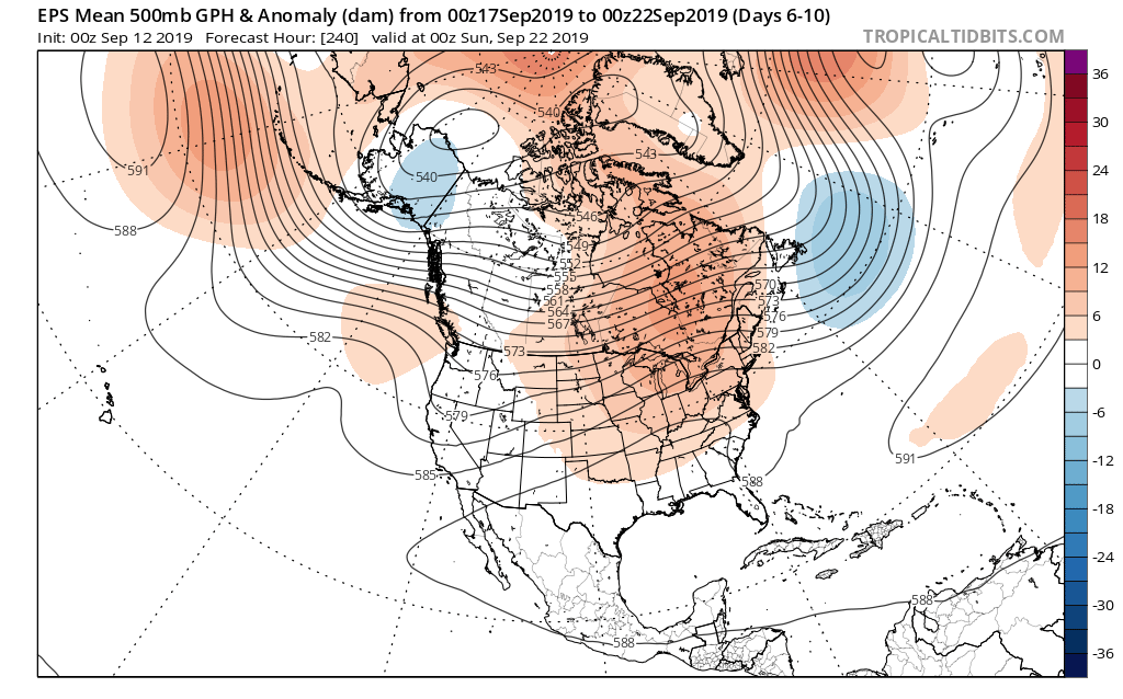

As we look ahead to next weekend, there’s the potential of a stronger cold front offering up more organized rain/ storm chances followed by a stronger cool shot. We’ll have more on this threat in our Weekly AG/ Severe Weather Outlook published this weekend.
Permanent link to this article: https://indywx.com/thursday-morning-rambles-warmth-continues-to-dominate-over-the-next-10-days/
Sep 11
Research Continues For The Upcoming Winter…
While still a little over a month from the release of our official annual Winter Outlook, we’re deep in research mode. This morning, we wanted to provide you with some updated model data, just for fun- all centered on meteorological winter (Dec. through Feb.).
UKMET- warm look with a stout southeast ridge in place.

European seasonal- warm look for the east though one could argue this would feature a warm start/ cold finish scenario (perhaps partly due to the warm SSTs in the eastern Atlantic).

Canadian seasonal- not only a cold look, but quite stormy as well. Plenty of high latitude blocking would force arctic air southeast into our portion of the country with an active storm track.

CFSv2- this would be a warm winter for the majority of the country as widespread ridging dominates.

The SST configuration remains an intriguing one. Despite the majority of data above in the warm camp as of now for the upcoming winter, this is the type setup that would likely force a predominant central/ eastern trough for the bulk of winter. The two areas we’re most focused on at this point? The central PAC and northeast PAC. Warmth across the north with cooling beginning to take place east (relative, of course, to the sea surface temperatures in the central PAC) strongly argues for cold to set up shop across the central and into the east. Let’s keep an eye on this over the next 4-6 weeks to see what, if any, changes take place. Should things remain relatively unchanged across the Pacific, we’ll likely see seasonal data begin to trend colder and colder for the upcoming winter.

(Our official detailed Winter Outlook with temperature and snowfall forecasts across the country will be out in mid to late October).
Permanent link to this article: https://indywx.com/research-continues-for-the-upcoming-winter/
