Updated 03.06.24 @ 7:30a Drier conditions will arrive for the middle of the week and we’ll want to enjoy them as a new batch of rain is set to arrive…
You must be logged in to view this content. Click Here to become a member of IndyWX.com for full access. Already a member of IndyWx.com All-Access? Log-in here.
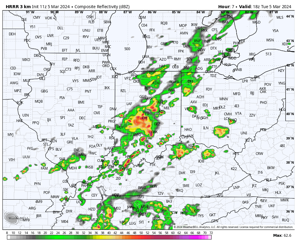
We’ve had a few storms north of the city, itself, early this morning, but for the bulk of the I-70 corridor, things are just now starting to get “busy.” Anticipate rain and storm coverage to continue to expand and grow heavier through the late morning into early afternoon before diminishing.
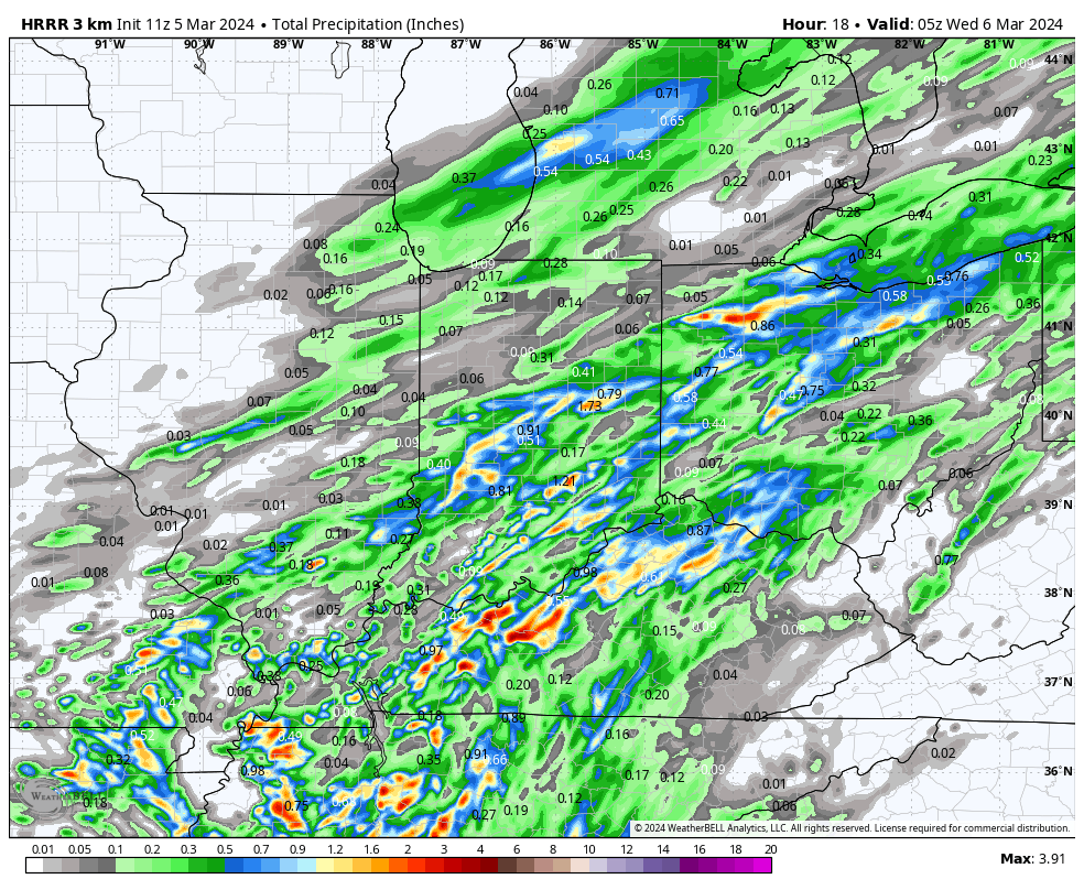
Rainfall totals of 0.25” to 0.75” will be most common with a few localized 1”+ reports. Rain and storm coverage will diminish through the afternoon and evening hours across the region.
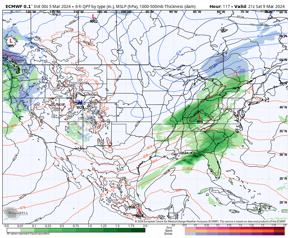
High pressure will briefly build into the region midweek, allowing for drying skies and pleasant early-March conditions. Enjoy, as another storm system will deliver a round of rain and embedded thunder Friday PM and Saturday.
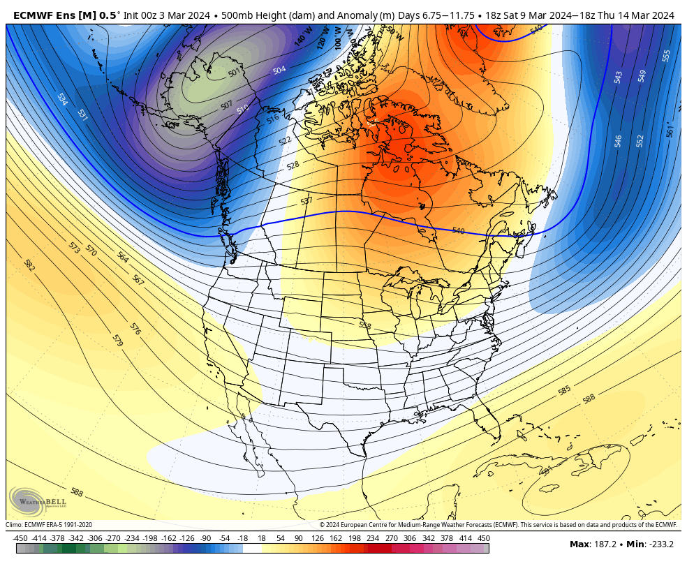
We turn briefly colder Sunday (and windy) but by Monday, the next warm-up is already scheduled to be well underway. This is just another instance of a brief chilly blast without any legs.
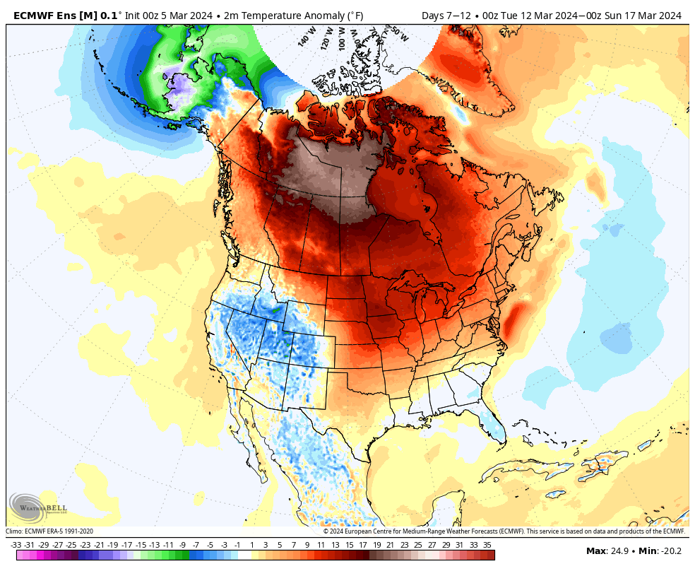
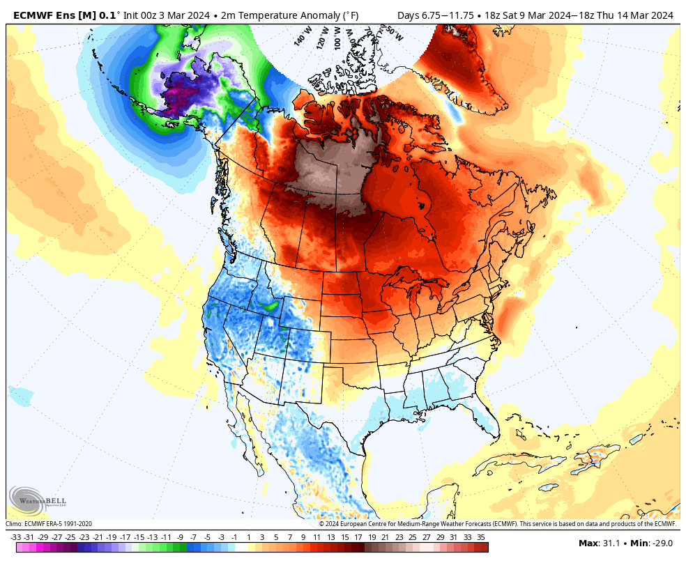
Speaking of cold, while there does remain a window of opportunity for a below normal regime to develop very late March and early April (if we can finally get the MJO to slide over into the colder phases), the short to medium term is still void of any sort of chill, at least for more than a day or 2 behind passing storms. Note the Week 2 ensemble data is still much warmer than normal for our neck of the woods. – A direct byproduct of the MJO rumbling through those classic warm phases.
Updated 03.04.24 @ 8a We couldn’t ask for better weather conditions to kick off the work week. Sunshine and unseasonably warm conditions will have several central Indiana neighborhoods flirting with…
You must be logged in to view this content. Click Here to become a member of IndyWX.com for full access. Already a member of IndyWx.com All-Access? Log-in here.
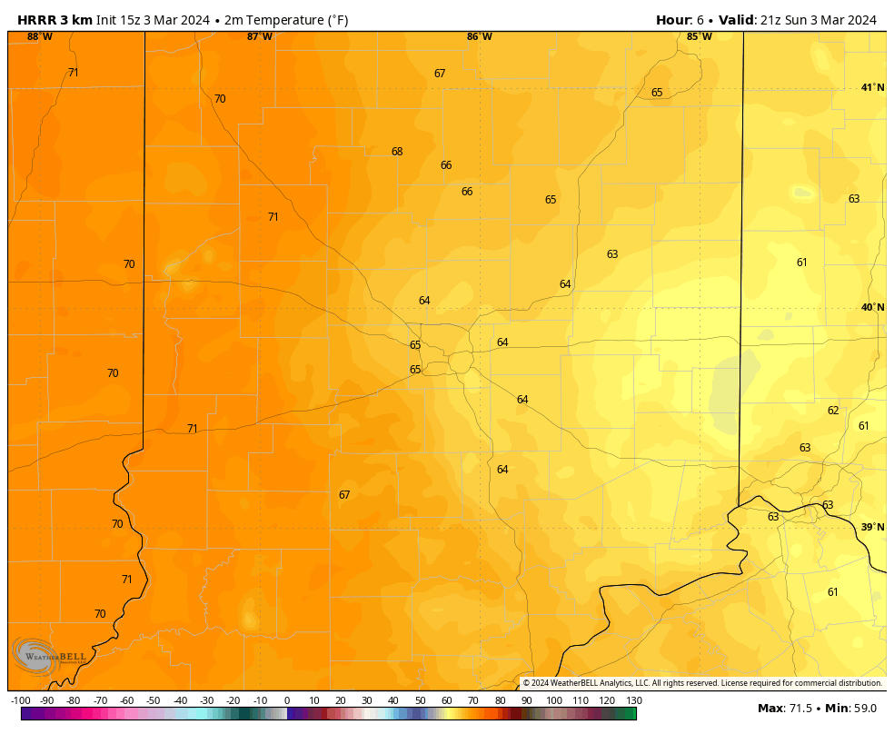
A gorgeous Sunday is on deck with highs rising into the 60s and near 70° west. Enjoy that sunshine while we’ve got it!
Dry conditions should prevail through the daytime hours Monday before showers and embedded thunder roll into town overnight and Tuesday morning. Unsettled conditions will hold through the day Tuesday.
Rainfall totals of 0.25” to 0.75” will be common by Tuesday night across the region.
The next low pressure system and associated frontal boundary will impact us Friday into Saturday. Look for a more widespread, heavier round of precipitation with this particular system as we close the work week.
Despite cooler shots of air flowing in briefly behind frontal passages, there’s no sustained below normal temperature regime on the horizon, and for good reason with this kind of MJO:
An unseasonably mild week is on tap with a couple chances of rain and embedded thunder. Widespread, organized severe weather isn’t anticipated in the upcoming week.
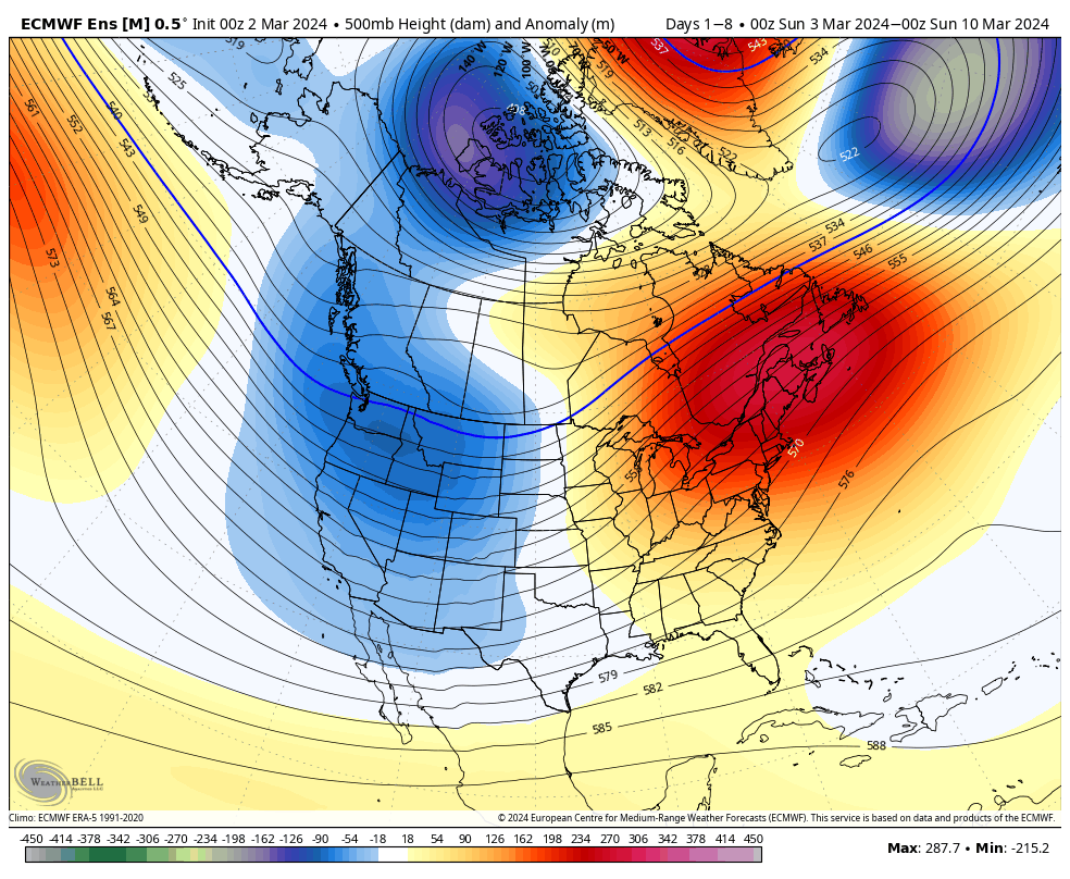
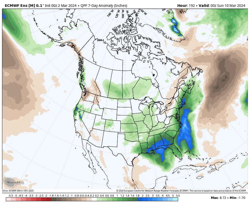
An anomalous upper air pattern will drive an unseasonably mild and at times wet regime, locally. Temperatures will run well above average in the week ahead across the Central and Eastern portion of the country with unseasonably cold conditions across the West. Plenty of 60s and even 70s are in store for daytime highs in the week ahead. Greatest deviations from normal in the rainfall department will come along the Southeast and Eastern seaboard. Slightly above normal rains are anticipated through the central Plains into the southwestern Great Lakes region.
Forecast Period: 03.02.24 – 03.09.24
After a quiet weekend (including a progressively brighter sky :-)), unsettled weather will come at us in 2 waves in the week ahead: Monday evening into Tuesday morning and again Friday evening into Saturday. In both cases, we expect widespread precipitation. In the case of our early week system, embedded thunder (non-severe) can’t be ruled out. With our late week storm system, the early call now is for more of an organized general rain to fall. Colder air will return to the region by the latter part of next weekend, potentially including some snow showers by Sunday.