Periods Of Heavy Rain Late This Evening-Overnight; Drier, Colder As We Open Christmas Week…
Updated 12.17.21 @ 7:34a
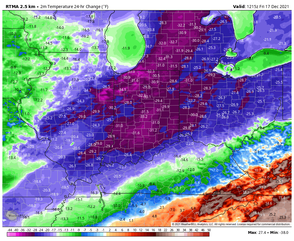
The cold front that moved through here yesterday is now draped across the TN Valley. Colder air has filtered into central Indiana this morning. We’re waking to temperatures more than 30° colder than 24 hours ago (upper 20s for most this morning out the door).
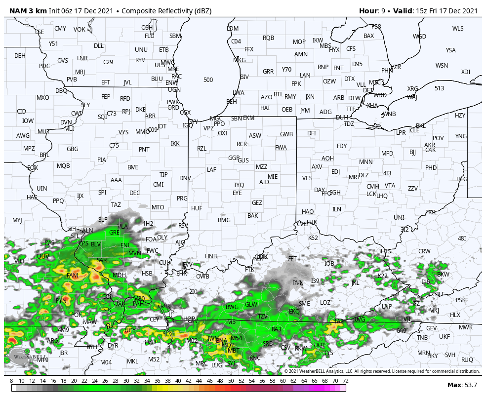
The frontal boundary will begin to lift back north this afternoon in response to a surface wave of low pressure developing in eastern OK. As a result, showers will spread back into the region as we progress through the 2nd half of the afternoon and into the evening. Eventually, as the low pressure system passes by to our south, a period of heavier rain can be expected during the overnight hours, including here in Indianapolis.
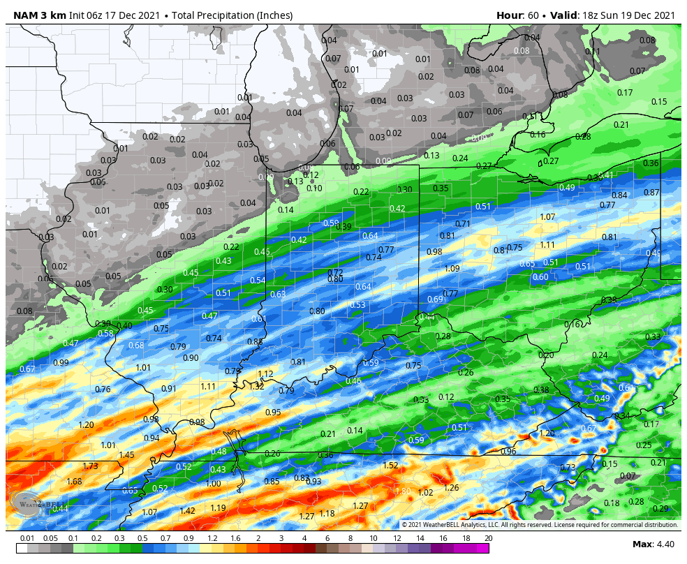
For most, an additional .50″ to 1″ of rain is anticipated (on top of what fell yesterday), but there will be locally heavier amounts.
The front will get one final shove to the southeast Saturday afternoon allowing colder and drier air to win out for the 2nd half of the weekend (highs Sunday likely won’t make it out of the upper 30s to around 40°).
This will set us up for a quiet open to Christmas week. You’ll want to take advantage of the calmer conditions as an active period is expected the closer we get to Christmas, itself, and through the New Year’s timeframe. Just in that time alone, we’re on the table to have to deal with (4) systems… More on those in the days ahead.