Category: Christmas/ Thanksgiving

Wishing You A Very Merry Christmas And A Blessed Holiday Season…

Updated 12.25.23 @ 6:58a

From our family to yours, we wish you warmest Christmas blessings and a joyous holiday season!

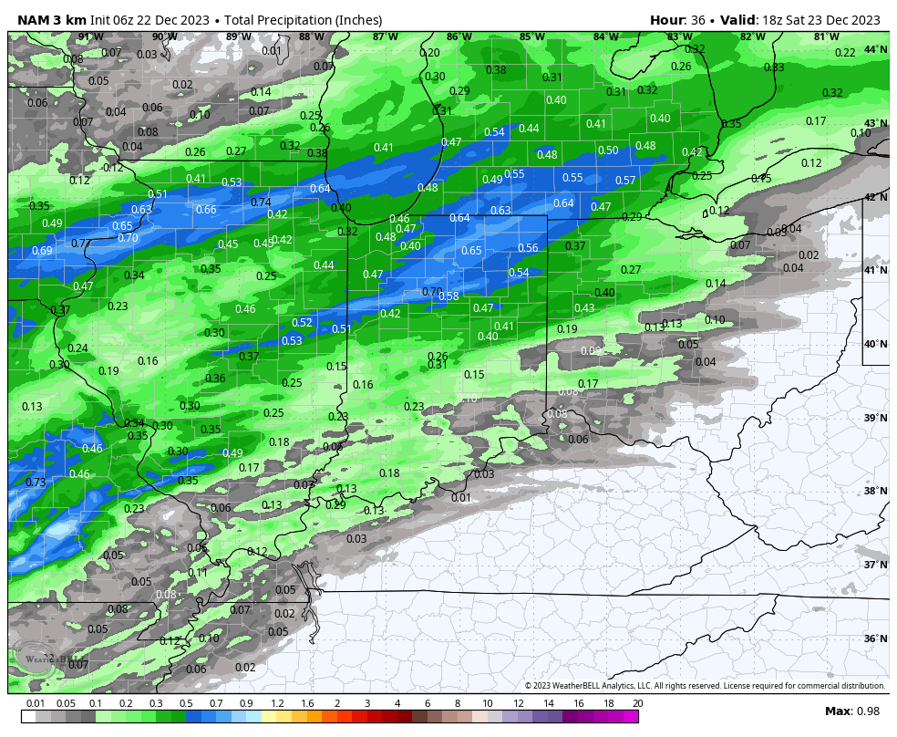
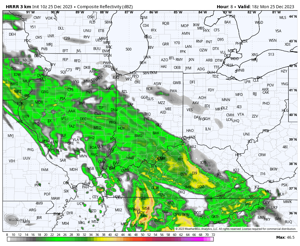
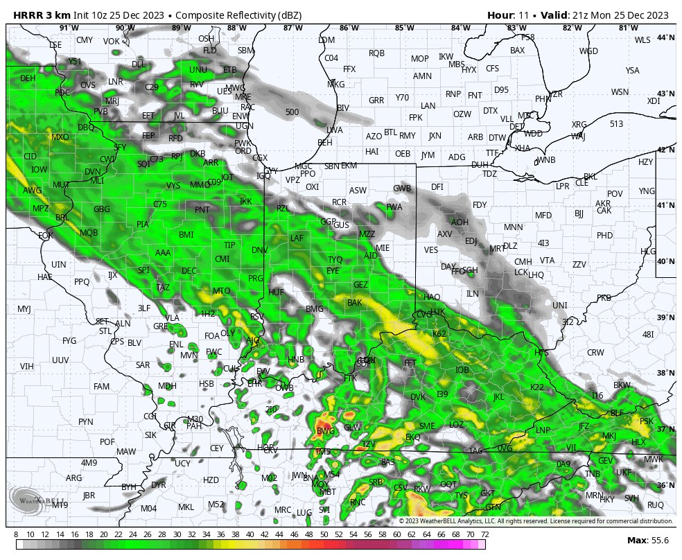
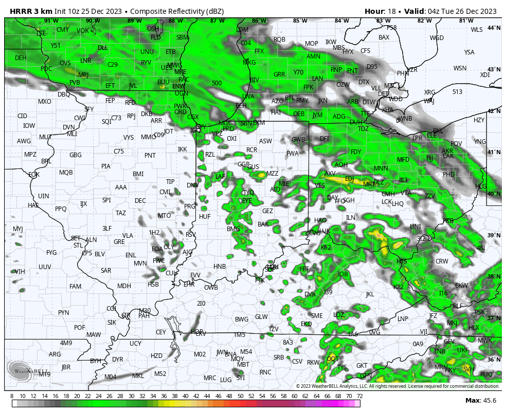
After a dry start to the day, rain will lift north and overspread central Indiana late morning into the early afternoon. A few moderate showers are likely at times. Rainfall coverage and intensity will diminish significantly as we move through mid and late evening. Though there will be a few exceptions, generally 0.50” to 0.75” will fall south of the I-70 corridor with amounts of 0.25” to 0.50” north of I-70.

1p forecast radar
4p forecast radar
11p forecast radar
Rainfall totals by noon Tuesday.

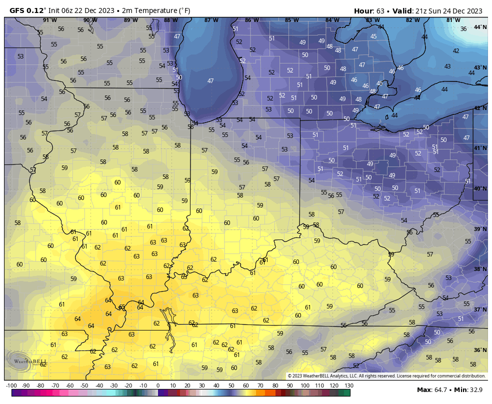
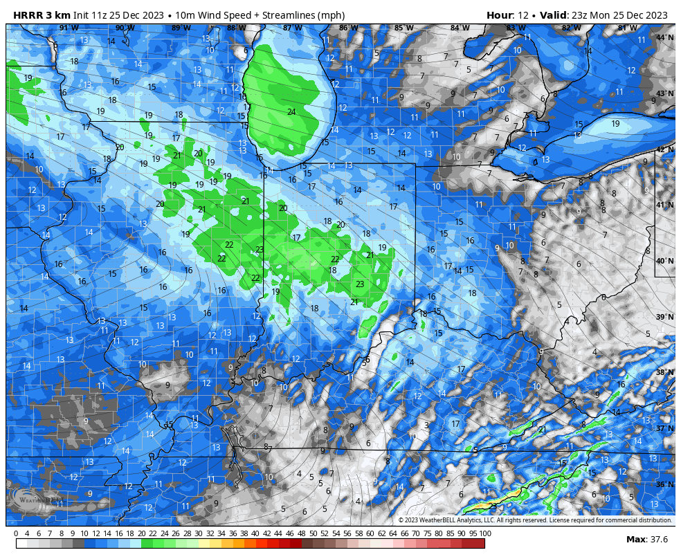
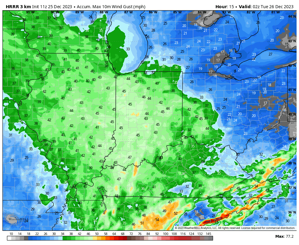
Strong southeasterly winds and unseasonably mild temperatures can also be expected today. Gusts will approach 40 MPH this afternoon across all of the region.

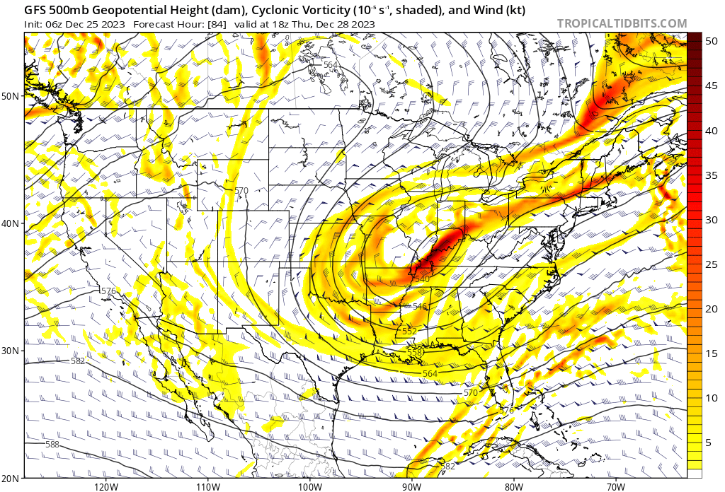
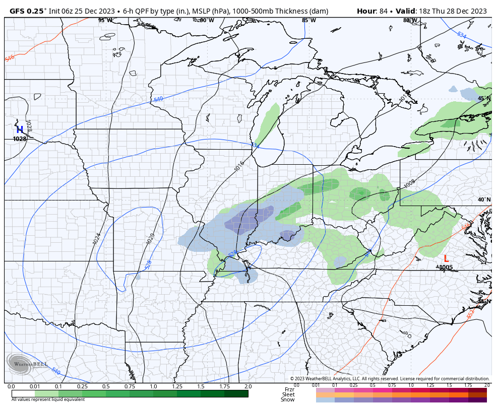
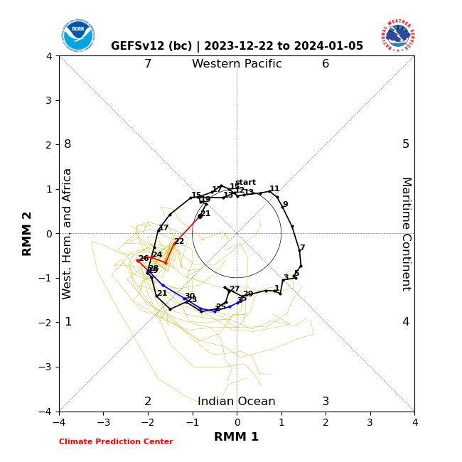
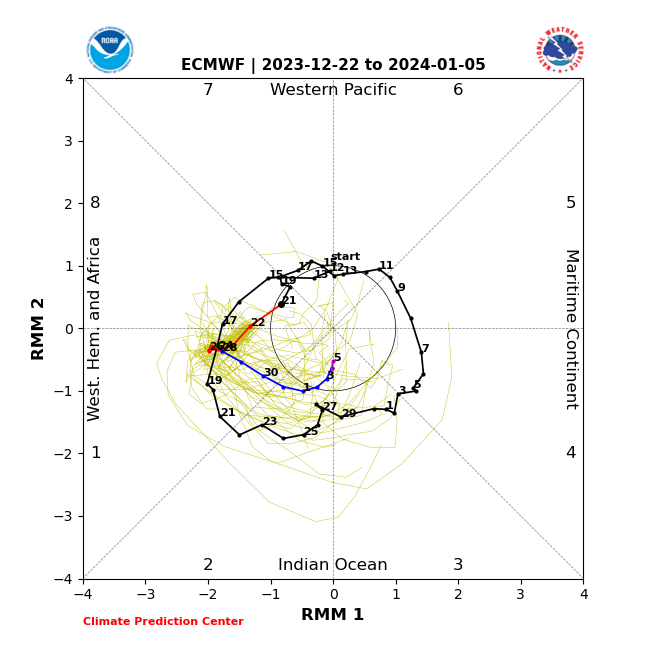
Our weather will dry out Tuesday and Wednesday but by this time all eyes will be poised to our west as we wait in the cold core upper level low to pivot across the region. While there won’t be a lot of cold air readily available for this system to tap into, we’ll have to see if it can manufacture its own cold air to create some potential localized winter weather “issues” for portions of the southern Ohio Valley and especially the Appalachians prior to the New Year’s weekend. For now, we’ll forecast a mix of rain and snow here Thursday- just know that we’ll likely have to firm that up once the details become clearer regarding the exact track of the upper low. As the ole saying goes, “cold core upper low, weatherman’s woe.” Solutions range from a cold rain to a localized accumulating wet snow event…

Permanent link to this article: https://indywx.com/wishing-you-a-very-merry-christmas-and-a-blessed-holiday-season/

VIDEO: Fog Lifts And Gives Way To Unseasonably Mild Conditions; Christmas Rain And Colder Transition Later In The Week…

Updated 12.24.23 @ 6:50a Areas of fog and drizzle will dissipate as we progress through the day and we even expect some breaks in the clouds at times. An unseasonably…

You must be logged in to view this content. Click Here to become a member of IndyWX.com for full access.  Already a member of IndyWx.com All-Access?  Log-in here.

Permanent link to this article: https://indywx.com/video-fog-lifts-and-gives-way-to-unseasonably-mild-conditions-christmas-rain-and-colder-transition-later-in-the-week/

VIDEO: Wet, Unseasonably Mild Christmas Still On Deck; Colder Shift To Close The Year And Open January…

Updated 12.23.23 @ 7a When we look at our current mild December, I suppose it should really come as no surprise, especially given our research that began early September with…

You must be logged in to view this content. Click Here to become a member of IndyWX.com for full access.  Already a member of IndyWx.com All-Access?  Log-in here.

Permanent link to this article: https://indywx.com/video-wet-unseasonably-mild-christmas-still-on-deck-colder-shift-to-close-the-year-and-open-january/

Friday Morning Rambles: Pattern Discussion To Close Out The Year…

Updated 12.22.23 @ 7:15a

We open the period with widespread milder than normal temperatures in the 1-6 day period. Greatest anomalies are centered over the upper Midwest. Note the step down to a pattern, locally, that’s more seasonable if not slightly cooler than normal to close the year and open 2024. That’s the emphasis we want to drive home- though turning colder, we’re not in the camp that our immediate region will have to deal with any sort of arctic air anytime soon.

Days 1-6
Days 6-11
Days 10-15

You know we’ll be keeping close eyes on the Madden Julian Oscillation over the next few days. Should the American guidance come to fruition, then a warmer pattern is certainly alive and kicking after the cooler pattern to open January. Interestingly this morning, early trends are more in favor of the European camp, but it’s still early and we’ll need to monitor closely through the Christmas holiday.

American guidance isn’t as bullish moving into Phase 3 early January with the overnight update.

In the shorter term, morning showers will transition to more of a widespread light rain across the northern half of the state later this afternoon and tonight. Some northern Indiana rain gauges could surpass 0.50″ during this time period from “round 1” of more widespread rain.

Pesky light showers will be around Saturday, but this will be more of a nuisance than anything else. Widespread measurable rain isn’t anticipated. We then flip the calendar to Christmas Eve and the forecast continues to improve. We even anticipate some sunshine to couple with the unseasonably mild air and breezy southerly winds. Highs approaching 60° can be expected as Santa loads up his sleigh.

More widespread rain arrives Christmas Day, especially by late morning and during the afternoon. This is the timeframe when we expect greatest coverage and heaviest rainfall rates of the period. Storm total rainfall of 0.50″ to 1″ still looks like a good bet.

Colder air works in behind the storm and left over “wrap around” precipitation will begin to mix with and change to snow Thursday.

The downhill slide to more seasonable and slightly colder than normal temperatures continues as we close out the year…

Permanent link to this article: https://indywx.com/friday-morning-rambles-pattern-discussion-to-close-out-the-year/

VIDEO: Timing Out Christmas Rain And Transition To Colder Times…

Updated 12.21.23 @ 7:45a We’ll notice more in the way of cloud cover today but dry times will prevail. Better opportunities for light rain arrive overnight into Friday, especially across…

You must be logged in to view this content. Click Here to become a member of IndyWX.com for full access.  Already a member of IndyWx.com All-Access?  Log-in here.

Permanent link to this article: https://indywx.com/video-timing-out-christmas-rain-and-transition-to-colder-times/