
You must be logged in to view this content. Click Here to become a member of IndyWX.com for full access. Already a member of IndyWx.com All-Access? Log-in here.
Category: CFSv2
Permanent link to this article: https://indywx.com/video-work-week-outlook-early-may-ideas/
Apr 04
Pattern Returns To An Active Time Of Things…
One word to describe the mid-April weather pattern? ACTIVE. Tonight’s medium and long range video update dives in further…
You must be logged in to view this content. Click Here to become a member of IndyWX.com for full access. Already a member of IndyWx.com All-Access? Log-in here.
Permanent link to this article: https://indywx.com/pattern-returns-to-an-active-time-of-things/
Mar 20
All-Access Video: Showers Arrive Later Today; Still Expecting A Beautiful Weekend And Looking Ahead To More Active Times…
A weak system will spread showers across central Indiana later today. We take a look at timing and amounts, along with spending time going over the long range pattern into…
You must be logged in to view this content. Click Here to become a member of IndyWX.com for full access. Already a member of IndyWx.com All-Access? Log-in here.
Permanent link to this article: https://indywx.com/all-access-video-showers-arrive-later-today-still-expecting-a-beautiful-weekend-and-looking-ahead-to-more-active-times/
Mar 14
Long Range Update: Cool “Set Back” Doesn’t Last; Looking Ahead To April…
You must be logged in to view this content. Click Here to become a member of IndyWX.com for full access. Already a member of IndyWx.com All-Access? Log-in here.
Permanent link to this article: https://indywx.com/long-range-update-cool-set-back-doesnt-last-looking-ahead-to-april/
Mar 11
Long Range Update And Summer Preview…
One more unseasonably chilly spell awaits late-March (behind our mid-March spring “tease”), but we continue to believe an unseasonably warm stretch of weather gets going by the last few days of the month- continuing into April. Furthermore, meteorological spring overall continues to look warm, relative to average, for central Indiana. In the event you missed our Spring Outlook earlier, it can be found here.
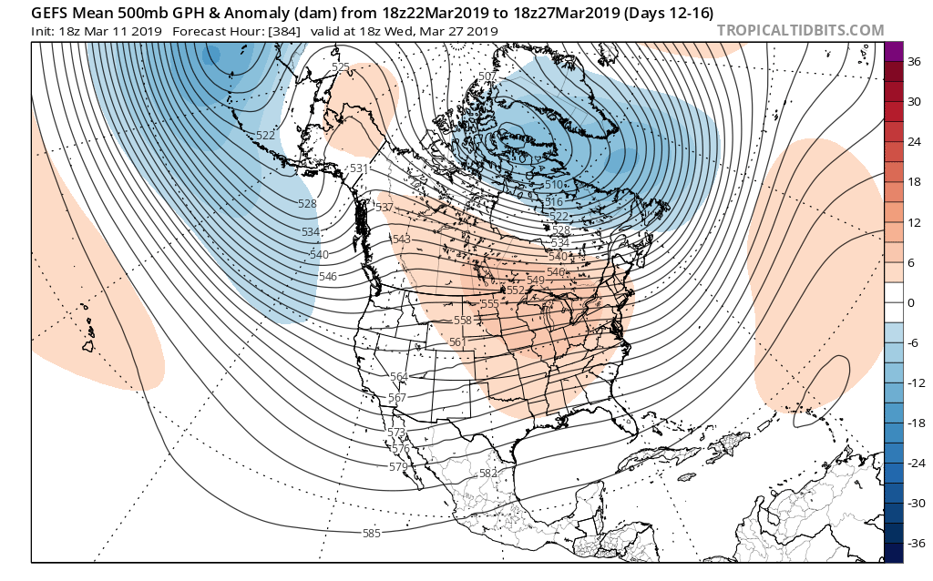
However, what follows the late-March set-back is a more significant and sustained push of unseasonably warm conditions.
Note the positive PNA that will help drive the chilly pattern next week returns to neutral as we put a wrap on the month:

To no surprise, modeling is painting a vastly different look as we close March and open April.
We turn cooler next week with the positive PNA in control, but this won’t last…
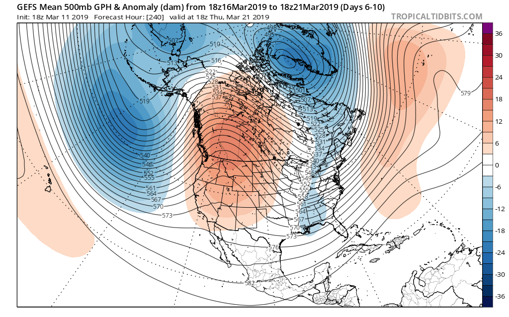
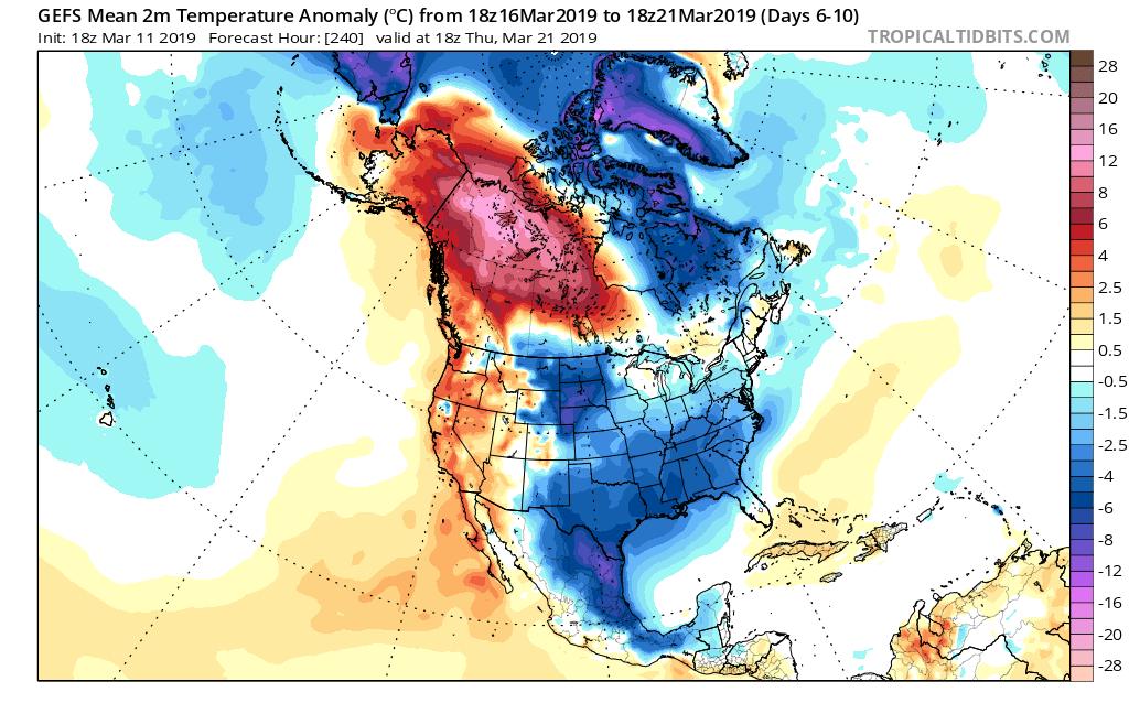
Note the significant change aloft (and at the surface) as we close the month and get set to head into April…
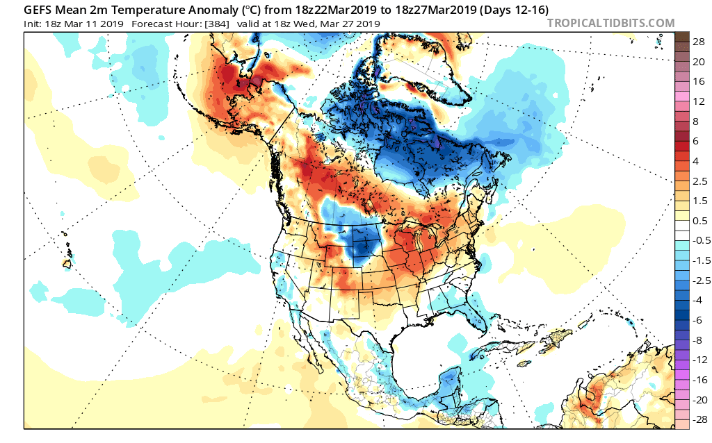
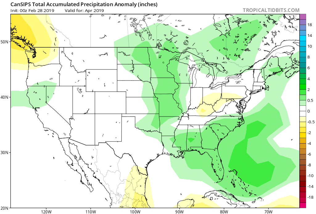
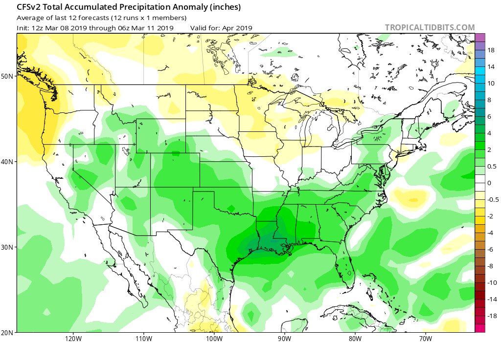
Longer term, modeling continues to give us an actual spring this year. We continue to expect average to slightly above average temperatures in April, complete with slightly above normal precipitation (with a “ramp up” in severe chances, locally).
Modeling is following suit with that idea:


It should also be noted that while not shown, the new European Weeklies in this evening also support the warmer than normal April idea.
As we look forward, we continue to research and build our summer outlook. Early indications would suggest that we transition out of an overall warmer than average spring towards a seasonal, to slightly below average, time of things this summer, complete with above normal precipitation. We, obviously, still have some time to go before the final product is ready to be published, but stay tuned. We are planning to launch our official summer outlook in early May.
Permanent link to this article: https://indywx.com/long-range-update-and-summer-preview/