
You must be logged in to view this content. Click Here to become a member of IndyWX.com for full access. Already a member of IndyWx.com All-Access? Log-in here.
Category: CFSv2
Permanent link to this article: https://indywx.com/video-evening-thoughts-around-the-pattern-into-late-june-early-july/
Jun 05
Long Range Update: Unseasonably Refreshing Pattern Set To Rule The Day…
A few days into June, Indianapolis is running half a degree below normal and 0.57″ below normal in the rainfall department.


Coolest anomalies have been focused over the Great Lakes region. A good portion of the region is running below average early on this month in the rainfall department, with the exception being the eastern Great Lakes.
As we look ahead, the MJO is forecast to move through Phases 3 and 4 with its eyes set on Phase 5 late month.

The relative “transient” warmth now lines up perfectly with Phase 3, but note the cooler pattern that Phase(s) 4-5 typically delivers.
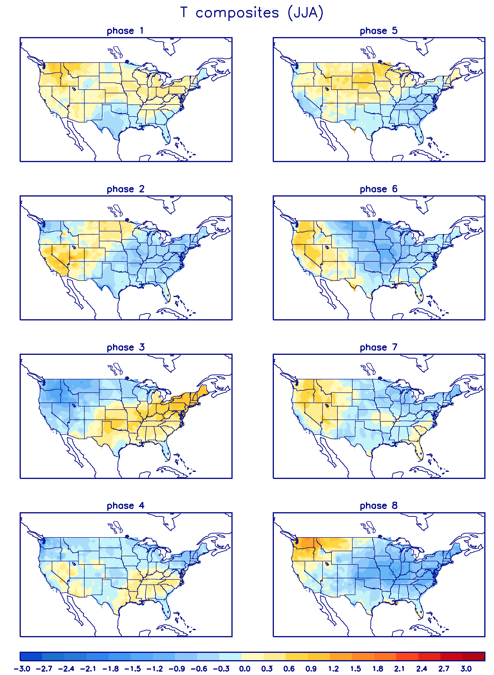
As a side note, there’s reason to believe this rather hyper MJO will continue, carrying us into the cooler Phases 6-8 as we move into the heart of the summer.
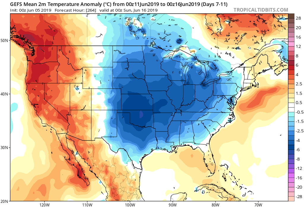
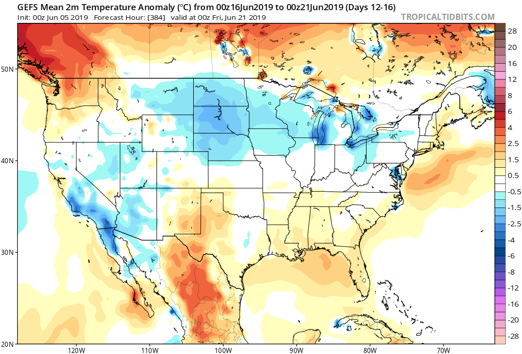
To no surprise, the medium and long range guidance is going towards a cooler than normal and unseasonably refreshing look as we move through the mid month period and into late June.
The Climate Forecast System agrees:

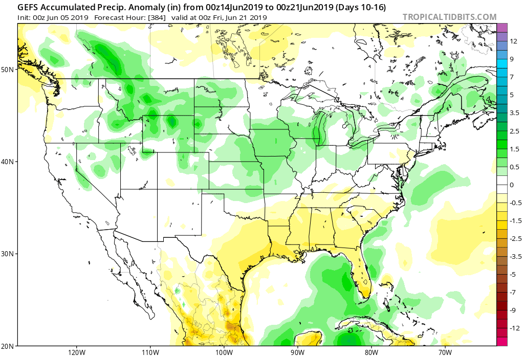
As for rainfall, we’ll use our short-term updates to handle the Weeks 1-2 period, but as we look ahead to mid-June, the pattern is expected to feature above normal rainfall across the Mid West and into the Ohio Valley and Great Lakes.
Permanent link to this article: https://indywx.com/long-range-update-unseasonably-refreshing-pattern-set-to-rule-the-day/
May 22
Prolonged Unsettled Stretch Of Weather…
Yesterday was only the beginning of a renewed prolonged stretch of unsettled and stormy weather. A series of fronts will make a move towards the OHV only to stall out and lift north back as a warm front over the upcoming 7-day period. The end result? An extended stretch of wet, stormy conditions.
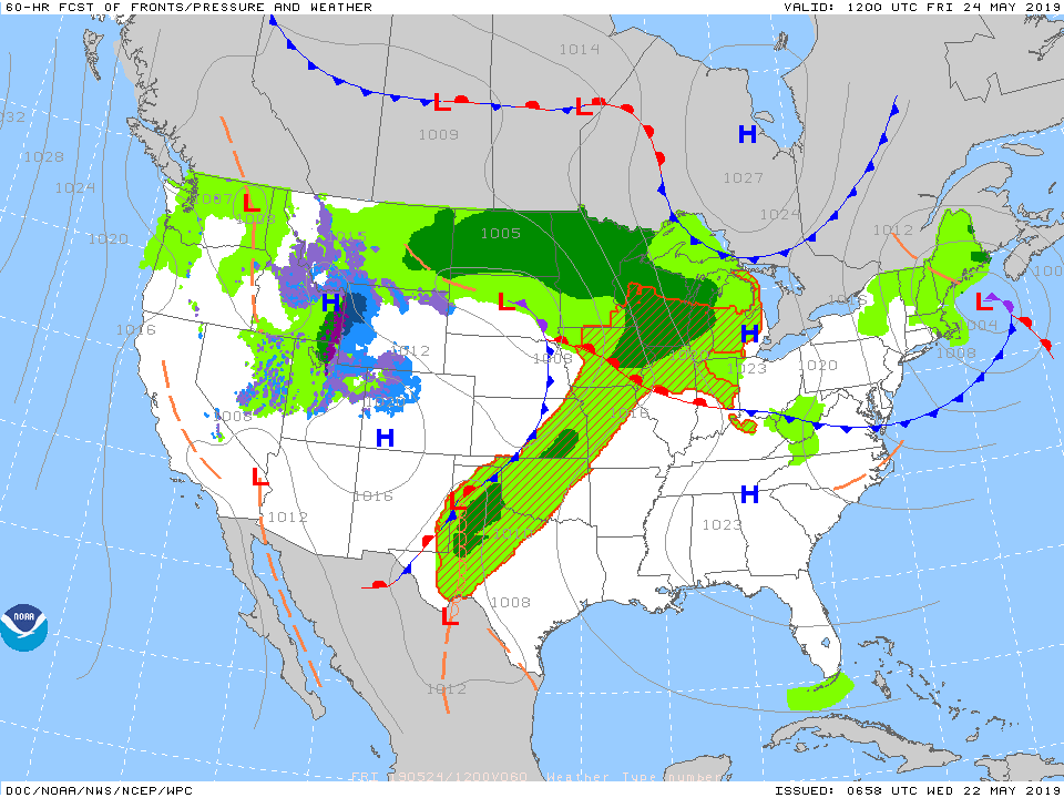
Get used to the setup above with a stalled front nearby and waves of low pressure moving along the associated boundaries from time to time. As these ripples of energy scoot along the front, more enhanced showers and thunderstorms can be expected.
It’s still tough from this distance to say with certainty which day(s) will offer up the most widespread shower and thunderstorm coverage in this pattern, but we continue to lean towards Saturday into Sunday. Stay tuned.
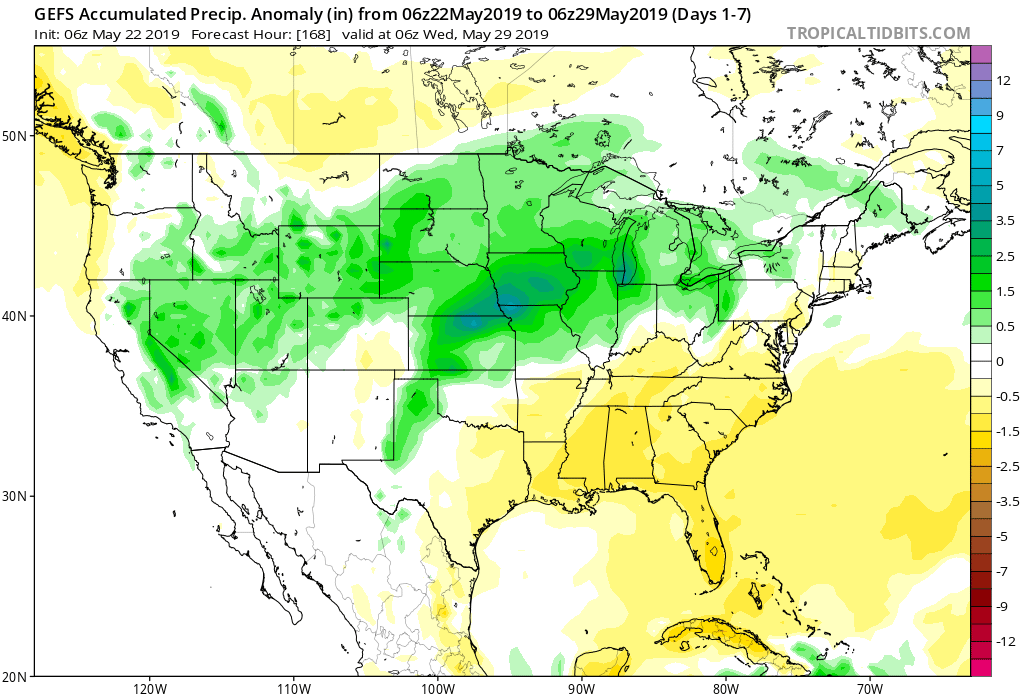
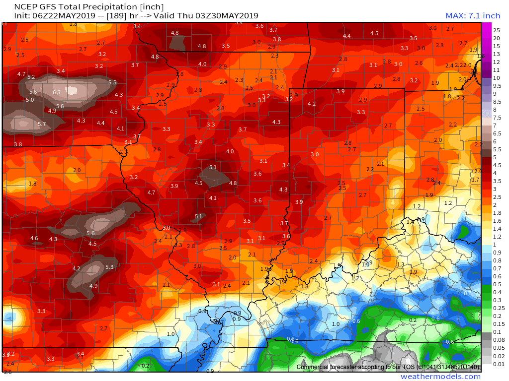
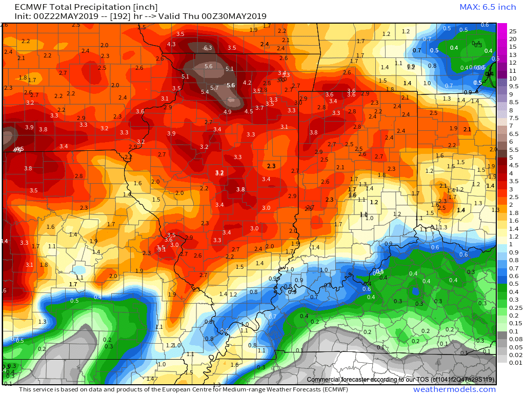
Models agree on widespread 1.5″ to 2.5″ rainfall totals over the upcoming week with locally heavier amounts.
Conditions will also return to a warmer than normal theme into the middle of next week. At times, conditions will become oppressive (depending on which side of the front you find yourself on). If heading to the track, ensure you have means to remain cool and pack the rain gear just to be safe!
More later tonight on the long range, including a video recap of our Summer Outlook.
Permanent link to this article: https://indywx.com/prolonged-unsettled-stretch-of-weather/
May 10
Long Range Video Update: Pattern Progression Into Late-May/ Early June…
You must be logged in to view this content. Click Here to become a member of IndyWX.com for full access. Already a member of IndyWx.com All-Access? Log-in here.
Permanent link to this article: https://indywx.com/long-range-video-update-pattern-progression-into-late-may-early-june/
May 09
2019 IndyWx.com Summer Outlook
2019 is absolutely flying by! Before you know it, we’ll be releasing our 2019-2020 Winter Outlook. Kidding- sort of. 😉
Is a blazing hot summer in store for central Indiana, or perhaps wet and cool? Let’s dig in to the details…
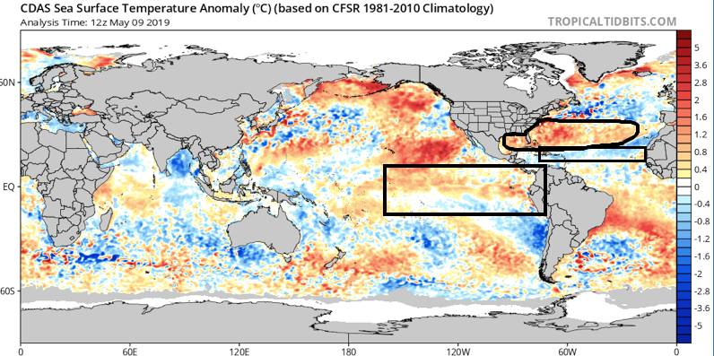
As we look at current sea surface temperature anomalies, a few items stand out:
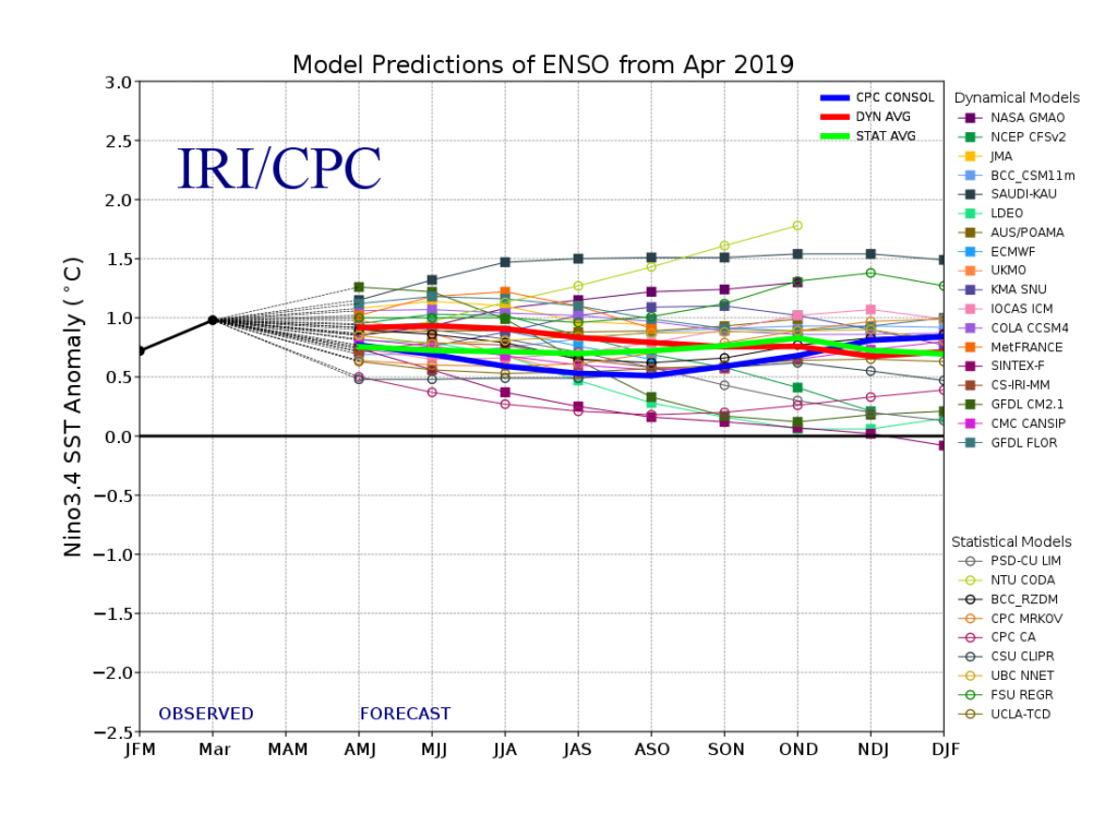
I. We expect a weak El Nino to continue through meteorological summer (June through August), and perhaps even into next winter.
II. MDR (Main Development Region for tropical entities) is running cooler than normal and would suggest an overall “less busy” hurricane season from a long-track perspective
III. SSTs are running much warmer than normal in the Gulf of Mexico and off the East Coast. This is important as while the long-track tropical systems may not be as frequent, we’ll have to remain on guard for the potential of active times closer to home this season. Additionally, these warmer anomalies tend to lead us to believe precipitation will run above normal across coastal areas into the Deep South this summer.
Let’s look at some of the climate computer model data for the summer season:
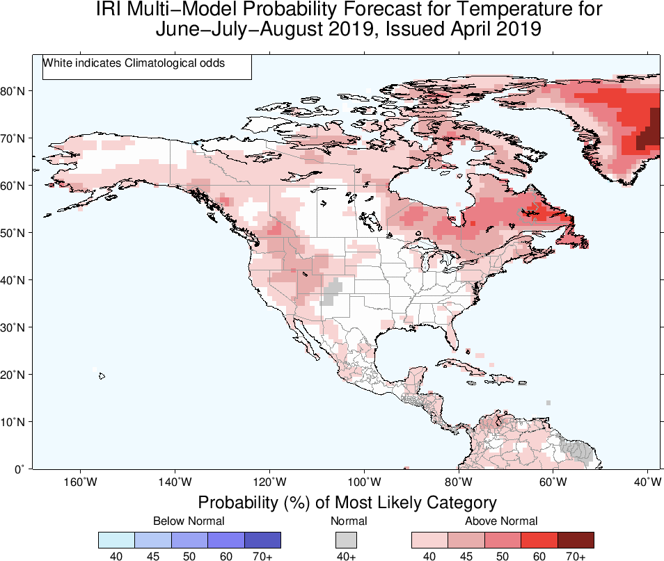
The latest IRI model (International Research Institute) shows relative warmth along the coastal areas and the west with greatest wet anomalies across the Northwest.

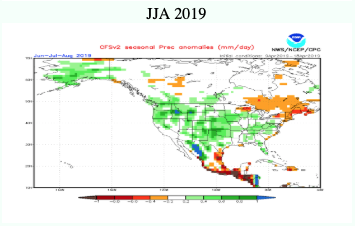
The CFSv2 is leaning towards an anomalously wet summer across a widespread portion of the country (exception being New England).

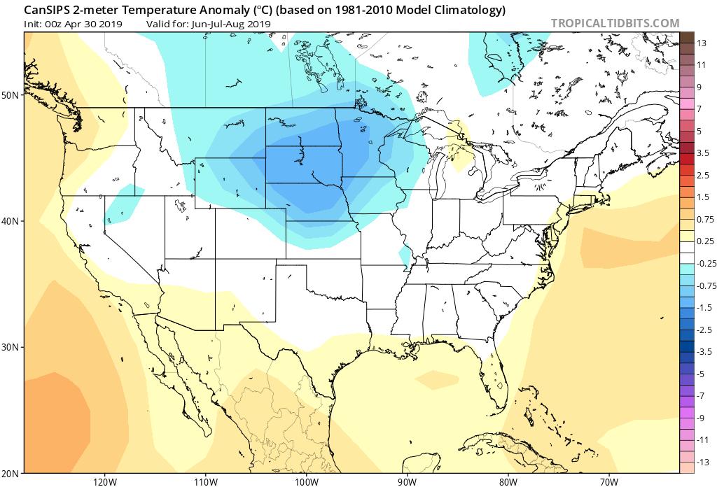
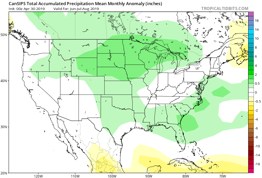
As we review the CanSIPS, it likes the idea of a cool, wet summer across the Heartland with warmth along the coasts.
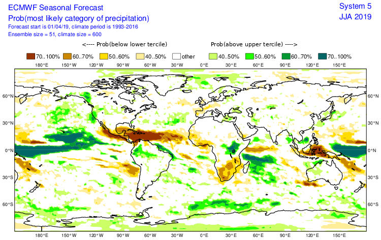
The European Seasonal Forecast has a seasonal summer for most of the country with warmth along the coasts, and a reflection of wetter anomalies across the northern Plain into the Northwest.

(The JMA Seasonal hadn’t updated as of this post).
After taking into account the various seasonal model data above (which is in remarkable overall agreement for a LR forecast idea), along with the current SST configuration, and analog data, this is how we see the Summer of 2019 playing out.

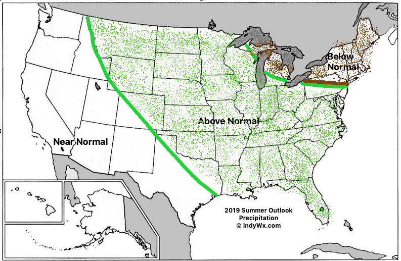
Specific to central Indiana, we’re forecasting a rather wet and cooler than average summer. Frequent storm systems should keep things active around these parts for the balance of the summer season, with the temperature scale tipping a touch cooler than normal.
While the number of named storms should be down compared to normal (highlighted by the Euro seasonal precipitation idea), we’ll have to keep close tabs on the Gulf of Mexico and off the Southeast coast for the potential of “last minute” development. Those warmer than normal sea surface temperatures lurking off the coast does warrant concern for at least the threat of another active year from a landfall perspective.
Permanent link to this article: https://indywx.com/2019-indywx-com-summer-outlook/