Thanksgiving Week Opens Cold…
 Highlights:
- Scattered flurries and snow showers Sunday morning
- Dry for Thanksgiving travels
- Rather boring week of weather ahead
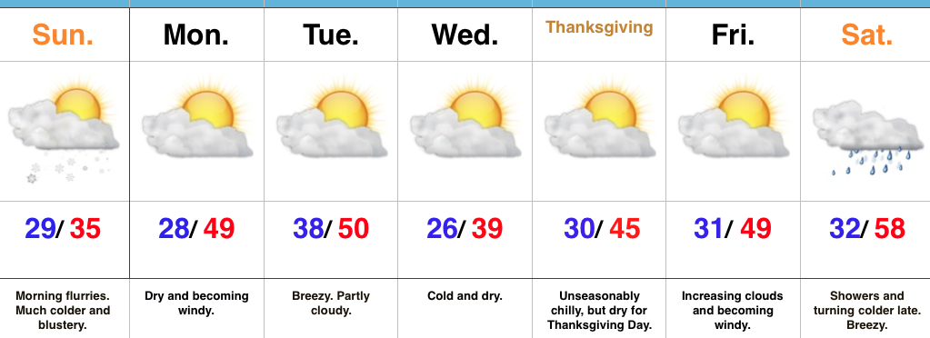
November Or December?! A strong cold front is slipping southeast as we type this forecast Saturday afternoon. This will result in a much colder close to the day, along with wrap around moisture transitioning to wet snow later this evening across central and northern portions of the state. Sunday will start off with scattered flurries and snow showers before dry conditions quickly return. It’ll be an unseasonably cold and blustery day.
As folks begin to travel for the upcoming Thanksgiving Day holiday, high pressure will provide an extended period of dry and rather uneventful conditions. A dry cold front will pass through the state Tuesday and help reinforce the chill for Thanksgiving, itself. While we’ll notice gusty breezes at times this upcoming week, precipitation will be hard to come by.
Our next threat of precipitation will arrive this time next week as a cold front moves south. Expect showers Saturday, followed by a wind shift and coldest air of the season by the second half of next weekend.
Upcoming 7-Day Precipitation Forecast:
- Snowfall: Trace – Dusting
- Rainfall: 0.10″ – 0.25″
 Highlights:
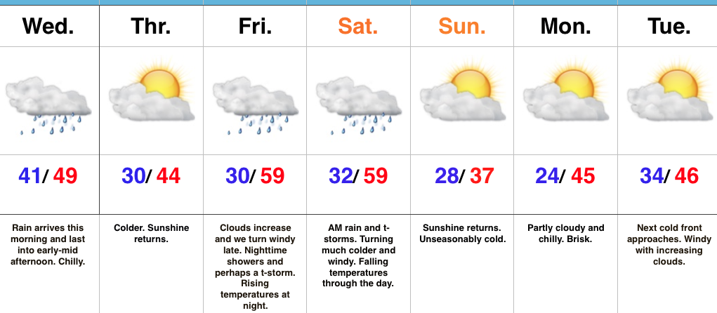
 Despite an active weather week ahead, the open to the new work week will be rather uneventful. Weak high pressure will keep us dry today and Tuesday. Fog and low clouds should give way to an increasingly bright sky by this afternoon (still more clouds than sun today) and partly cloudy skies Tuesday.
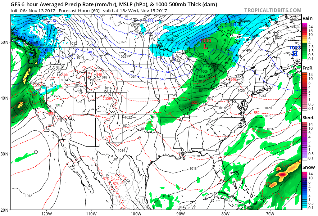 A stronger storm will impact the region as we close out the work week. Strengthening low pressure will track into the Great Lakes and drag a trailing cold front through our region Friday evening. A briefly milder southwesterly air flow will push temperatures close to 60° Friday afternoon/ evening before the sharply colder push of air blows into town for the weekend. The transition may include strong to severe thunderstorms Friday PM, and the Storm Prediction Center (SPC) has outlined a large portion of the region under a severe risk Friday. It’ll be important to stay tuned to future updates. Even outside of potentially damaging thunderstorm gusts, non-t-storm winds will gust over 40 MPH Friday.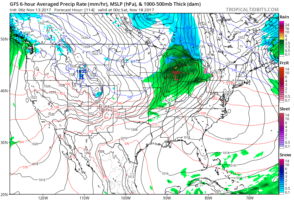
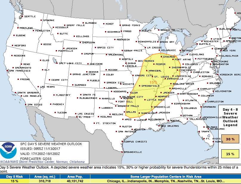 Once the cold front sweeps through the region, a sharply colder air mass will plunge into the Ohio Valley for the weekend. Overnight data has trended even colder and would suggest falling Saturday temperatures (most of the day will be spent in the 30s) and highs only in the lower to middle 30s Sunday.
 Speaking of cold, Thanksgiving week is looking unseasonably cold, and there’s also the potential of early-season snow (far too early for specifics).