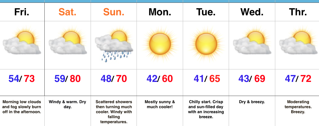
Sunday Morning Showers; Crashing Temperatures…
A cold front is on the move this evening. After a summer-like Saturday (that likely featured the last 80° day until next spring), MUCH cooler air will invade Sunday.
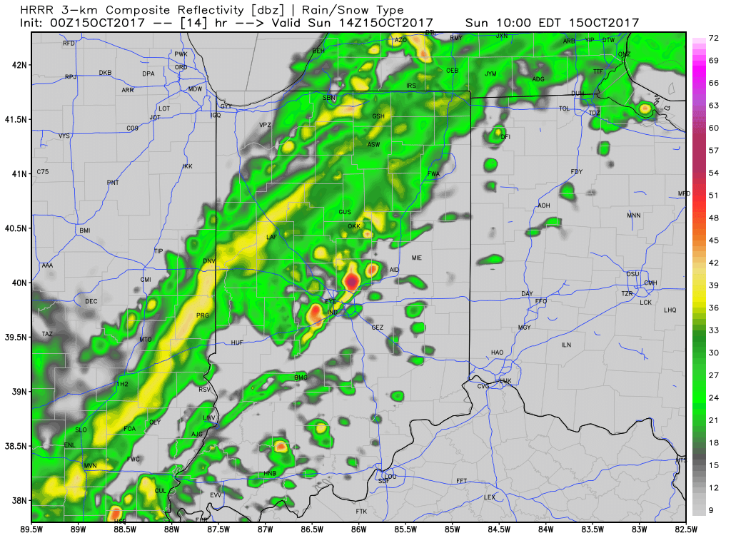
This evening, showers and thunderstorms, some of which have been strong-to-severe, are ongoing to our west and northwest. As the cold front draws closer, showers will push into central Indiana Sunday morning (mid-to-late morning). These showers and embedded thunder will be much weaker than what’s currently impacting our western neighbors. Here’s an idea what the radar may look like around 10a.
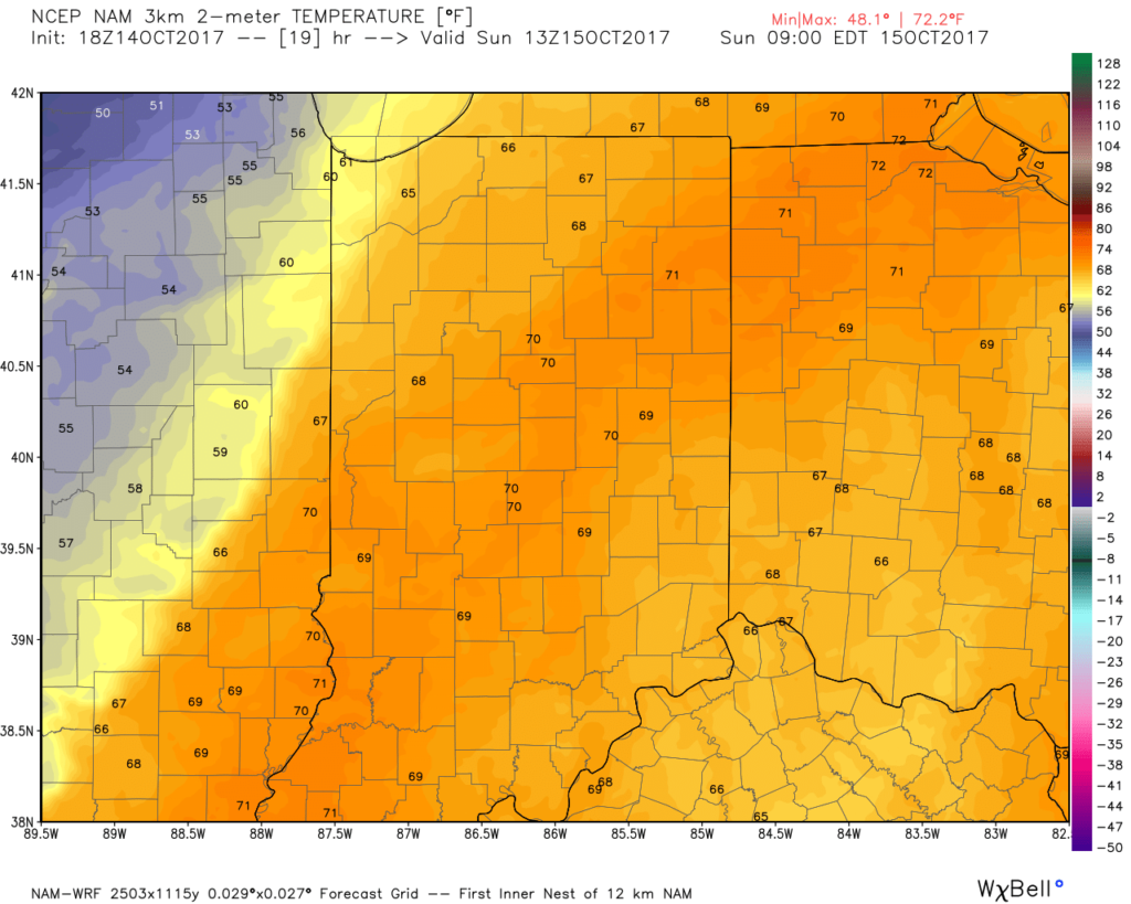
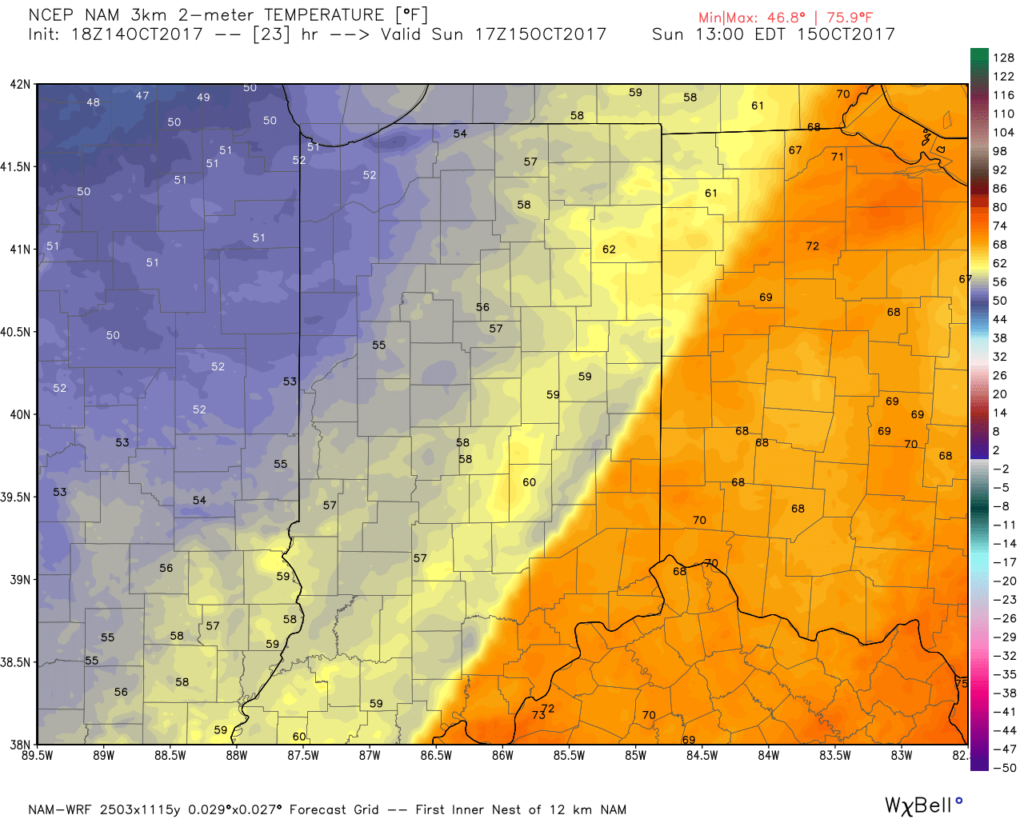
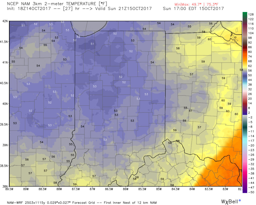
The bigger story Sunday will be the falling temperatures. Early risers will be greeted by temperatures around 70°, but these mild readings will transition to downright chilly conditions before sunset: 50s by lunch and 40s shortly after dark. Lows Monday and Tuesday mornings will fall into the 30s for outlying communities.
 Highlights:
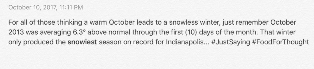
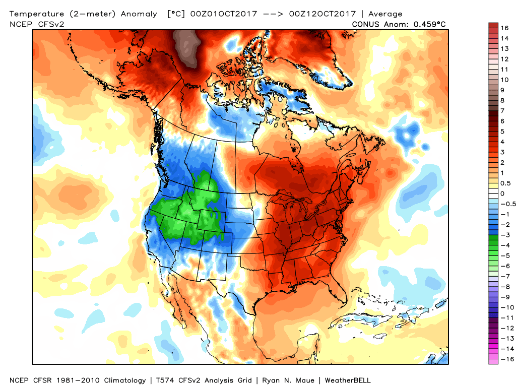 In coffee shops and my travels around the great state of Indiana, I’ve overheard lots of talk centered on because October has been so warm, another lackluster snow season awaits. Let us remind you that the infamous snow season of ’13-’14 featured a very warm first half of October.
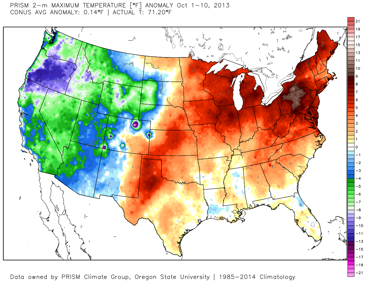
 The upcoming 7-10 days will feature more of a transitional period of weather that we’ve come to know and love around these parts. Warmth will spread northeast this weekend ahead of an approaching cold front (around 80° Saturday) before falling temperatures Sunday afternoon behind the frontal passage. The chilliest air so far this season will descend upon the region early next week. That said, the chill won’t hold and another surge of above normal warmth will spread northeast by the latter parts of next week.
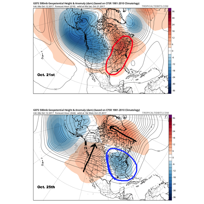 It should also be noted that analog data and research also would lean heavily in the cold direction to wrap up October and these findings also favor a chilly November… More on that later! Speaking of later, an updated 7-day will be posted this evening. Make it a great day!
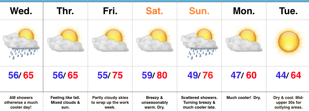 Highlights:
 Highlights: