Category: Arctic Cold

Strong Storm Potential Midweek; Cold, Wintry Conditions Reinforce Themselves Next Weekend…

Updated 03.26.22 @ 8:45a

Some northern Indianapolis suburbs are waking up to more than a coating of snow this morning (have reports of 1″ to 2″ in and around Fishers this morning). Across other parts of the area, snow didn’t accumulate much more than a dusting, but all of the area has gotten in on the late season snow “excitement” (at least seeing it fall) between last night and early Saturday morning.

As we progress through the day, drier air will take hold and help put an end to the localized snow squalls. Skies will clear tonight and winds will diminish, allowing temperatures to fall into the middle 20s. If that’s not cold enough, Monday morning should feature low temperatures between 20° and 22° for most, especially outside of the immediate metro.

Forecast low temperatures Monday morning

The new work week will open with sunshine before clouds increase late Monday and into Tuesday. Light rain will be fast to follow.

After a break in the action Wednesday morning, temperatures will briefly spike into the lower 70s by afternoon, courtesy of a strong southerly flow ahead of an approaching cold front. Our attention by this time will shift to the west as an expanding area of rain and thunderstorms approaches for Wednesday evening into Thursday morning. Side note: I wouldn’t be surprised if the Storm Prediction Center (SPC) eventually puts at least southern portions of the state in a risk of severe weather Wednesday (focused on evening into the nighttime hours). We’ll monitor that moving forward.

The front will quickly sweep through the state Thursday morning, allowing temperatures to fall through the day Thursday. In fact, temperatures will likely once again grow cold enough to allow wrap around rain to begin mixing with snow Thursday evening. Friday will likely feature scattered snow showers with temperatures struggling to make it out of the 30s for highs. Additional hard freezes are on deck next weekend (20s at night).

Snow will once again fly across the region late next week

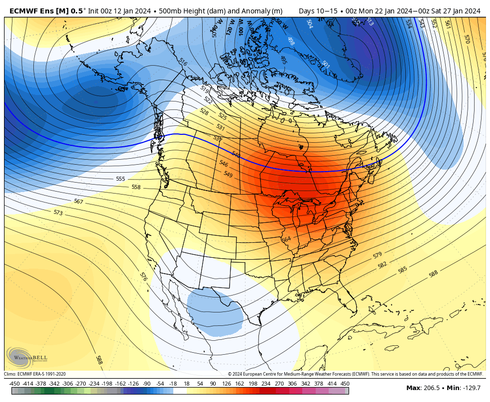
The pattern beyond next weekend continues to look colder than normal into the 10-15 day period. As long as that NAO remains negative, we won’t get excited for “stick and hold” spring conditions anytime soon…

April 5th-10th is expected to continue the cool (to colder) than normal theme.

Permanent link to this article: https://indywx.com/strong-storm-potential-midweek-cold-wintry-conditions-reinforce-themselves-next-weekend/

Still Some Winter Left In The Tank…

Updated 03.25.22 @ 7:40a Rain will mix with and change to snow after sunset with widespread snow showers and embedded squalls taking up residence across the area Saturday morning. A…

You must be logged in to view this content. Click Here to become a member of IndyWX.com for full access.  Already a member of IndyWx.com All-Access?  Log-in here.

Permanent link to this article: https://indywx.com/still-some-winter-left-in-the-tank/

VIDEO: Wintry Conditions Make A Return; April Looks To Open On A Cooler Than Average Note…

Updated 03.24.22 @ 7:22a

You must be logged in to view this content. Click Here to become a member of IndyWX.com for full access.  Already a member of IndyWx.com All-Access?  Log-in here.

Permanent link to this article: https://indywx.com/video-wintry-conditions-make-a-return-april-looks-to-open-on-a-cooler-than-average-note/

Persistent Rain Gives Way To Some Hailers Wednesday PM? Colder Shift With Wintry Precipitation This Weekend Into Early Next Week…

Updated 03.22.22 @ 6:52a

A shield of rain is lifting into central Indiana during the predawn hours and once it arrives, we can expect wet times to persist through the better part of our Tuesday.

An all day rain can be expected across the region.

This is all part of a surface low that will lift northeast out of the central Plains region (today) into the lower Great Lakes region (Thursday). In association with this low pressure system, a warm front will lift northeast across the region Wednesday. Eventually, a cold front will move from west to east and sweep the state Wednesday night and early Thursday.

As this all transpires, a steady “all day” soaker can be expected across the region today.

Periods of rain will persist through our Tuesday.

Heaviest rain will be confined to western and northwestern parts of the state where amounts of 2″+ can be expected by 7a Wednesday. For immediate central and eastern Indiana, amounts of 0.50″ to 1.25″ can be expected by Wednesday morning.

Precipitation will turn more “showery” in nature by Wednesday morning, but by this timeframe, all eyes will be turning to the potential of thunder Wednesday afternoon as just enough instability and cold air aloft combine. From the city, itself, and points north and east, the threat of a few stronger cells are present Wednesday afternoon (after lunchtime). With the ingredients in place, a few of these storms could produce hail as they race off to the northeast.

We’ll turn MUCH cooler Thursday and Friday with a few “nuisance” variety showers around, but compared to what we see today and Wednesday, these won’t be a big deal (just annoying ;-)).

The colder times continue into the weekend and early portions of the next week and with a fast northwesterly flow aloft, a couple of disturbances will likely deliver the potential of mixed rain/ snow showers Saturday and again Monday.

Snow showers will likely be flying across the region as we open up the weekend.
A clipper system will offer up the chance of additional snow Monday morning.

We still expect a hard freeze (25° to 30°) early next week for a good chunk of the region.

Permanent link to this article: https://indywx.com/persistent-rain-gives-way-to-some-hailers-wednesday-pm-colder-shift-with-wintry-precipitation-this-weekend-into-early-next-week/

VIDEO: Stunning Open To The Work Week Before Unsettled Weather Returns; Snow Mixes In By The Weekend…

Updated 03.21.22 @ 6:52a

You must be logged in to view this content. Click Here to become a member of IndyWX.com for full access.  Already a member of IndyWx.com All-Access?  Log-in here.

Permanent link to this article: https://indywx.com/video-stunning-open-to-the-work-week-before-unsettled-weather-returns-snow-mixes-in-by-the-weekend/