Updated 01.12.24 @ 12:18p
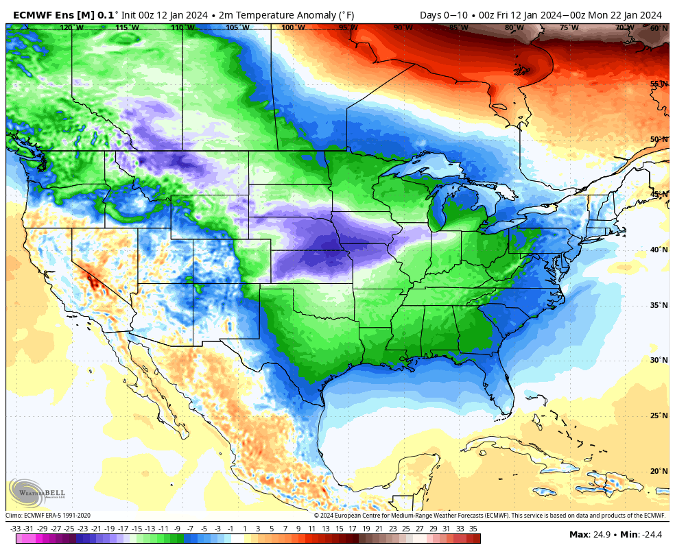
The upcoming 10-days is a case of cold and if you believe some of the guidance, even colder (next weekend). Multiple nights below zero and dangerous wind chill values of 20° to 30° below zero are on tap at times during this period. You know that we’re interested to see if we meet our respective targets. It’s not just the magnitude of the cold, but the duration and widespread nature, as shown over the upcoming 10-day temperature anomalies from last night’s European ensemble.
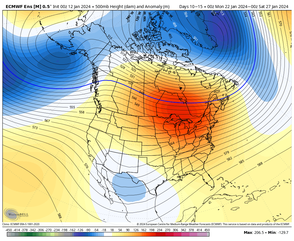
But milder changes are on the horizon as we rumble through the warmer phases (at least this time of year) of the MJO and see some temporary trends within our teleconnection suite (AO, NAO, EPO, and PNA) that favor a period of much less harsh, and even milder than normal conditions developing by the last week of the month.


After our frigid stretch, temperatures even only a few degrees above normal will feel like a heatwave.
The hunch here is that we return to another cold stretch as we rumble into February. Long range guidance shows “part 2” of our high latitude blocking event and the thought here is this is a byproduct of a combination of sea surface temperature (SST) configuration in the northwest ATL, the current state of our Nino, as well as the SST configuration in the central/ northern PAC. At any rate, the alignment between teleconnections and, of course, the MJO rolling into the colder phases supports this idea. Let us worry about that and you enjoy the late month “mild-up!” Heavens knows after these next couple weeks, you will have earned it!
We’ll continue to keep tabs on the threat of snow over the next couple weeks. Things can, obviously, change but as of now I’m not seeing any hefty snow threats for central Indiana. The one feature that does potentially require watching is out there towards the end of next week, but the overall fast paced flow should prevent this from deepening into anything overly significant. At least that’s the way we see it now.
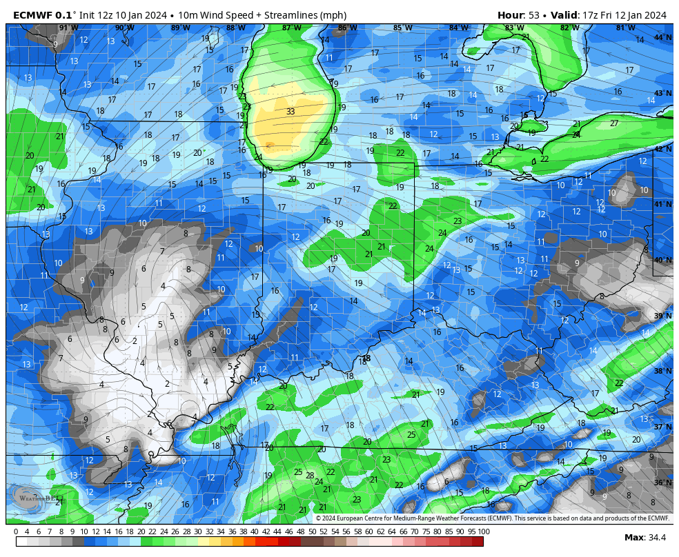
We’ll continue to keep close tabs on short-term trends but feel good with what we have out there concerning rain/ snow amounts, timing of the transition, and damaging wind potential.