Updated 11.22.24 @ 10:18a A few light echos are noted across east-central Indiana mid morning and falling in the form of mostly light rain with a few wet snowflakes mixed…
You must be logged in to view this content. Click Here to become a member of IndyWX.com for full access. Already a member of IndyWx.com All-Access? Log-in here.
Updated 11.21.24 @ 6:45p After an unseasonably warm November, the season’s 1st snow took place right on schedule. (Thank you for all of your reports, by the way. Please keep…
You must be logged in to view this content. Click Here to become a member of IndyWX.com for full access. Already a member of IndyWx.com All-Access? Log-in here.
Updated 11.21.24 @ 7:07a We’re waking up to a steady snow falling across central Indiana and while this isn’t the “real deal” just yet, it certainly makes for a festive…
You must be logged in to view this content. Click Here to become a member of IndyWX.com for full access. Already a member of IndyWx.com All-Access? Log-in here.
Updated 11.19.24 @ 7:37p Before we talk snow, there will be a period of a chilly light rain to deal with mid-to-late morning Wednesday, continuing into the early afternoon (especially…
You must be logged in to view this content. Click Here to become a member of IndyWX.com for full access. Already a member of IndyWx.com All-Access? Log-in here.
Permanent link to this article: https://indywx.com/tuesday-night-musings-latest-thinking-on-thursday-evening-and-looking-towards-favorable-period-for-early-season-mischief/
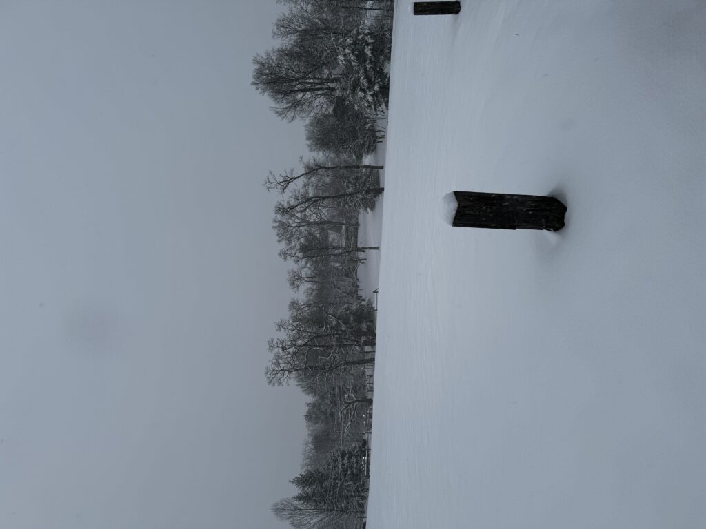
Yesterday’s snow storm was a sight for sore eyes, especially for my snow-starved central Indiana friends (you know who you are).
I took a couple of these pictures outside a cozy dinner at the Loft at Traders Point Creamery last night. “Serene” doesn’t begin to describe the evening.
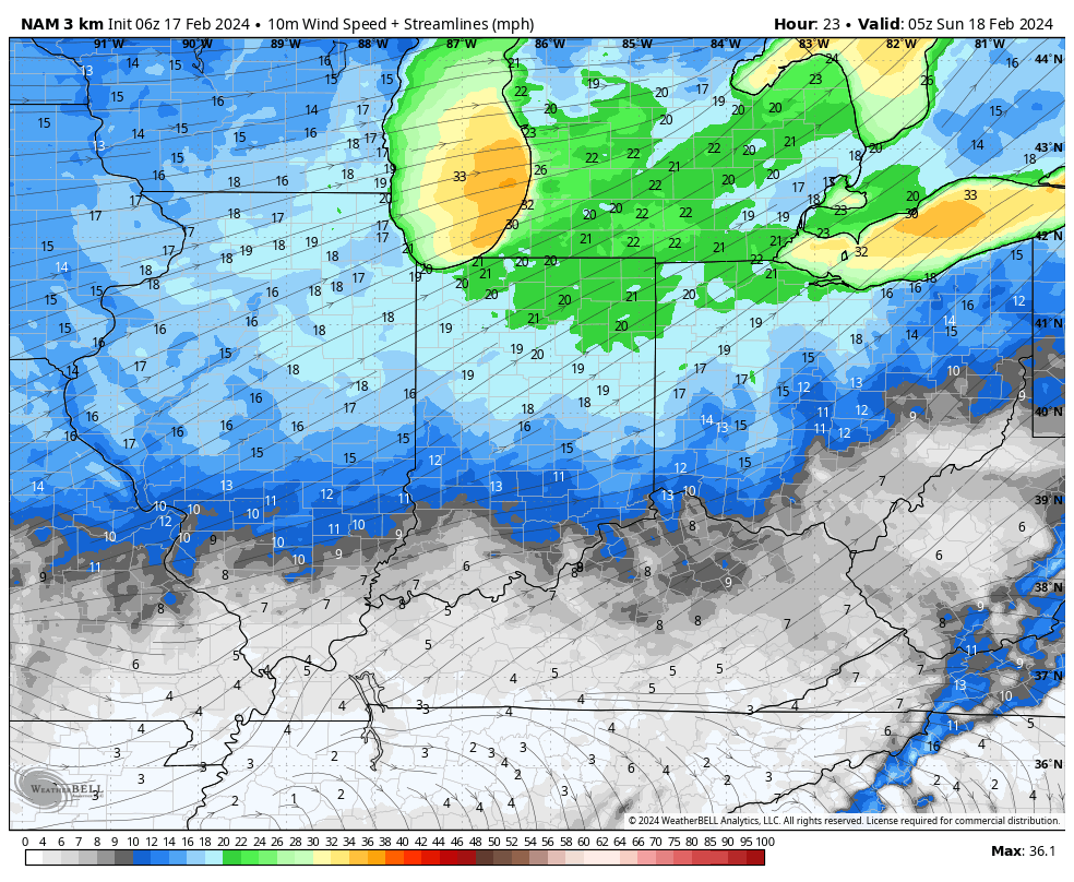
Low clouds and lingering lake-driven snow flurries this morning should give way to a brightening afternoon sky. We’ll stay bitter today with the fresh heavier snowpack. Highs will struggle to make it into the middle 20s. Winds will remain gusty this morning before a bit of a “lull” and then pick up yet again overnight into Sunday morning.
Another round of gusty winds will arrive overnight into Sunday morning, this time out of the southwest.
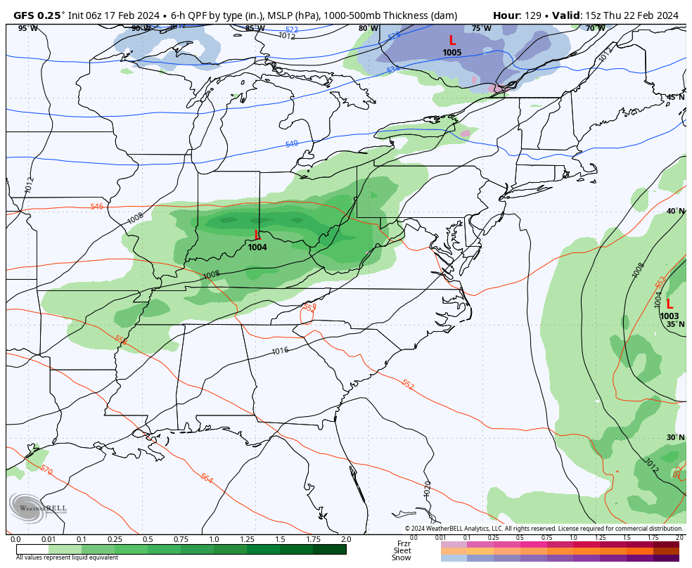
Those southwest winds will indicate a flip to milder times into midweek and overall dry conditions. Rain will return overnight Wednesday into Thursday, but doesn’t appear to be overly heavy from this distance.
After spring-like highs in the 60s midweek, another cold “jab” will take aim on the region going into next weekend. We use the term “jab” as this once again won’t be a cold air mass with staying power. We likely will quickly return back into the 50s and 60s next week after a day or two in the 30s over the weekend. Timing the cold and moisture may yet again produce a round of snow late next week and we’ll continue to keep an eye on that in the days ahead.
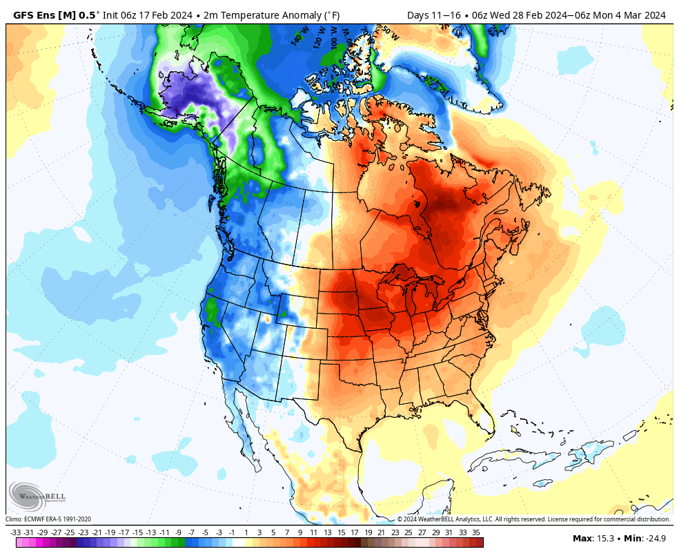
Overall, this will likely prove to reinforce the idea that any cold over the course of the coming couple weeks will be transient in nature. “Islands of cold in a sea of milder times.” We note ensemble guidance is particularly bullish on a spring-like pattern taking foot as we close February and open March. Far too early for details, but we may need to watch for the potential of an active severe weather setup during this time period, as well.