You must be logged in to view this content. Click Here to become a member of IndyWX.com for full access. Already a member of IndyWx.com All-Access? Log-in here.
Category: Arctic Cold
Permanent link to this article: https://indywx.com/tuesday-evening-video-update-lots-of-winter-on-the-table/
Feb 23
Busy Winter Weather…
February has been a brutally cold month and there’s no let-up in sight during the upcoming 7-10 days.
 The snowpack has expanded over the past few days.
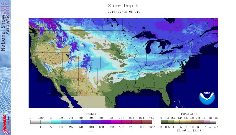 The arctic air is very hard to move and forecast models can struggle mightily in the mid range when arctic air is involved. Add in a vast snowpack over the TN Valley and Ohio Valley and I wouldn’t buy full force into the warm, mostly liquid precipitation solutions as depicted by some European and GFS runs as of late. More on that later.
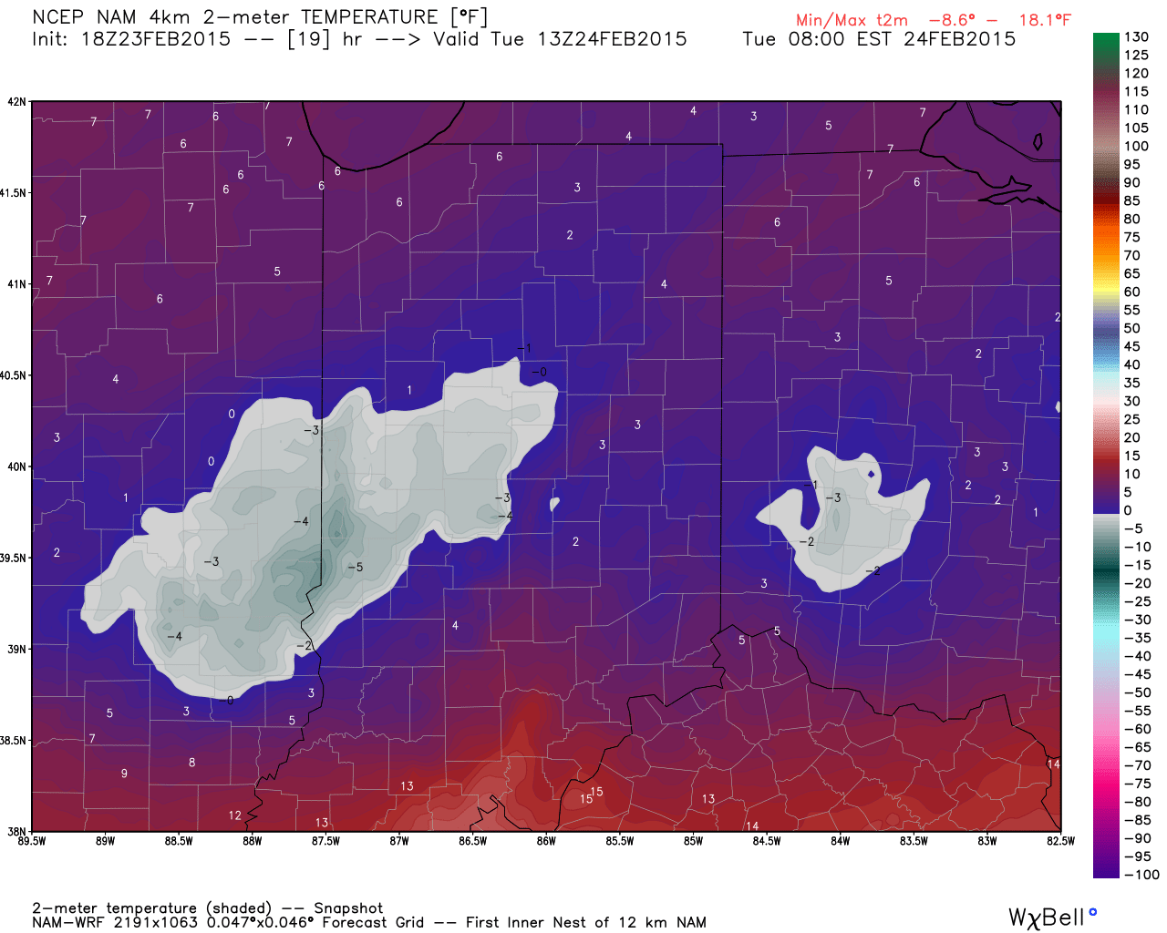
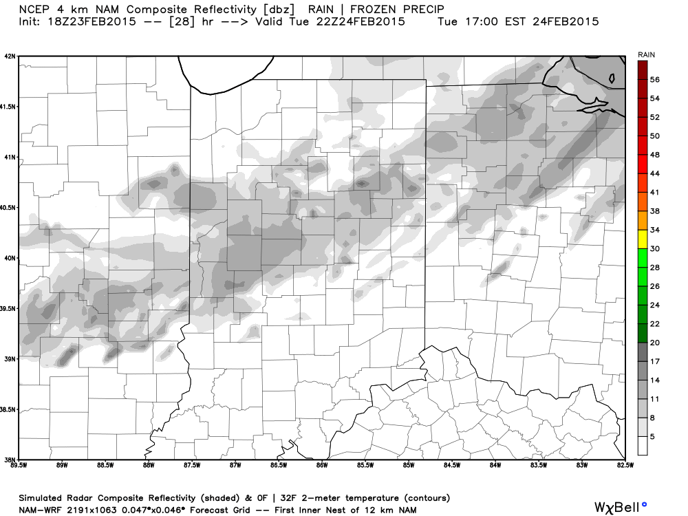
Arctic air is the story in the short-term along with a gusty wind that will precede very light snow Tuesday afternoon/ evening.
 More bitterly cold, arctic air will be with us as we wrap up the work week and head into the weekend. Additional records will fall.
Snow may also be with us. We’re keeping a close eye on a clipper system that could deliver accumulating snow prospects around these parts Wednesday night/ Thursday. The latest RGEM solution (below) depicts a more easterly track. We also note the latest GFS delivers light snow in here Wednesday night and Thursday, as well. We’ll keep a close eye on things.
 Late weekend into early next week features another complicated and very complex event. We believe it’s far too early to buy into any one particular solution provided by the various forecast models, but certainly have to “raise an eyebrow” to the mostly wet, warmer solutions. There’s an awful lot of dense arctic air around and with a widespread snowpack we have to wonder if modeling may be overdoing the warming (where have we seen this before ;-)).
A wavy front may lead to more wintry “mischief” Sunday into early next week. Again- far too early for specifics, but additional wintry weather is certainly possible.
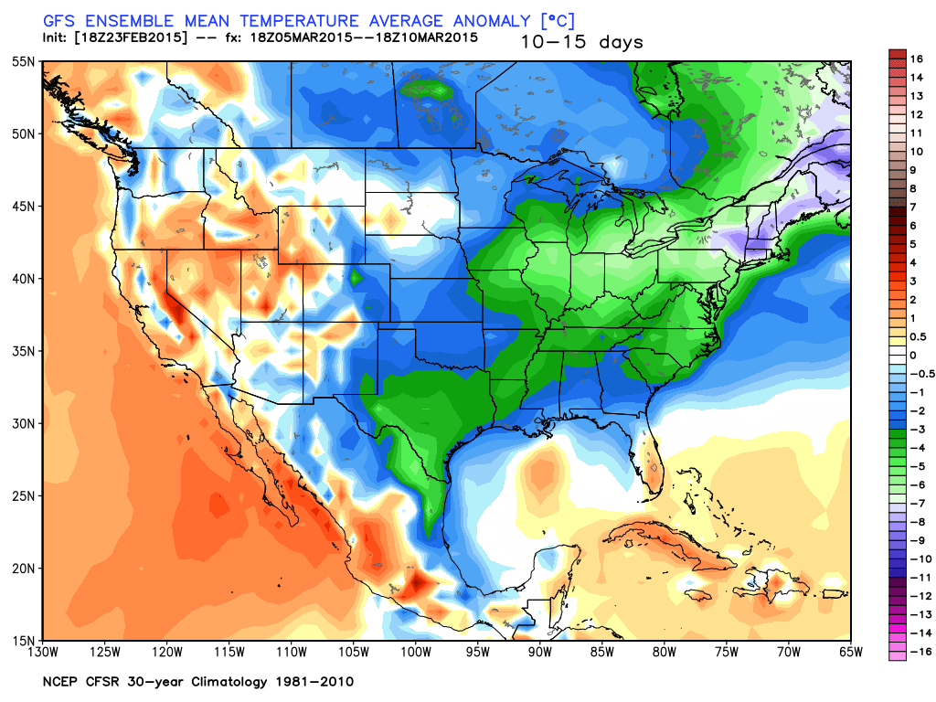
 In the longer term, there’s just no let up in sight from the colder than normal conditions. Sure we may see a couple of days of milder air (we are heading into March, after all), but, as a whole, the majority of the upcoming couple weeks look MUCH colder than normal.
Permanent link to this article: https://indywx.com/busy-winter-weather/
Feb 23
Brutally Cold Week…
 Bundle Up…A series of arctic highs will build south and result in an absolutely frigid week across a large portion of the country, including here on the home front. Several cold records will fall this week.
For the most part, we’re looking at a dry week, but a skinny band of light snow may blow through the area Tuesday afternoon/ evening- not a big deal.
Models are struggling on the details with our next storm system. It’s possible we’ll have to add a wintry mix of rain and snow into your Sunday forecast, but prefer to wait another set of runs before doing so. Timing and track remain big questions at this point- common from a Day 6+ event. The GFS and European lean towards a milder, wetter event while the Canadian is colder and more suppressed. Much more on this later.
Upcoming 7-Day Precipitation Forecast:
- 7-Day Snowfall Forecast: Dusting
- 7-Day Rainfall Forecast: 0.00″
Permanent link to this article: https://indywx.com/brutally-cold-week/
Feb 22
Bitterly Cold Week…
 Frigid Times…If you haven’t done so already, we highly recommend cleaning up from yesterday’s snow storm as the bitterly cold conditions moving in this evening will turn any left over slush into concrete.
Most of today will feature dry conditions, but we’ll note scattered flurries and light snow this afternoon as arctic air pours into the region. Winds will also increase and gust upwards of 20 MPH by evening. The combination of wind and cold will lead to dangerous wind chill values of 15 to 25 degrees below zero tonight into Monday morning.
Reinforcing arctic air will build into the region with a burst of light snow Tuesday afternoon. This will only help to drive home the point of our title above- a bitterly cold week is upcoming. Needless to say, we won’t just beat record lows this week, but absolutely smash them.
The next opportunity for a substantial winter event appears to be eyeing us during the upcoming weekend. We’ll have more on this as time draws closer.
Upcoming 7-Day Precipitation Forecast
- 7-Day Rainfall Forecast: 0.00″
- 7-Day Snowfall Forecast: Dusting to 1″
Permanent link to this article: https://indywx.com/bitterly-cold-week/
Feb 21
Saturday Morning Update
Good snowy Saturday morning, friends! We’re getting reports of 3″-5″ of snow so far across central Indiana from “round 1” of our winter storm. While heavy snow bursts remain on radar this morning (case in point from Whitestown down to the west side of Indianapolis), the widespread snow has come to a brief end. Brief is the key word here as widespread snow will overspread most of the region late morning into early afternoon. An additional 1″-2″ of snow will be a good bet from “round 2.”
Here’s a snap shot of what the radar may look like later this morning- centered on 11a.
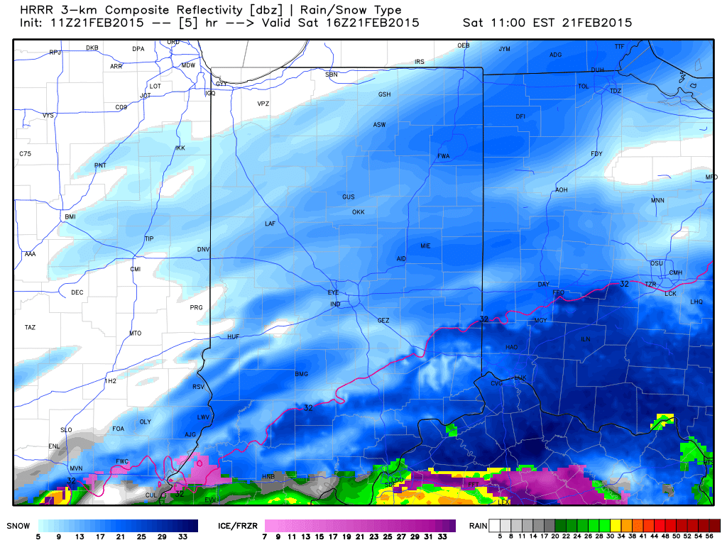 As we push deeper into the afternoon, snow should slowly press south and east of our region. It’ll be important to go ahead and begin the big dig as cold reloads tonight into Sunday and another record cold shot eyes the region early next week.
We’ll have more on your 7-day forecast later today, including another potential winter storm late in the period. For now, enjoy the snow!
Permanent link to this article: https://indywx.com/saturday-morning-update/

