Highlights:
- Periods of heavy rain
- Tight temperature gradient
- Much colder to open 2016
Very Wet Period Before We Turn Colder…We hope you had a blessed Christmas full of joy, peace, and laughter!
It was a beautiful Christmas across the region, complete with temperatures reaching the 50 degree mark for the first time since 1987! Many would prefer cold and snow (yours truly included), but we couldn’t ask for better weather to get out and enjoy those new gifts from Santa! The countdown to Christmas 2016 begins now. 
The weather will once again turn quite active around these parts as we head into the extended Christmas weekend. Waves of heavy rain will push north Saturday and grow heavy Saturday evening. Periodically heavy rain will continue Sunday. Flooding concerns are present as event rain totals of 3″-5″ should be widespread, with locally heavier amounts.
The other big weather item to note will be the tight temperature gradient from north to south Saturday evening. Note the modeled temperature forecast Saturday night, including temperatures ranging from the lower 40s north to the upper 60s south. Heads up for central IN communities, the cold air will win out Sunday as temperatures fall through the day after an early morning high.
Image below is courtesy of Weatherbell.com
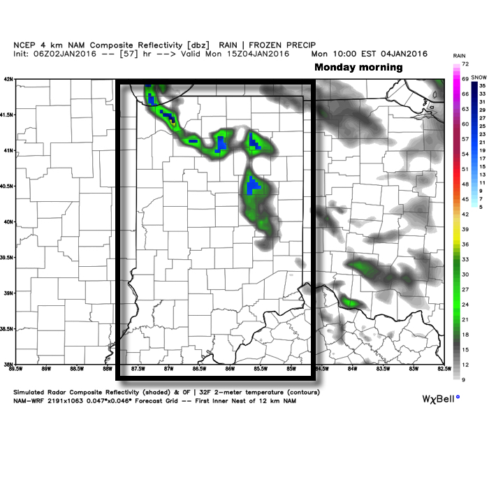
 Another push of heavy rain will surge into IN Monday as low pressure tracks northeast into the Great Lakes region. A secondary area of low pressure will form along the Mid Atlantic coast Monday and provide interior portions of the NE an icy/ snowy combo to open the new work week.
Image below is courtesy of Tropicaltidbits.com
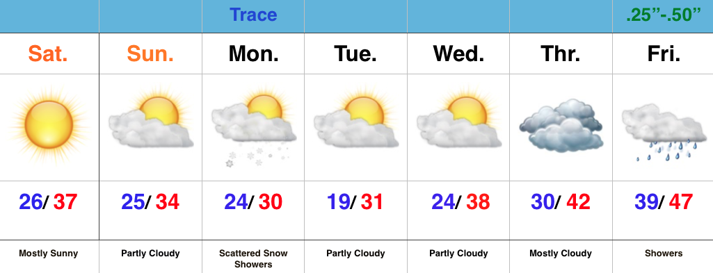
 Things will (FINALLY) begin to dry out and chill down as we rumble closer to closing 2015 and welcoming 2016. Though forecast models aren’t seeing much in the way of precipitation with the surge of cold air, don’t be surprised if we deal with scattered snow showers during the Thursday-Friday period as upper energy teams up with the arctic surge.
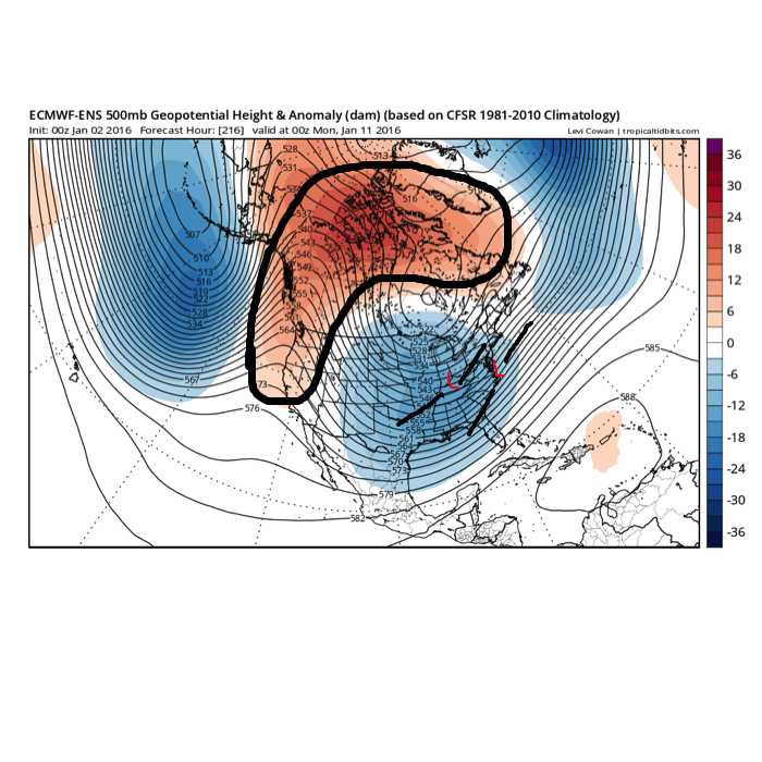
All-in-all, it’s a step in the right direction for establishing the winter pattern that we think lies ahead, but we caution with a positive AO, things are likely to still be transient over the first 7-10 days of January. Once to mid month, we still believe a sustained shift to colder, more wintry times loom.
Image below is courtesy of Tropicaltidbits.com


 Highlights: