Transitional Week Of Weather…
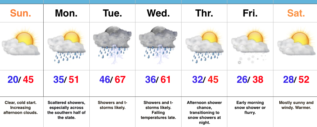 Highlights:
- Warming back up
- Storms around Tuesday-Wednesday
- Colder late week
- Windy warm-up next weekend
Don’t Blink…The second half of the weekend has gotten off to a frosty, but bright start! Unfortunately, clouds will begin to increase this afternoon. Thankfully, the increasing clouds won’t keep temperatures from getting a significant boost this afternoon compared to the frigid air of Saturday.
A few showers will scoot through the state Monday, but most of these will be confined to the southern third of Indiana and most neighborhoods should remain rain-free. A more significant storm system will lift northeast Tuesday and this will provide better coverage of showers and thunderstorms Tuesday (especially late in the day) into Wednesday. After a midnight high, temperatures will fall through the daytime hours Wednesday.
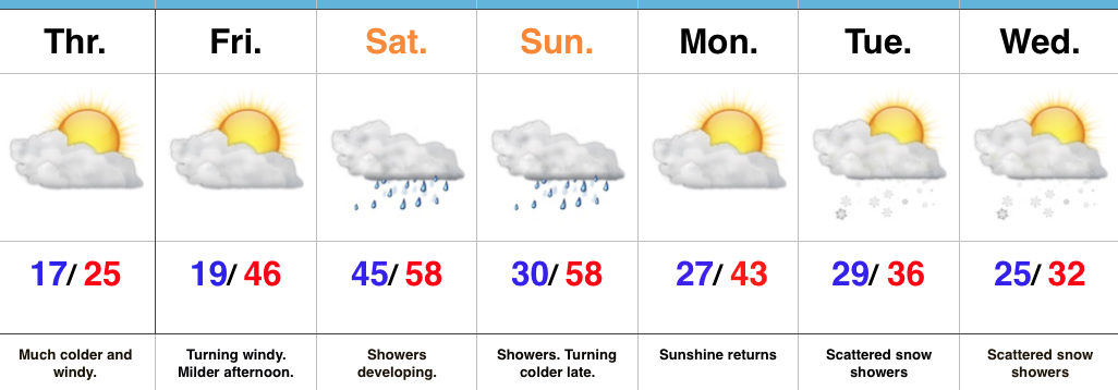
Another fast-moving, weak, weather maker will impact us Thursday evening into Friday morning. Scattered showers Thursday PM will transition to light snow showers overnight into early Friday morning. Friday will be chilly, but moderating conditions return as early as Saturday, along with a strong and gusty southwest flow by the afternoon!
Upcoming 7-Day Precipitation Forecast:
- Snowfall: Trace – Dusting
- Rainfall: 1.00″ – 1.25″
 The anomalous warmth is impressive enough, but perhaps the most impressive is the duration of the unseasonably warm, April-like, warmth. By the time all is said and done (Friday night), many communities will set multiple new records for so many consecutive days of 60°+ level warmth in the month of February. That doesn’t set well for spring vegetation. Given the look to the overall pattern in the weeks ahead, it’s hard to deny the glaring signs for additional well above normal warmth (speaking in “overall” terms). Accordingly, vegetation will likely continue to sprout and bloom early with such a pattern- even as far north as here in central IN.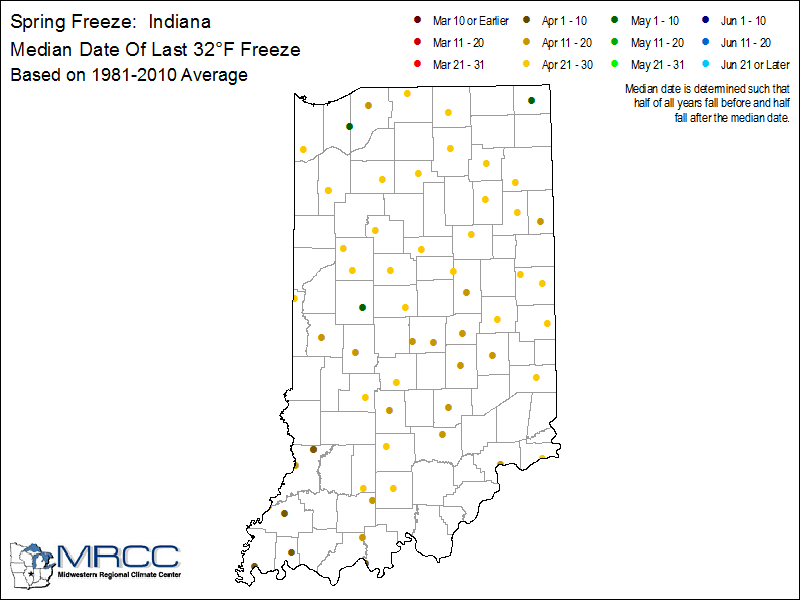
 Timing: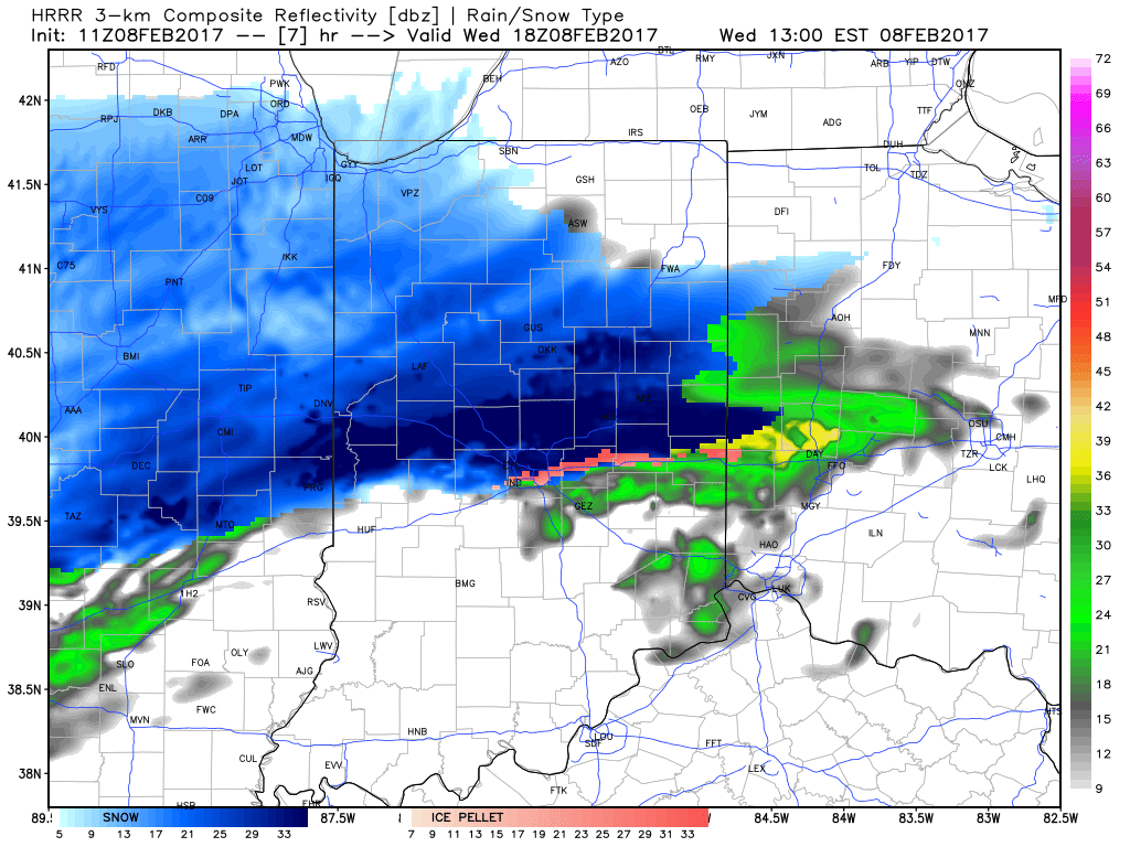


 Timing:
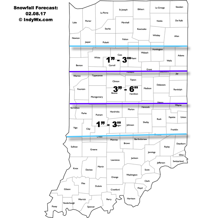
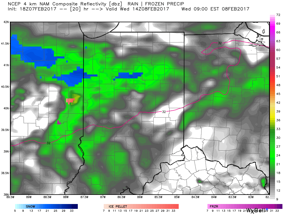 It’s not until we push into Wednesday afternoon and evening that more widespread snow will move through central Indiana, including Indianapolis.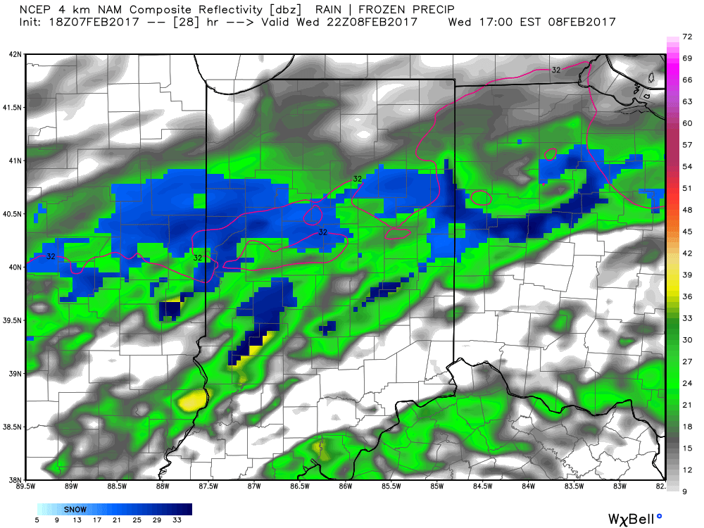
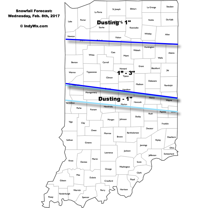
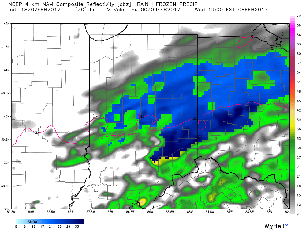 Periods of moderate to locally heavy snow can be expected through central and north-central parts of the state Wednesday evening, especially between the hours of 3p-7p. This will be a wet snow and though the snowfall intensity should be impressive at times, it’ll have a hard time accumulating from what it otherwise could be if the ground was cold. With that said, we do anticipate snowfall rates to overcome initially marginally cold air and “warm” surface temperatures. Our forecast calls for a dusting to 1″ for the city, itself, increasing to 1″-3″ north of the city- encompassing most of north-central Indiana. Roadways will likely become slushy with wet snow accumulation Wednesday evening.