Confidence Growing In Potential Major Winter Storm…

Confidence continues to grow in the prospects of a major winter storm impacting the Mid West and Ohio Valley Friday into Saturday.  A cold front will slip through central Indiana Thursday night, allowing colder air to push back into the state.  At the same time, surface low pressure should begin to organize along the tail end of the frontal boundary across the Ark-la-tex region.  As we progress through the day Friday, cold air will continue to penetrate south into the Ohio Valley while the surface low lifts northeast into the region.  While we can argue about the specific track (this is still a few days out, after all), the pattern supports a central Ohio Valley track as we progress through the day Friday into Saturday.
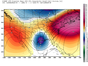
EPS 500mb ensemble mean Friday
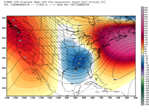
EPS 500mb ensemble mean Saturday
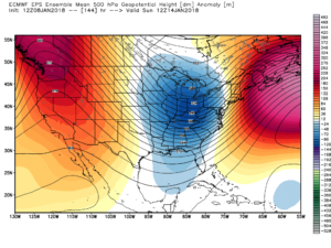
EPS 500mb ensemble mean Sunday

We caution not to get too worked up over individual operational output (including those “spectacular” runs) as run-to-run variance is likely over the next few days.  That said, when we have support from overall pattern techniques that have supported a significant interior event for late this week since last week, along with ensemble agreement, it does lead to greater than normal confidence.  If you have travel plans late this week/ weekend, we suggest keeping a very close eye on the forecast.  This will be a high impact event for portions of the Ohio Valley.

While it’s impossible to say precisely where the heaviest swath of snow is laid down in this situation from a few days out, this is a storm that should carry a swath of 6″ to 12″+ snow just to the northwest of the track.  Additionally, an initial period of an icy mixture of sleet and freezing rain is also possible.  Finally, as the storm wraps up over the Ohio Valley Saturday, a strengthening wind will lead to potential severe blowing and drifting issues.  Fresh arctic air will flow into the region Saturday night into Sunday that will return sub-zero wind chills to the area.

Bottom line, stay tuned…
Brief Thaw; Late Week Winter Storm Brewing?

Highlights:

  • Brief midweek thaw
  • Late week winter storm threat
  • Much colder air returns

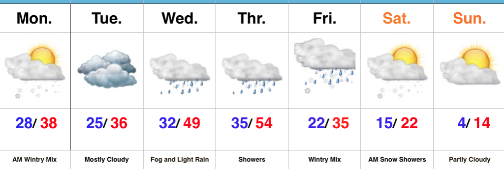
Take It Slow This Morning…An overnight mixture of sleet, freezing rain, and snow has created a few slick spots, but widespread travel issues haven’t been reported this morning.  Thankfully, even a 1° to 2° difference (milder) in surface temperatures overnight helped us out in that regard.  The wintry mix is heading out and we should even see a little sunshine later today.

As temperatures settle back below freezing tonight, concern is present for the possibility of freezing fog and freezing drizzle in spots into Tuesday morning.  A warm front will then lift north through the state Wednesday helping our brief midweek “thaw” get underway in earnest.  Showers will accompany the milder conditions into Thursday.

A cold front will settle south through the state Thursday night and colder air will press southeast.  At the same time, a secondary area of low pressure will develop along the tail end of the front and lift northeast into the Ohio Valley Friday evening into early Saturday.  While this has the sure sign to be a significant, impactful winter storm, we’re obviously still a couple days away from being able to nail down precise track and strength.  Stay tuned and keep close tabs on that Friday-Saturday forecast.  We’ll turn much colder once again over the weekend.

Upcoming 7-Day Precipitation Forecast:

  • Snowfall: 2″ to 4″
  • Rainfall: 0.50″ to 0.75″

Busy, Busy, Busy…

Highlights:

  • Messy wintry mix arrives tonight
  • Briefly milder midweek
  • Potential storm brewing Friday

Snow And Ice Arrive Tonight…Clouds will lower and thicken across the state as we progress through the day.  We’ll also note a stiff easterly breeze as an approaching storm system inches ever so much closer.  This storm system will spread a wintry mix through the state tonight into early Monday morning.  Initially, we think most of central Indiana will deal with snow before a transition to freezing rain during the overnight, continuing into Monday morning.  Before the transition, 1″ to 2″ of snow seems to be the best idea before an icy glaze develops atop the freshly fallen snow.  Based on the expected transition to freezing rain, there’s an opportunity for up to a tenth of an inch of freezing rain.  That said, we’ll have to keep a very close eye on temperature profiles this evening as even the difference of a couple of degrees aloft can make all the difference in a faster or slower transition to freezing rain.  Expect the Monday morning commute to be heavily impacted.

Colder air will push back in here Monday evening into Tuesday with considerable cloudiness remaining.  A milder southerly flow will overtake the region Wednesday into Thursday.  Low clouds and fog along with drizzle will develop Wednesday and we may have to deal with a touch of freezing drizzle early in the day before temperatures rise.  A spike in temperatures will take place Thursday, briefly sending central Indiana into the 50s before a cold front slides through the state Thursday evening.

An area of low pressure will develop along the southern end of the frontal boundary and lift northeast into the TN Valley and eastern Ohio Valley Friday.  As colder air presses into the region, precipitation will change from a wintry mix of sleet and freezing rain to all snow through the day Friday.  It’s far too early to get specifics around accumulation ideas, but this storm has potential to be significant.  Much colder air will whip in here next weekend.

Upcoming 7-Day Precipitation Forecast:

  • Snowfall: 2″ – 4″
  • Rainfall: 0.50″ – 0.75″

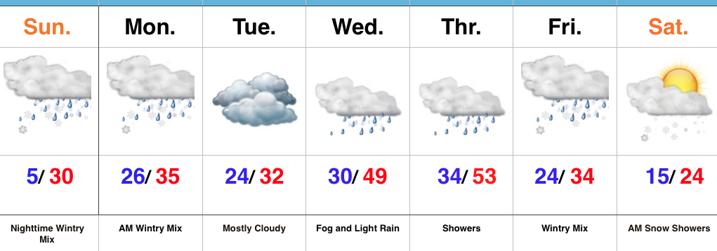
Frigid Saturday Gives Way To A Messy Sunday Evening…

Highlights:

  • Bitter cold eases
  • Mix of snow and ice
  • Milder midweek

Bitter Today; Wintry Mix By Sunday Evening…Most central Indiana reporting sites are checking in this morning between 6° and 10° below zero, but we note a couple of spots are even colder.  Arctic high pressure will remain in control of our weather today, leading to sunny and bitter conditions.

An approaching storm system Sunday will help increase our cloud cover through the morning and we expect snow to develop by evening.  As warmer air aloft works into the region, a transition to freezing rain is expected during the overnight into early Monday morning.  The morning commute looks very messy Monday.

Moderating temperatures will develop by midweek and as the milder air moves over the cold surface, thick fog and areas of drizzle and light rain will develop Wednesday.  A cold front will sweep through the state Thursday with showers and we’re keeping close tabs on a secondary piece of energy that will lead to a wintry close to the work week for portions of the Ohio Valley.  In fact, a significant winter event should develop out of this pattern Friday into Saturday.  The early call for now is that this is east of our region, but stay tuned.  Snow showers will fly in the colder air to close the week regardless.

Upcoming 7-Day Precipitation Forecast:

  • Snowfall: 1″ – 2″
  • Rainfall: 0.50″ – 0.75″