
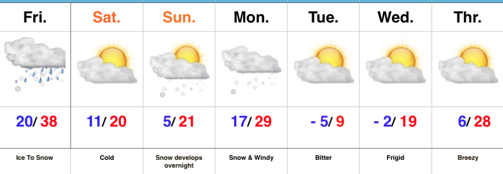
 Highlights:
- Heavy snow Monday morning
- Bitter air returns
- Milder, wet weekend
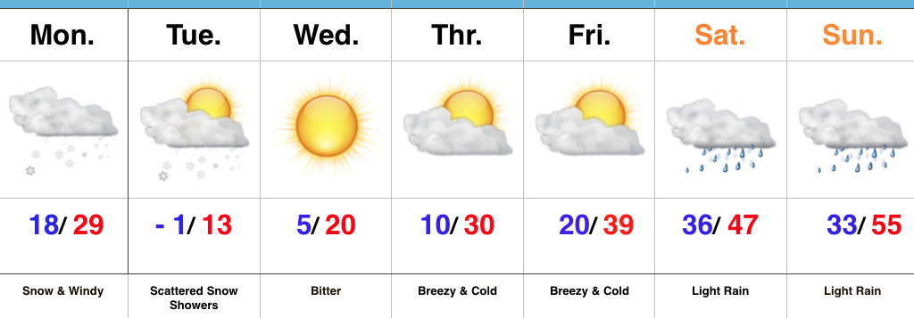
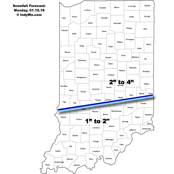
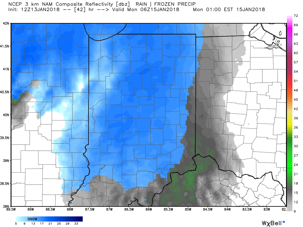
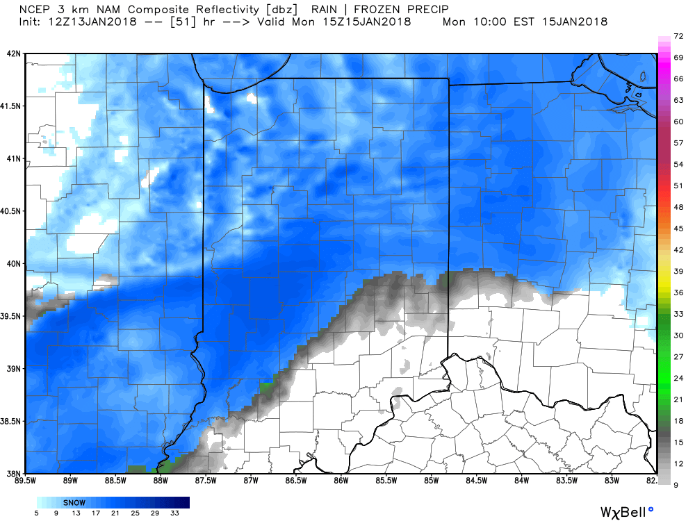
Snowy Open To The Week…A vigorous clipper system and associated arctic cold front will drop southeast and spread a swath of snow across the region tonight into Monday. We expect light snow to encompass most of central Indiana later this evening (between 7p and 10p west to east) before increasing in overall intensity during the overnight. Periods of moderate to heavy snow can be expected during the mid-morning hours Monday, including impressive snowfall rates at times. Allow plenty of extra time to reach your destination Monday. Steady snow will give way to scattered snow showers during the afternoon, continuing into Tuesday as fresh arctic air pours into the region. By the time all is said and done, most of the region can expect a fresh 2″ to 4″, including some locally heavier totals. The other item on the agenda will be blowing and drifting snow that we’ll have to deal with Monday afternoon through the night and into Tuesday.
Arctic high pressure will settle overhead Tuesday night through the midweek stretch, allowing sunshine to return, but we’ll remain well below average (average temperatures this time of year include highs in the mid-30s and lows around 20).
A moderating trend takes place late week, but the “less cold” air will come with gusty southwesterly winds and increasing clouds Friday. Those clouds will give way to periods of rain along with milder conditions over the weekend as an area of low pressure tracks into the Great Lakes.
Upcoming 7-Day Precipitation Forecast:
- Snowfall: 2″ to 4″ (locally heavier totals)
- Rainfall: 0.25″ to 0.75″

 Arctic high pressure will settle over a growing snowpack to help setup a frigid stretch through early and mid week. Multiple nights with below zero readings are expected beginning Tuesday morning where most will wake up to readings of 3° to 8° below zero (not counting the wind chill).
 Highlights:
 Precipitation will end for all except southeastern portions of the state by mid-to-late afternoon and then we’re left with the “clean up” from round one. Saturday and most of Sunday will feature dry and very cold conditions.
 Dry, but bitterly cold conditions return for the mid and late week stretch.
 The model finally suggests that freezing rain will begin to transition to sleet around the morning rush hour.
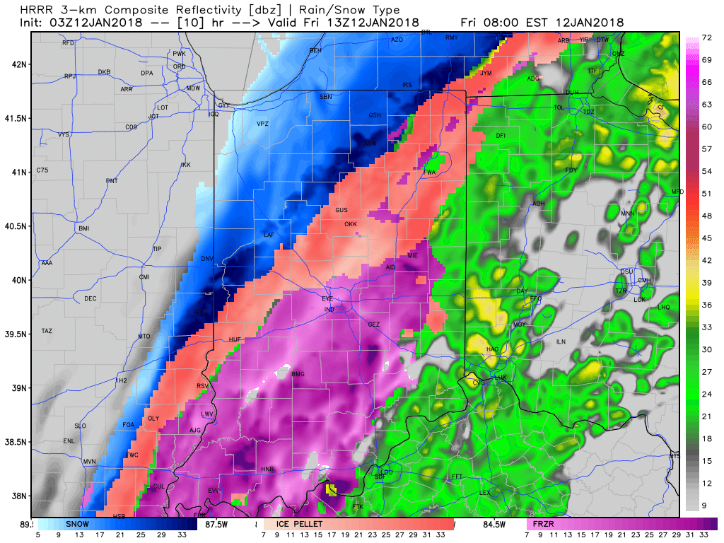 An icy mixture of sleet and freezing rain is expected to transition to snow late morning into the early afternoon hours across the region.
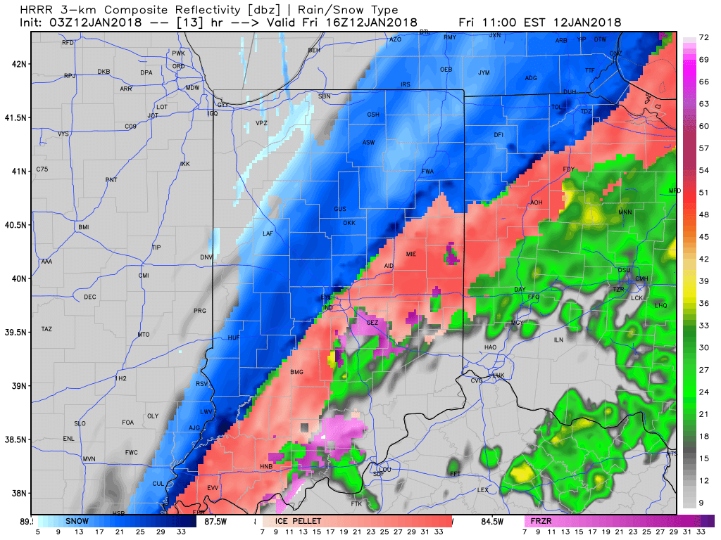 We suggest ensuring you charge your electronic devices and cell phones tonight in the event you lose power overnight or Friday morning. We’ll hope for a faster transition to sleet and snow than data currently suggests, but the concern is certainly present this evening for an impactful ice storm for portions of southwestern and central Indiana.