
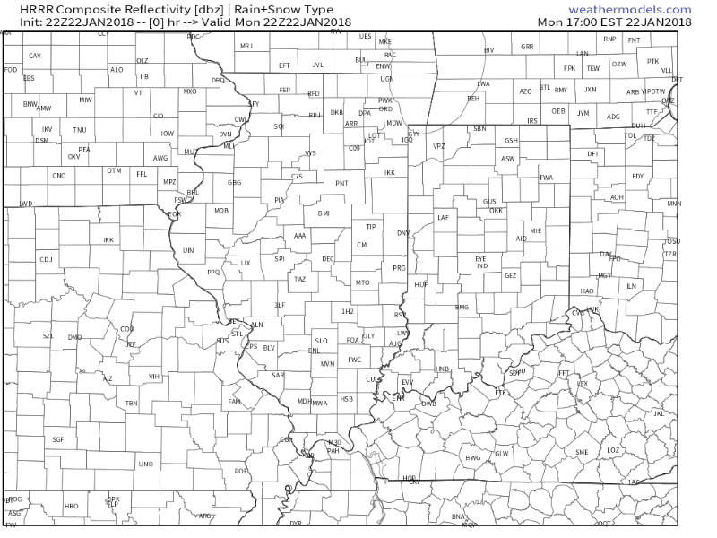
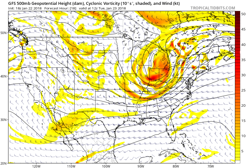
 I. Another round of showers will pivot through central Indiana later this evening ahead of a cold front. Once the cold front sweeps through the state, temperatures will fall during the overnight and grow cold enough to allow precipitation to transition to wet snow showers Tuesday as upper level energy rotates through the Ohio Valley.
 II. High pressure will settle overhead through midweek and while we’ll “chill” to near seasonal levels Wednesday, the rebound will begin Thursday and we’ll climb into the 50s for highs Friday, complete with an increasingly gusty southwest breeze.
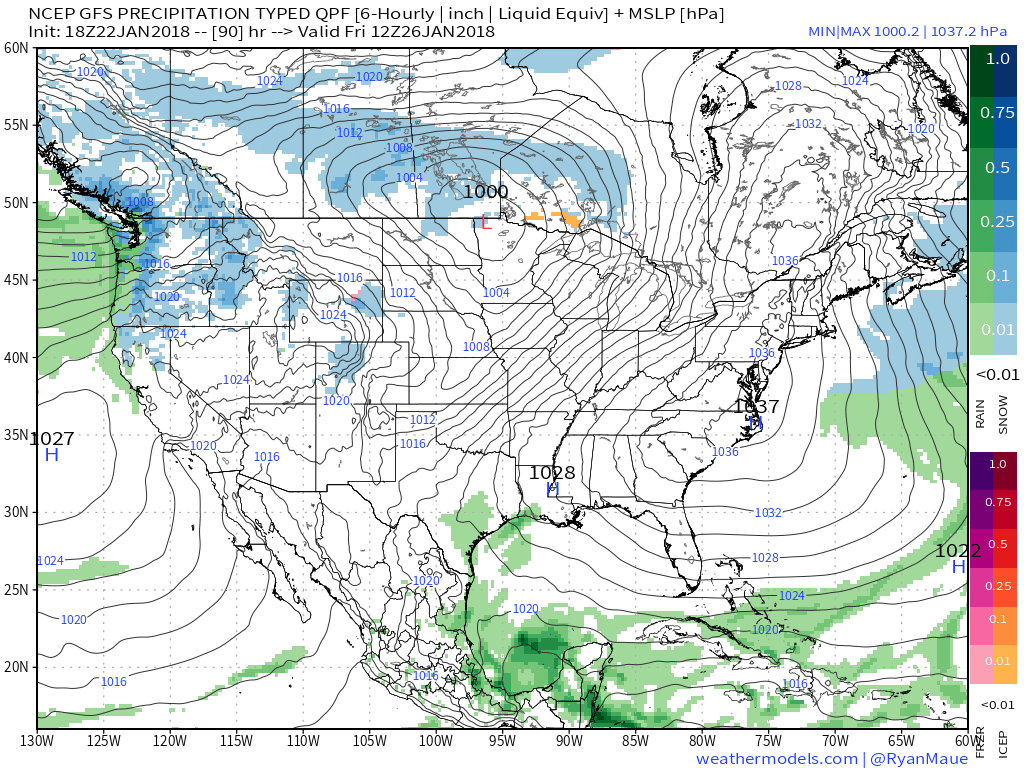 III. Our next storm system will approach late Friday night into Saturday with rain and gusty winds. Models differ on rainfall amounts and we’ll split the difference for now (in general we forecast between 0.25″ to 0.50″, but we’ll keep a close eye on data over the next few days).
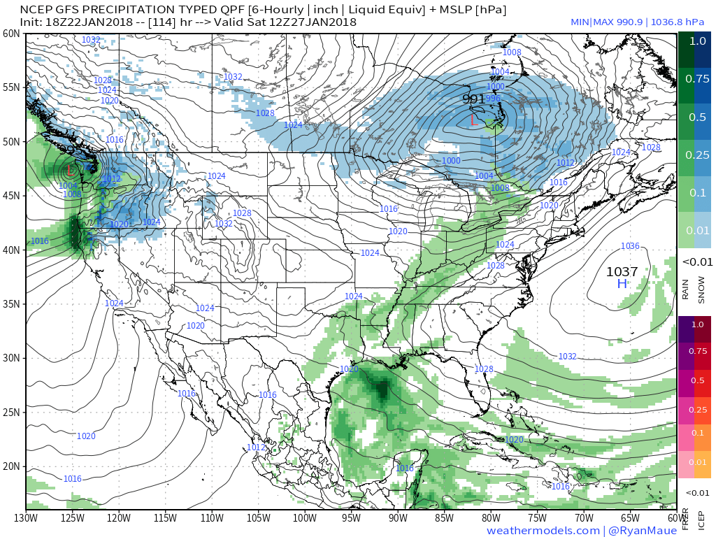 IV. We’ll turn cooler for the second half of the weekend, but the overall pattern is a transient one into next week and overall milder than average. That said, things will begin to change in big time fashion as we rumble into February. Winter is a long ways from being over…
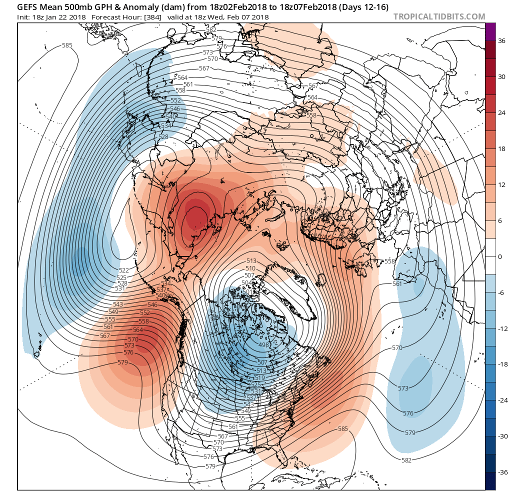
 However, big changes begin to take place this weekend and will remain intact for the majority of the next couple weeks. The mean trough position will back into the west while ridging takes hold across the east. This will feature temperatures that will push to above average values and lead to an active and moist southwesterly flow.
 Over the upcoming (10) days, temperatures may reach 50°, or greater, on 3 to 4 of those days. Compared to how frigid we’ve been (already had 7 mornings this month with sub-zero lows), this will feel like a heat wave.