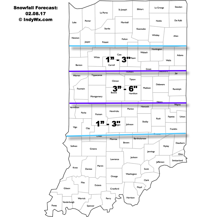
The set-up:
A cold front is stalled across TN and lower Ohio Valleys this morning. Meanwhile, upper level energy is moving out of the north-central Plains. This upper level energy will continue to slide southeast and “feed” a developing surface low along the stalled front by evening. Strong frontogenesis is forecast and this will aid in development of localized heavy snow bands and associated intense snowfall rates by afternoon, continuing into the evening. (If you’re interested in learning more about frontogenesis and it’s impact on winter weather, please read this fantastic paper). Here’s our updated snowfall forecast. Please note snow amounts won’t necessarily follow the clean lines below, but this is our best idea as of now.
 Timing:
We expect initial light to moderate snow to impact northern areas this morning, but it’s not until this afternoon when the “real deal” begins. The onset of heavy snow will set-up just north of the city and the “bulls eye” with this event from a heavy snow perspective may very well paint itself across Indy’s northern suburbs, including several hours of heavy, wet snow from 12p-5p. Moderate to heavy snow will then shift south to encompass the city, itself, mid to late afternoon, including the rush hour. We highly recommend getting home early today if at all possible as the heaviest snowfall rates for the city, itself, will likely center on the evening rush. Things will likely be very, very messy for travel as heavy wet snow falls. In periods of heaviest snow, visibility near zero can be expected, especially just north of the city.
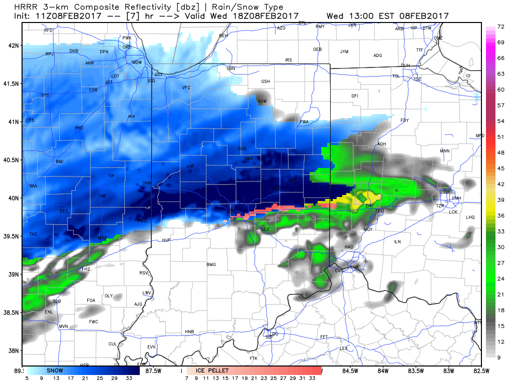
Forecast radar 1p, courtesy of Weatherbell.com.

Forecast radar 4p, courtesy of Weatherbell.com.

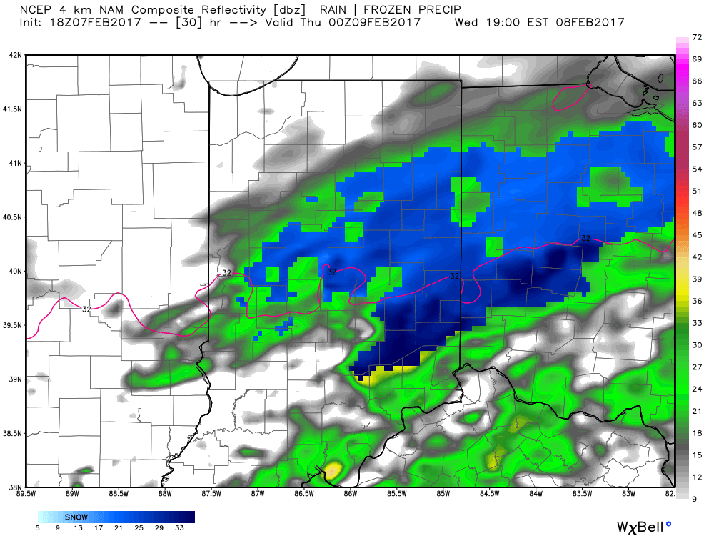
Forecast radar 6p, courtesy of Weatherbell.com.
Snowfall should begin to diminish and pull east between 7p-8p for most of central Indiana. Cold air will follow as lows tonight dip into the middle teens for most with a significant snowpack down. Highs Thursday will only top out around 20.
As always, be sure to follow us on social media (Twitter: @indywx, Facebook: IndyWx.com, Instagram: IndyWxCom) for more updates on the go! Be safe and happy snow to all!
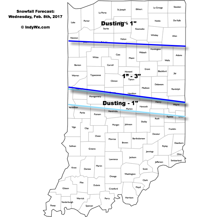 Timing:
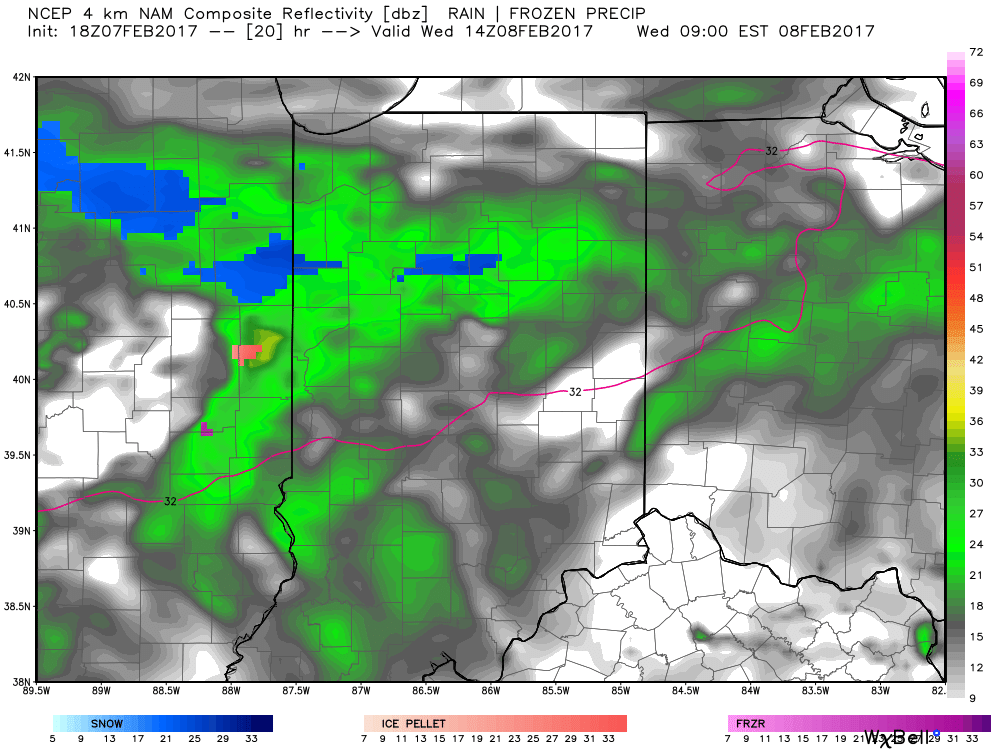 It’s not until we push into Wednesday afternoon and evening that more widespread snow will move through central Indiana, including Indianapolis.
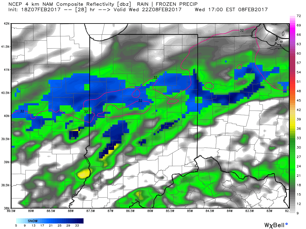
 Periods of moderate to locally heavy snow can be expected through central and north-central parts of the state Wednesday evening, especially between the hours of 3p-7p. This will be a wet snow and though the snowfall intensity should be impressive at times, it’ll have a hard time accumulating from what it otherwise could be if the ground was cold. With that said, we do anticipate snowfall rates to overcome initially marginally cold air and “warm” surface temperatures. Our forecast calls for a dusting to 1″ for the city, itself, increasing to 1″-3″ north of the city- encompassing most of north-central Indiana. Roadways will likely become slushy with wet snow accumulation Wednesday evening.
 However the cold air won’t last and milder times will return by the second half of the weekend. This back and forth “tug of war” type regime will remain as cold and warmth (relative to average) continue to battle over the upcoming couple weeks. The latest European ensemble shows this nicely.
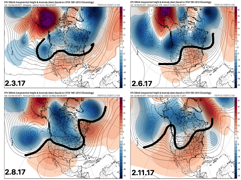 This also favors a rather active pattern and confidence is high on a wetter than average period upcoming over the next couple weeks. See the GFS ensembles support this idea. A couple strong storms are also possible Tuesday.
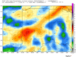
 Unfortunately for snow lovers, the majority of significant moisture should fall as rain. Best snow chances appear to come with “backlash” wrap around snow showers and squalls Tuesday night into Wednesday morning. Accumulating snow is possible, but most amounts should be light. We’ll keep an eye on it.
 Longer-term, the fight continues deeper into the month. As
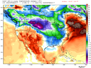
 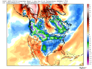 2.) What at one time looked to be a significant weekend storm now may not even deliver any precipitation at all to the region. A flurry is possible, but most should remain precipitation-free this weekend. Expect a gusty southwest wind developing SB Sunday. Highs around freezing Saturday will zoom into the middle 40s Sunday. Lows Saturday morning in the middle 10s will rise into the upper 20s to around 30 Sunday morning.
 3.) A more significant storm system will cut for the Great Lakes early next week and this will deliver gusty showers and embedded thunderstorms. A couple of stronger storms aren’t out of the question. Locally heavy rains can be expected, including amounts of 1″-1.5″ (locally heavier totals).
 4.) Cold air will rush back into the region behind the storm and snow showers and squalls are likely by Wednesday.
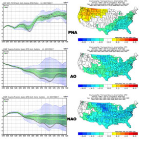
 5.) Longer-term, a real fight is developing on the overall direction we’re heading as February evolves. Analog methods and teleconnections (shown below) would yield bullish cold signals and give hope to winter enthusiasts. However, modeling isn’t in agreement on the wintry ideas. In fact, some modeling is very spring-like as mid-Feb nears. Stay tuned as we try and iron out the details this weekend. Updates will come.