
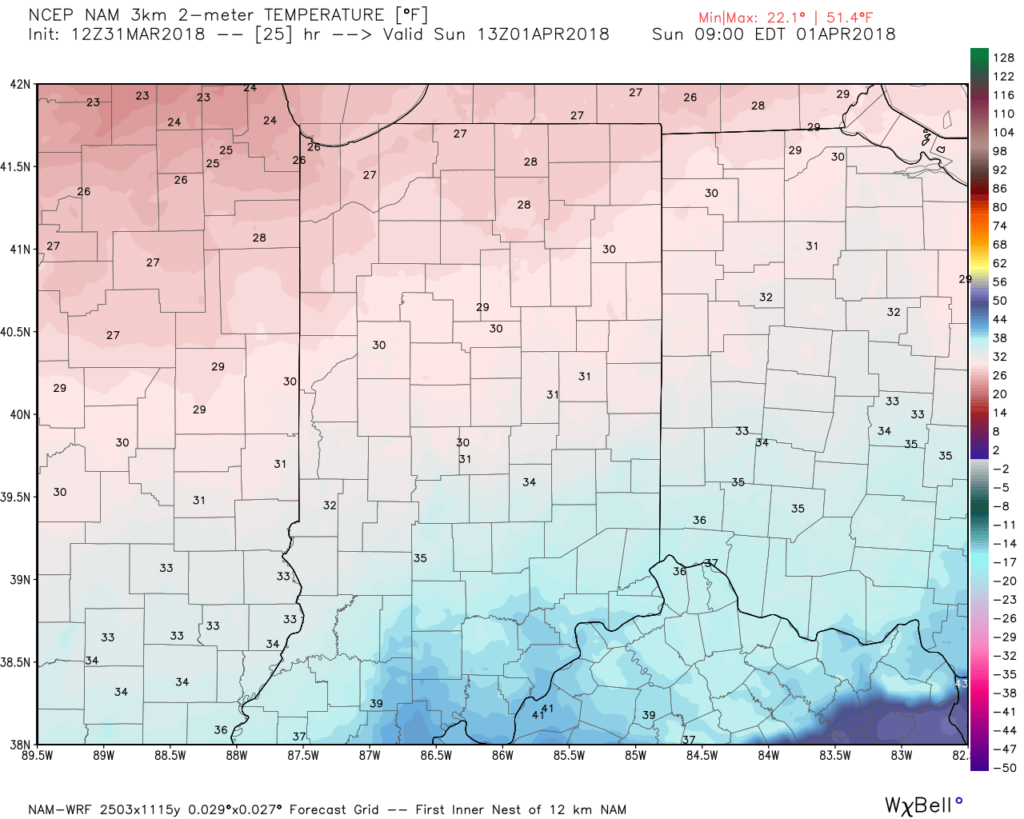
A cold front will blow through central Indiana this evening and colder air will spill into the region overnight. We’ll wake up with temperatures in the upper 20s to lower 30s Easter morning with dry conditions in place.
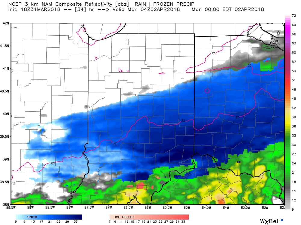
 Most of the daytime Easter Sunday will feature dry conditions. Clouds will increase, lower, and thicken through the afternoon ahead of an area of low pressure that will track through the lower Ohio Valley Easter night. This will spread precipitation into central Indiana towards 5p-6p. Initially, precipitation is likely to begin as a cold rain, but we expect a rather quick transition to wet snow shortly after the onset. Periods of moderate to heavy snow will fall into the nighttime across the I-70 corridor. This will lead to reduced visibility and slick travel as snowfall rates will (once again) overcome marginally cold surface and pavement temperatures. If you must travel tomorrow night and early Monday, expect roadways to be slick at times- including being slush and snow covered.
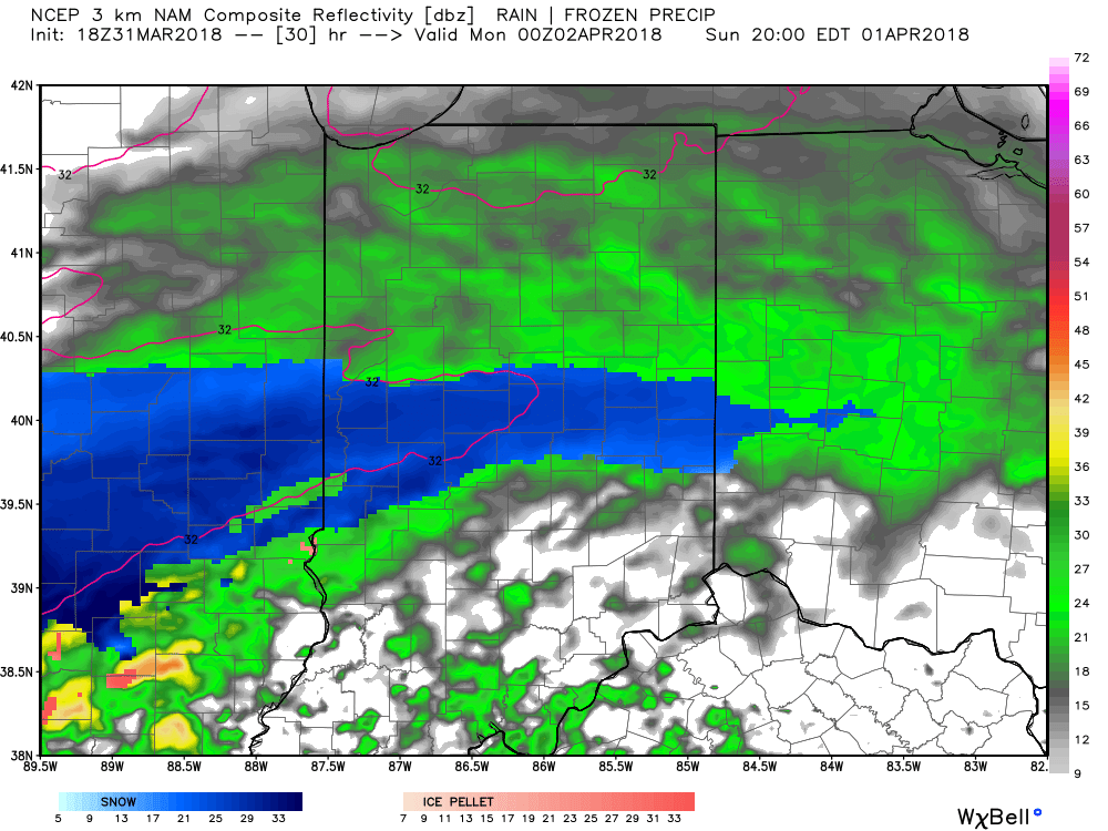
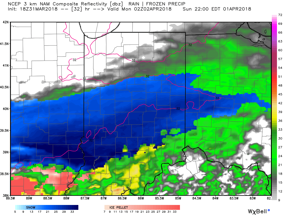
Here’s an idea of what the radar may look like tomorrow night, courtesy of weatherbell.com:
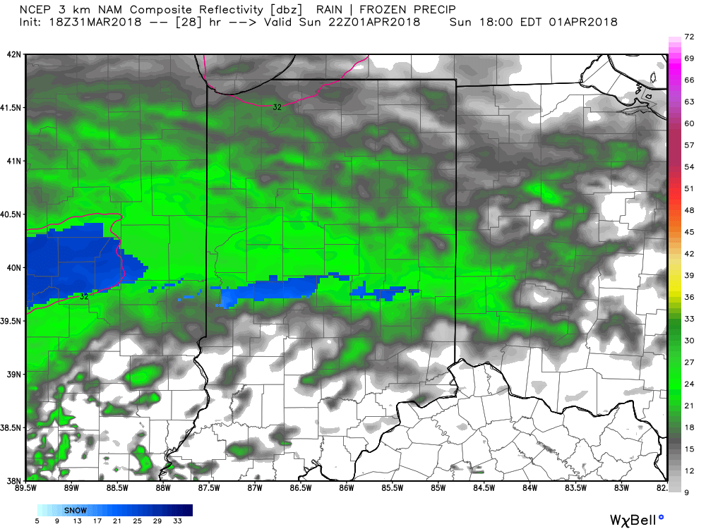
6p forecast radar
8p forecast radar
10p forecast radar
12a forecast radar Monday
This will be a rather quick-hitting event, but “thump” potential is written all over it, including localized intense banding. These localized bands could result in a couple of reports of 4″+ in spots. We think heaviest snow falls in the 6p-midnight window.
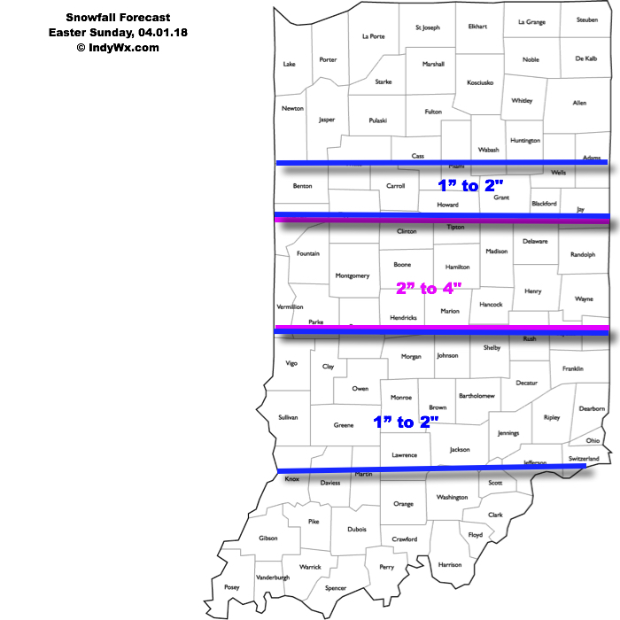
Our current snowfall forecast:
 Another winter event is possible next weekend, including the potential of additional accumulating snow. Should we get snow down, the possibility of near-record cold is present with the late season blast of arctic air next weekend. Lows in the 10s aren’t out of the question at least one night next weekend- likely Sunday.
 As we look ahead, a wet week is in store for the region. Periods of widespread rain, heavy at times, will come at us in waves:
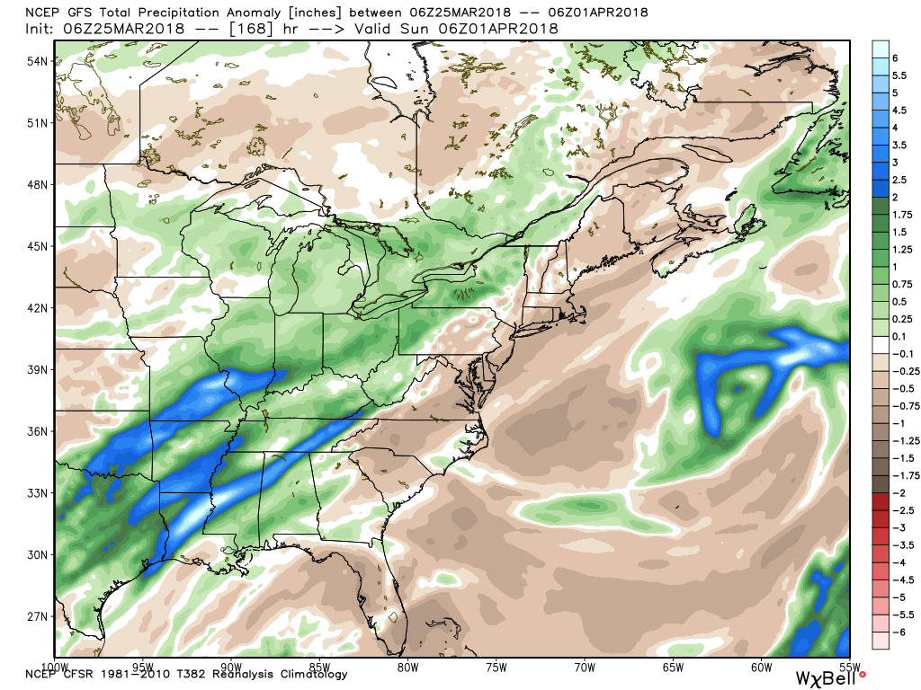 After a brief relaxation in the unseasonably cold regime, well below average temperatures are expected to return as we move through early April. It’ll feel more like winter than spring through the better part of the first half of the month.
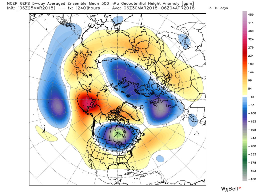
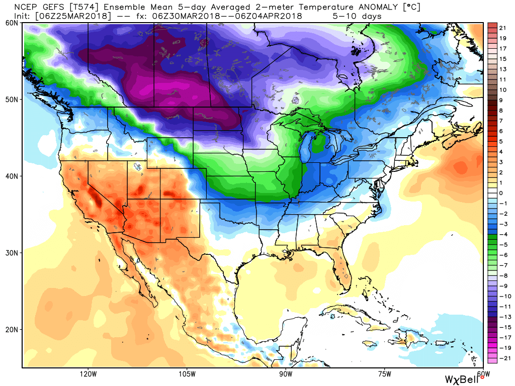
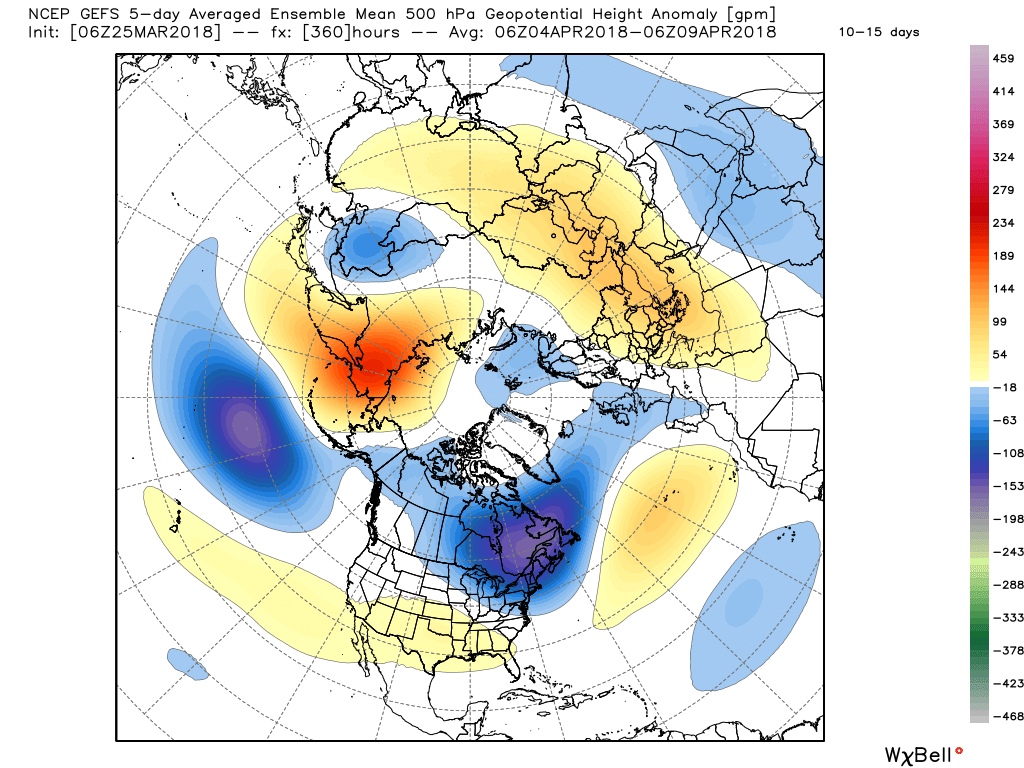
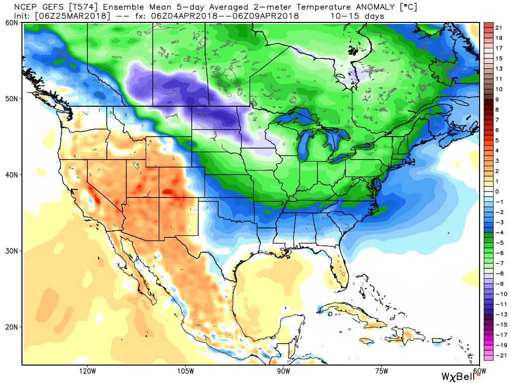 It’s also too early to think about yesterday as the last snow of the season. Given the early April look, it wouldn’t surprise us if an additional snow event or two came along…
 The early spring “fling” has lulled many into believing winter’s finished. While the worst of the winter is certainly behind us, we continue to think a dose of “reality” awaits as we progress through the better part of the first half of March. To be more specific, we feel the period March 6th through the 20th will offer up below average temperatures and an active pattern- capable of producing wintry threats.
 Sure enough, modeling is going to the pattern that will produce below normal temperatures (doesn’t appear to be anything particularly frigid, but colder than average, nonetheless) through mid-month.
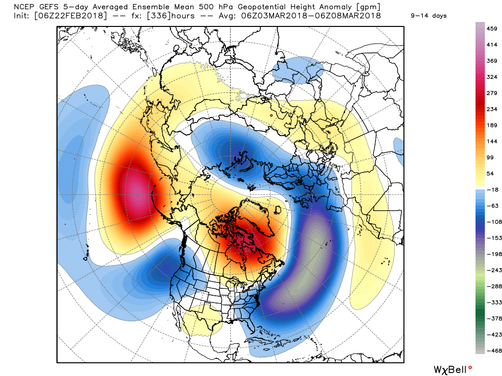
 With blocking in place, an undercutting jet will serve to deliver an active storm track.
 Keeping in mind March winter events need multiple items to come together to create impactful situations, it’s also important not to simply “buy in” to the idea that just because it’s been warm lately that winter is finished. March can be a wild month, as long-time Hoosiers are aware. The pattern we’re heading into over the next 10-14 days is one that’s been void most of the winter (high latitude blocking in place) and can serve as the player needed to flip a “nuisance” variety late-winter event to one that’s much more significant. We’ll need to remain on guard for the potential of one or two “more significant” wintry events as we move through the first couple weeks of the month.
 The end result is one that should promote colder than average times over the next couple weeks, overall, along with an active storm track. With blocking in place, the potential of one or two more significant late-winter events are on the table, and we’ll have to fine tune specifics as the individual storms come. While confidence is high that someone within the Ohio Valley region is likely to still deal with a big-hitter event, there’s no way to get specific until the individual players are on the field. Thereafter, the pattern should begin to transition to one more conducive for “stick and hold” spring conditions during the latter portion of the month.
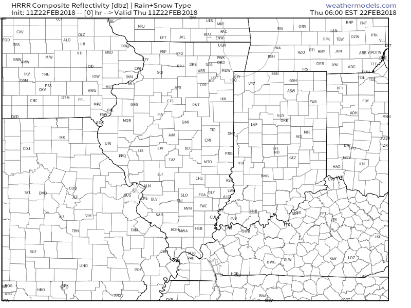 Embedded thunderstorms may target southern Indiana late tonight and Friday morning before more widespread thunderstorms (a couple could become strong) Saturday. The Storm Prediction Center (SPC) has included the southern half of the state in a “marginal risk” of severe thunderstorms Saturday.
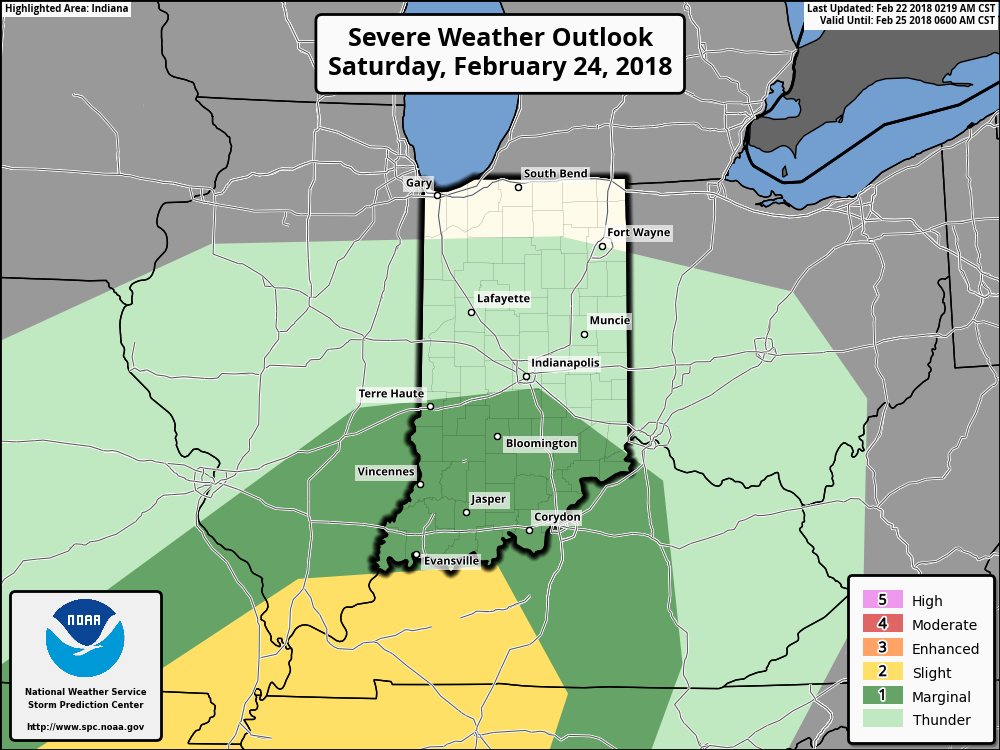 All total, additional rainfall between now and Sunday morning should reach 2″ to 3″ across a widespread portion of the southern half of Indiana with locally heavier amounts.
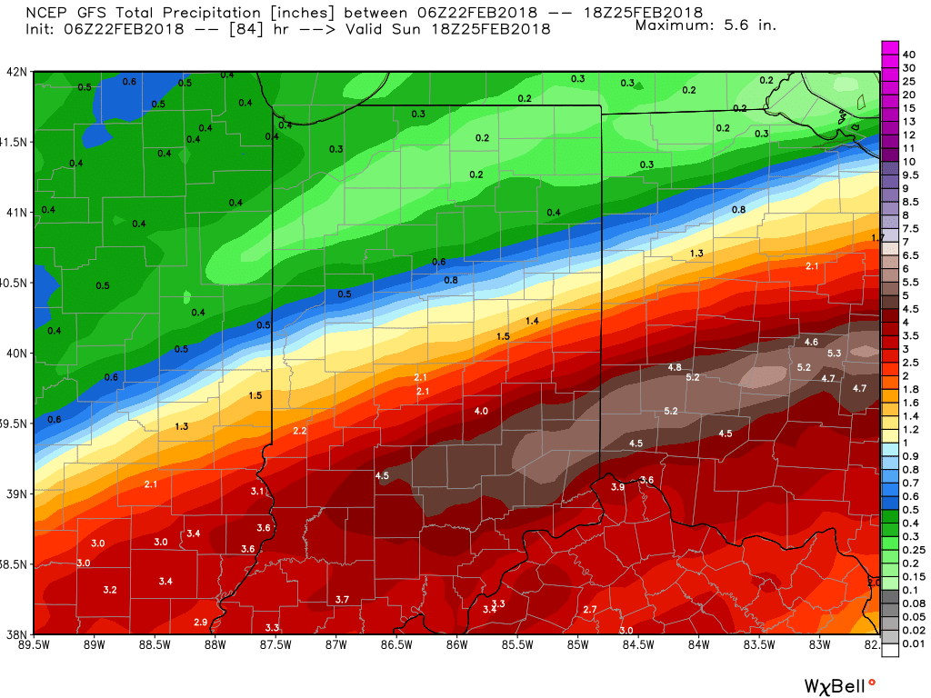 We’ll finally dry things out as we close the weekend and head into early next week as high pressure settles overhead.
 Next week will begin a pattern transition from the unseasonably warm weather we’ve enjoyed as of late to a colder regime for the first half of March. We note models continue to tank the NAO and AO.
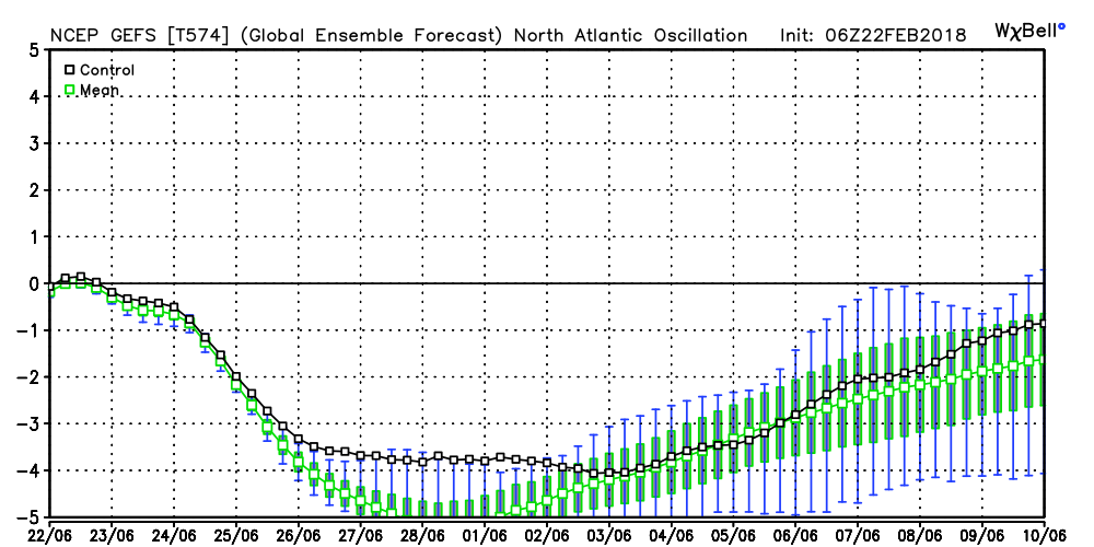
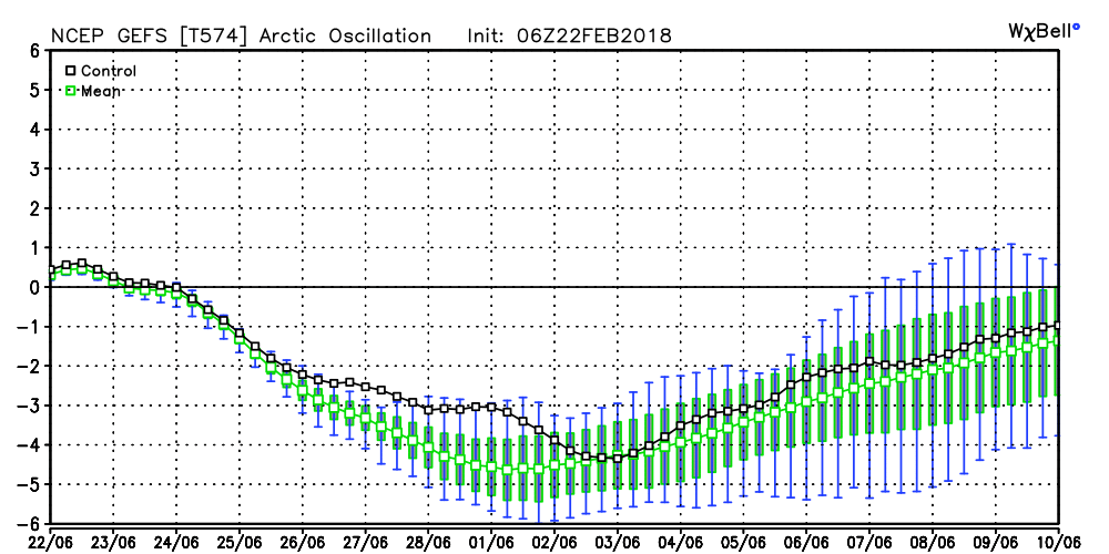 Accordingly, the models are seeing the trough and associated colder than average pattern returning to the eastern half of the country as we rumble through the first half of March. With such a strong block in place, this can turn into an active pattern for a couple weeks to go along with the cold. Both the GEFS and EPS agree on the overall look.
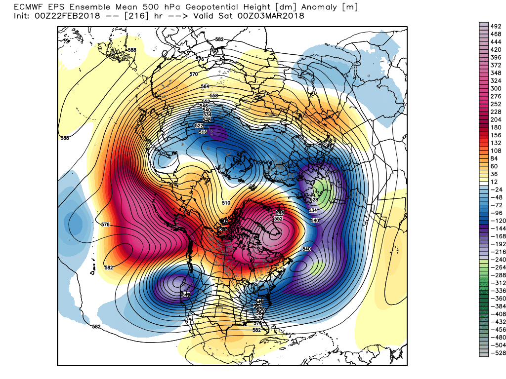
 While there’s no way to get specific on the individual storm threats that will eventually come with this pattern, the potential is present for a few storms to “bowl” underneath the block through the first 10-15 days of the month. Each storm will have the capability of delivering wintry precipitation, but this can also be a tricky time of year where most, if not all, ingredients need to come together to create significant wintry events. In a winter that’s been frustrating to central Indiana snow lovers (frigid, but dry first half and milder, wetter second half), perhaps it would be fitting to get a couple good snow dumps in March (when most are wanting and ready for spring)…
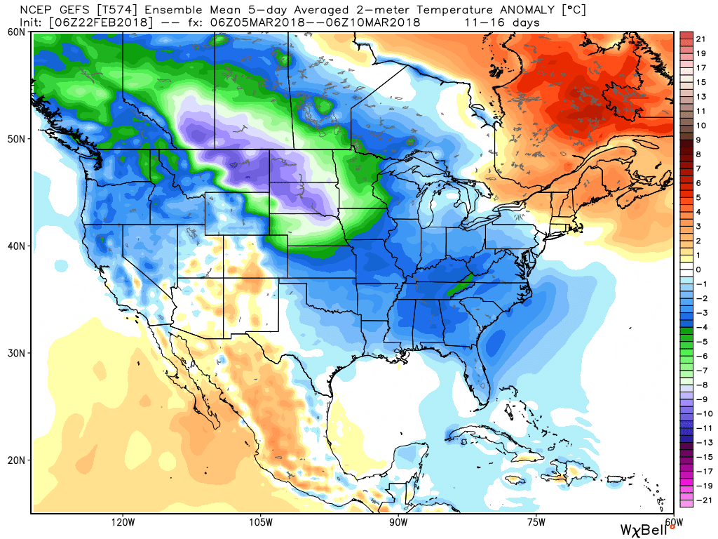
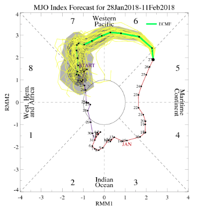 As we look at today’s MJO plot note how we’ve meandered about Phase 7 much longer than initially expected. Also (still) note the attempt to move into the colder phases towards the end of the period, which we’ll talk about here in a bit.
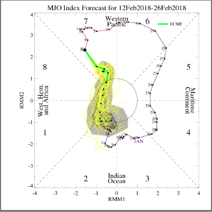 The result has been a cold north-central that has “bled” into the Ohio Valley, while the immediate eastern seaboard and especially southeast has already gotten off to a warm to blow torch start to the month.
 Looking ahead, there’s no denying the overall warm pattern (relatively speaking) over the upcoming couple weeks. Phase 7 will continue to do work on the pattern.
 Obviously this is right in the heart of when we thought the colder MJO phases would combine with favorably cold teleconnection signals to produce a period of frigid weather. Instead, cold shots will be fleeting and any sort of winter weather threats of significance will be few and far between over the next 10-14 days. In short, Phase 7 will overrule the colder teleconnection signals that will evolve over the period.