You must be logged in to view this content. Click Here to become a member of IndyWX.com for full access. Already a member of IndyWx.com All-Access? Log-in here.
You must be logged in to view this content. Click Here to become a member of IndyWX.com for full access. Already a member of IndyWx.com All-Access? Log-in here.
You must be logged in to view this content. Click Here to become a member of IndyWX.com for full access. Already a member of IndyWx.com All-Access? Log-in here.
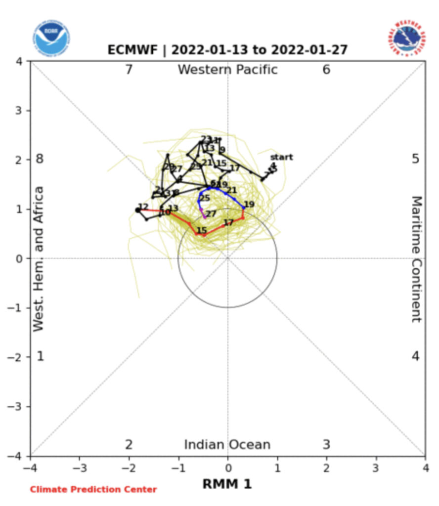
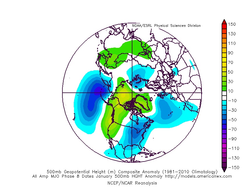
The primary driver (the Madden Julian Oscillation, or MJO) will be in a favorable phase to allow colder than average temperatures to take up residence across the eastern part of the country as we close out January. To no surprise, these particular phases favor positive heights over the high latitudes (blocking) which helps drive more of a persistent colder than normal pattern.
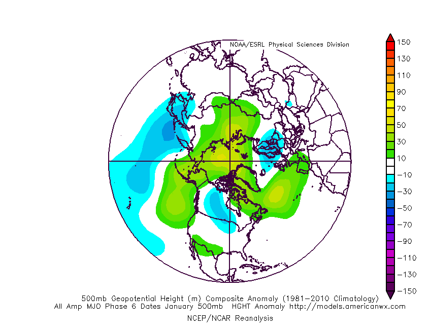
We’ll keep an eye if the MJO gets stuck in the neutral phase, but the “loop” around into Phase 6 this time of year would continue to favor cooler (to colder) than normal conditions across our portion of the country.
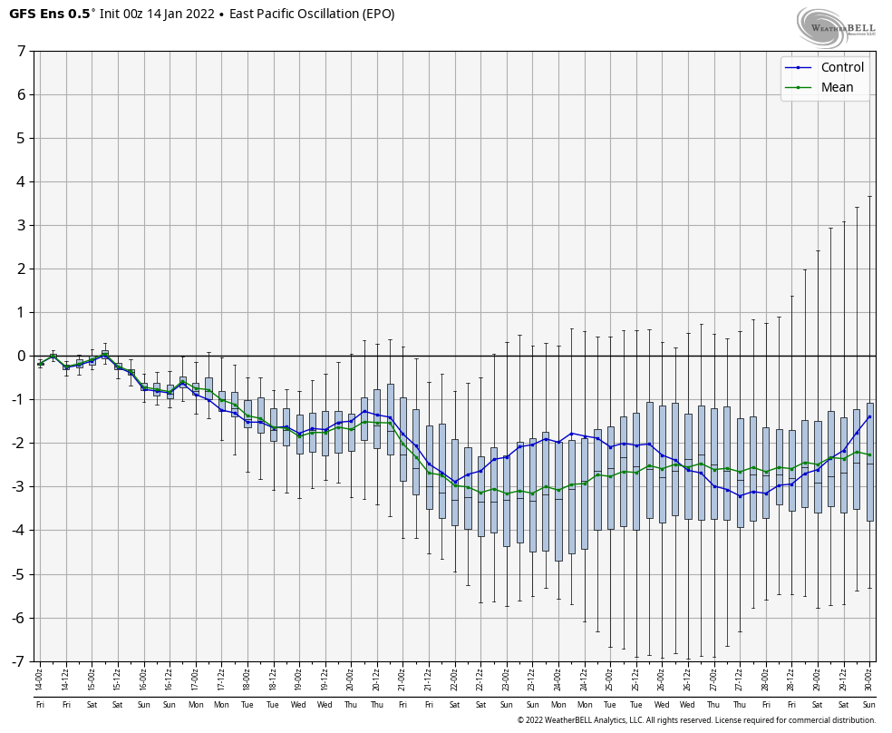
That brings us to our teleconnections. The “big 3” (this time of year include the AO, EPO, and PNA) are also all in favorable position to deliver a colder than normal pattern to close January.
One could also build a case that February would at least open colder than normal based off a combo of the above (MJO and teleconnections) and we agree with that idea, but do believe a “flip” in the regime is ahead after the first week, or so, of the month to milder times.
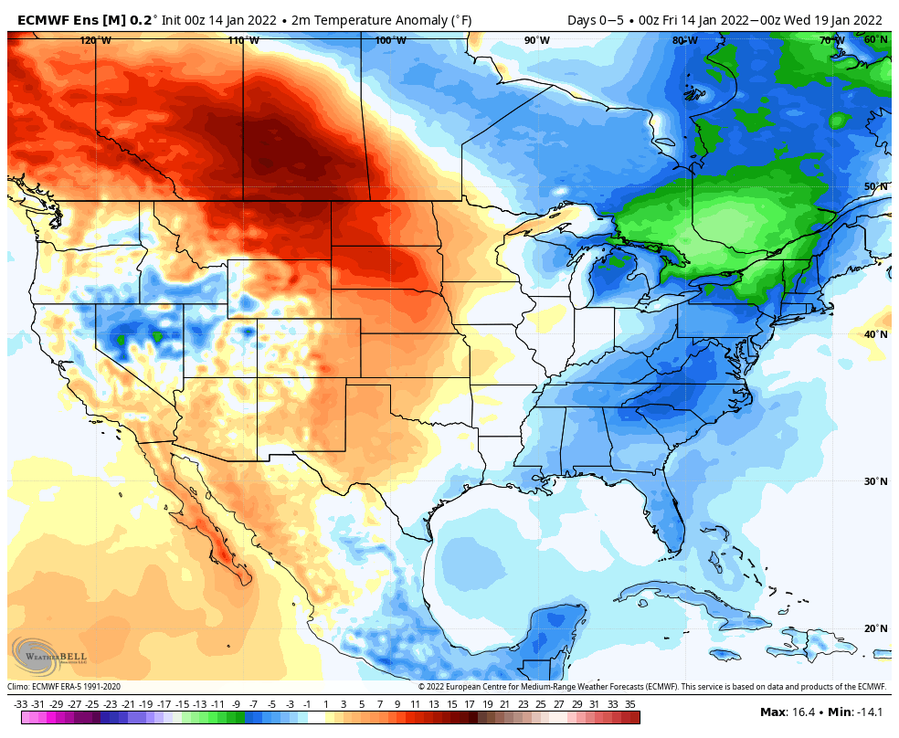
To no surprise, modeling is showing this cold close to the month.
The opportunity is present for Week 2 to be bitterly cold, as the European is hinting above. Sub-zero temperatures are on the table, especially if we can get some snow down.
Speaking of snow, this pattern should produce a couple opportunities for central Indiana to get in on the act before the end of the month, or beginning of February. Despite the incredibly slow start to the season, take any one particular solution with a grain of salt when looking at operational guidance 2 weeks out.
You must be logged in to view this content. Click Here to become a member of IndyWX.com for full access. Already a member of IndyWx.com All-Access? Log-in here.