Updated 12.12.22 @ 2:50p
You must be logged in to view this content. Click Here to become a member of IndyWX.com for full access. Already a member of IndyWx.com All-Access? Log-in here.

Dec 12
Updated 12.12.22 @ 2:50p
You must be logged in to view this content. Click Here to become a member of IndyWX.com for full access. Already a member of IndyWx.com All-Access? Log-in here.
Permanent link to this article: https://indywx.com/video-monday-afternoon-update-on-the-2nd-half-of-december/
Dec 09
Updated 12.09.22 @ 4:45a
You must be logged in to view this content. Click Here to become a member of IndyWX.com for full access. Already a member of IndyWx.com All-Access? Log-in here.
Permanent link to this article: https://indywx.com/lr-update-pattern-discussion-through-december-and-into-january/
Dec 02
Updated 12.2.22 @ 5p
In the modern era of social media wx, I can’t recall a time when the North Atlantic Oscillation (NAO) has received so much focus. The only problem is we aren’t in the period when the NAO can be labeled as a “primary driver” of the pattern, even when it’s as negative of a state as it’s currently in and forecast to remain over the upcoming couple weeks. If this were late Jan through mid-March, I would be banging the drum (and loudly) for the impacts of such a strongly negative NAO.
Long time followers of the site know that we lean heavier on various teleconnections over another based on the time of the year. Late fall through the first half of winter, our research has shown the Pacific North American pattern (PNA) and East Pacific Oscillation (EPO) can have a much larger impact on a given pattern than the NAO or AO. Of course, the Madden Julian Oscillation (MJO) always rules when in an amplified state. If bored one night, you can read a lot more about all of the teleconnections here. 🙂
The relatively mild start to the month was expected. We’re in a fast west to east “zonal” flow pattern right now and that will continue through the next few days, at least. Any one particular storm system (or airmass) won’t last long with such a flow. The thinking here is that the PNA eventually trends more neutral to positive and the MJO swings into the more traditionally cold phases to drive a progressively colder time of things east and south Dec. 5 through 15, followed by a much colder (and more persistent) regime for the 2nd half of the month, into early January. One suggestion for those that like to watch each and every model operational model run, expect wild swings and changes from one run to the other. This is normal during transitional periods. From this distance, there’s still no way to be able to confidently say a particular storm system will be rain, snow, or a mix of both.
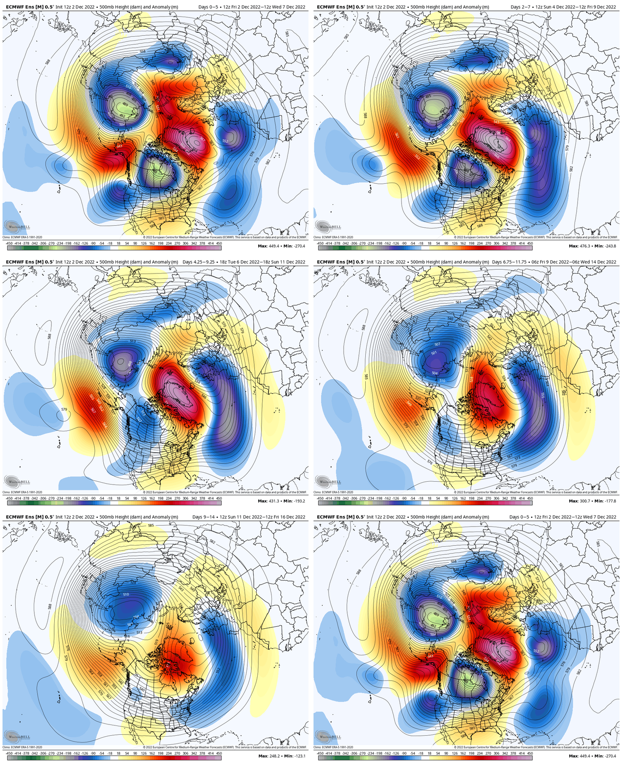
Ensemble guidance remains bullish on the progressively colder regime evolving through the month.

The trough gets “tucked” into the eastern US by Day 8 and beyond, and that’s really when the fun is likely to begin, including further south and along the eastern seaboard for the lead up to Christmas this year.
Note by the Day 10-15 period how the cold is widespread across the country as a whole, including into the Deep South where the warmth will be most notable over the upcoming week, thanks to the negative PNA.

As the high latitude blocking remains, this is a pattern that will turn quite stormy, as well. The thought here is that the OHV storm track over the upcoming week to 10 days shifts south during the period after for a while, opening up others deeper into the South and East for the threat of wintry “fun and games” as well come mid and late December. I would anticipate a rather expansive snowpack being established by mid and late month, and potentially further south than normal for so early in the season.
For fans of cold, wintry weather, let’s just hope the NAO wants to play “nice” and go negative come late winter and into the spring. 😉 Unfortunately, I think when we will be at the time of year to fully capitalize on such, it’ll be in a warm phase, but one can hope, right?
Permanent link to this article: https://indywx.com/teleconnection-chatter-friendly-reminder-that-the-nao-isnt-king-this-time-of-year/
Nov 30
Updated 11.30.22 @ 5:46p We’ll have our weekly long range update tomorrow, but wanted to post some thoughts around the December pattern and respective ideas this evening. First and foremost,…
You must be logged in to view this content. Click Here to become a member of IndyWX.com for full access. Already a member of IndyWx.com All-Access? Log-in here.
Permanent link to this article: https://indywx.com/trying-to-remain-grounded-with-the-december-pattern/
Nov 15
Updated 11.15.22 @ 7:43a
You must be logged in to view this content. Click Here to become a member of IndyWX.com for full access. Already a member of IndyWx.com All-Access? Log-in here.
Permanent link to this article: https://indywx.com/video-short-term-snow-update-pattern-drivers-that-should-dominate-the-bulk-of-this-years-holiday-season/