Updated 06.07.24 @ 7:47a We couldn’t ask for more pleasant and refreshingly cool conditions for this time of year than what we’ve got at present. Even cooler air will descend…
You must be logged in to view this content. Click Here to become a member of IndyWX.com for full access. Already a member of IndyWx.com All-Access? Log-in here.
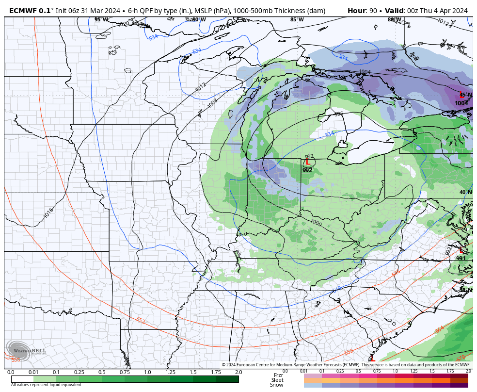
While we have a couple of storm systems to track in the upcoming week, the majority of the heavy rain and severe weather will remain confined to areas west of here- mostly throughout the Plains and into the upper Mid West. In short, the immediate-term has “more bark than bite.”
The overall long range look reflects a lack of any sort of stagnant regime, locally, and it also doesn’t show that we’ll have to endure much in the way of “extremes” over the upcoming 3-4 week period from a temperature or precipitation perspective. – A good sign as Plant24 hits its true stride.
Week 1
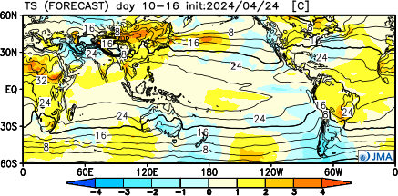
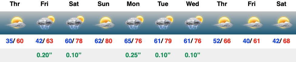
The JMA and European are in agreement that this period will feature warmer than normal temperatures and near average rainfall. Of note, we’re tracking storm systems that will impact our weather Friday, Saturday, and again Monday and Tuesday.
Week 2
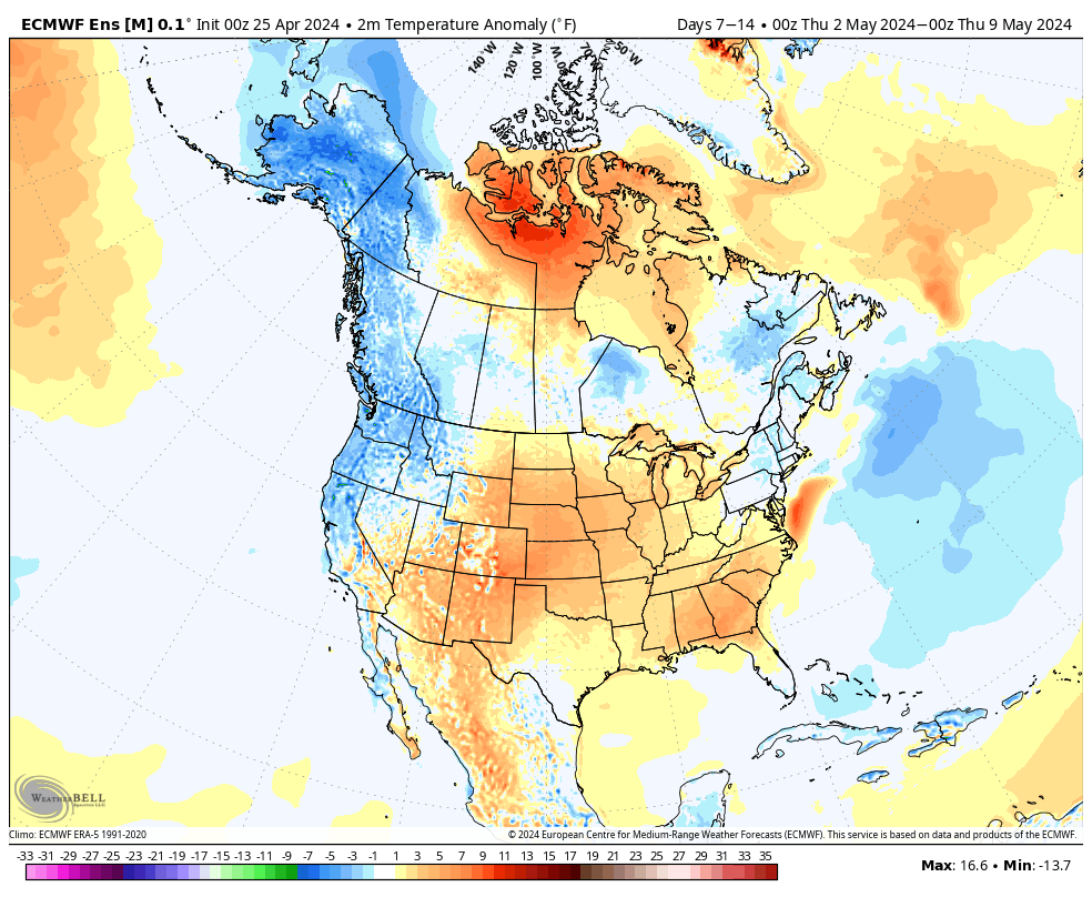
We note guidance getting more bullish on an East Coast trough beginning to develop during this time period. While likely averaging out slightly above normal as a whole in Week 2, I’d also plan on a few days of cooler air (type of stuff that could send us to around 40° at night and low-mid 60s during the day) around the Day 8 – 10 time frame. The period should once again feature timely rains, but nothing far off from the average.
Weeks 3-4
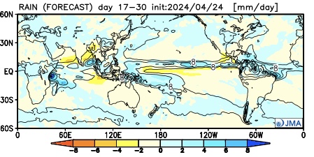
It’ll be interesting to watch what the European Weeklies do later today during this time frame, but the JMA is highlighting a more unsettled (wetter) pattern for now in the middle to latter part of May. Near to slightly below average temperatures and widespread above normal rains are being shown. (We’ll update this period after reviewing today’s European Weeklies).
While unseasonably warm air will build in here early next week, don’t put away the cold weather gear just yet. We’re likely even looking at additional frost threats as we get towards late next weekend and/ or early Week 2. More details below in this week’s #AGwx and #Severe Weather Outlook.
“Transitional” is the word to describe the upcoming couple weeks worth of weather around these parts. The warmth to open the period will cool significantly next weekend and early Week 2, only to give way to renewed warming late April.
Note the roller coaster in the temperature anomalies over the next couple of weeks.
The active pattern in the week ahead will dry significantly late in the forecast period as the cooler airmass takes hold.
In the more immediate term, we’re tracking 2 storm systems in the week ahead: Tuesday – Wednesday and again Thursday night into Friday.
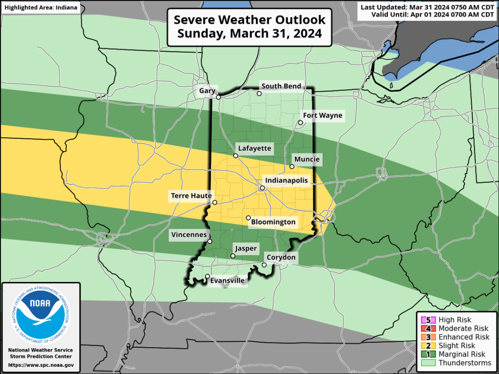
The Storm Prediction Center includes western Indiana in a risk of severe weather Tuesday. We’ll monitor for the potential of a further east extension of this risk area.
We think (2) rounds of storms are on deck Tuesday. The first round likely is associated with a warm front lifting north through the state Tuesday morning (hail threat) followed by a second round of activity Tuesday night into Wednesday morning (main concern being damaging straight line winds with this round). As of now, storm total rainfall amounts of 0.50″ to 1″ seem likely during this timeframe.
Another round of showers and embedded thunder will precede a blast of chilly air next weekend. We bracket Thursday night into Friday morning for this particular round of rain. An additional half inch, or so, of rain seems reasonable from this distance.
By the time we get to next weekend and early Week 2, drier and much cooler, more stable air should take up residence.
We note the warm open, chilly finish in the 10-day meteogram. Also note the frost threat at the end of this period.
We’re running a little more than 3° below normal to open the month, but changes are in the offing. The majority of the upcoming 7-day period should feature seasonal to above normal temperatures and that will likely only strengthen into the Week 2 timeframe.
Unfortunately, we have a big rain event set to unfold as we roll through the middle of the week. Rain (more “showery” in nature) will continue as we close out the work week before a gorgeous Saturday.
The recent chilly open to April will begin to transition to a warmer look over the upcoming week. Slightly cooler air Friday will give way to a significant warm-up through the weekend and into Week 2.
Our expected active spring will remain intact over the next couple weeks, including an overall above average look in the rainfall department.
In the short-term period, this is highlighted between what falls Wednesday-Friday.
Though severe weather won’t be a concern, heavy rain will during the aforementioned timeframe. We still think widespread 1.5”+ amounts are likely for many area rain gauges. As of now, severe weather isn’t expected, locally, based on the SLP track. Further east into Ohio, a few severe storms will be on the table. We’ll monitor for any last minute west adjustments leading into the system.
Widespread, soaking rains will turn more “showery” in nature Friday before dry air takes firm control and provides a pleasant Saturday.
Don’t get used to the dry weather. Despite the warmer trend, another round of rain and storms can be expected the 2nd half of the weekend into early next week.
Upcoming *10-Day Rainfall Projection: 1.5” to 2.5”
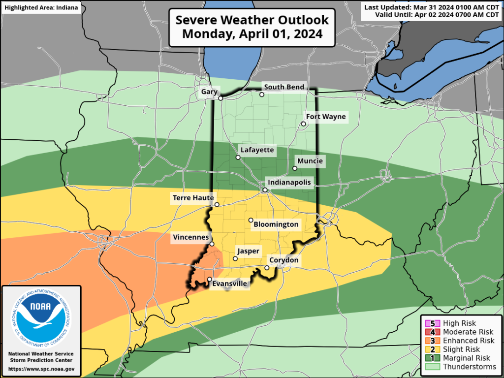
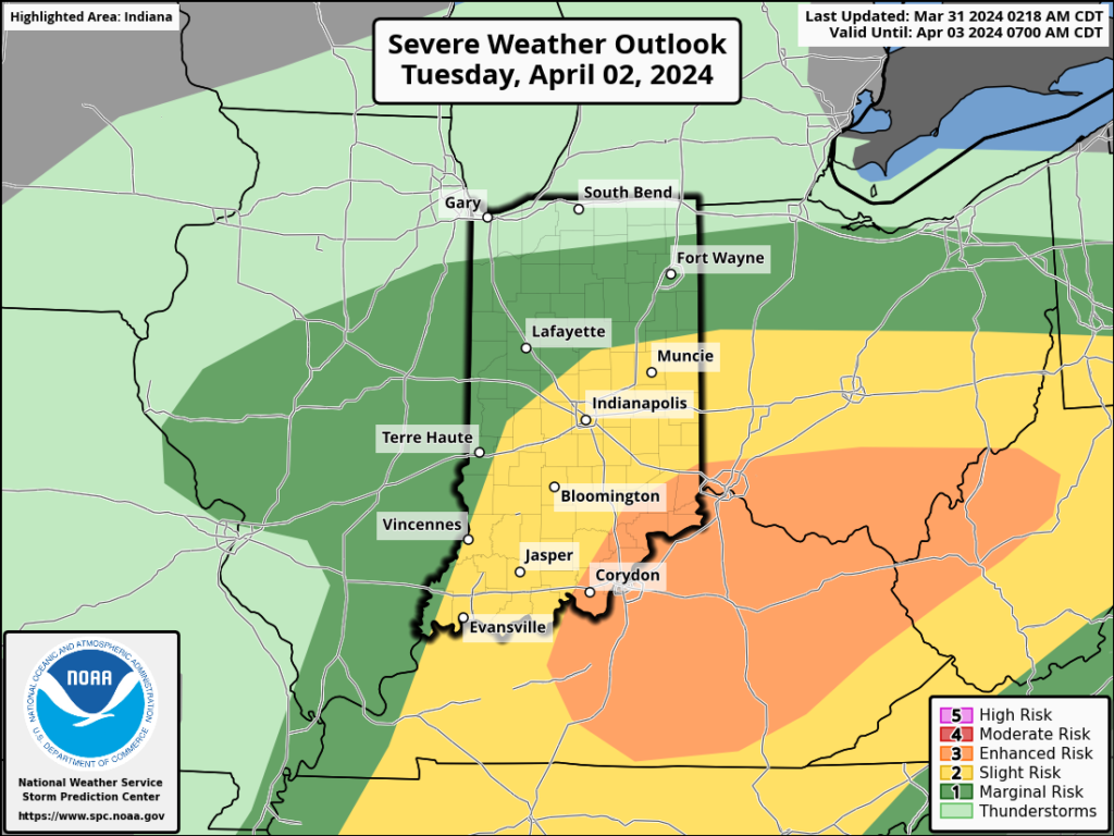
The upcoming immediate term will be headlined by a multi day heavy rain and severe weather episode. A stalled frontal boundary will serve as the pathway for multiple waves of low pressure to ride along through Tuesday. In addition to a heavy rain and flooding threat (primarily targeting immediate central and north-central Indiana), we’ll also likely have to deal with (3) rounds of severe storms. We’ll allow our short-term products to handle those severe threats, but just know all modes of severe are on the table with the greatest emphasis being on large hail with this setup. Should a couple discrete cells develop near or just south of the boundary then an elevated tornado threat would ensue. Again, we’ll have a fresh post hoisted later this afternoon or evening on that.
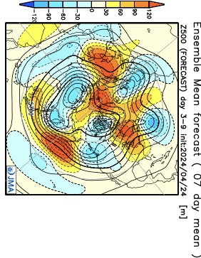
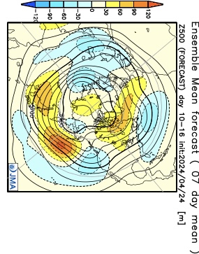
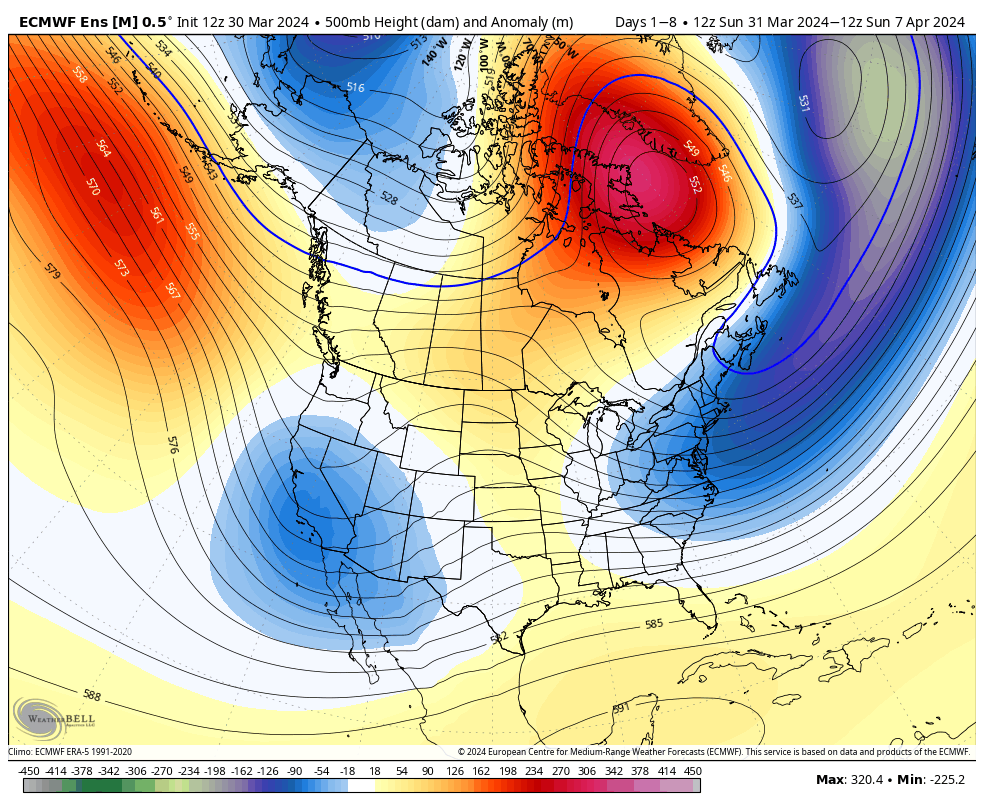
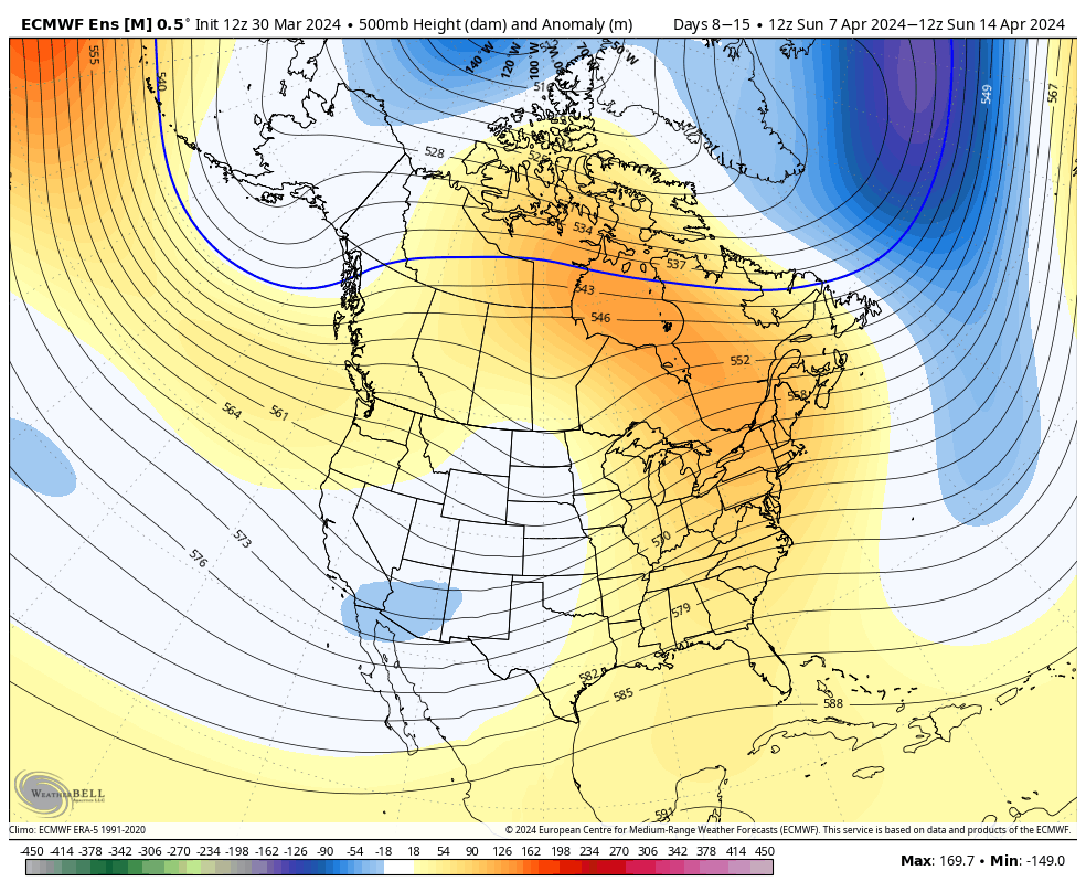
Overall, there’s no change in the idea of an active pattern continuing from Week 1 (image 1 below) into Week 2 (image 2 below).
The cooler pattern behind our early week storm system will reverse in significant fashion Week 2. – Transitional regime at its finest.
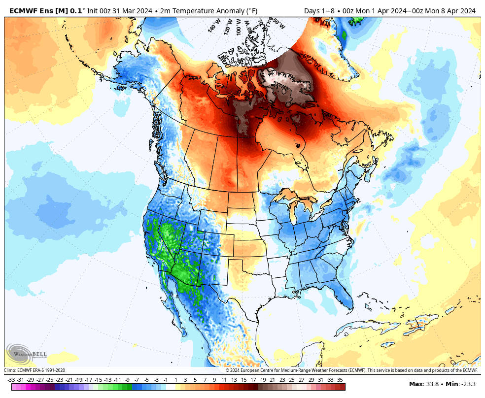
Week 1 temperature anomalies
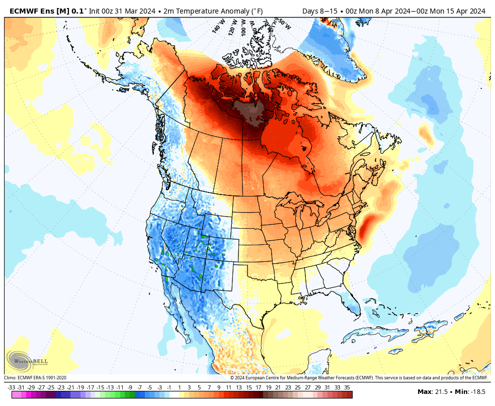
Week 2 temperature anomalies
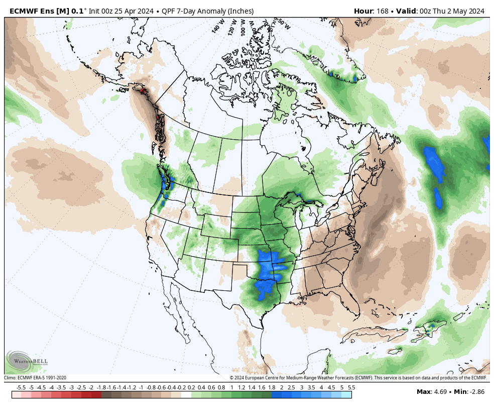
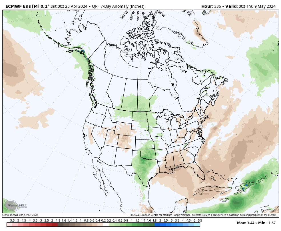
The busy nature of the pattern is reflected in the upcoming 2 week precipitation anomalies.
Severe weather will be possible at least across a portion of our immediate viewing area starting this evening and continuing daily through Tuesday.
Colder air will crash in here Wednesday and as an upper low swirls overhead, wet snow will develop. Snow may even fall heavily enough to accumulate on grassy surfaces in spots Wednesday night into Thursday morning.