Updated 06.07.25 @ 8:16a Most of our Saturday will be free of any rain and very pleasant. An approaching disturbance will help push a complex of showers and embedded thunder…
You must be logged in to view this content. Click Here to become a member of IndyWX.com for full access. Already a member of IndyWx.com All-Access? Log-in here.
Updated 06.01.25 @ 7:59a Cool, Canadian high pressure will remain in control of our weather as we wrap up the weekend. Morning lows fell deep into the 40s this morning…
You must be logged in to view this content. Click Here to become a member of IndyWX.com for full access. Already a member of IndyWx.com All-Access? Log-in here.
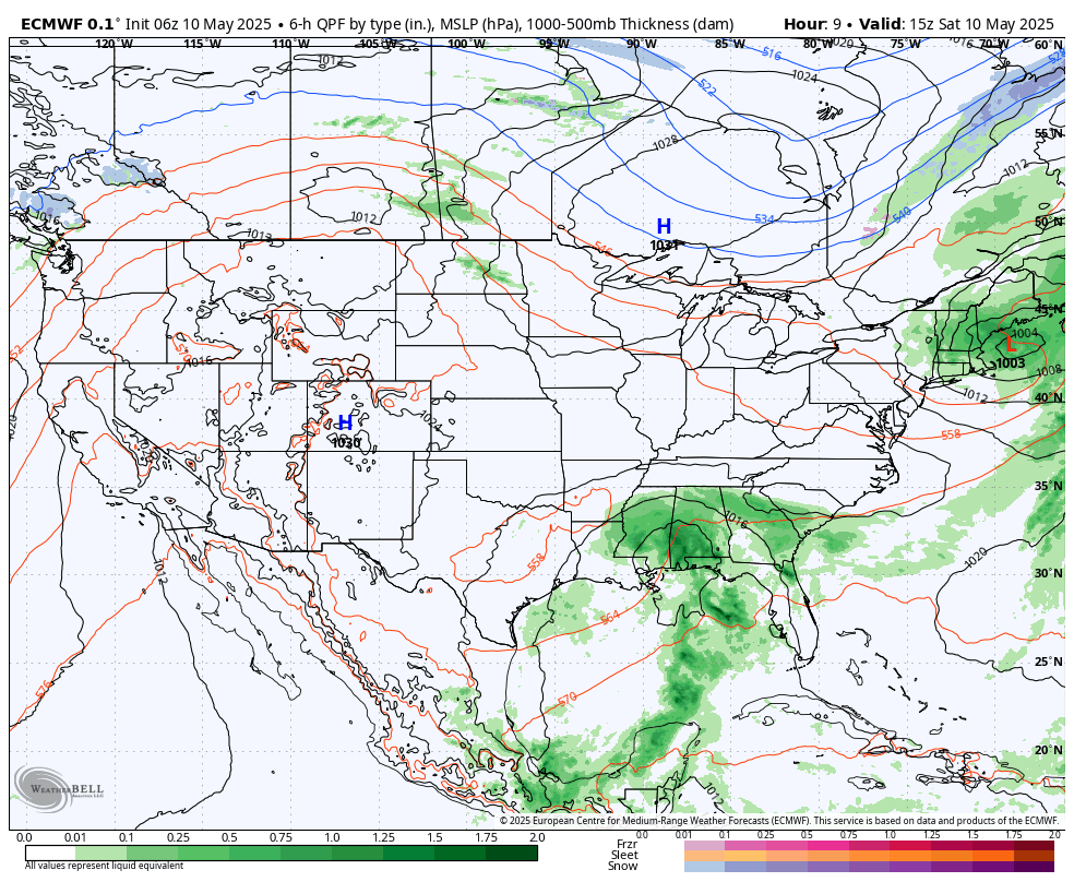
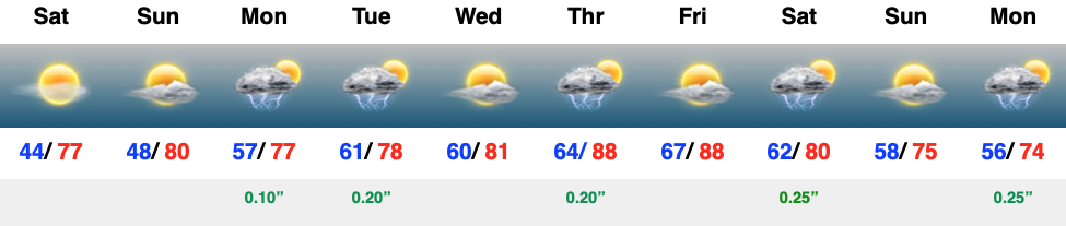
Mother’s Day weekend couldn’t be any more spectacular! High pressure will support plentiful sunshine and pleasant temperatures today that will warm to around the 80° mark for Mother’s Day, itself.
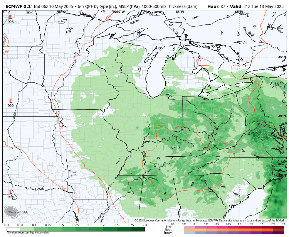
That same storm system you see off to our south this weekend will lift north through the early part of the work week and present an opportunity for scattered showers and embedded thunder to return around these parts Monday and Tuesday.
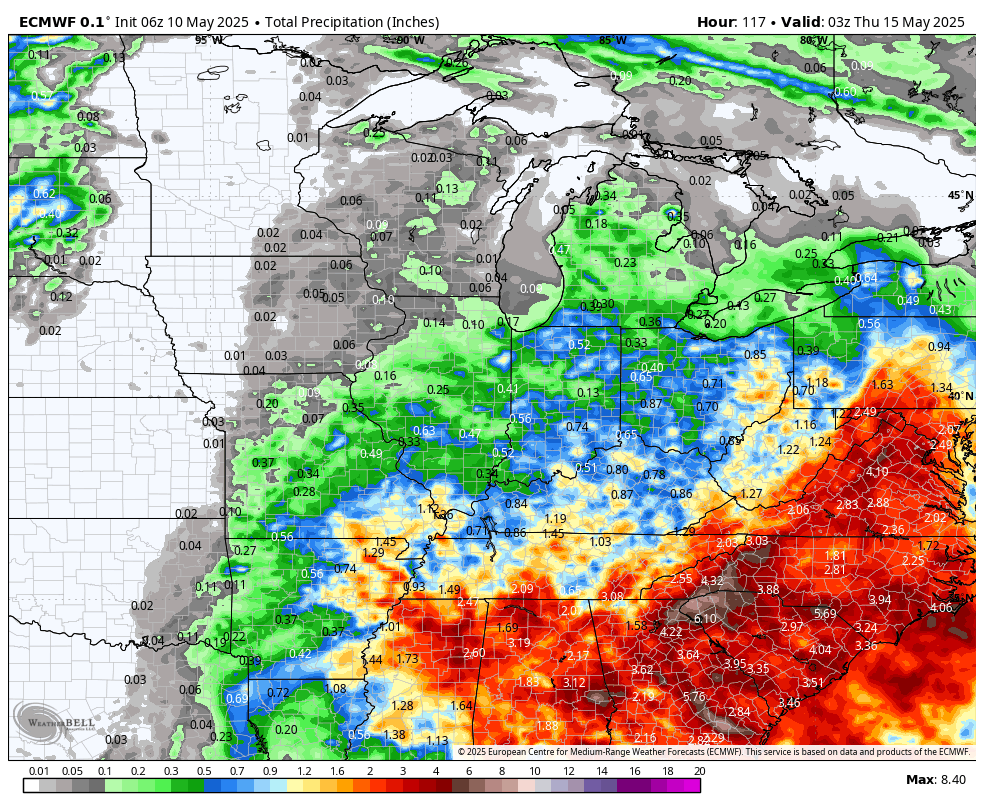
0.25″ to 0.50″ should be most common during this time period, but there will be some localized 0.50″ to 1″ amounts.
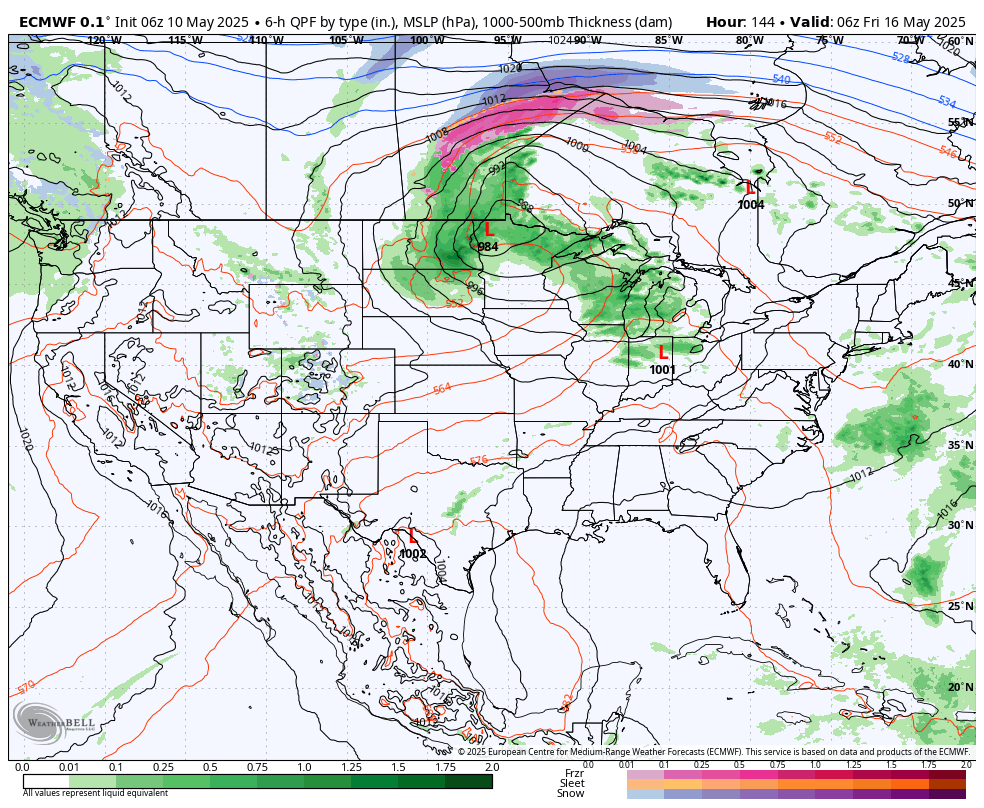
A cold front will approach late week with the opportunity of stronger storms. Could a few of these be severe Thursday? Yes, but still too far out for specifics. We’ll also really notice an uptick in warmth and humidity as we close the work week (some communities will flirt with the 90° mark).
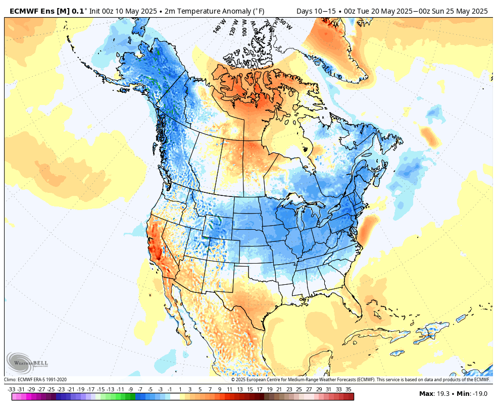
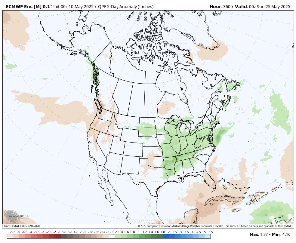
Looking further ahead, out towards the all-important Memorial Day/ Indy 500 weekend shows a pattern that will generate a cooler and likely wetter time of things, relative to normal. We’ll be able to start getting more specific regarding Memorial Day weekend late next week.
Updated 05.03.25 @ 7:33a A stubborn “cut off” low will meander around the Ohio Valley throughout the weekend and early stages of the work week. This means our region will…
You must be logged in to view this content. Click Here to become a member of IndyWX.com for full access. Already a member of IndyWx.com All-Access? Log-in here.
Updated 04.27.25 @ 8:20a The upcoming 7-day period will run slightly wetter and milder than normal across the Ohio Valley. We forecast between 1.5″ and 2″ of rain to fall…
You must be logged in to view this content. Click Here to become a member of IndyWX.com for full access. Already a member of IndyWx.com All-Access? Log-in here.