 Highlights:
- Scattered storms
- More concentrated; heavier rain this weekend
- Drier to open the work week
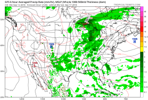
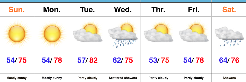
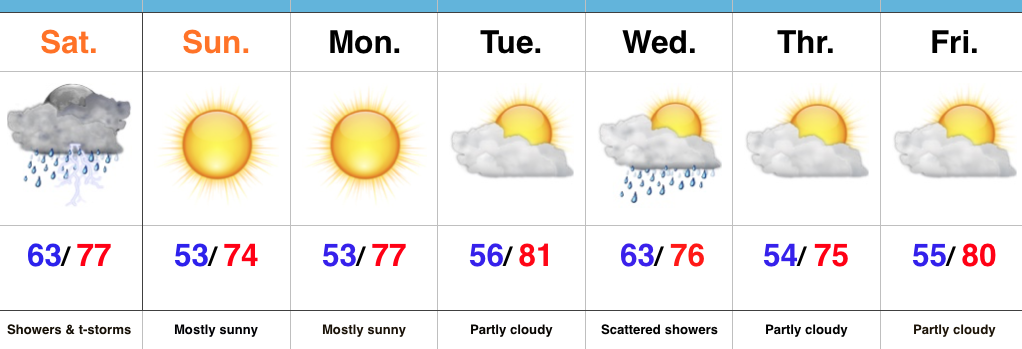
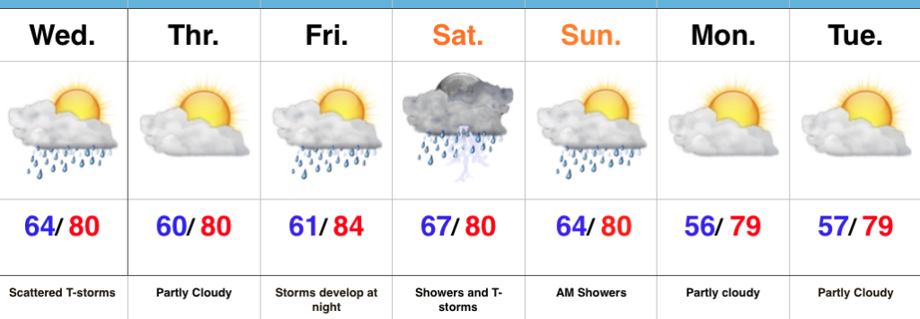
Scattered Storms Around…A weak frontal boundary will kick up a couple of scattered storms today. While rainfall totals won’t be uniform (some may not even see any rain at all), a couple of heavier downpours are a good bet. We’ll notice a drier and slightly cooler air mass overnight into Thursday.
The dry time won’t last long as a more significant storm system approaches this weekend. Most of the daytime Friday should be dry, but rain and storm chances will increase Friday night and Saturday continues to look wet with periods of showers and thunderstorms. Morning showers will impact portions of the region Sunday before we dry things out Sunday PM. Dry times continue to open the new work week.
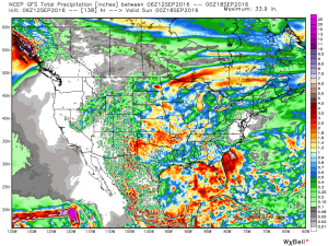
Upcoming 7-Day Precipitation Forecast:
- Snowfall: 0.00″
- Rainfall: 1.00″-1.50″
 Temperatures are running slightly below average, locally, with cooler anomalies across the Northeast.
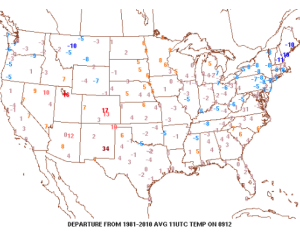 High pressure will remain entrenched over our region today and supply dry conditions and pleasant humidity levels.
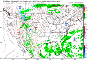 Our next storm system will push in Wednesday and as the cold front sags south through the state, it will spark scattered showers and possibly a thunderstorm.
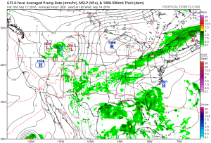 Reinforcing cool air will move in behind the front for a couple days. Lows in the lower-middle 50s with highs in the upper 70s.
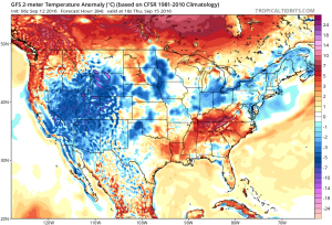 As we flip the page to the weekend, it still looks rather damp Saturday as another boundary moves in. This will have more moisture to work with when compared to Wednesday and rain coverage will be more widespread. As a whole, (7) day rainfall totals should be in the 0.50″-1.00″ range for most.