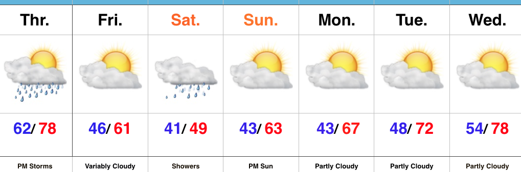
Thursday Storms Before A Cooler Trend…
 Highlights:
- Strong storms possible Thursday afternoon
- Cooler close to the work week
- Raw Saturday
- Delightful open to next week
Thursday Rumbles…While storms have pressed through the northern portions of the state today, we’ve enjoyed a couple days of pleasant weather across most of central Indiana. That will come to an end Thursday as scattered to numerous showers and thunderstorms develop, especially during the afternoon into the evening hours. A few of these storms could become strong-to-severe, including damaging wind and large hail potential. The cold front will pass Thursday night and help usher in a briefly drier and much cooler air mass to close out the work week.
Our next storm system will pass south of the region Saturday and result in thickening and lowering clouds Friday evening, and showers Saturday. With a stiff east wind, showers at times, and temperatures well below average, we have the makings for a downright “raw” spring day Saturday. The second half of the weekend will easily be “the pick” as we return to drier air and increasing sunshine Sunday afternoon.
Early next week looks to get off to a pleasant start, including plentiful sunshine and moderating temperatures.
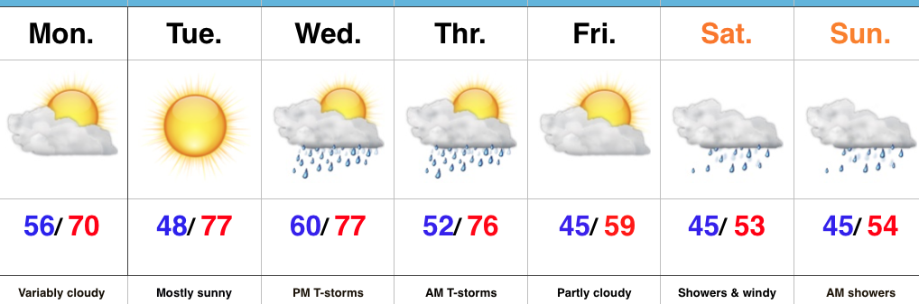
Upcoming 7-Day Precipitation Forecast:
- Snowfall: 0.00″
- Rainfall: 0.75″ – 1.25″
 Highlights:
 Highlights:
 Highlights:
 Highlights: