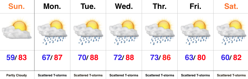
Heavy Rain; Strong Storms This Week…
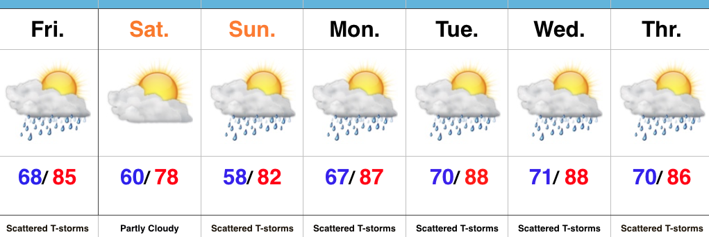
 Highlights:
- Beautiful Sunday
- Multiple rounds of heavy rain and storms through the work week
- Cooler next weekend
Gearing Up For Busy Times…We’ll wrap the weekend up on a pleasant note with plentiful sunshine and low humidity. Enjoy it as active times loom…
We’ll begin to notice an increase in humidity as early as tonight and there’s a chance some of our far western counties could get in on a shower or thunderstorm this evening into the nighttime. Better coverage of showers and thunderstorms will come in waves beginning Monday and continuing through the majority of the work week. Individual disturbances moving southeast will have ample energy and moisture to work with and it won’t take much for storms to become severe in this kind of set-up. Dew points will reach “oppressive” levels Monday into Tuesday (70°+) and precipitable water values will exceed 2″ at times. Accordingly, where storms “train” there’s the potential of 3″-6″ of rain by week’s end.
While we can’t shut off rain and storm chances, we can introduce cooler and drier air working in here by the weekend. Despite the drier, more refreshing feel, an active northwest flow will remain and a secondary cold front may sweep through the state Saturday, sparking additional showers and storms.
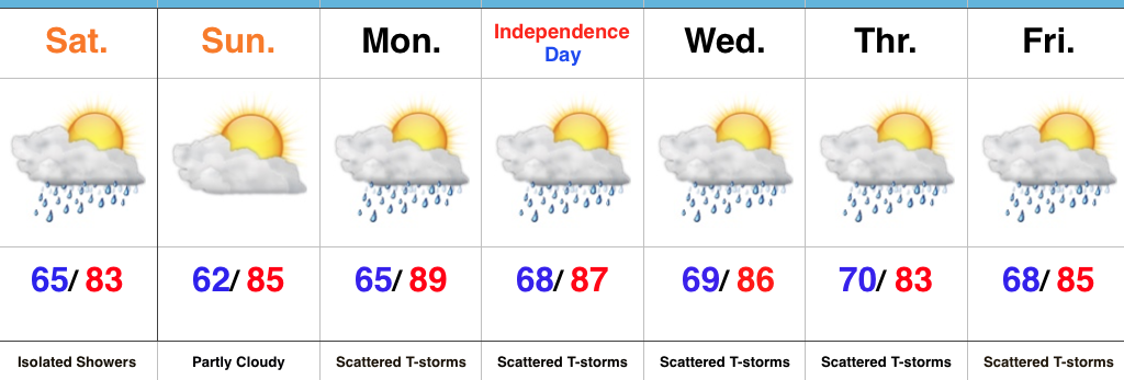
Upcoming 7-Day Precipitation Forecast:
- Snowfall: 0.00″
- Rainfall: 2″-3″ (locally heavier amounts)

 Highlights:
 Highlights:
 Highlights: