Dry Pattern Continues; Cooling Off For The Weekend…
 Highlights:
- One more summer-like day
- Fall-like weekend
- Dry weather continues
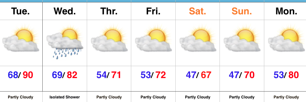
Cooler Air Inbound…We have one more sultry day to get through as highs near record territory Tuesday with partly cloudy conditions prevailing. A frontal boundary will slip through the state Wednesday, but moisture will be limited with the frontal passage. If you pick up a quick shower Wednesday count yourself lucky. Most will remain rain-free. Cooler air will then settle into the state as we head into the weekend. If you have plans to head out to the pumpkin patch or apple orchard, ideal autumn weather will greet you!
Looking ahead, a new warming trend will develop next week and there’s no significant rainfall in sight, unfortunately.
Upcoming 7-Day Precipitation Forecast:
- Snowfall: 0.00″
- Rainfall: 0.00″ – 0.10″
 Highlights:
 Highlights:
 Highlights:
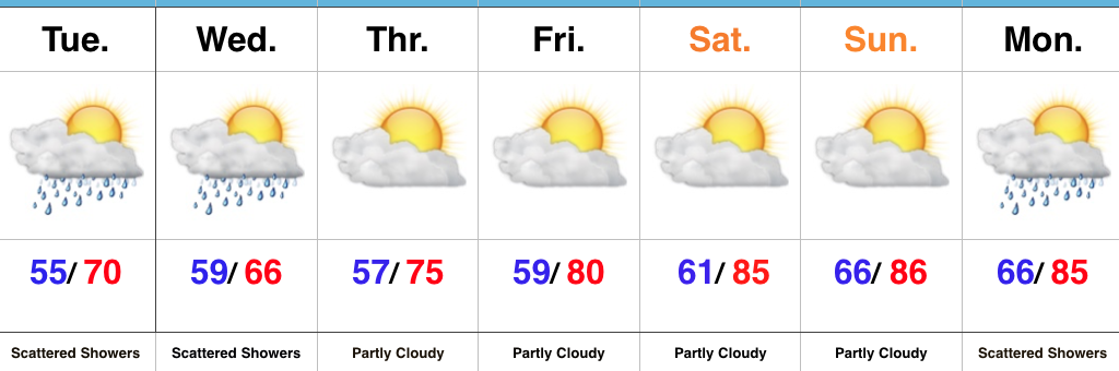 Highlights: