Not Much Sunshine In This Forecast…
 Highlights:
- Milder times
- Unsettled heading into the weekend
- Colder next week and remaining unsettled
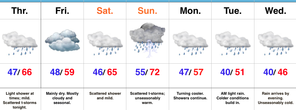
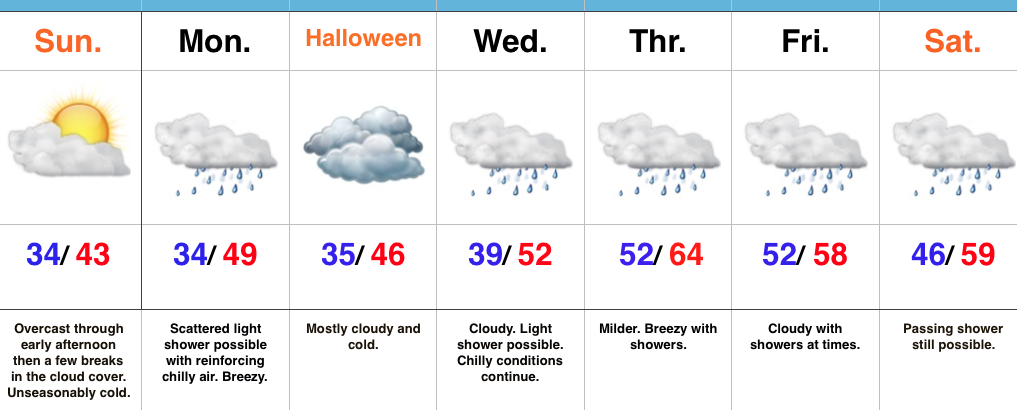
Vitamin D Needed…While we’re going through a milder stretch of weather between now and the end of the weekend, it’ll come with considerable cloudiness and periods of rain at times.
Most of today will only feature light passing showers and mist, but a clap or two of thunder can be expected tonight as a cold front passes through the state. The air mass behind the front won’t be particularly cold and a seasonable day is on tap to wrap up our work week Friday.
A warmer southwesterly air flow will return this weekend and this will help boost temperatures to levels as much as 15° above average Sunday. Scattered showers can be expected Saturday into Sunday and we’re monitoring the potential of a stronger storm Sunday afternoon and evening. You’ll want to stay tuned for future updates on Sunday’s storm threat.
As we rumble into a new work week, the active and wet pattern will continue and we’ll add a colder feel to the equation, as well. Monday through Wednesday will feature a “step down” regime: seasonable conditions Monday before turning colder than normal Tuesday and Wednesday.
Upcoming 7-Day Precipitation Forecast:
- Snowfall: 0.00″
- Rainfall: 1.00″ – 1.50″
 Highlights:
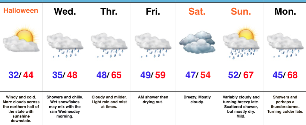
 The upcoming few days will feature additional unseasonably chilly conditions before moderating through the second half of the week.
 This will feature a hard freeze for central Indiana tonight. We dipped to the first 32° temperature of the season here at IndyWx.com HQ this morning and will likely beat that Halloween morning. Widespread upper 20s to around 30° can be expected.
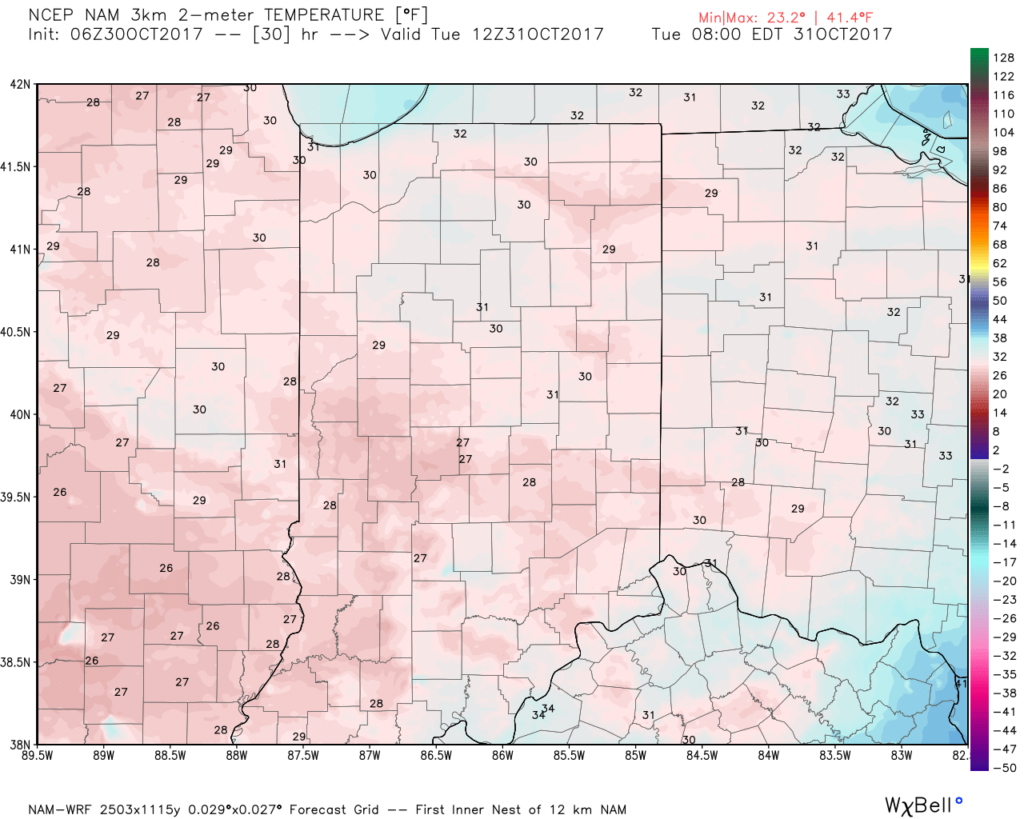 This cold air is thanks to a cold front and reinforcing chill that will feature a band of showers that scoots through the state late morning into the early afternoon.
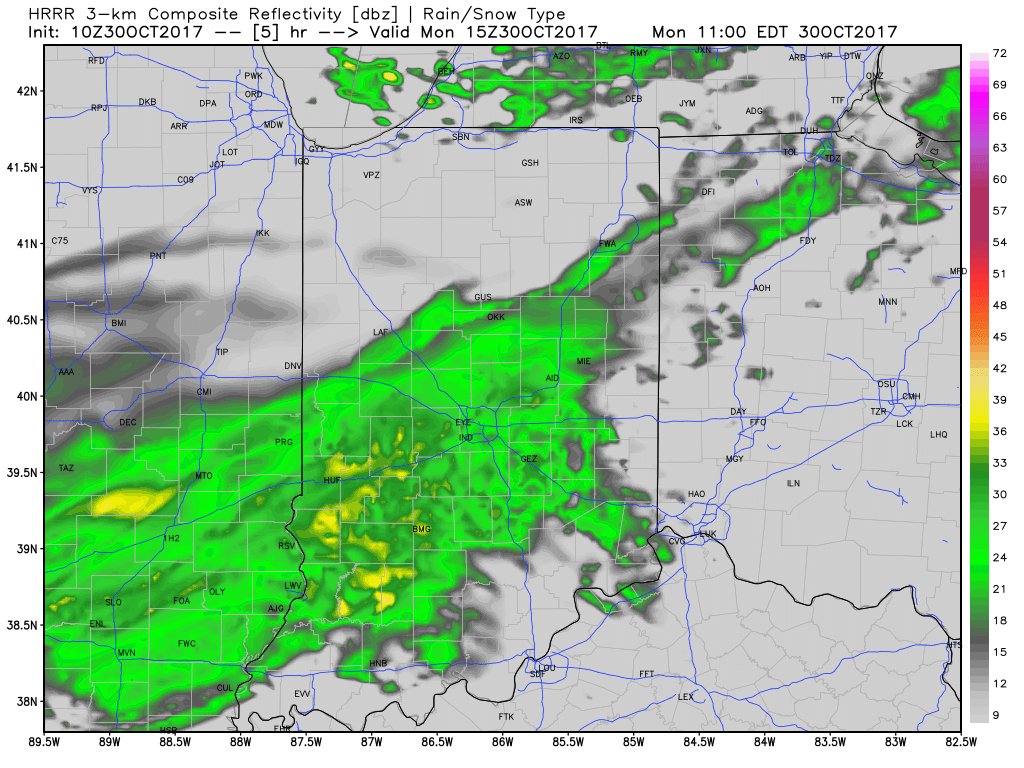 Rainfall amounts won’t be significant and feature totals between 0.10″ to 0.20″ through most of central Indiana.
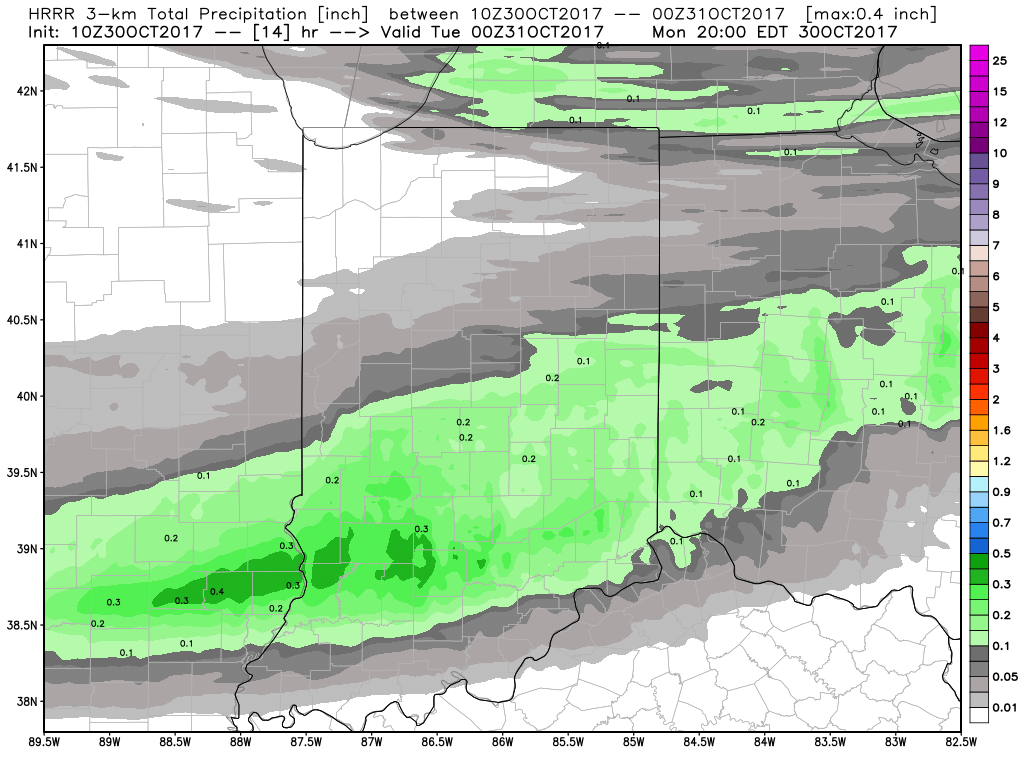 Unsettled weather will return late week and through the upcoming weekend, but temperatures will moderate and return to levels that are above average. There are indications cold will push again in the 8-10 day period, but a warmer pattern will engulf our region during the medium range period and feature temperatures that will reach the 60s by Thursday and Friday.
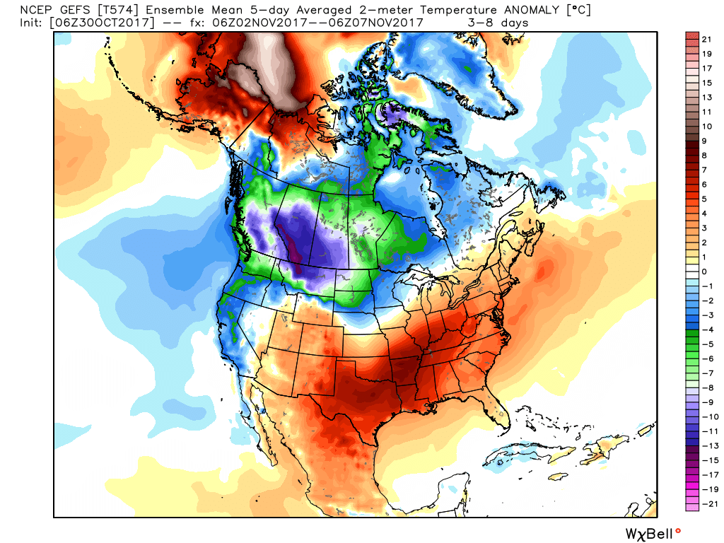 The warmer conditions will also come with rain. A “wavy” cold front will approach late week with showers before returning north as a warm front late in the weekend. Finally, this frontal boundary will push southeast early next week with cold air returning. With the movement and stubborn nature of the front, expect a prolonged duration of unsettled conditions. It won’t rain the entire time, but we’ll keep showers in our forecast beginning Wednesday into the weekend.
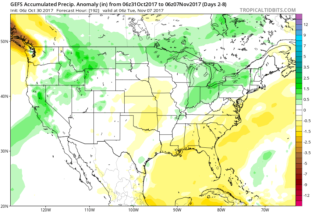
 Highlights:
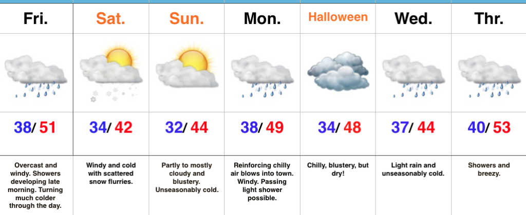 Highlights: