Quick video update from the road this evening on what the upcoming work week will deal central Indiana:
You must be logged in to view this content. Click Here to become a member of IndyWX.com for full access. Already a member of IndyWx.com All-Access? Log-in here.
A summer-like feel will return as we move through the weekend. While the heat and humidity won’t be excessive by any means, you’ll certainly notice a different feel when compared to the cooler air we’ve enjoyed over the past 10 days, or so. We forecast highs in the mid-upper 80s with plentiful sunshine through the weekend. While an “isolated” thunderstorm is possible, most will remain rain-free until early next week. That said, best rain and storm chances will be confined to northern Indiana Thursday evening and forecast radar products are picking up on a skinny line of showers and thunderstorms.
A thin line of storms may impact northern Indiana this evening. Image courtesy of weathermodels.com.
This area of thunderstorms is forecast to diminish before it would impact central Indiana.
Forecast radar 9p. Image courtesy of weathermodels.com.
The weekend will be highlighted by plentiful sunshine with only isolated storm coverage and an increasingly muggy feel. Note the southwest air flow returning around an area of high pressure off the East Coast and our next approaching storm system to the northwest.
That storm system will settle south and begin to impact central Indiana early next week with storm chances increasing Monday into Tuesday. With rich tropical moisture in place, locally heavy rain will be likely as the front moves in.
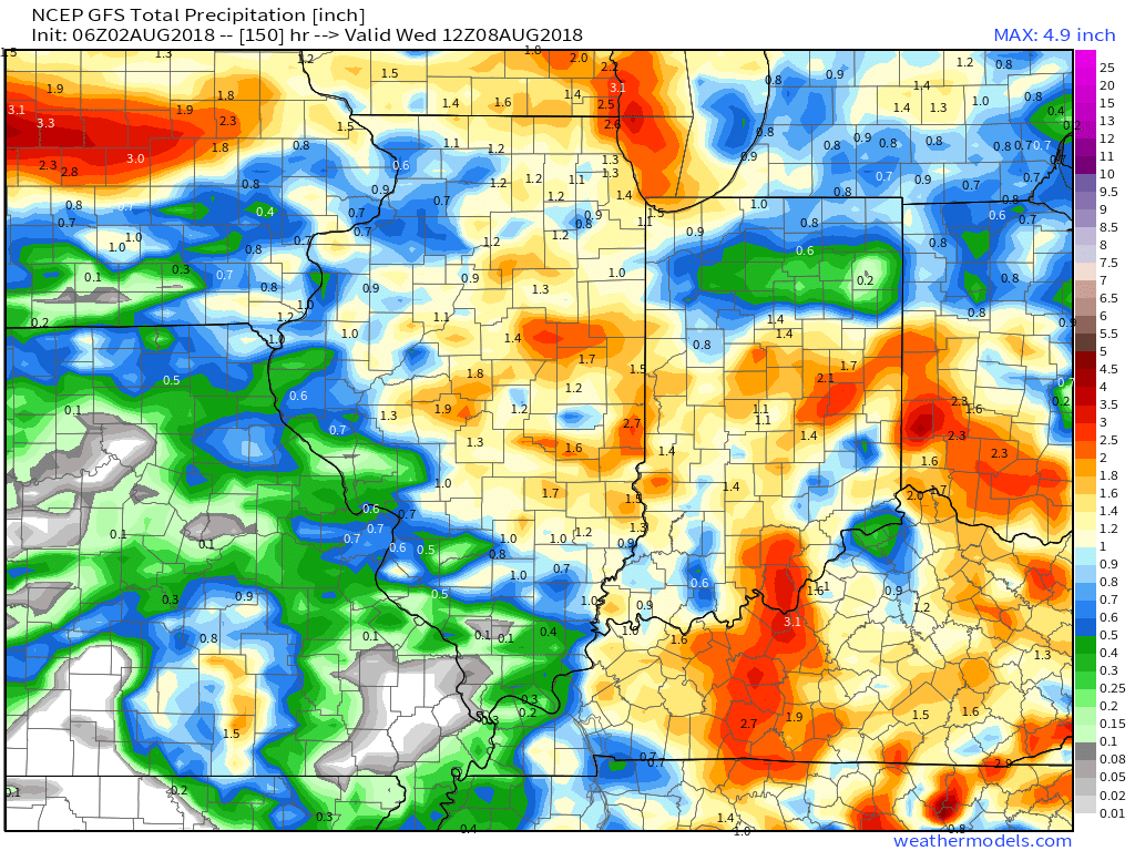
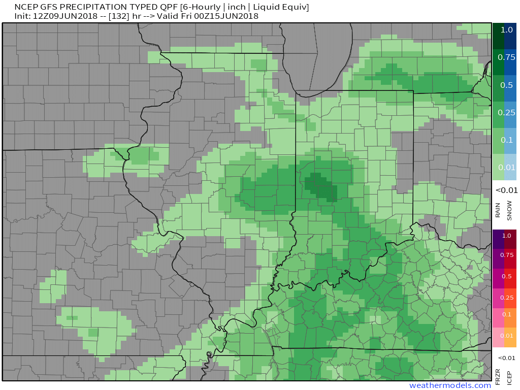
Models are in overall agreement of additional significant rainfall early next week (widespread 1″ to 2″).
You must be logged in to view this content. Click Here to become a member of IndyWX.com for full access. Already a member of IndyWx.com All-Access? Log-in here.
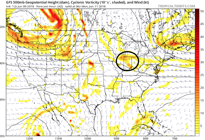
An active, and at times stormy, pattern will remain into the new week. The setup remains the same and doesn’t need rehashing :-). While we’ll have to keep a close eye on the potential of morning convection around the area Sunday, thinking here is beginning to shift to Sunday night and predawn Monday as the next best chance of gusty storms and more widespread coverage of beneficial rain. A warm and muggy air mass will be in place and as vigorous upper level energy interacts with the tropical air, thunderstorms that initiate to our northwest should hold together, if not grow stronger moving into central Indiana.
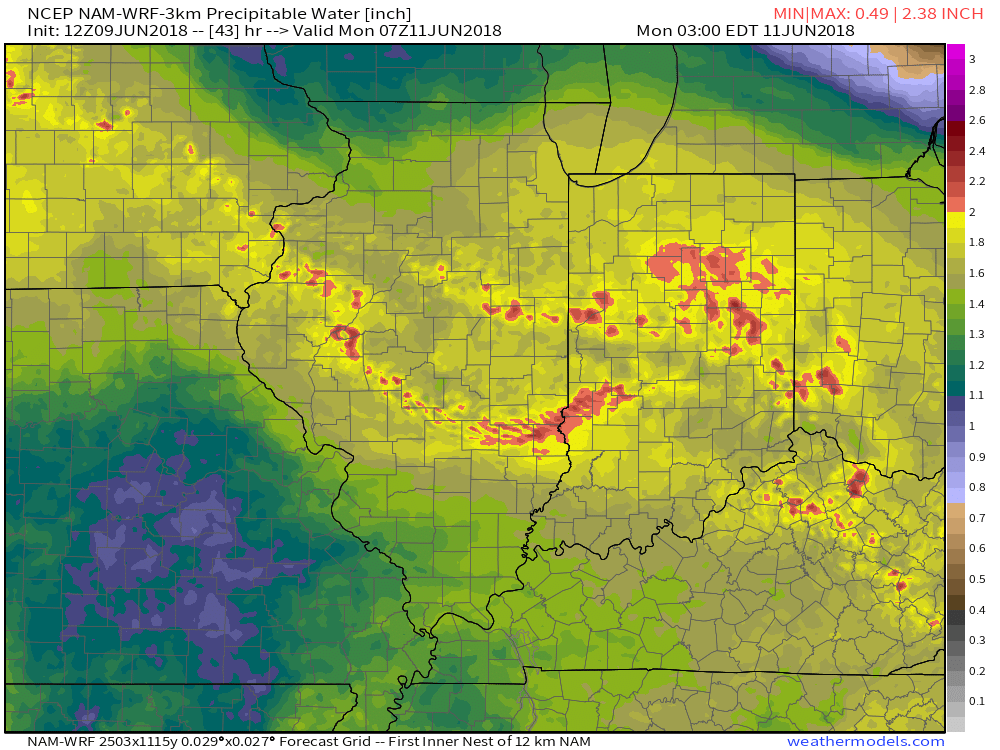
Upper level energy will track across the state Sunday night and Monday morning.Dew points are forecast to surge into the lower 70s Sunday night.Precipitable water values will approach 2″ Sunday night and early Monday morning.Forecast radar is beginning to pick up on potentially a noisy time of things Sunday night.
A warm and sticky air mass will remain in place through the first half of the work week before a frontal passage offers up a brief bout of slightly drier air for the middle of the week. Dew points will ease back into comfy range (50s) Wednesday and should also lead to a mostly dry day.
We’ll get to at least briefly enjoy a drier air mass Wednesday.
Humidity will build once again as we move into the latter portions of the work week and with the return of the summer mugginess will come a return of thunderstorm chances (scattered coverage Thursday and Friday).
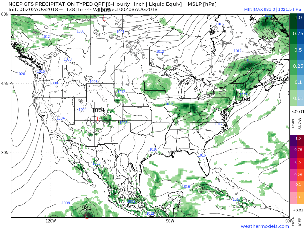
An early look at next weekend shows general agreement with the GFS and European forecast models: drier air returning along with slightly cooler air. We’ll keep you updated!
You must be logged in to view this content. Click Here to become a member of IndyWX.com for full access. Already a member of IndyWx.com All-Access? Log-in here.


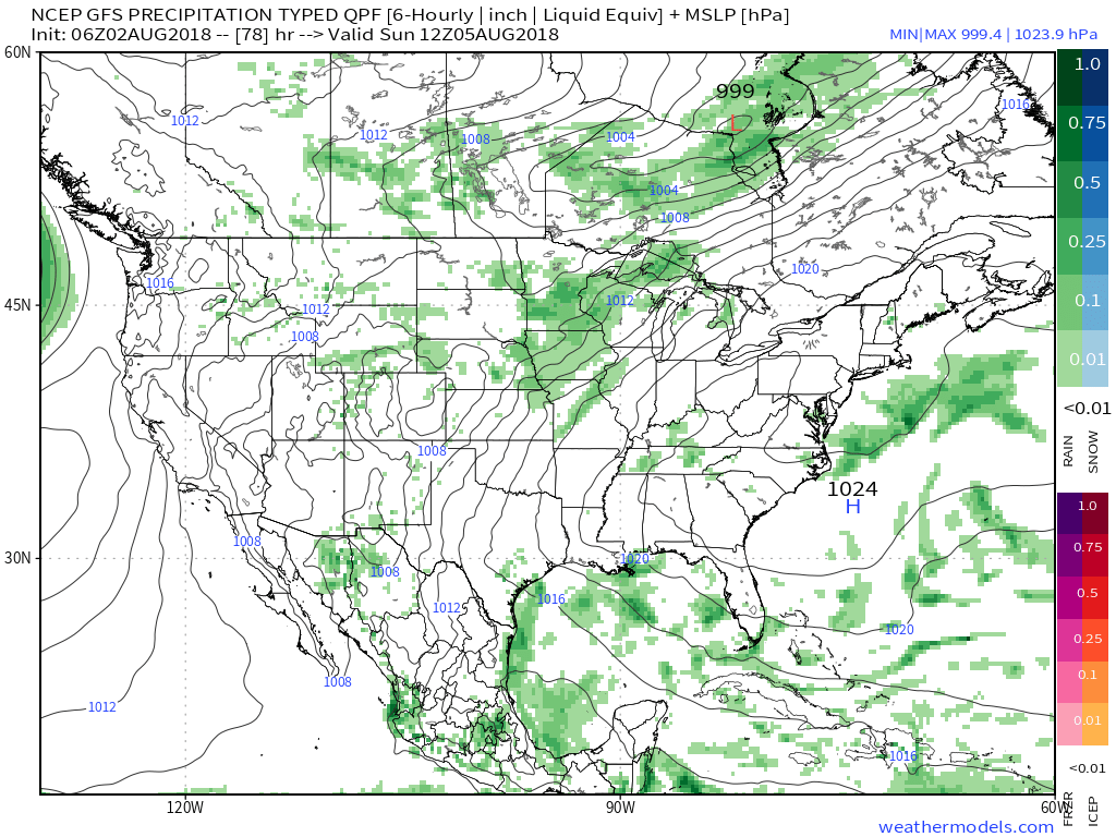 That storm system will settle south and begin to impact central Indiana early next week with storm chances increasing Monday into Tuesday. With rich tropical moisture in place, locally heavy rain will be likely as the front moves in.
 Models are in overall agreement of additional significant rainfall early next week (widespread 1″ to 2″).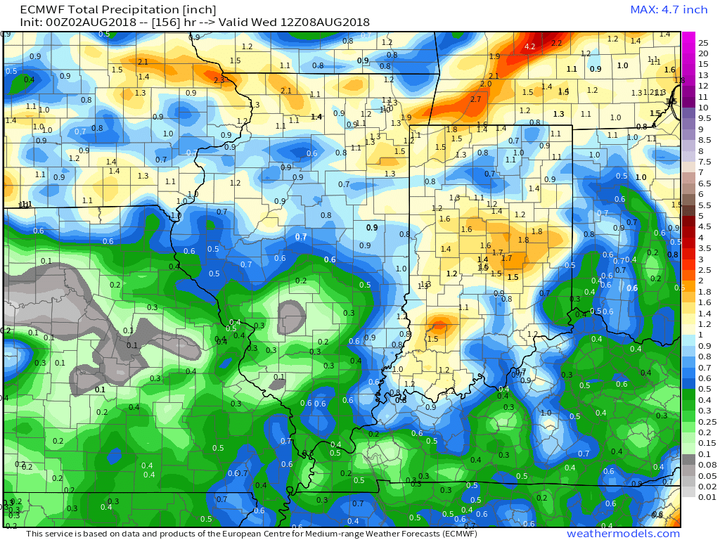



 An early look at next weekend shows general agreement with the GFS and European forecast models: drier air returning along with slightly cooler air. We’ll keep you updated!