Damp Open To The Weekend; Improvements On The Way…
 Highlights:
- Damp at times through Saturday
- Sunshine returns
- Looking ahead to Christmas
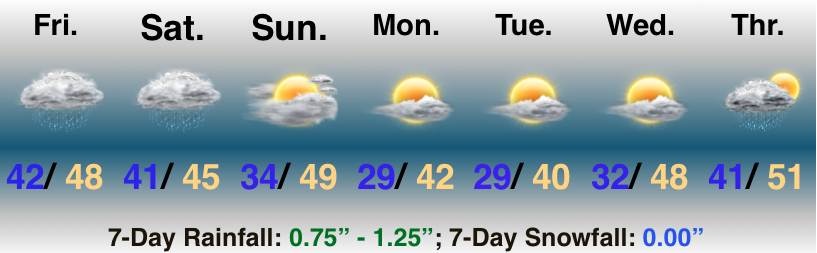
Rain Gear Needed…A storm system will lift north along the Ohio River between now and Saturday night before crossing the Appalachians and “jumping” to the mid Atlantic coast Sunday into Monday. This will result in periods of rain today and Saturday. Heaviest and most concentrated rainfall will remain along and south of the I-70 corridor- especially across southwest IN. For the majority of us, this won’t be a major rain event.
Improving weather will develop for the 2nd half of the weekend as we introduce at least a little sunshine into the forecast. That sunshine will set the tone for the new work week, including a nice stretch of weather (by late-December standards) Monday through Wednesday.
A cold front will blow through the state Thursday with a shower possible, followed by colder air to close the work week.
Looking ahead towards Christmas, we still anticipate this to be around the timeframe that we’re transitioning back to colder air. It’s far too early to get specific around rain or snow, but the transitional pattern does support the idea of more active times. Stay tuned…
 Highlights:
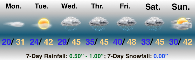
 Highlights:
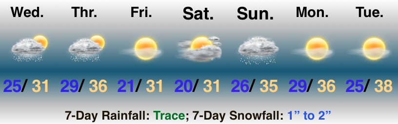
 II. Wet Halloween: A cold front will approach the state Tuesday evening into our Halloween. Widespread rain is expected Wednesday, BUT the silver lining may be that the bulk of precipitation will be shoved to our southeast before most trick-or-treaters take to the streets.
 III. Chilly Open To November: Reinforcing chilly air will blow into town behind the cold front and set the stage for an unseasonably chilly open to November. Generally, lows will fall into the middle 30s and highs will top out in the upper 40s for the first few days of the month.
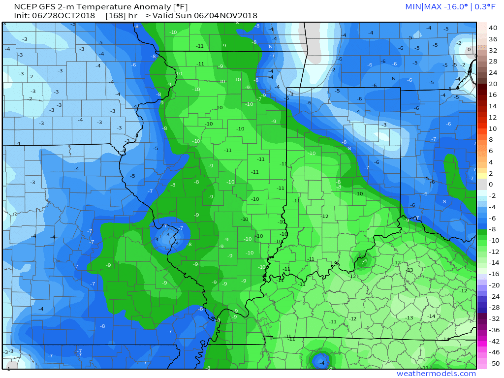 IV. Raw Saturday: It’s a “rinse and repeat” scenario as next weekend opens raw and wet thanks to a new storm system moving through the region. Gusty showers and unseasonably cool temperatures can be expected Saturday. Note the possibility of wet snow to fall on the northern periphery of the storm system through IA, MN, and WI. (Signs of the times).
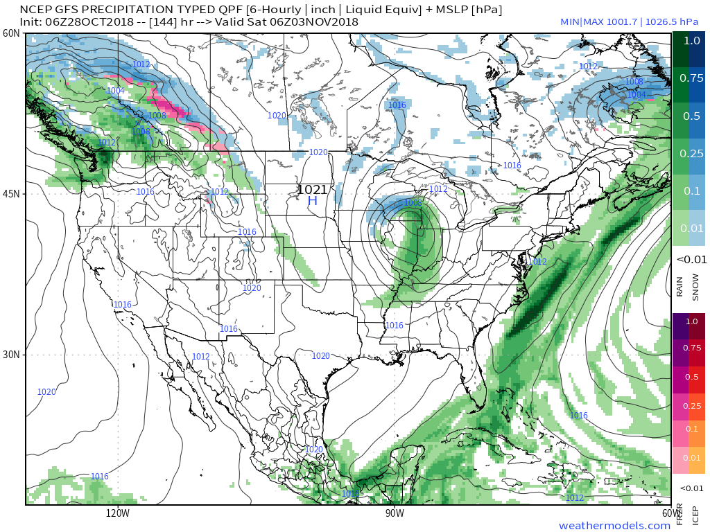 V. Wet Pattern: After a long stretch of dry weather through the balance of October, a big shift in the pattern is taking place now and will continue to promote well above normal rainfall as we move through the first couple weeks of November. In some cases, the upcoming (10) days alone may yield 3″ to 4″ of rain in some areas of the region.